- Difficulty Difficult
- Time 6 hours
- Round-Trip 10km
- Elevation Gain 530 meters
- Season July - September
- Camping Yes
- From Vancouver 3 hours
- Public Transit No
- Dog Friendly No
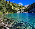
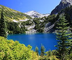
Rohr Lake is a beautiful, turquoise coloured lake situated in the alpine area between Pemberton and Lillooet. The hike to the lake follows the route to the Marriot Basin before branching off and heading up a very steep boulder field, offering incredible views along the rocky section.
This route stops at Rohr Lake but hikers can continue on towards Mount Rohr, making for a very long day-hike. This would add an additional 7km total and about 500m of additional elevation.
The route to Rohr Lake begins alongside Highway 99 across from the Salt Shed. However, there is access via a Forest Service Road (FSR) on the North side of the Highway just west of the Salt Shed. This is the same FSR that you will hike along but the road has several spots that are meant for vehicles with higher clearance. If you are able to drive up to one of the four parking areas, it will cut down the amount of hiking distance. Refer to the Directions section below.
From the parking along Highway 99, walk along the highway in the direction towards Pemberton and look for a small trail that heads into the bushes. Follow this trail a short distance until it reaches a clearing next to the FSR where there are often cars parked. This is the first parking area along the FSR.
Walk up the FSR, following the gravel road as it gradually climbs. You will pass a 2nd clearing on the left where more cars can park. Just after the 2nd parking area, stay on the main road to the left as you pass a spur to the right that goes up hill to a dead end. A short distance further and you pass a 3rd clearing where vehicles can park. Continue following the road for about another 1km as you quickly make time along this easy section of the route. The FSR will eventually reach the 4th and final clearing for parking where only vehicles with a higher clearance can reach.
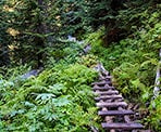
From the final parking area, the FSR ends and becomes a trail. Follow the trail into the forest as it makes its way over wooden planks, across streams, and through muddy sections. After a couple hundred metres, the trail starts to climb through the forest as you gain elevation.
After hiking for about 45-minutes, you reach the junction with signs on a tree that point to the Wendy Thompson Hut to the left and Rohr to the right. Go right and continue following the trail uphill as it passes through a couple of very muddy bogs. The trail will eventually reach a clearing with a meadow. Watch for markers and flagging tape to the right and follow the route uphill through the trees.
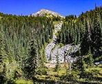
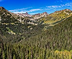
The steep boulder field begins at the next clearing. Stay to the right of the boulder field and watch for trail markers and flagging tape as you make your way up the steep slope. Watch your step through the mud and boulders as a stream of water is often flowing down the rocks on or near the trail route, making the hike difficult and treacherous in some sections. After a short reprieve from the steepness, the trail veers left and continues up the boulders while offering sweeping views of the valley and the area around the Marriot Basin. Continue to follow the trail up the boulder field until it ends just steps from Rohr Lake.
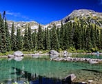
Walk towards the shore of the lake for the first views of the turquoise coloured water. There is a rocky beach area a short walk to the right, offering a scenic view of the lake and the rugged slope on the south shore. There are also several other viewpoints along Rohr Lake, including one at the far end (eastern end) of the lake that are worth seeing. Follow the trail to the left along the lake as it gradually makes its way up onto some rocks where you will be treated to a view of Rohr Lake.
If you are not planning to continue to Mount Rohr, return via the same route you arrived. Follow the trail back down the boulder field, being very careful to watch your footing as you make your way down the slippery rocks and mud. Watch for flagging tape and follow the trail into the forest as it descends back down to the meadow area. Once you've made it to the meadow, the return is a little easier.
Continue to follow the trail into the forest as you descend quickly and pass through the two muddy bogs, eventually returning to the junction. Go left and downhill until the trail begins to level and you cross the wooden planks, returning to the Forest Service Road. Follow the road back down to where you parked and began your hike.
How to get to Rohr Lake
Estimated Driving Time from Vancouver
3 hours
The hike to Rohr Lake starts alongside Highway 99, north of Pemberton. The parking is about 26km from the intersection and gas station in Mount Currie. There are several options for parking, depending on what type of vehicle you drive and whether it can drive up the Forest Service Road. These are the parking options:
- There is some parking at the side of Highway #99 directly across from the Salt Shed. This is the official start of the route to Rohr Lake.
- There is a Forest Service Road just before the Salt Shed (after the bridge over Cayoosh Creek). There are 4 areas along the FSR to park:
- The first is a short drive up the FSR and most cars should be able to drive to this point. This point is where the trail from Highway 99 joins the FSR.
- The second is further up the FSR and most cars should be able to reach this point too. There are not many spots, so if the area is full, cars may have to drive back down the road.
- The third is a short distance beyond the second area and is quite small.
- The fourth is more than 1km further up the FSR and has several sections that will require a higher clearance vehicle.
Note that the FSR is narrow and turning a vehicle around in some sections is impossible. Do NOT block the road.
Driving from Vancouver, drive towards Highway #1 and head westbound towards Horseshoe Bay, merging onto the Highway #99 towards Squamish and Whistler. Continue North along Highway #99: The Sea To Sky Highway, passing through Squamish, Whistler, and Pemberton.
When you reach the intersection in Mount Currie next to the gas station, turn right and head towards Lillooet. Immediately zero your odometer and drive for the next 26km. Watch your speed driving through Mount Currie and then drive up the steep section of Highway, passing the parking lot for Joffre Lakes. About 1km after crossing a bridge over Cayoosh Creek, watch for the Forest Service Road on your left, if you are going to attempt the FSR. If not, continue a few hundred metres further and pull over on the right by the Salt Shed. When it's safe to do so, park on the other side of the highway, across from the Salt Shed.
The trail begins a short distance west (towards Pemberton) from the parking across from the Salt Shed.
View a map of Driving directions to Rohr Lake.

Although we try to keep information as current as possible, www.vancouvertrails.com makes no warranty or representation as to the availability, quality, fitness for purpose, conditions or accuracy of the information provided with respect to this trail or trails. The information provided herein is further subject to our Terms of Use.

Comments
Add Comment View All Comments