- Difficulty Easy
- Time 0.5 hours
- Round-Trip 0.75km
- Elevation Gain 40 meters
- Season April - November
- Camping No
- From Vancouver 1 hour, 30 minutes
- Public Transit No
- Dog Friendly Yes
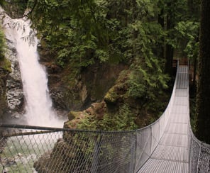
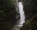
Located Northeast of Mission, BC, Cascade Falls is a scenic waterfall that can be viewed from a suspension bridge that crosses the river, just in front of the falls. The short walk uphill to the falls makes the long drive worth the trip.
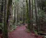
From the parking lot, walk towards the metal gate by the hill (note: sometimes the gate is not noticeable if it is open) and walk up towards a trail that begins on the right. Follow the trail up a steep hill as it winds to the right and within minutes you reach a set of wooden stairs. Climb the wooden stairs until you are just underneath the suspension bridge, where you get the first scenic view of Cascade Falls.
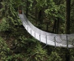
Walk up the remaining stairs and cross the suspension bridge. During the early spring months and after a rainfall, an enormous amount of water flows over the rocks and into the canyon down below. Continue across the bridge to the wooden platform on the far side.
The wooden platform is as close as you can get to the falls and when a lot of water is dropping into the canyon, you can feel the mist from this platform. After enjoying the view, cross back over the suspension bridge and walk back down the wooden stairs, returning to the parking lot via the gravel trail.
How to get to Cascade Falls
Estimated Driving Time from Vancouver
1 hour, 30 minutes
Cascade Falls Regional Park is located Northeast of Mission, BC, near the small community of Deroche.
From Vancouver
From Vancouver, drive east towards Highway #1 and enter the highway heading eastbound. Drive through Burnaby and into Coquitlam and take Exit #44 United Blvd / Highway 7B. This route is known locally as the Mary Hill Bypass. Continue driving straight for about 7km and then merge right onto Lougheed Highway (Hwy 7) heading east across the Pitt River Bridge into Pitt Meadows.
Continue to follow the Lougheed Highway into Maple Ridge and through the town for about 10km. Watch for signs and turn right to continue following the Lougheed Highway. Drive about 23km into the town of Mission.
Continue following the directions "From Mission" below.
From Mission
From the town of Mission, drive towards Highway #7 (Lougheed Highway) and head eastbound. The road will merge with North Railway Avenue next to a series of train tracks. Continue following this route as you again merge back with the Lougheed Highway. After about 6km from Mission, turn left onto Sylvester Road. There should be signs about Cascade Falls just before the turn.
Follow Sylvester Road for about 15km through the farming community, along the scenic windy road. Turn right onto Ridgeview Road and within in a minute, you will arrive at the parking lot for Cascade Falls Regional Park.
View a map of Driving directions to Cascade Falls.

Although we try to keep information as current as possible, www.vancouvertrails.com makes no warranty or representation as to the availability, quality, fitness for purpose, conditions or accuracy of the information provided with respect to this trail or trails. The information provided herein is further subject to our Terms of Use.

Comments
Add Comment View All Comments