- Difficulty Easy
- Time 5.5 hours
- Round-Trip 17km
- Elevation Gain minimal
- Season year-round
- Camping No
- From Vancouver 1 hour 20 minutes
- Public Transit No
- Dog Friendly On-Leash
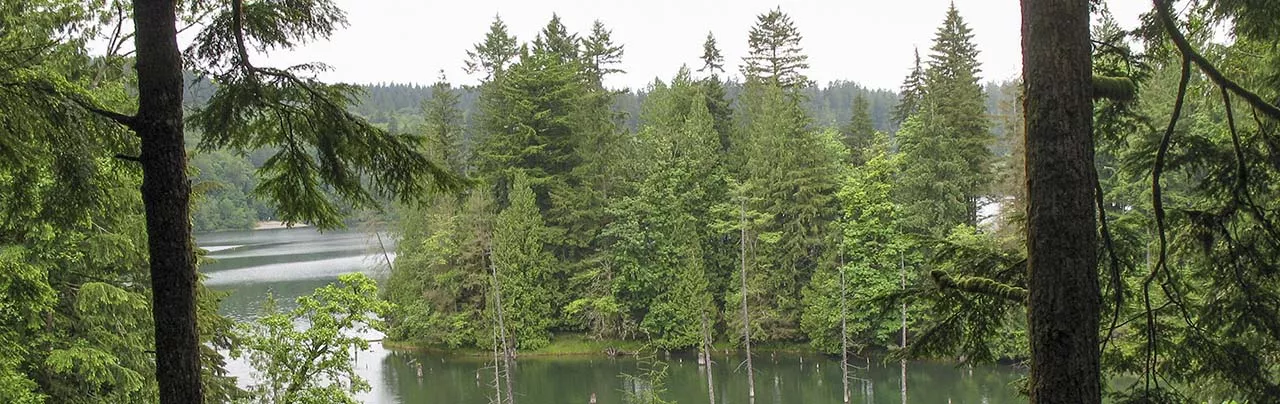
Located north of Mission, BC, Hayward Lake offers a scenic hike along the trails maintained by BC Hydro. The lake has two trails; the Railway Trail on the west side and the Reservoir Trail on the east side.
Railway Trail
The Railway Trail along the west side of Hayward Lake is a fairly flat and wide trail as it once served as the railway line that connected the Stave Lake Reservoir to the town of Mission. The trail is 12km and takes 3.5 hours to complete to Ruskin Dam and back.
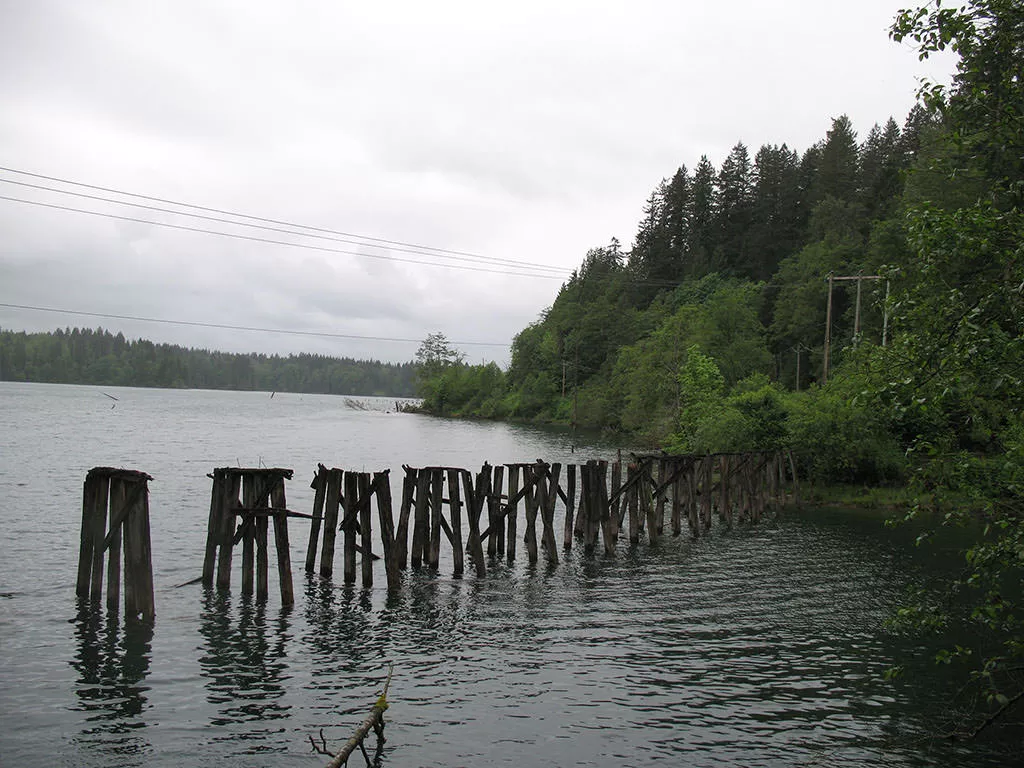
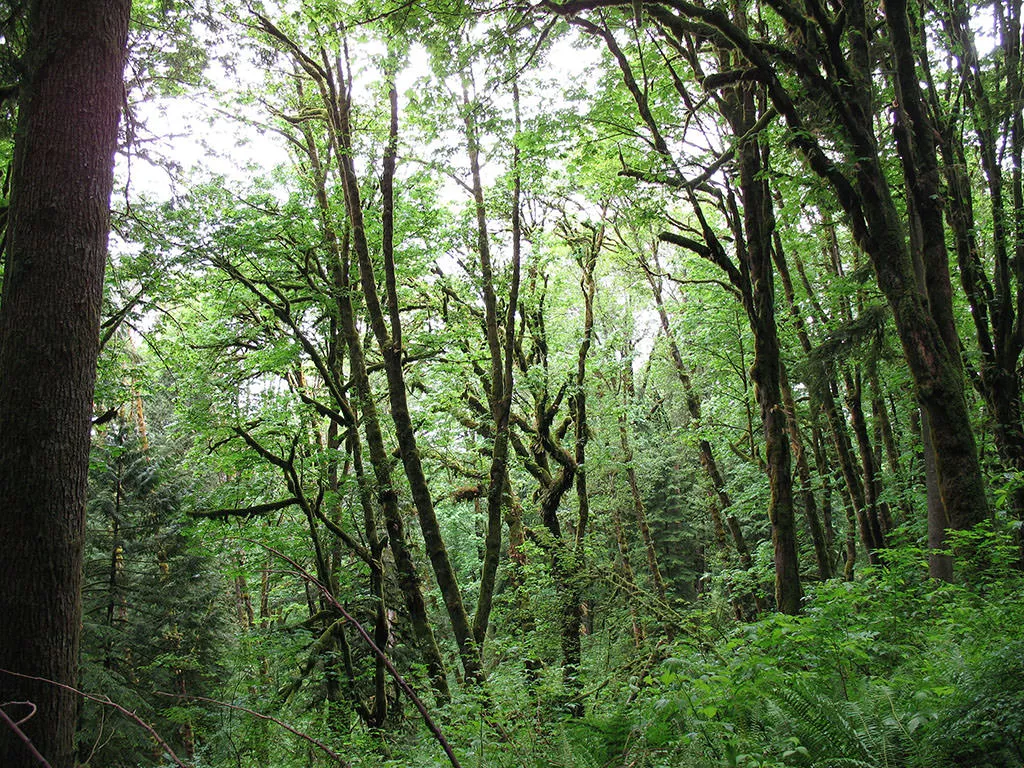
From the Hayward Lake Recreation Area parking lot, walk towards the lake, passing the washrooms and follow the paved trail as it becomes gravel. Just as you leave the recreation area, on the right of the trail is the scenic Beaver Pond. Continue south on the trail as you catch occasional glimpses of the lake before reaching a viewpoint. The trail veers into the forest just as old wooden pillars from trestle bridges can be seen still standing from the lake. The trail narrows and crosses several bridges and walkways before emerging back alongside the lake on the former railway route.
Continue south, passing a small beach and eventually arriving at a parking lot. A few hundred meters beyond the parking lot is Ruskin Dam. After checking out the dam, retrace your footsteps north back towards the Hayward Lake Recreation Area parking lot. Alternatively, if Ruskin Dam is not closed, you can cross the dam and walk along the Reservoir Trail that starts at the yellow gate and follows the eastern shore of Hayward Lake.
Reservoir Trail
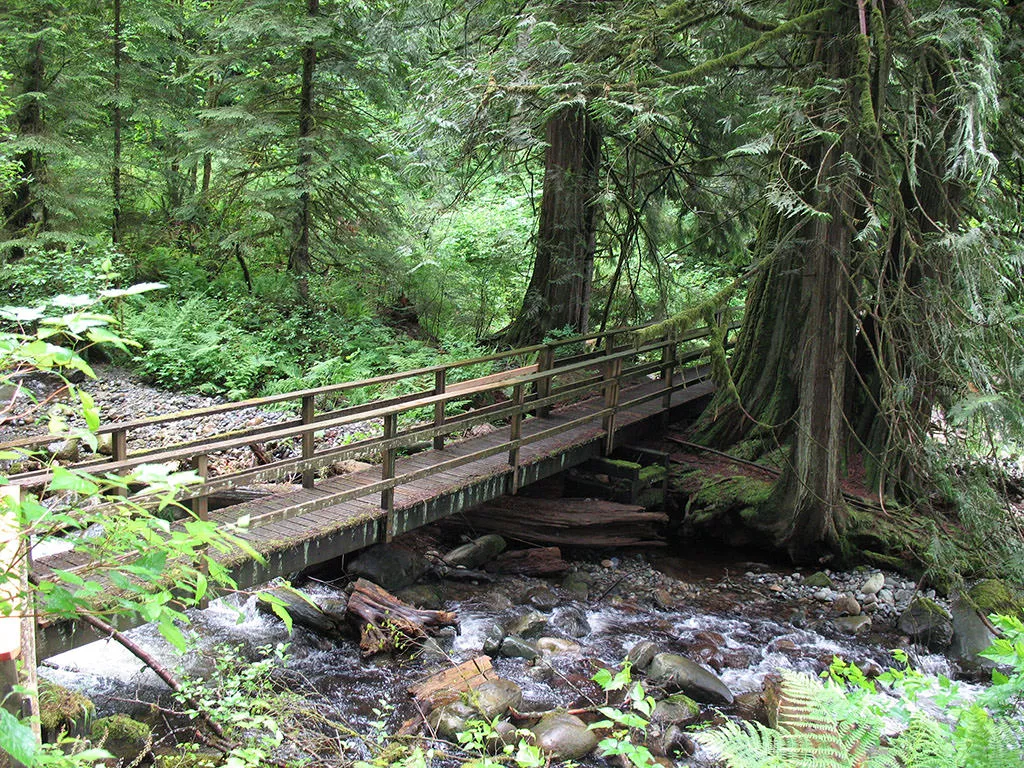
The Reservoir Trail is 17km (5.5 hours long) round trip trail that passes through thick, lush forest covered in sheets of moss. To reach the trail from the Hayward Lake Recreation Area parking lot, walk towards the washrooms and veer to the left onto a path. After a short distance, the path crosses a wooden bridge and continues up a paved area to the Stave Falls Dam and Powerhouse. Cross the dam, staying on the edge to avoid traffic. Once across, stay on the right side of the fence as the trail begins to ascend a steep series of switchbacks before reaching the top where there is a view of the valley below.
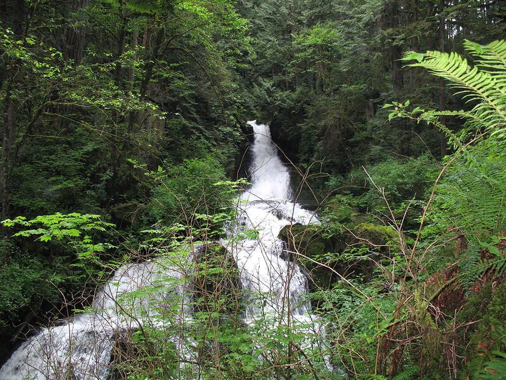
Continue along the trail and about 10 minutes later, you arrive at a sign to Steelhead Falls. Go right for this short detour and follow the path as it heads downhill and through a short set of wooden steps before arriving at a view of the waterfall.
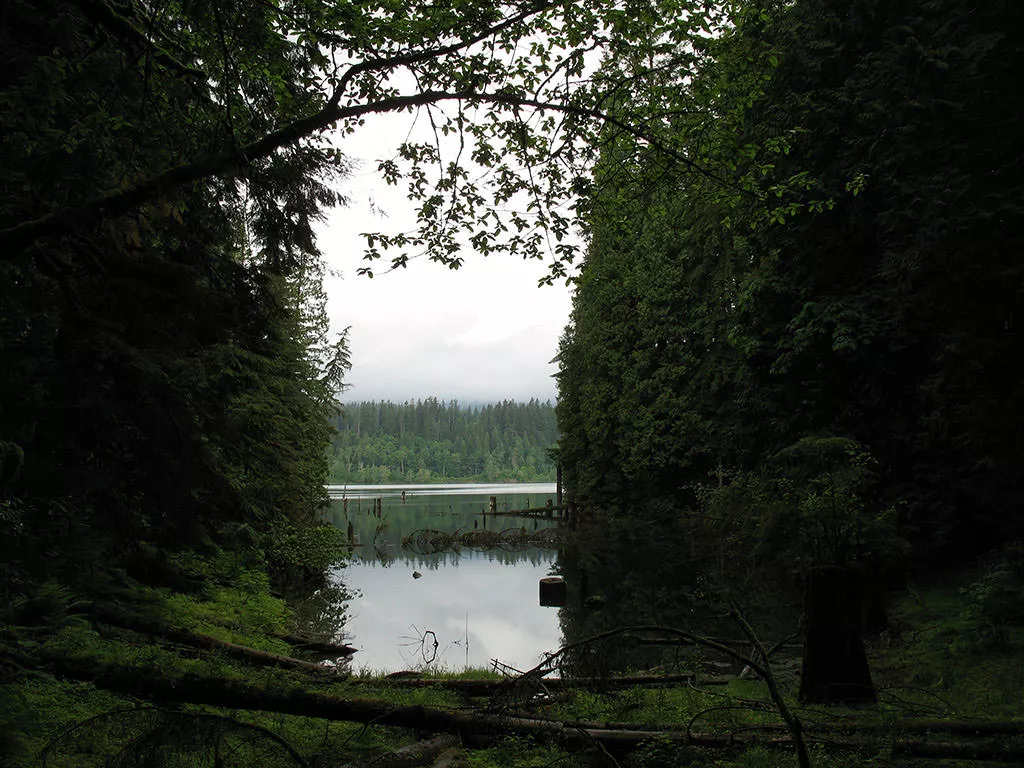
After walking back up the hill to the main trail from Steelhead Falls, go right and continue heading south. The trail meanders through lush green forests and across wooden bridges carpeted with moss. The trail eventually reaches a junction that leads down to a canoe launch and a small dock. The short side trip is worth it as the small dock offers a nice view of Hayward Lake.
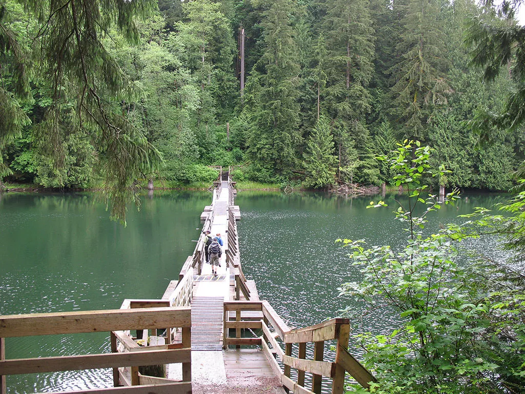
Back on the main trail, continue your hike heading south as the trail begins to descend. After a downhill section, cross the floating bridge and walk up the other side. A short distance later, the trail exits the forest onto a wider gravel road. Continue down the gravel road towards the yellow gate where Ruskin Dam is located off to the right.
At this point, retrace your steps north towards Stave Lake Reservoir and back across to where you parked. Alternatively, if Ruskin Dam is not closed, you can cross the dam and return via the Railway Trail on the west side of the lake.
How to get to Hayward Lake
Estimated Driving Time from Vancouver
1 hour 20 minutes
Hayward Lake is located east of Maple Ridge and north of Mission near Stave Lake. To reach the Hayward Lake Recreation Area parking lot, take Highway #1 (Trans Canada Highway) eastbound to Exit #44 - Pitt Meadows / Maple Ridge Exit. Stay to the right as you drive a brief distance alongside the highway and then go left and underneath the Port Mann Bridge to the stoplights. Drive straight through the lights and continue along the Mary Hill Bypass. Turn right onto Lougheed Hwy and cross the bridge towards Pitt Meadows.
Continue straight along Lougheed Hwy into Maple Ridge and turn left at the major intersection onto Dewdney Trunk Road. Drive approximately 20km to just before the crossing at the Stave Lake Reservoir. A sign on the right points to Hayward Lake Recreation Area and a small paved road on the right heads downhill. A short distance on this road brings you to a large parking area.
View a map of Driving directions to Hayward Lake.

Although we try to keep information as current as possible, www.vancouvertrails.com makes no warranty or representation as to the availability, quality, fitness for purpose, conditions or accuracy of the information provided with respect to this trail or trails. The information provided herein is further subject to our Terms of Use.
Comments
Add Comment View All Comments