- Difficulty Easy
- Time 1.75 hours
- Round-Trip 3.8km
- Elevation Gain 50 meters
- Season March - November
- Camping No
- From Vancouver 1 hour, 30 minutes
- Public Transit No
- Dog Friendly On-Leash
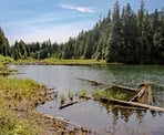
The hike around Devil's Lake in Mission, BC, is a scenic forested loop with views of the area from the beach and the floating bridge on the south end of the lake.
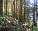
Although the hike is rated as easy, the trail is quite rugged along the east side of the lake as it passes through some rocky sections that are very uneven and can be slippery and muddy. The route crosses a floating bridge on the south end, with great views of the area.
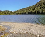
From the parking area at the side of the forest service road, walk down the wooden stairs and follow the trail downhill. The trail will descend and pass over a couple of wooden bridges as it heads towards Devil's Lake. Just after crossing a small stream, follow the trail to the right and out onto the beach area of Devil's Lake. This is the final stop for a lot of visitors to the area as they spend the day at the lakeside.
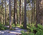
Continue the hike around the lake by returning to the trail and following it into the forest heading north. The trail is well defined and easy to follow as it follows a route away from the lake with minimal views between the trees.
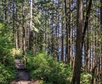
The trail rounds the north end of the lake and then begins to ascend slightly as it passes along a rocky, rugged section. There are many ups and downs along the east side of the lake as you carefully step over the rocky terrain, watching your step as you descend through other sections.
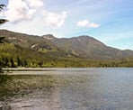
The trail will emerge from the forest cover and follow under a set of power lines before returning to the forest. The terrain becomes a bit easier before descending and, again, exiting the forest cover as you are almost alongside the lake. From here, you should be able to spot the floating wooden bridge up ahead. As you continue to walk towards it, look off to the side and back, enjoying the views of Devil's Lake and Rockwell Peak on the other side.
Crossing the floating bridge provides one of the best views of the lake area. After enjoying the views, continue to follow the trail on the other side as it makes its way through the forest. The trail will eventually meet up with the trail you were on earlier, completing the lake loop near the beach access.
Return to the parking area along the forest service road by following the trail uphill, crossing the wooden bridge before walking up the final set of wooden stairs.
How to get to Devil's Lake
Estimated Driving Time from Vancouver
1 hour, 30 minutes
The trailhead and access to Devil's Lake in Mission, BC, is located at the 5km mark along the Florence Lake Forest Service Road (FSR).
To drive to Devil's Lake from Vancouver, drive east and onto Highway #1, heading eastbound. Before the Port Mann Bridge, follow Exit #44 and stay in the left lane as you exit, merging onto the Mary Hill Bypass heading towards Maple Ridge. Follow the Mary Hill Bypass for about 7km and continue as you head over the Pitt River Bridge into Pitt Meadows.
After crossing the Pitt River Bridge, drive for about 6km and stay in the left 2 lanes, turning left onto Dewdney Trunk Rd. Follow Dewdney Trunk Rd. for 15km. Just before the Stave Lake Dam, turn left onto the Florence Lake FSR and follow the gravel road for 5km. The kilometre markings are on the trees or at the side of the road. At the 5km mark, there are two outhouses and a parking area alongside the right side of the road. Park here and the trail begins at the wooden stairs next to the outhouses.
View a map of Driving directions to Devil's Lake.

Although we try to keep information as current as possible, www.vancouvertrails.com makes no warranty or representation as to the availability, quality, fitness for purpose, conditions or accuracy of the information provided with respect to this trail or trails. The information provided herein is further subject to our Terms of Use.

Comments
Add Comment View All Comments