- Difficulty Easy
- Time 1 hour
- Round-Trip 1.6km
- Elevation Gain 115 meters
- Season year-round
- Camping No
- From Vancouver 1 hour 20 minutes
- Public Transit No
- Dog Friendly Yes
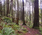
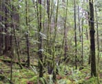
The Stave Dam Forest Interpretation Trail is a loop through a forest managed by the District of Mission. The route climbs uphill to a couple of viewpoints that overlook the Stave Lake area and the route offers a look at the beautiful forest in the region.
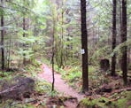
Before you go on this hike, it's worth printing out the brochure provided by the District of Mission. The route has several numbered signs, which correspond to the descriptions in the brochure.
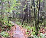
The trail begins on the east side of Dewdney Trunk Road at a small wooden plank next to a gravel parking area by the road. Walk up the wooden plank and into the forest as the route climbs towards a junction. Make sure to go left at the junction to hike the loop in a clockwise direction as this corresponds with the numbered signs in the brochure.
Follow the trail to the left as it continues uphill passing through the beautiful forest. The route climbs steeply until it reaches a gravel road. Cross the gravel road where the trail continues on the other side, following the wider trail uphill.
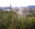
As the trail begins to level, make sure you are continuing to follow the markers on the trees. The trail makes its way up through a narrow section onto some rocks as this section is easy to miss if you are not following the markers. Once on the rocky ridge, you are treated to a spectacular view that overlooks the Stave Lake area, offering clear sight lines off into the distance on a sunny day.
After enjoying the view, the trail continues on the other side of the rocky ridge, entering back into the forest and looping around. Within minutes, you are treated to another viewpoint that is similar to the first.
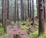
Continuing along the trail, it begins to descend as you carefully make your way back downhill enjoying the fresh air of the forest. After hiking downhill for sometime, you reach the gravel road. Cross the road and continue on the trail through the forest as you immediately cross a small bridge.
Within a few more minutes, you reach the junction where you began. Go left and back down the last section, crossing over the plank and returning to the gravel parking area next to the road.
How to get to Stave Dam Forest Interpretation Forest
Estimated Driving Time from Vancouver
1 hour 20 minutes
The Stave Dam Interpretation Trail is located in Mission, BC, along Dewdney Trunk Road.
To drive to the trailhead from Vancouver, drive towards Highway #1 and enter the highway heading eastbound. Before crossing the Port Mann Bridge, take Exit 7B onto the Mary Hill Bypass heading towards Pitt Meadows and Maple Ridge.
Continue to follow the Mary Hill Bypass and, just after passing under a train bridge, stay right merging onto Highway #7 heading over the Pitt River Bridge into Pitt Meadows. Drive for about 6km and turn left onto Dewdney Trunk Road.
The rest of the drive follows Dewdney Trunk Road for about 25km to the trailhead. Pass through the community of Haney before leaving the urban area as you continue east. Eventually, you reach Stave Dam where you drive across and follow the steep road up the other side as it winds through a few switchbacks. After the final switch back, drive a short distance and watch for a gravel parking area on the left side of the road near a small wooden bridge that goes into the forest. Carefully turn left onto the gravel parking area and start the trail at the wooden bridge.
View a map of Driving directions to Stave Dam Forest Interpretation Forest.

Although we try to keep information as current as possible, www.vancouvertrails.com makes no warranty or representation as to the availability, quality, fitness for purpose, conditions or accuracy of the information provided with respect to this trail or trails. The information provided herein is further subject to our Terms of Use.

Comments
Add Comment View All Comments