- Difficulty Intermediate
- Time 3 hours
- Round-Trip 8km
- Elevation Gain 230 meters
- Season March - November
- Camping No
- From Vancouver 1 hour, 20 minutes
- Public Transit No
- Dog Friendly Yes
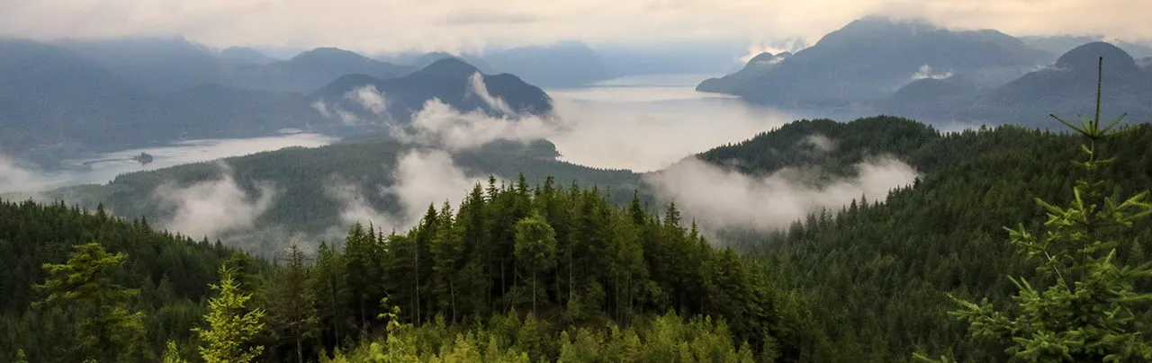
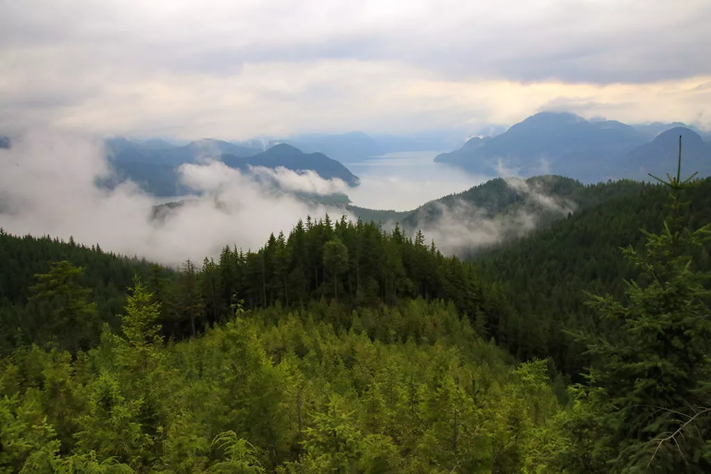
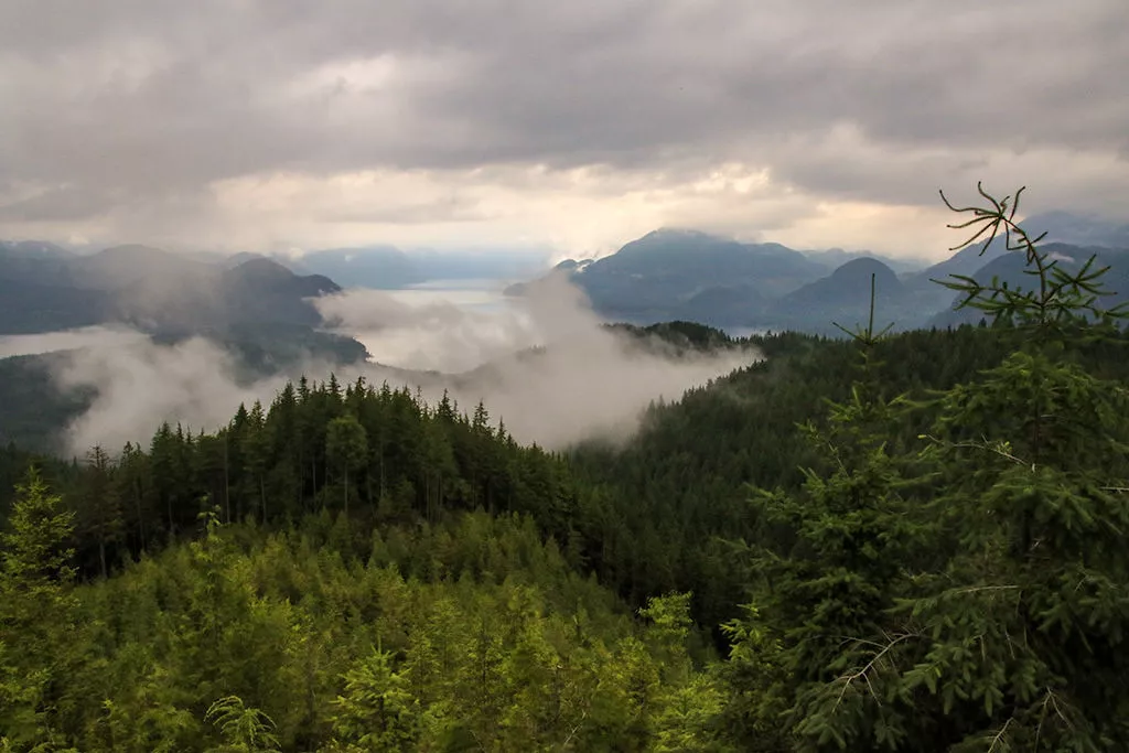
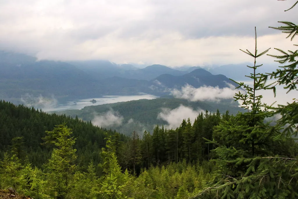
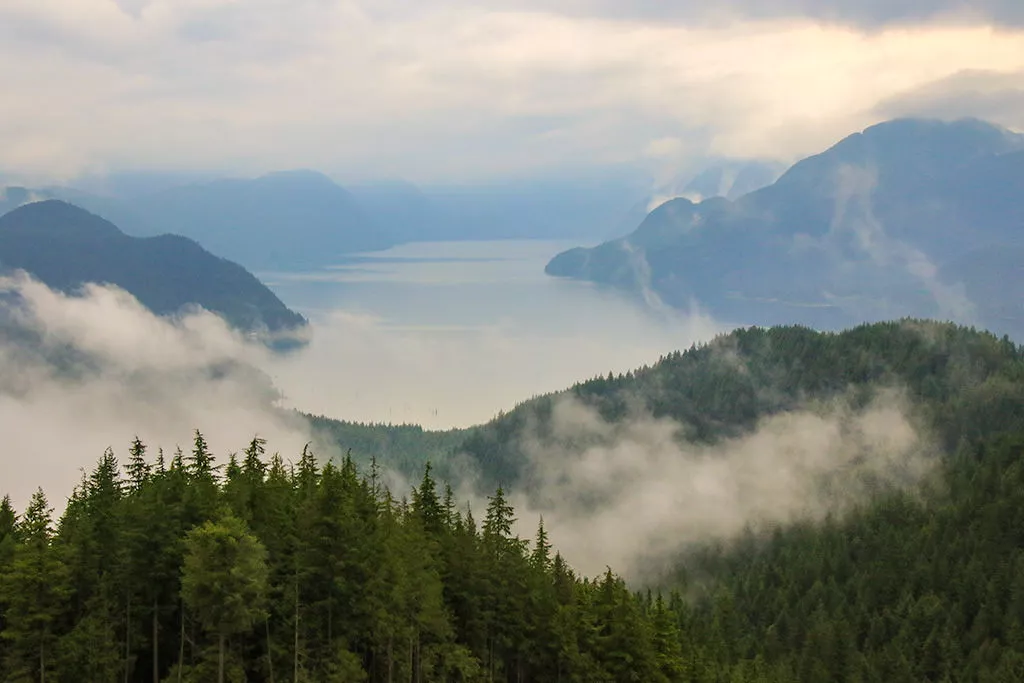
The Hunter Road Trail follows a forest service road and ends at a spectacular viewpoint looking north towards Stave Lake. Located in the Steelhead community of Mission, the hike is not too exciting but the view is well worth the effort.
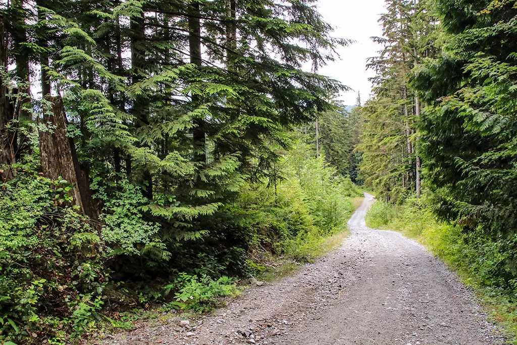
From the metal gate, follow the gravel road across the wooden bridge as it begins to climb steeply. Most of the elevation gain occurs in the 1st kilometre and the 4th kilometre with the middle section of the route being a little more level.
Continue up the steep gravel road until you finally reach the top about 30-minutes later.The road passes a logged section before dropping slightly and continuing to a junction. There are 3 junctions and if you go left at all 3, you will reach the top. Go left at the first junction and continue your hike.
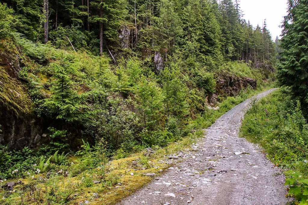
The road continues where it reaches a 2nd junction. Go left again and, after a short section, the route begins to climb steeply again. Keep going until you reach a 3rd junction and go left again. The trail begins to level and makes one final veer to the left where it abruptly ends at the viewpoint. The view is spectacular as you are able to see quite far north looking up towards Stave Lake.
After you have finished enjoying the view, following the gravel road back via the route you arrived. Make sure to go right at all of the junctions as you descend the steep sections and pass through the level section. After making the final descent and crossing the wooden bridge, you arrive back at the metal gate where you began.
How to get to Hunter Road Trail
Estimated Driving Time from Vancouver
1 hour, 20 minutes
The Hunter Road Trail is located in the Steelhead community of Mission, BC.
To reach the trail from Vancouver, drive easy to Highway #1 and take highway #1 eastbound to Exit #44: Highway 7B to Pitt Meadows / Maple Ridge (the Mary Hill Bypass). This exit is just before the Port Mann Bridge.
Follow Highway 7B and then merge onto Highway 7 (Lougheed Highway) and cross over the Pitt River Bridge. Continue following the highway through Pitt Meadows and until you reach the lights at Dewdney Trunk Road in Maple Ridge. Turn left onto Dewdney Trunk Road and continue, follow this road for quite awhile, even after you leave the town and drive along a remote section of Maple Ridge.
Eventually you reach the dam at Stave Lake. Drive across the dam and continue up the hill of switchbacks, as you continue to follow Dewdney Trunk Road into Mission.
As you approach the small community of Steelhead, turn left onto Cardinal Street. Immediately turn left onto Ainsworth Street. Then, make the first right onto Roach Street. Roach Street turns into Sabo Street. Just follow this road until the very end where there is a metal gate and a small gravel parking area on the left.
Make sure to not block the driveways of residents or the metal gate and be respectful of the residents living in the area.
View a map of Driving directions to Hunter Road Trail.

Although we try to keep information as current as possible, www.vancouvertrails.com makes no warranty or representation as to the availability, quality, fitness for purpose, conditions or accuracy of the information provided with respect to this trail or trails. The information provided herein is further subject to our Terms of Use.
Comments
Add Comment View All Comments