- Difficulty Intermediate
- Time 1 hour
- Round-Trip 1.1km
- Elevation Gain 105 meters
- Season April - October
- Camping No
- From Vancouver 1 hour, 30 minutes
- Public Transit No
- Dog Friendly Yes
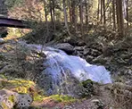
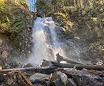
Davis Lake Provincial Park is located north of Mission, BC, and is a picturesque lake with some great views. The rugged and steep trail passes McDonald Falls, which has several points where the waterfall drops along Murdo Creek.
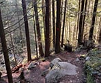
Although the distance is short, the upper section of this trail is very steep, the terrain is rugged, with rocks to step over and a fallen tree to pass underneath. Some hikers will find this trail easy due to its short distance, but other will find it quite difficult due to the terrain. The trail is well marked with plenty of orange trail markers on the trees.
Follow the trail near the bridge, just off the Lost Creek Forest Service Road, as it gradually goes downhill towards Murdo Creek. Before reaching the creek, the trail veers sharply to the right and continues downhill. The upper section of the route is very steep, so use caution with your footing.
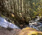
The trail follows alongside Murdo Creek and there are some views of the waterfall. At a point where the trail is next to the creek, carefully step down onto the rocks below and enjoy the view of McDonald Falls. The best view from the trail is obstructed, so climbing down onto the rocks will offer the best view of the waterfall.
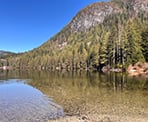
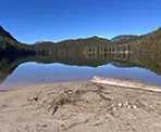
Continue hiking down the trail as it descends at a gentler pace compared to the top section. Follow the trail markers on the trees and walk along the rocky route until you reach the beach next to Davis Lake. The view is spectacular with Monastic Peak to the left and clear, calm view across the lake. There is a trail along the east side of the lake the offers a few additional views of the lake.
Once you've explored the area around Davis Lake, return via the route where you arrived and follow the orange markers back up the trail. The trail climbs steeply until making the last push up to the parking area long the Lost Creek Forest Service Road.
How to get to Davis Lake and McDonald Falls
Estimated Driving Time from Vancouver
1 hour, 30 minutes
Davis Lake Provincial Park is located north of Mission, BC, along the Lost Creek Forest Service Road. The gravel road is bumpy and can be driven by most vehicles but cars will need to drive the road at a slower pace. Higher clearance vehicles are recommended.
To reach the trailhead from Vancouver, drive to Highway #1 and enter the highway heading east. Take Exit #44 onto Highway 7B, the Mary Hill Bypass towards Maple Ridge. Drive along the Mary Hill Bypass until it merges with Lougheed Highway and passes over the Pitt River Bridge.
Continue driving through Pitt Meadows, Maple Ridge, and heading towards Mission while staying on Lougheed Highway. Continue driving through the town of Mission and, just east of Mission, watch for signs to Cascade Falls. Turn left onto Sylvester Road and drive 15km. The road will then become a gravel road and turn into the Lost Creek Forest Road. Drive 3km along the gravel road and just after driving over the bridge that crosses Murdo Creek, park on the left side where there is a wide clearing.
View a map of Driving directions to Davis Lake and McDonald Falls.

Although we try to keep information as current as possible, www.vancouvertrails.com makes no warranty or representation as to the availability, quality, fitness for purpose, conditions or accuracy of the information provided with respect to this trail or trails. The information provided herein is further subject to our Terms of Use.

Comments
Add Comment View All Comments