The Best Hiking Trails on Salt Spring Island
Salt Spring Island is located in the stunning Salish Sea between mainland British Columbia and Vancouver Island and is a charming paradise renowned for its vibrant arts scene and breathtaking natural beauty. Beyond its thriving arts community, delectable farm-to-table fare, and lovely markets, the island has an intricate network of hiking trails that meander through dense forests, across green meadows, and along rugged shorelines.
These are some of the best hiking trails that Salt Spring Island has to offer.
Mount Erskine Trail
The views from Mount Erskine are spectacular on a clear day, spanning across the channel towards Vancouver Island. The hike begins from a road called Trustee’s Trail and is not too steep of a climb, with most hikers being able to complete the loop in under 2 hours. The trails are numbered and hikers should aim for the viewpoint near where Trail #1 and Trail #3 join for the best view.
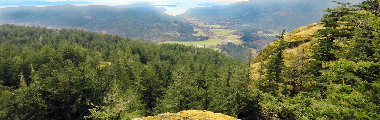
Mount Maxwell from Armand Way
Also known as Baynes Peak, the Mount Maxwell via Armand Way trail exists in Mount Maxwell Provincial Park and is one of several ways to reach the peak. Starting from the cul-de-sac at the end of Armand Way, the trail has a variety of uphill sections and portions that are fairly flat through the forested route. After the trail reaches the junction with the loop around the upper portion of the mountain, go left and there are a couple of excellent viewpoints before the trail climbs to the peak of Baynes Peak.
The peak can also be hiked via the Mount Maxwell Burgoyne Bay trail but the route is much longer. If you’re not willing to hike to the top, you can also drive to the top as well, however the road is very rough and requires a 4×4 with decent clearance in sections.
Ruckle Provincial Park
Ruckle Provincial Park is one of the gems of Salt Spring Island, with a network of trails, camping, and scenic coastal views throughout the park. If you’re making a quick stop at the park or hiking with young families, the short Ruckle Loop is a great route that goes from the day-use parking lot to a scenic point looking out to the Salish Sea. If you’re looking for a longer hike, the trail to Yeo Point is a great hike that follows the coastline, offering plenty of incredible views. Note that this version of Yeo Point starts from a different trailhead, however it can also be reached from the Ruckle Provincial Park day-use area by following the shoreline.
Chris Hatfield Trail
The Chris Hatfield Trail offers a short route to Yeo Point and the nearby beach, following a scenic west coast forested route. The trailhead is located near the end of the gravel Meyer Road and the hike can be done in about an hour. However, the rocky beach is a beautiful place to spend some extra time exploring or you can hike further along the shoreline in the direction of Ruckle Provincial Park and enjoy several different viewpoints.
Comments that gratuitously attack or demean individuals or organizations are not acceptable. We reserve the right to remove comments or any other content we deem unacceptable in our sole discretion, including removing user names and profile pictures. For our full website terms and conditions including our legal guidelines for user postings and comments on www.vancouvertrails.com, please see our Terms of Use and Privacy Policy.