- Difficulty Intermediate
- Time 4 hours
- Round-Trip 12km
- Elevation Gain 185 meters
- Season April - October
- Camping Yes
- From Vancouver 1 hour, 30 minutes
- Shuttle Service Parkbus
- Dog Friendly Yes
Trail Notice
Golden Ears Provincial Park is currently closed due to events surrounding the recent atmospheric river, including high water levels and damage to roads used to access the park.
The completion of a bridge over Gold Creek in late-2015 connected the East Canyon and West Canyon trails and it's possible for hikers to do a loop through this area of Golden Ears Provincial Park. The route passes several points of interest, including Viewpoint Beach, Hikers Beach, and the Gold Creek Lookout.
This trail is rated as Intermediate due to its length and one section of the route which is steep and rugged. Aside from this and despite being long, the majority of the route is fairly easy as it follows old logging roads which climb and descend gradually.
Starting from the Gold Creek parking lot, walk to the far end and look for the signs to the East Canyon Trail (this is not the same trail as the one to Gold Creek Falls). Follow the trail as it briefly climbs, then go left onto another trail and head away from the parking lot. Not too long after walking along the connector trail, you reach the East Canyon Trail. Go left and begin hiking into the backcountry.
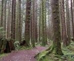
The East Canyon Trail was a road formerly used for logging operations, so it climbs gently and remnants of the days when industry was in the area can often be seen at the side of the trail. Continue following the route as it passes a small waterfall to the right and reaches a junction with the connector trail to Gold Creek Falls. Go straight and stay on the East Canyon Trail as it ascends briefly before descending and reaching the bridge over Gold Creek to your left.
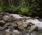
Before crossing the bridge, it's worth the time to continue further on the East Canyon Trail to Viewpoint Beach, a rocky beach along Gold Creek that's less than 1km further. From Viewpoint Beach, on a clear day, you can see Golden Ears and also Raven Peak. It's also a nice location to step for a snack and enjoy the creek during the summer months. Hikers Beach is located on the other side of the creek and, once you hike back to the bridge and cross, the trail will go to a junction with a trail that takes you to that beach. After enjoying Viewpoint Beach, hike back down the East Canyon Trail to the bridge.
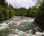
Cross over the bridge and enjoy the views of Gold Creek rushing below before following the trail on the other side. Not too long after crossing the bridge, you reach a junction and going right takes you to Hikers Beach. This is also a great side trip if you have time but there is a creek crossing just after the junction that is only passible during the summer or early fall season, depending on the rain and weather.
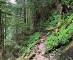
Continue the loop by leaving the junction and heading up the steep hill towards the West Canyon Trail. The trail climbs steeply and this next section is the most challenging of the entire route. Go left onto the West Canyon Trail to begin hiking back towards the parking lot areas. This section of trail is quite rugged, with lots of rocks and roots to step over so be sure to use caution and take your time hiking through this area.
The West Canyon Trail passes the Gold Creek Lookout, marked by an old wooden sign on a tree, offering a view of the creek below and the bridge that you crossed earlier. After enjoying the view, carefully walk up the wooden steps and continue through the forest along the West Canyon Trail as it starts to descend.
Watch for a sign to your left marking a trail that goes to the Gold Creek Falls Viewpoint. If you have extra energy and don't mind hiking down a steep hill and then back up again, this view of Gold Creek Falls is spectacular as you see it from an angle looking straight on. Follow the orange markers on the trees as the trail descends steeply, making its way down some old, slippery wooden planks, before reaching the bottom. Go right and then look for an opening in the trees offering a view. There is no specific marked view, so you will have to find the best view as you peer through the trees. After enjoying the view, follow the orange markers and hike back up the steep hill to the West Canyon Trail.
From the junction of the Gold Creek Falls Viewpoint back to the start, the hikes is fairly easy but long. Follow the West Canyon Trail as it makes its way through the forest, passing over a couple of bridges and past the junction to the Viewpoint Trail. Not much further and you reach a water tower on your left and the junction to the Menzies Trail. Go left onto the Menzies Trail (if you reach the West Canyon parking lot, you've gone too far and will need to walk back to the Menzies Trail) and follow it for the next 10-minutes until it descends through a switchback and finishes at the road near the one-way bridge you drove across earlier. Walk across the bridge towards the parking lot where you started your hike.
How to get to Golden Ears Canyon Loop
Estimated Driving Time from Vancouver
1 hour, 30 minutes
Golden Ears Provincial Park is located north of Maple Ridge. If you are driving from the Vancouver area, drive to Highway #1 and enter the highway heading Eastbound. Drive east through Burnaby and exit before the Port Mann Bridge, taking Exit #44 to Highway 7B the Mary Hill Bypass. As you exit in one of the 2 lanes, stay to the left to ensure you merge onto the Mary Hill Bypass.
Follow the Mary Hill Bypass and merge onto Highway 7 heading east across the Pitt River Bridge to Pitt Meadows and Maple Ridge. Continue driving along Highway 7 into Maple Ridge and turn left at the lights onto Dewdney Trunk Road. Drive for some distance until the intersection with 232 Street and turn left.
Drive north along 232 Street until a large roundabout and turn right onto 132nd Avenue. Follow this street as it turns into Fern Crescent and eventually you will reach the Golden Ears Provincial Park sign at the entrance to the park. Follow the Golden Ears Parkway all the way to the end for about 13km, crossing a one-way bridge and arrive at the Gold Creek Parking Lot.
View a map of Driving directions to Golden Ears Canyon Loop.
Parkbus
Parkbus provides access to Golden Ears Canyon Loop. For rates, departure times, and to reserve your seat, visit the Parkbus website.

Although we try to keep information as current as possible, www.vancouvertrails.com makes no warranty or representation as to the availability, quality, fitness for purpose, conditions or accuracy of the information provided with respect to this trail or trails. The information provided herein is further subject to our Terms of Use.


Comments
Add Comment View All Comments