- Difficulty Intermediate
- Time 2 hours
- Round-Trip 3.5km
- Elevation Gain 320 meters
- Season April - October
- Camping No
- From Vancouver 2 hours, 45 minutes
- Public Transit No
- Dog Friendly No
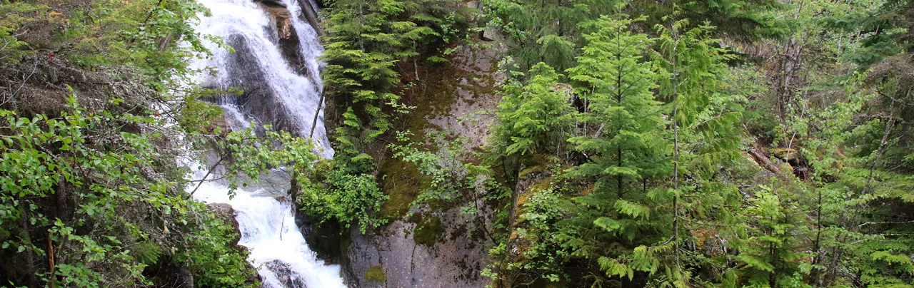
Cool Creek Canyon is a short, steep hike that offers scenic views of waterfalls and the Birkenhead River valley area north of Pemberton, BC. The route climbs up the steep hill on one side of Cool Creek, crossing a bridge higher up, before descending down the other side back to the road.
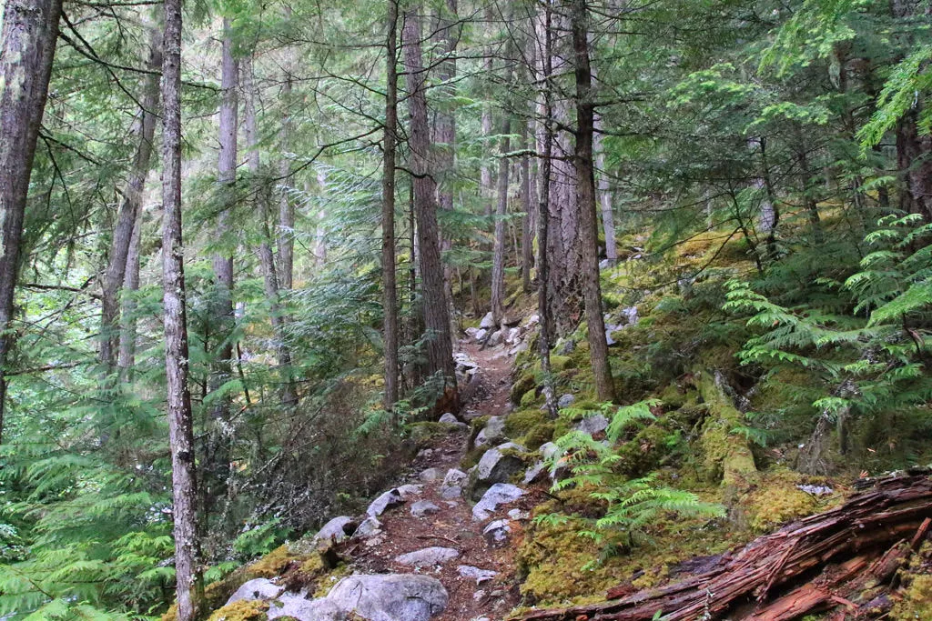
From the trailhead next to the small gravel parking area alongside Portage Road, walk past the wooden sign and follow the trail as it begins to climb quickly. The route passes through a forested section, offering occasional glimpses of Cool Creek while steadily climbing as you work to pace yourself. Near a rockslide, the trail veers to the left and continues following a path near the creek.
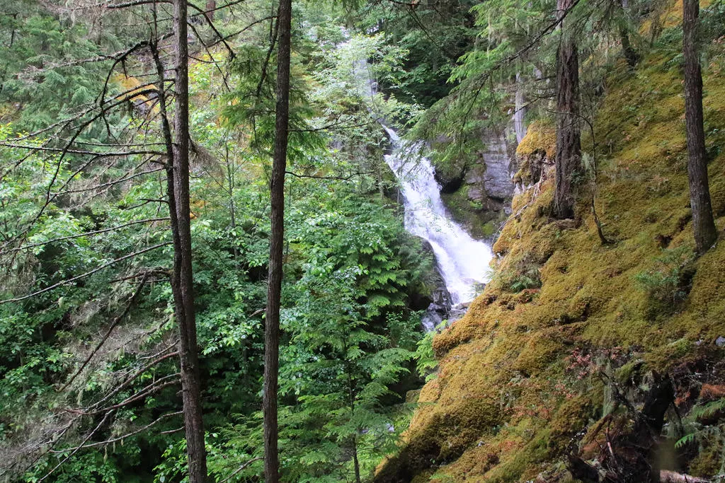
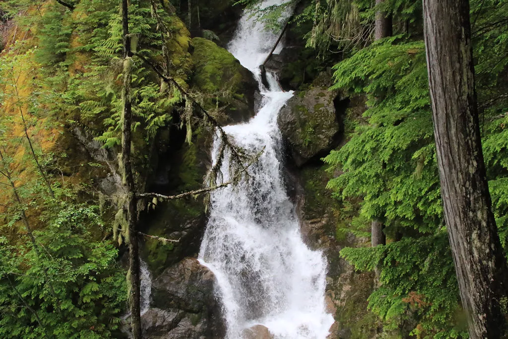
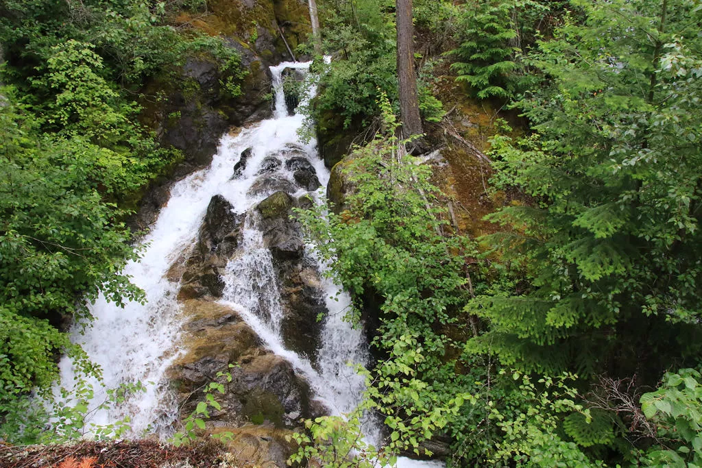
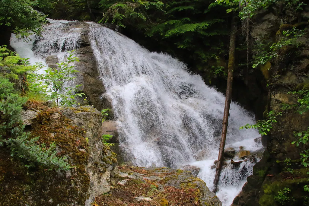
There are no trail markers but the route is clearly defined and well maintained. As you make your way higher up the canyon, there are a couple of places to enjoy the view of the rushing water. Do not venture too close as the rocks can be slippery and the rushing water can quickly sweep you over the edge unexpectedly.
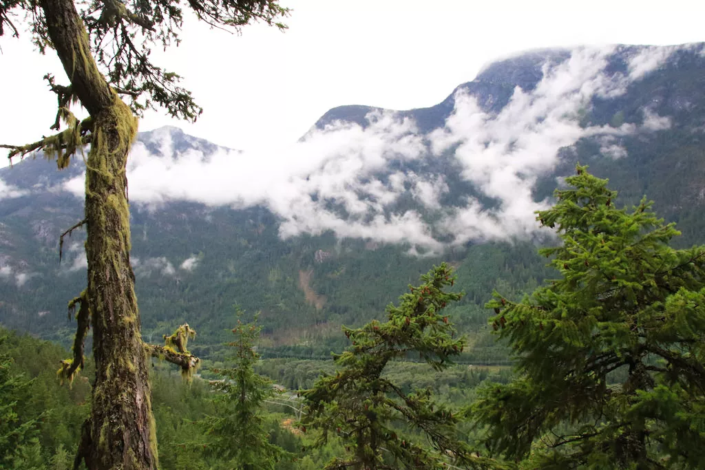
The trail weaves its way up onto several rocky ridges and scenic views of the Birkenhead River valley can be seen between the trees. Quickly stop to enjoy the views, catch your breath, before continuing up the narrow trail that pass up and over the rocks. The route begins to ascend at a lower rate as you quickly make time through the forest and reach a wooden bridge crossing Cool Creek. This is the highest elevation point of the hike and the trail will descend on the opposite side of the creek.
Follow the trail downhill as it descends via a series of switchbacks where there is often a great view of a waterfall at the switchbacks closest to the creek. There are a couple of spots that offer a clearer view of the waterfalls than they did on the other side of the canyon. As you continue descending, the trail reaches a junction where another trail goes off a short distance to the right to a picnic table. This is a beautiful spot with a view that looks north up the Birkenhead River valley, offering a great place for lunch.
Return to the trail and continue to descend. The hike down is fairly quick as you continue to follow the creek before the trail exits the forest and returns back to Portage Road. Walk left along side the highway back to the small gravel parking area to where you began your hike.
How to get to Cool Creek Canyon
Estimated Driving Time from Vancouver
2 hours, 45 minutes
The Cool Creek Canyon Trail is located north of Pemberton, just off of Portage Road on the way to D'Arcy where the Spetch Creek FSR begins. The turnoff to the Spetch Creek FSR is about 13km north of Mount Currie and there is a signboard for Cool Creek Canyon right at the start of the gravel road with lots of parking.
From Vancouver, drive to Highway #1 and head northbound towards Horseshoe Bay. Merge onto Highway #99, the Sea To Sky Highway, and begin the long drive north bound towards Pemberton.
Continue driving north along Highway #99, leaving Pemberton and drive through the community of Mount Currie, carefully watching your speed. Go straight at the intersection, heading towards D'Arcy (not Lillooet). When you cross the train tracks at the end of the community of Mount Currie, zero your Odometer. Drive about 13km and watch for a gravel road on your right. There are no warnings or signs but it is just after a very long straight stretch of road and will be on the right. Once you turn onto the gravel road, there will be a sign for Cool Creek Canyon and one for the Spetch Creek FSR.
If you drive over a bridge for Poole Creek, you have gone too far. If you make it to a lake called Gates Lake in the small community of Birken, you have gone too far. From the town of Birken, you will need to backtrack about 9km.
View a map of Driving directions to Cool Creek Canyon.

Although we try to keep information as current as possible, www.vancouvertrails.com makes no warranty or representation as to the availability, quality, fitness for purpose, conditions or accuracy of the information provided with respect to this trail or trails. The information provided herein is further subject to our Terms of Use.
Comments
Add Comment View All Comments