- Difficulty Easy
- Time 2 hours
- Round-Trip 5km
- Elevation Gain 160 meters
- Season year-round
- Camping No
- From Vancouver 30 minutes
- Public Transit No
- Dog Friendly On-Leash
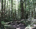
Whyte Lake is a small, peaceful lake in the hills of West Vancouver above Horseshoe Bay. The trail is scenic, following Nelson Creek uphill through a grove of Western Cedar and Douglas Fir trees and pass several large old growth giants. The trail begins at a somewhat steep pace but, overall, is relatively short and easy.
From the metal gate in the gravel parking area just off of Westport Road, walk down the gravel access road as it weaves and passes under the highway. Just after the overpass, follow the gravel access road up a steep slope. While the trail is rated easy, this will be the steepest section of your climb and is not very long, so take your time. Just after the road veers left and a water tower comes into view, look for a trail sign post to the right. Take this trail to the right and walk into the forest, continuing uphill.
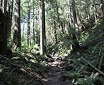
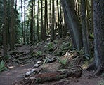
This section of the trail is part of the Trans Canada Trail. It continues to climb at a more gradual rate as you enjoy the second growth forest. Within 15 - 20 minutes, you will reach a trail sign at a junction. Go left onto the Whyte Lake trail and walk down the short hill to where the trail passes along some wooden railings. Through this section, be sure to look up at the trees as there are several large, old-growth Douglas Firs along the canyon.
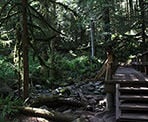
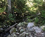
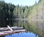
The trail continues through the forest, eventually passing over a wooden bridge over Nelson Creek. In the spring, it will often be muddy and may occasionally have snow covering it during the winter months. Not long after passing over a second wooden bridge, the trail reaches a sign pointing to Whyte Lake to the right. Go right and within a minute, you arrive at the small wooden dock and the quiet lake.
After enjoying your time at the lake, retrace your steps back down the hill, going right at the junction onto the Trans Canada Trail, then following the gravel road back down, under the highway and back to the metal gate where you began.
Hike Extension to the Baden Powell
For those looking for a longer hike, you can continue along the Whyte Lake Trail past the lake, over the wooden boardwalks, to a junction. Go left at this jucntion and downhill a short distance where the trail will join the Baden Powell Trail. At the Baden Powell Trail, if you go right and follow the trail uphill, it will take you to Eagle Bluffs but it's a long, difficult hike. There are sections of the Baden Powell that are quite steep and challenging .
How to get to Whyte Lake
Estimated Driving Time from Vancouver
30 minutes
The trailhead for Whyte Lake is located near Highway #1 in West Vancouver, just east of Horseshoe Bay. To get there from Vancouver, take the Lions Gate bridge to the North Shore and stay to your left so that you exit the bridge to West Vancouver. After looping around, stay in the right lane, and at the first set of traffic lights, turn right onto Taylor Way. Drive up the hill and, just after passing under the highway overpass, turn left onto Highway #1 (Trans Canada Highway) heading westbound.
Drive about 8km and exit at Exit #4 Woodgreen Drive to Caufield. At the stop sign, turn left onto Woodgreen Drive. At the 4-way stop, go straight onto, what is now called Westport Road, and follow this road as it briefly goes up a hill, then winds its way down and passes under the highway. Immediately after passing under the highway, turn right into a gravel parking area and park in a spot as close to the metal gate as possible. The trail begins from the metal gate.
View a map of Driving directions to Whyte Lake.

Although we try to keep information as current as possible, www.vancouvertrails.com makes no warranty or representation as to the availability, quality, fitness for purpose, conditions or accuracy of the information provided with respect to this trail or trails. The information provided herein is further subject to our Terms of Use.

Comments
Add Comment View All Comments