- Difficulty Difficult
- Time 7.5 hours
- Round-Trip 11.5km
- Elevation Gain 975 meters
- Season June - October
- Camping No
- From Vancouver 20 minutes
- Public Transit Yes
- Dog Friendly Yes
The hike to Eagle Bluffs from Horseshoe Bay is a steep route that follows the Baden Powell Trail to the incredible viewpoint. The trail passes close to Whyte Lake before continuing uphill and entering Cypress Provincial Park.
Note that it is more common to hike to Eagle Bluffs from the Cypress downhill ski area at the top. This route has limited parking at the trailhead and is more difficult.
The hike begins from the small parking lot next to the old Sea To Sky road near the Horseshoe Bay Ferry Terminal ticket booths. Walk through the gate, past the sign and the trail immediately climbs very steeply uphill. After a 5-10 steep incline, the path levels and follows alongside the rocky wall of Highway #99. Follow the trail underneath the highway where it reaches a sign on the other side.
Go left at the sign and follow alongside the highway for a short distance until the trail gradually veers away from the highway. After walking up a small hill, you reach a clearing next to a metal gate and Highway #99. Go right up the steep hill as you leave the highway area for good.
The trail climbs quickly up an old access road. After 10-minutes of steep uphill, the trail levels briefly as you quickly make time but then begins to climb again. Eventually, you reach a sign that points to the right to Whyte Lake.
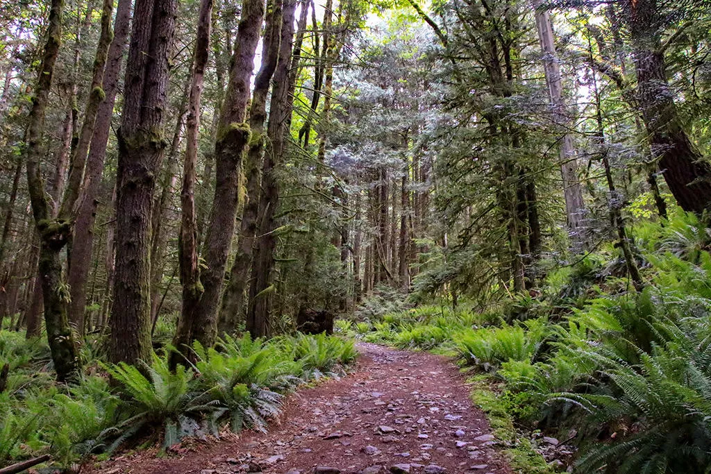
Go left and continue following the Baden Powell Trail uphill until the trail briefly levels before continuing uphill once again. Go left at a junction and stay on the wide, old road. At the end of the wide, old road, a trail begins and continues uphill as you reach a BC Parks' sign marking the boundary of the Provincial Park. Continue following the narrow Baden Powell Trail, watching your step as you make your way up the rocky route.
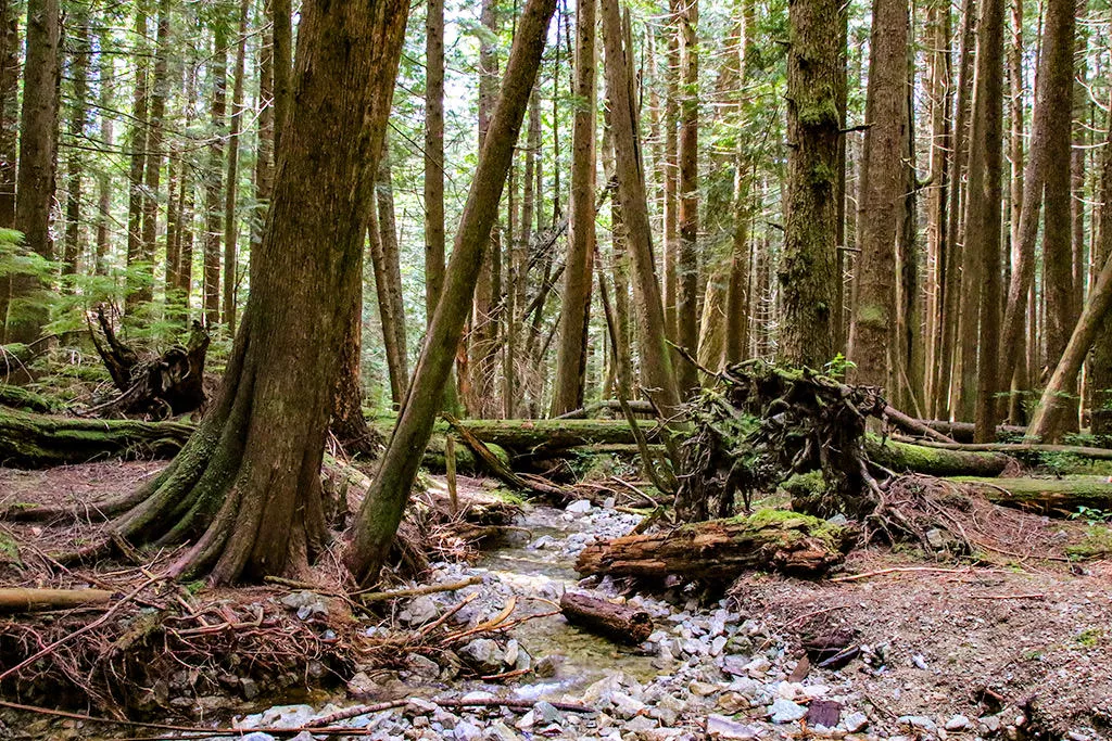
The trail passes through a scenic section, crossing a creek. During the spring and early summer, the creek can be running high and crossing along the log is your best option. Once you have crossed the creek, the trail will climb significantly as some of the steepest sections remain before reaching Eagle Bluffs.
After hiking for over a couple of hours in the forest, the trail emerges at a boulder field. Scramble up the rocks, keeping to the right and following the occasional orange marker. At the top, the trail continues its relentless climb in the forest as you make your way up some switchbacks.
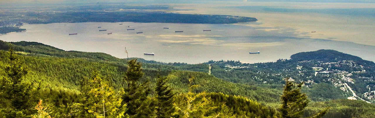
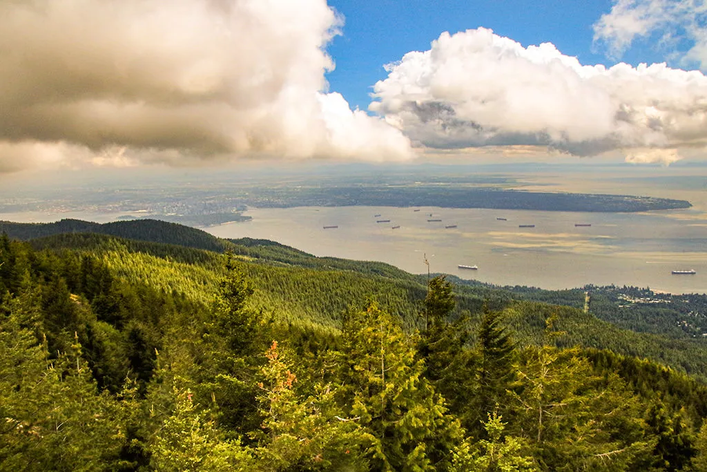
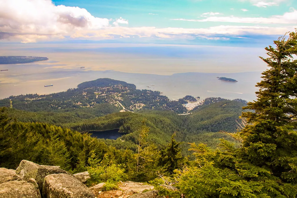
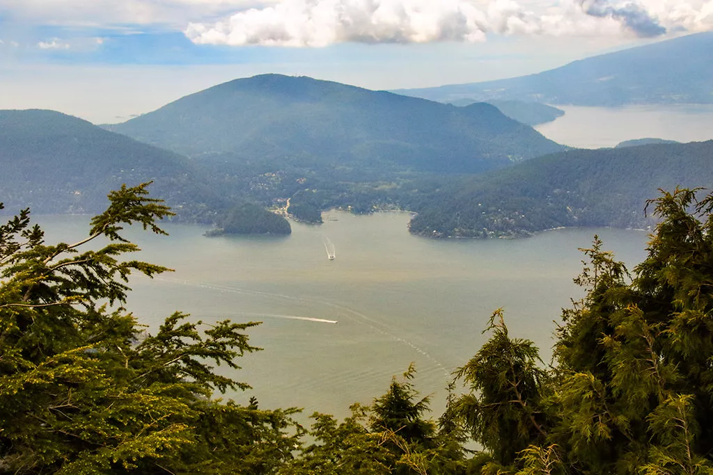
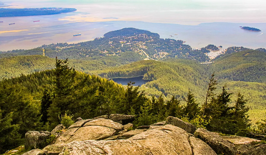
As you near the top, there is a viewpoint from a rocky bluff. Eagle Bluffs is a bit further beyond this point. Follow the route up the rocks and through the trees as it rounds a corner, bringing you up onto Eagle Bluffs. The view is incredible as you look down towards the entrance to Howe Sound and across towards the city.
After enjoying the view, being the hike back downhill by following the trail on the east side of Eagle Bluffs where you arrived. Follow the worn route past the lower viewpoint and disappear into the forest as you descend quickly along the steep trail. Watch your footing and take your time on the boulder field, loose rocks, and tree roots. After descending along the Baden Powell for quite sometime, cross back over the creek and continue as you pass the BC Parks' sign. Not much further and the narrow trail reaches the old road.
Follow the access road back downhill until you reach the junction with the Whyte Lake Trail. It is only a short 500-metres to Whyte Lake from the Baden Powell Trail and worth a visit if you have some remaining energy.
From the Whyte Lake Trail junction, follow the road back down towards the highway, crossing under the highway, and making the final descent back to the parking lot area.
How to get to Eagle Bluffs via Horseshoe Bay
Estimated Driving Time from Vancouver
20 minutes
The trailhead to Eagle Bluffs from Horseshoe Bay is the same trailhead as the Baden Powell Trail in West Vancouver. It's located at a small parking lot on the old Sea To Sky road, just on the other side of a fence that separates the Horseshoe Bay ferry ticket booths.
To access this small parking lot, you will need to take Exit #2 highway exit when heading westbound towards Horseshoe Bay along Highway #1. This exit is just after the one for the Ferry Terminal but before getting onto the Sea To Sky Highway heading Northbound.
After taking Exit #2, drive straight through the roundabout and continue a short distance down the old Sea To Sky road on the other side of the Ferry Terminal. Slow down and watch for a small, gravel parking lot on your right, which is just beyond an imaginary line with the ferry ticket booths. If you reach the 3-way intersection at the overpass, you just missed the parking lot and you will need to turn left and loop around via Eagleridge Drive (and Marine Drive) and try again (see below).
If you miss this exit and end up on the Sea To Sky Highway, you will not be able to turn around for several kilometres until you reach Ansell Place. Once turned around, or if you end up in Horseshoe Bay, it's best to return to Horseshoe Bay, drive to the roundabout where Marine Drive begins, and eastbound a short distance on Marine Drive, turning onto Eagleridge Drive. Follow Eagleridge Drive until it crosses the highway, then make a left at the roundabout. Drive down the old Sea To Sky Road and be prepared for the parking lot on the right.
View a map of Driving directions to Eagle Bluffs via Horseshoe Bay.
Transit Access to Eagle Bluffs via Horseshoe Bay
Eagle Bluffs from Horseshoe Bay is a transit-friendly hike as a West Vancouver Blue Bus provides service to the Horseshoe Bay area right from downtown Vancouver. Make your way to the bus stops downtown along Georgia Street near Seymour Street. Look for Bus #250 to Horseshoe Bay. This bus will take you right to the stop and takes just under 1-hour. You will need to exit the bus near the end of Marine Drive where the overpass is (across from Glen Eagles Elementary School). Once you?ve exited the bus at this stop, walk to the roundabout and walk across the overpass. Go right and carefully walk along side the road for about 150-metres to where there is a small gravel parking lot and the beginning of the Baden Powell Trail.
Note that if you miss getting off of the bus at the correct bus stop, the bus will stop at the Horseshoe Bay Ferry Terminal. It is about a 15-minute walk from the ferry terminal to the trailhead.

Although we try to keep information as current as possible, www.vancouvertrails.com makes no warranty or representation as to the availability, quality, fitness for purpose, conditions or accuracy of the information provided with respect to this trail or trails. The information provided herein is further subject to our Terms of Use.
Comments
Add Comment View All Comments