- Difficulty Difficult
- Time 5 hours
- Round-Trip 6.5km
- Elevation Gain 630 meters
- Season April - November
- Camping No
- From Vancouver 1 hour
- Public Transit No
- Dog Friendly No
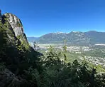
The Slhanay Peak Trail is a rugged hike that takes you to several incredible views that overlook the town of Squamish and the nearby Stawamus Chief. The trail is steep and has several technical sections and is therefore rated as difficult.
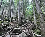
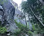
The trailhead is located along the Mamquam River Forest Service Road where it immediately enters the forest and climbs up a rocky trail. The first 50 metres is a gradual incline but once the trail gets onto the mountain side, the path begins to climb very steeply. Zig zag your way up the hill, being careful where you step, until you get close to the rock wall. Follow the trail to the right of the walk wall as it continues climbing and you carefully make your way over several boulders.
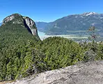
The next section of trail is the trickiest as it passes along a narrow path where there is a steep downhill to your right. Be very careful not to venture too close to the edge. The trail wraps around a cliff area and then arrives at a viewpoint. This viewpoint is partially blocked by trees and there is a much better viewpoint a short distance further along the trail. Continue along the trail and watch for a small trail on the right that takes you to a rocky outcrop with a view of Squamish and the Stawamus Chief to the left.
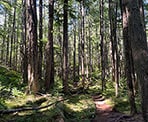
Return to the trail and, a short distance beyond the views, go left at a junction. The hike is much easier and passes through a lush forest with plenty of moss, only ascending at a gradual pace. At a second junction, go left again and continue to follow the well defined trail.
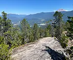
During the next section of trail, it's important to watch for a trail heading off to the right as this takes you to the best view along the Slhanay Peak Trail, known as Tony's Lookout. The trail is not obviously marked as there is a worn wooden sign on a tree but it can easily be missed. Once you reach the path on the right, follow the short 150 metre trail and walk up onto the rocky outcropped towards a bench overlooking one of the most magnificent views in the area. For many, this might be the end point of their hike as Tony's Lookout offers a much clearer view than at the summit.
Walk back down the rocky outcrop and return to the main trail. If you are heading to the summit, continue walking uphill and a short distance later, you reach a junction next to a damaged wooden sign post. The trail to the left goes up a steep hill to the summit and is a more direct route. The trail to the right is much longer and wraps around before reaching the summit, however there are no views along the longer route.
Go left at the junction and follow the more direct trail to the peak. The trail climbs gradually at first but then becomes very steep as you continue to make your way up the hill. Eventually, the trail begins to level where there is a small trail to the right to a false peak. Continue along the main trail as it passes through a small forested grove and approaches a large rock wall. At the junction by the rock wall, go left and make your way up onto the rock, following the worn route where you reach the peak of Slhanay a short distance further.
After enjoying the peak, walk back down the rocky summit, and return into the forest along the trail. Make sure to go right at the junction after entering the forest, otherwise you will be on a different route and will end up doing the long trail. Follow the trail down the steep hill until it returns to the main trail. Go right and head back down hill, passes through the forested area and past all of the viewpoints.
When you reach the viewpoint near the section of trail with the steep cliff, be very careful hiking around this and back over the boulders as you make your way downhill. The downhill descent is very steep and the terrain uneven, so be careful where you step and make sure to take your time. Eventually, you get to the bottom and quickly make your way out of the forest and back onto the FSR.
How to get to Slhanay Peak Trail
Estimated Driving Time from Vancouver
1 hour
The trailhead for the Slhanay Peak Trail is located along the Mamquam Forest Service Road (FSR), just 1.5km from the Sea To Sky Highway in Squamish, BC. There is plenty of parking along the Mamquam FSR next to the trailhead. Please make sure to park perpendicularly to the road to allow more space for additional vehicles.
If you are driving from Vancouver, drive to Highway #1 the Trans Canada Highway and make your way onto the highway heading westbound. Drive towards Horseshoe Bay and merge onto Highway 99, the Sea To Sky Highway, heading Northbound toward Squamish.
After passing the Sea To Sky Gondola, drive for another 1.5km and, as the highway goes down a hill, watch for the turnoff on the right to the Mamquam FSR (it's before the traffic light). Turn right onto the gravel Mamquam FSR and drive 1.5km. After driving 1.5km, there will be an area on the right to park. The trail begins just past this parking area where it immediately enters the forest.
The beginning of the Mamquam FSR is gravel and very well maintained and should be drivable by most vehicles.
View a map of Driving directions to Slhanay Peak Trail.

Although we try to keep information as current as possible, www.vancouvertrails.com makes no warranty or representation as to the availability, quality, fitness for purpose, conditions or accuracy of the information provided with respect to this trail or trails. The information provided herein is further subject to our Terms of Use.

Comments
Add Comment View All Comments