- Difficulty Intermediate
- Time 3.5 hours
- Round-Trip 6km
- Elevation Gain 260 meters
- Season April - October
- Camping No
- From Vancouver 1 hour
- Public Transit No
- Dog Friendly Yes
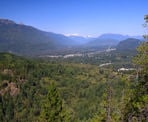
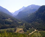
Mount Crumpit in Squamish is located next to the Stawamus Chief and has some pretty spectacular views for a hike that is not as popular as others in the region. There are several viewpoints that look towards the Chief, Howe Sound, and across the town of Squamish towards several of the mountains to the west.
One thing to note before starting this hike is there are a lot of trails around Mount Crumpit and they are like a maze if you are not prepared. There are trail signs at some junctions but it is not always clear which junction you are at or the trail names are on signs attached to trees that are easy to miss. Be prepared for this with a good map and navigation tools, like a GPS or compass.
This description follows a clockwise loop, however the trail can be completed in the opposite direction too. The trail that descends from Mount Crumpit in the clockwise direction is quite steep, so if you prefer to hike up a steep trail instead of down, you may consider hiking the trail in a counter-clockwise direction.
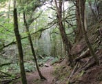
From the trailhead on Westway Avenue, enter the forest and cross the bridge. Immediately go left and follow the wide trail uphill along an open section as the trail levels and you quickly make time. When the trail crosses some boardwalks, go right at the junction and onto the S&M Connector Trail.
Follow the S&M Connector Trail and after just 50-metres, there is a trail on your right next to a fallen log. This is the end of the loop where the route will return after hiking up to the top of Mount Crumpit. Continue straight, following the S&M Connector Trail as it climbs gradually and passes through a scenic forest in a small valley. The S&M Trail is shared with the occasional mountain biker, so keep an eye out for anyone coming down the hill. Stay on the S&M Connector, passing the first junction.
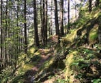
After walking for about 1km, you reach a junction with a sign for the Fatherside Trail to the right. Go right and follow the Fatherside Trail. The next section of the route is a bit confusing as there are several junctions but it's important to stay on the Fatherside Trail (the signage is not that great). Go right at the first junction, then a very sharp left at the second junction. The trail goes up a gradual hill before dipping down slightly and veering to the right. Go straight at a 4-way junction and, after the 4-way junction, keep an eye out for a trail on the right. When you reach a trail that goes to the right, there should be a sign on the tree labeled the Woodpecker Trail. Go right and follow the Woodpecker Trail as it climbs steeply up the side of Mount Crumpit.
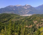
After climbing uphill for about 10-15 minutes, you reach a junction. Go left and follow the trail up onto the rocks for a worthwhile viewpoint that looks North towards several mountain ranges. Once you have enjoyed the viewpoint, return to the main trail and continue.
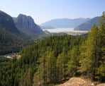
Shortly after, you reach another junction where there is a sign that points one direction to the longer route and the other to the shorter route. Go right and follow the trail in the direction of the shorter route. After hiking for another 5-10 minutes, the trail reaches another junction. Go left at this junction downhill a short distance and the trail exits the forest onto a rocky bluff with a great view of the Chief looking across the Mamquam FSR.
Return to the main trail and follow it a short distance until it suddenly seems like it ends. It doesn't end but actually continues to the right up a steep rock scramble, requiring the uses of your hands, as you make your way up. It's a short scramble and before you know it, you reach the top where there is yet another great view of The Chief and Howe Sound.
Continue following the trail and go left at a junction as the trail goes downhill slightly before climbing again and wrapping around the mountain to a viewpoint near the peak of Mount Crumpit. You can walk to the peak just off the trail to the left but there is no view as most of the views are along the trail itself. Follow the trail further until you reach another view looking south. This is the final view point near the top before the trail descends.
After enjoying the viewpoints near the top of Mount Crumpit, follow the trail a short distance before it begins to descend quickly down a very steep route. The loose dirt can be slippery so take care to watch your step and take your time. Go right at a junction and continue a short distance to another junction with a sign. This time go left and follow the Deep Ends Trail to the S&M Connector.
The trail begins to climb uphill again and then it feels like it ends again. Follow the worn path up the rocky slope to where a dirt trail continues as you make your way over the rock and then begin to descend again. A short distance after the hill, a trail goes off to the left to a rocky bluff. This is worth exploring as it's one of the best views as you walk out onto the rocks with a full view of the Chief and Howe Sound in front of you. Walk to the right a bit where there is a wooden bench looking at the view to the North West.
Return to the main trail and continue downhill as the trail again descends down some steep section. One section is a bit tricky where you will have to carefully lower yourself over a rock, using your hands to hold onto some other rocks on the side. The pace quickens as the trail continues downhill at less of an incline. Go right at two separate junctions and a short distance further, you return to the S&M Connector Trail where you passed by the fallen log earlier. It may not be recognizable at first but go left for about 50-metres and you reach the boardwalks at the junction with the S&M Connector Trail.
At the boardwalks, go left and follow the trail through the open section that you hiked earlier, returning down the hill. Watch for the trail to the right and follow it, crossing the wooden bridge and returning to Westway Avenue where you began.
How to get to Mount Crumpit
Estimated Driving Time from Vancouver
1 hour
Mount Crumpit is located in Squamish, just north of The Chief.
To drive to the trailhead for Mount Crumpit from the Vancouver-area, drive to Highway #1 and head westbound towards Horseshoe Bay. Merge onto Highway #99: The Sea To Sky Highway and drive north towards the town of Squamish.
As you get close to the town of Squamish, watch for the Chances Casino on the right and at the light after the casino, turn right onto Clarke Drive. Immediately after turn off the highway, turn left and continue a few hundred metres on Clarke Drive. Almost immediate (again), turn right onto Guilford Drive. Follow Guildford Drive for about 500-metres and turn left at the 4-way intersection onto Westway Avenue. Follow Westway Avenue for about 2km until you reach the end where it curves right onto Cherry Drive. In that curve, the trail begins next to a wooden sign.
Parking
Ensure to park where parking is permitted and try to minimize the disturbance of the neighbours. If there is no parking along the street, there is a gravel parking lot about 500-metres down Westway Avenue with a trail map of the area.
View a map of Driving directions to Mount Crumpit.

Although we try to keep information as current as possible, www.vancouvertrails.com makes no warranty or representation as to the availability, quality, fitness for purpose, conditions or accuracy of the information provided with respect to this trail or trails. The information provided herein is further subject to our Terms of Use.

Comments
Add Comment View All Comments