View Slesse Memorial Trail Description | Add Comment
Taylor from New Westminster writes:
I'm only rating this a 1 star because i was not able to access the hike with my Rav4 which I thought would have been enough clearance. The service road to the trailhead is full of divots and ditches throughout the road, making cars bottom out constantly. You will definitely need a tall jeep or some other vehicle with high clearance in order to get to the trailhead. I will be trying again eventually but with with sandbags to place in the divots to reduce bottoming out, or with a higher vehicle.
Posted: October 20, 2020 09:19:32 AM PST
Lisa from Langley writes:
Drove up the last week of August to the trailhead, and hiked to the plaque. A little over an hour to get up to the plaque. Road was sketchy but doable for my Subaru Crosstrek, definitely bottomed out a couple times though. Road to trailhead was open, to answer the previous review.
Posted: September 14, 2020 01:48:08 PM PST
Imola Gotz from North Vancouver writes:
As far as we heard this is an awesome hike!
Anybody hiked this trail in Aug or Sept of 2020? We are willing to leave our vehicle on the main road and hike the 6km to the trailhead, but were wondering if the access road is actually closed, meaning un-passable for hikers on foot?
Any info would be much appreciated:)!
Posted: September 5, 2020 07:40:42 PM PST
darrin from Chilliwack writes:
Road for access (Nekawatch FSR) is closed for active logging.
Went up the road yesterday and there were signs posted about active falling and on further inspection they actually had work vehicles parked further up on the road blocking the way thru to the trailhead. So if you go, have a back up hike plan if the road continues to be closed. Back up plans could include Pierce Lake or Radium Lake which are both good and fairly steep hikes within a 10 minute drive.
Posted: February 9, 2020 03:54:36 PM PST
GG from Vancouver writes:
Did in Sep 7, 2019. Awesome hike with incredible views! What comments say about 4x4 is absolutely true, do not drive unless you have high clearance. See pics.
Recommended hike!
Posted: September 12, 2019 10:22:03 PM PST
Jonathan White from Abbotsford writes:
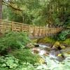
First, a big thank you to the city of Chilliwack for the great signage job, for this and other mountains, sometimes getting to the trail head can be quite confusing. The trail is in great shape, the bridge is wonderful ,nice work trail keepers
It was a beautiful sunny day, a nice breeze blowing, was a great day to hike up the mountain
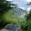
As I got to the Memorial Plaque with the Mountain looming over it .So happy to get here but sad for what had happened here
About another 1.5 km to the memorial with the propeller and parts from the wreckage
A very nice day, leave early if you like taking pictures there’s so much to see and enjoy
Posted: August 22, 2019 11:26:57 AM PST
Gerry McGuire from Vancouver writes:
Anybody, I'm a novice hiker who would like to go to the propeller cairn, but I'll need a guide for sure. If anybody could help me with this. I'm willing to pay for the help, and would like to go in July of 2019. Thank you. Gerry 604 961 9123 [email protected]
Posted: February 12, 2019 02:02:20 PM PST
keaghnan from delta writes:
Hi Just attempted this hike the other day. Unless you have a truck don't attempt to go on this hike.
Most cars only made it in 3km and its another 3km in to the start of the hike.
Posted: August 5, 2018 04:55:28 PM PST
Joe from Surrey writes:
Im planning to head up there this Friday, anybody know the conditions?
Posted: July 10, 2018 10:27:03 AM PST
angel gray from richmond writes:
Hey all,
i’ve attempted this hike once while snow still covered the service road and could not make it up. However I’m planning on going up this friday (JULY 2ND, 2018) do any of you know if there’s still snow? i’ll be going up in an SUV, ford escape.
wish this hike wasn’t so difficult to get to :(
Posted: July 2, 2018 03:28:54 PM PST
STEVE from Vancouver writes:
Andre, can you please clarify how bad the washout is? Planning on going for a drive in my Mini and then doing the hike but want to make sure we can make it.
Cheers.... Steve
Posted: May 7, 2018 01:31:11 PM PST
Alan from Port Moody writes:
Andre, I'm thinking of doing this hike on May 12 or 13, 2018. At what point did you hit snow? Was it doable with micro spikes or crampons, or did you need snowshoes? Is a 4x4 really necessary, or is a high clearance SUV good enough?
Thanks!
Posted: May 6, 2018 10:38:27 PM PST
Andre from Richmond writes:
Updated driving instructions as of May 5th, 2018:
The gravel road is washed out twice - once around 3km, next around 2 km from the trailhead. First washout is crossable with a 4wd. Park at the end of the drivable road and start walking. At the first fork, turn left (follow signs for slesse and rexford). Go up the severely washed out forest service road and turn right at the next fork. The trailhead is a short distance ahead to your right, look for the technical tape hanging from the trees. If you've reached the sign for rexford (no mention of slesse) you've gone too far.
Posted: May 6, 2018 03:57:31 PM PST
Ali from Surrey writes:
Did this Hike on Thanksgiving weekend. Trail is in a pretty good shape. However, there was a fair amount of snow at the top which made it somewhat challenging. Views from the top were amazing. To get to the trailhead, you do require a vehicle with high clearance. An AWD SUV would do just fine, but a car would definitely NOT make it.
Posted: October 19, 2017 07:24:37 PM PST
Sarah from Langley writes:
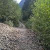
The trail was being worked on as I hiked today. A lot of the overgrowth had been cut back and the bridge is safe to cross. Very muddy in the beginning but not too bad once you pass the stairs. I only made it to the plaque but the views were very beautiful and well worth the trek. The changing leaves added a lovely red to the blue and green mountain backdrop. I brought my dog and had no problems; lots of water for him to drink. The only bathroom is at the recreation site when you first enter. Make sure you have a good vehicle with ground clearance and tires before you attempt the 6km service road.
Posted: October 1, 2017 09:34:21 PM PST
Darin from Chwk writes:
The trail is very overgrown at the moment. If you want to bushwhack and walk through spiderwebs for two hours hit this hike up. We gave up before we saw any nice vistas. Also the bridge shown in the photos above is washed out. Trail must be overgrown because most people see the washout and can't see the trail continuing, and leave. It does continue, but it's not obvious.
Posted: August 19, 2017 10:25:07 PM PST
Jerry from Surrey writes:
Good Hike overall.
The drive up, you will need a truck/suv with high clearance. It is quite rocky and full of deep dips.
The trail itself, it is not for the faint hearted. It was muddy, bushy and full of bugs. The terrain itself made it difficult. I'd recommend wearing long sleeve and pants for the flies and mosquitos.
The view up top was great, however, getting up there wasn't.
Posted: August 16, 2017 12:55:59 PM PST
Have you hiked Slesse Memorial Trail? Share your experience with us:
Comments that gratuitously attack or demean individuals or organizations are not acceptable. We reserve the right to remove comments or any other content we deem unacceptable in our sole discretion, including removing user names and profile pictures. For our full website terms and conditions including our legal guidelines for user postings and comments on www.vancouvertrails.com, please see our Terms of Use and Privacy Policy.




Rob Chan from Vancouver writes:
1 star because your Rav 4 couldn't make it lol
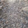
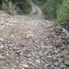
A stock subaru crosstrek made it on STREET tires, along with camper vans and other hilarious vehicles. The FSR to the lower trailhead might as well be paved.
The upper trailhead is an additional .6km of rock crawling jungle retardation, you WILL need a high clearance 4x4 to do it. We did it just to do it. But honestly i'm not sure i'd do it again.
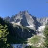
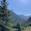
Hike is mostly shaded, incredible view at the end of the trail. Almost no bugs, and because of forest fires, quite cool even in the sun
Posted: August 19, 2023 10:44:52 PM PST