- Difficulty Intermediate
- Time 6 hours
- Round-Trip 12km
- Elevation Gain 920 meters
- Season July - October
- Camping No
- From Vancouver 2 hours, 20 minutes
- Public Transit No
- Dog Friendly Yes
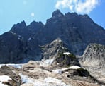
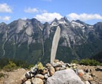
The Slesse Memorial Trail in Chilliwack is steeped in history as the route passes a memorial plaque remembering the victims of one of Canada's worst aviation disasters. The hiking trail continues up to the base of Mount Slesse, known as the Propeller Cairn, where a piece of one of the propellers from the plane is propped up by rocks next to other artifacts. The view from the Propeller Cairn is incredible as you stand in front of the towering Mount Slesse and can look across the valley to Mount Rexford and the surrounding region. The route up the NE Buttress of Mount Slesse is also a well known mountain climbing destination.
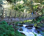
From the tall wooden sign marking the trailhead for the Slesse Memorial Trail, follow the trail into the forest as it descends, weaving its way through the forest. A short distance into the hike, the trail follows alongside Nesakwatch Creek before reaching a log bridge. As of 2017, the bridge has recently been rebuilt and railings have been added thanks to the Chilliwack Outdoor Club.
Follow the trail as it ascends through the forest, passing through a few switchbacks as you quickly gain elevation. The trail then becomes quite rocky and passes under a canopy of alders as it climbs at a gentle pace.
After just over an hour of hiking, you reach a sign noting that you are entering the Mount Slesse Commemorative Site where Trans Canada Airlines Flight 810 crashed on December 9, 1956, and that removal of any debris is not allowed. Despite months of searching, the crash site was not found until May of the following year due to the remoteness and ruggedness of the area. To this day, many pieces of the plane have not been found and still remain in the area.
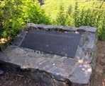
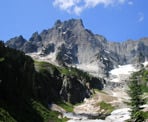
Continue following the trail to where, a short distance further, you reach the memorial plaque that is perched in front of Mount Slesse. The plaque is the destination for many day hikers who want to see this part of the area's history and also the incredible view of Mount Slesse in the background.
The trail to the Propeller Cairn continues about 10-metres before the plaque on the left side. Follow the trail as it climbs steadily but not too steeply, through the tree cover. After a long gradual uphill, the trail veers to the right and reaches a clearing, offering some views of the surrounding area. Continue up as you carefully watch your step climbing up some rock before resuming up a steeper section of trail through several switchbacks.
As the trail briefly levels, you pass through an old-growth grove with several large cedar trees. Watch for glimpse of views on both sides of the trail. As you leave the forest, the trail opens up and you make a final, steep ascent up the mountain, before reaching the Propeller Cairn.
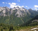
The views from the Propeller Cairn are incredible as you look up towards the towering Mount Slesse, across to the pointy peaks of Mount Rexford, and south into the United States along the Coast Mountain range. The memorial site where the propeller sticks out of the rock has many other pieces from the plane wreckage that have been discovered over the years and seeing the surroundings from this elevation, one can truly appreciate the difficulty of searching for the wreckage during the winter months.
After spending some time at the Propeller Cairn to enjoy the view, begin your hike back down, following the trail and carefully watching your step along the loose gravel and muddy sections. Follow the trail back into the forest as it weaves its way downhill before reaching the rocky portion of trail and beginning the long walk back to the first memorial plaque. Enjoy the view from the plaque one last time, then follow the trail back downhill, eventually reaching the forested area, crossing the log bridge, and walking the final uphill stretch back to the parking area.
How to get to Slesse Memorial Trail
Estimated Driving Time from Vancouver
2 hours, 20 minutes
The trail to Mount Slesse is located south of Chilliwack Lake Road along a very rugged Forest Service Road that requires a 4x4 with high clearance. The road has several washouts and large rocks and is not suitable for small cars.
From Vancouver, drive east on Highway #1 to Chilliwack and take Exit 119A: Vedder Road. Drive south on Vedder Road through Chillwack and turn left onto Chilliwack Lake Road. At about 30km, turn right onto a gravel road next to the Riverside Campsite.
Zero your odometer and begin driving along the Chilliwack South Forest Service Road. After crossing a bridge, turn right and follow the road until you have gone about 6km to where there is a small parking area on the right and a tall wooden sign marking the start of the Slesse Memorial Trail.
Park in the parking area or alongside the road, making sure not to block other vehicles that may continue further up the road.
View a map of Driving directions to Slesse Memorial Trail.

Although we try to keep information as current as possible, www.vancouvertrails.com makes no warranty or representation as to the availability, quality, fitness for purpose, conditions or accuracy of the information provided with respect to this trail or trails. The information provided herein is further subject to our Terms of Use.

Comments
Add Comment View All Comments