- Difficulty Intermediate
- Time 6 hours
- Round-Trip 11.5km
- Elevation Gain 650 meters
- Season March - October
- Camping No
- From Vancouver 1 hour
- Public Transit No
- Dog Friendly Yes
Located along the Sea To Sky Highway near Murrin Provincial Park, the trail climbs steeply up the side of the mountain before disappearing into the forest and reaching the quiet Petgill Lake. Just a 10-minute hike beyond Petgill Lake is a viewpoint that overlooks Howe Sound, Mount Sedgwick behind the old Woodfibre Mill, and the Tantalus Mountain Ranges to the North.
From the parking lot at Murrin Provincial Park, carefully cross the highway making sure you wait until there is ample space between vehicles as cars are traveling 80km / h through this section. Walk 100 meters along the gravel section of highway to the left, towards Squamish, and look for an old wooden sign at the start of a steep rocky trail. This marks the trailhead to Petgill Lake.
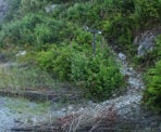
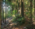
The first section of the trail is a steep scramble as you use your hands to make your way up the side of the mountain next to the highway. The trail enters into the forest and continues to ascend as the sound of traffic becomes fainter. Watch for the orange markers on the trees as the trail dips down into a couple of small ravines, climbs alongside rocky mountain ledges, and passes a couple of viewpoints overlooking Howe Sound below.
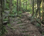
After hiking uphill for the first 1.5kms, or 30 - 40 minutes, the trail descends quickly and reaches a wide gravel path which is an old logging road. The next section of the hike follows the old road for quite sometime as it starts out relatively flat but then begins to climb through switchbacks through the forest. During the route along the road, the trail crosses 2 creeks, which are sometimes just a trickle of water during the summer months. About 10 - 15 minutes beyond the second creek, the route veers to the left off the road and back onto a trail. At this point the road is completely overgrown and barely recognizable as a road.
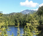
The trail continues uphill reaching a rocky ridges before dropping down into another ravine and continue uphill once again. For the next 45 minutes the trail goes through another series of ups and downs, including climbing over an open rocky outcrop and descending down a steep narrow trail between huge boulders, challenging the endurance and muscles in your legs. Eventually, the trail begins to level and reaches a junction point. Go left at the junction and a few minutes beyond you are on a rocky ridge above Petgill Lake. You can climb down the rocks or continue along the trail as it descends down near to the lake shore.
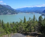
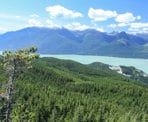
On a clear day, the more spectacular sight is the viewpoint that is a short 10-minute walk beyond the lake. Continue along the trail as it descends next to the lake to a junction and go left back up a hill towards the viewpoint. The trail curves to the right and an opening in the trees reveals a scenic 180-degree view of Howe Sound, including the Tantalus Mountain Range to the north, Mount Sedgwick directly across, and the area between the viewpoint and the highway south of where you hiked.
After finishing your lunch, hike back along the trail towards Petgill Lake and go right at the junction, climbing back up onto the rocky outcrop above the lake before descending back into the forest and onto the trail back towards the trailhead. Retrace your footsteps through the series of ups and downs, back down the old logging road, and eventually down the steep mountain side along the highway, being careful not to lose your grip as you climb over the rocks. Once back alongside the highway, walk south are carefully cross the highway returning back to the Murrin Provincial Park parking lot.
How to get to Petgill Lake
Estimated Driving Time from Vancouver
1 hour
Petgill Lake is located along the east side of the Sea To Sky Highway just south of Squamish. The trail starts on the other side of the highway from the parking lot of Murrin Provincial Park.
To reach the parking lot from Vancouver, drive to Highway #1 (the Trans Canada Highway) and follow the highway west bound towards Horseshoe Bay. Watch for signs to Squamish and merge onto the Sea To Sky Highway (Highway #99) and continue driving northbound. Pass through the traffic light in Britannia next to Mine Museum and drive up the steep hill along the highway, watching for signs to Murrin Provincial Park. As the highway rounds the corner, a lake appears on your left with a left turn lane. Slow down and take this turning lane, making a left hand turn across the highway and into the Murrin Provincial Park parking lot.
The trail to Petgill lake begins on the other side of the highway, so parking close to the parking lot entrance is easiest. Be careful when walking across the highway for oncoming traffic.
View a map of Driving directions to Petgill Lake.

Although we try to keep information as current as possible, www.vancouvertrails.com makes no warranty or representation as to the availability, quality, fitness for purpose, conditions or accuracy of the information provided with respect to this trail or trails. The information provided herein is further subject to our Terms of Use.

Comments
Add Comment View All Comments