- Difficulty Intermediate
- Time 5 hours
- Round-Trip 7km
- Elevation Gain 440 meters
- Season July - October
- Camping No
- From Vancouver 1 hour
- Public Transit No
- Dog Friendly No
Starting from the top of the Sea To Sky Gondola, the Al's Habrich Ridge Trail rises into the backcountry to offer incredible views of Howe Sound and the community of Squamish, BC. The route goes just beyond Neverland Lake and an extended route can be hiked to Neverland Falls. The Al's Habrich Ridge Trail is best done by taking the Sea To Sky gondola to the top but can also be done after hiking the Sea To Summit route from the bottom of the gondola.
Walk to the area behind the Gondola and down the gravel road as you enter the backcountry. At the bottom, walk up the gravel road on the other side as it passes some water pumps and then a rock climbing area. At the first junction, go left following the signs up a separate gravel road. Continue past another clearing to your left until you reach a sign on your left where the trail enters the forest to the Al's Habrich Route.
The trail immediately crosses a small creek, which is sometimes dry in the later summer months. Continue following the trail markers as the route climbs quickly, passing over loose dirt. The trail will eventually reach a large rock with a rope hanging down to assist in pulling yourself to the top. Just beyond the rope assist is a second, smaller rope. Pull yourself to the top of both before continuing to make your way uphill.
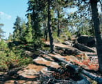
Just beyond the rope assists, the trail begins to open up and follow a ridge along a granite rocky outcrop. Watch for markers and follow the route as it's easy to lose the trail through this section. There are occasional views of the mountain ranges to the west of Howe Sound and the views get better the higher you climb.
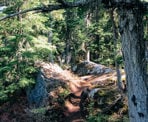
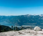
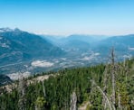
The trail eventually reaches the top of this rocky ridge before dropping down into an old growth forest of yellow cedars. Follow the dirt trail through the forest as it climbs fairly steeply, being careful not to trip over the occasional exposed tree root. The trail will eventually begin to descend between two large rocks before it opens up with an incredible view of Howe Sound. On a clear day, the view will extend through a good portion of Howe Sound and north of Squamish. For a better view, backtrack along the trail for about 20-meters then scramble up the mountain to your left onto the large rock. From the top, you will be able to see a similar view of Howe Sound and Squamish but also view the Chief and several of the mountains in Garibaldi Provincial Park.
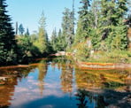
To continue the trail from where you first arrived at the view (if you scrambled to the top, carefully make your way back down), you will go left on the rocky granite and walk along the ridge admiring the view. There are the occasional blue arrows painted onto the rock pointing the direction to where you need to go. At the end of the ridge, the route steps off the back of the ridge and onto a dirt trail that enters the forest. Follow this trail as it meanders through the trees, first passing a junction to the trail that takes you to the high ridge, then passing a junction with a trail that takes you to Neverland Falls. Not far beyond the second junction, you reach Neverland Lake, a small lake that has a small waterfall on the far end up to the early summer.
There are a couple of additional viewpoints beyond the lake that are within 10-minutes or so. To continue, walk to the far end of the lake, cross the rocks where the river drains, then walk up the rocky steps, following the trail at the top. The trail dips down into the trees before rising onto another rocky outcrop with a view of Howe Sound. Continue to the right, following the ridge as you make your way to the top a few minutes later. The views at the top include Howe Sound and northward towards Garibaldi. This area marks the end of the Al's Habrich Ridge Trail.
Before returning, those who want to add another 1-hour longer to their trip can complete the Neverland Loop Trail, which begins at the first junction beyond the lake on your way back. Go right and follow the trail uphill through the old growth forest. This route passes the Neverland Falls, which is a scenic waterfall, which is best viewed earlier in the summer before the snowpack melts.
Return to the Sea To Sky Gondola by following the forested trail back around, then walking along the ridge with the incredible view. Walk up into the forest as it then descends quickly before arriving at the lower granite ridge. Carefully watch for the trail markers as you walk along the ridge, make your way back down the rope-assists, and then return to the gravel road before reaching the gondola where you began.
How to get to Al's Habrich Ridge Trail
Estimated Driving Time from Vancouver
1 hour
The Al's Habrich Ridge Trail starts from the top of the Sea To Sky Gondola in Squamish. To get there from downtown Vancouver, drive towards Georgia Street in downtown Vancouver and head westbound as Georgia turns into the Stanley Park Causeway. Cross the Lions Gate Bridge and stay left as the off ramp wraps around into West Vancouver. At the first set of traffic lights, turn right onto Taylor Way and drive up the hill. Turn left towards Highway #1 and drive onto the highway heading westbound.
As Highway #1 approaches Horseshoe Bay, stay left and merge onto Highway #99, the Sea To Sky Highway, heading northbound. Continue driving through Lions Bay and Britannia towards Squamish. Watch for signs to Shannon Falls and when you reach the traffic light, turn left and park in the long-term parking.
Note: There is a 3-hour limit on parking next to the Gondola, therefore you will have to park in the long-term parking to have enough time to get to the top and complete the Al's Habrich Ridge Trail. There is a free shuttle service that travels between the long-term parking or you can walk to the Gondola by crossing the highway at the lights and walking by Shannon Falls, following the signs along the trail.
View a map of Driving directions to Al's Habrich Ridge Trail.

Although we try to keep information as current as possible, www.vancouvertrails.com makes no warranty or representation as to the availability, quality, fitness for purpose, conditions or accuracy of the information provided with respect to this trail or trails. The information provided herein is further subject to our Terms of Use.


Comments
Add Comment View All Comments