- Difficulty Intermediate
- Time 5 hours
- Round-Trip 10km
- Elevation Gain 880 meters
- Season July - October
- Camping No
- From Vancouver 30 minutes
- Public Transit Yes
- Dog Friendly Yes
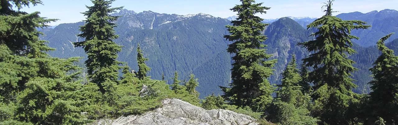
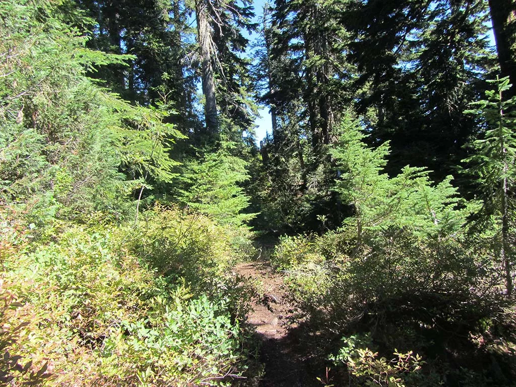
Mount Fromme is located just east of Grouse Mountain and is much less traveled than many of the other North Shore hiking trails. There are some views from the top of the backcountry mountains but the city views are blocked by trees. However, the hike is very enjoyable as it follows the St. Georges and Peer Gynt trails, briefly passing along the Old Grouse Mountain Highway, on its way to the top.
From the cul-de-sac at the top of St. Georges in North Vancouver, a trail enters into the forest. Follow this trail as it crosses a wooden bridge and within minutes, arrives at a clearing underneath power lines. Take note of this spot as it is not marked and you will need to return down this path later. Go right and walk underneath the power lines for about 50 meters to the next trail junction on your left. At the junction, go left and follow the wide gravel trail uphill along the St. Georges Trail.
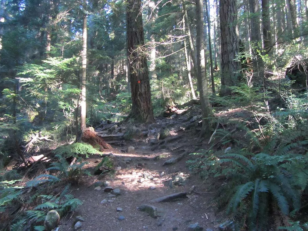
The trail passes a radio antenna before going over a small wooden bridge and becoming a much narrower trail in the forest. The trail climbs steeply as you quickly make your way to the first junction. Go left for just a few meters, then right at a second junction as you continue along the St. Georges Trail, gaining elevation with each step.
Cross the Baden Powell Trail and continue uphill. The trail climbs fairly steeply as you step over loose rocks and tree roots. Eventually, the trail exits onto the Old Grouse Mountain Highway. This marks the end of the St. Georges Trail.
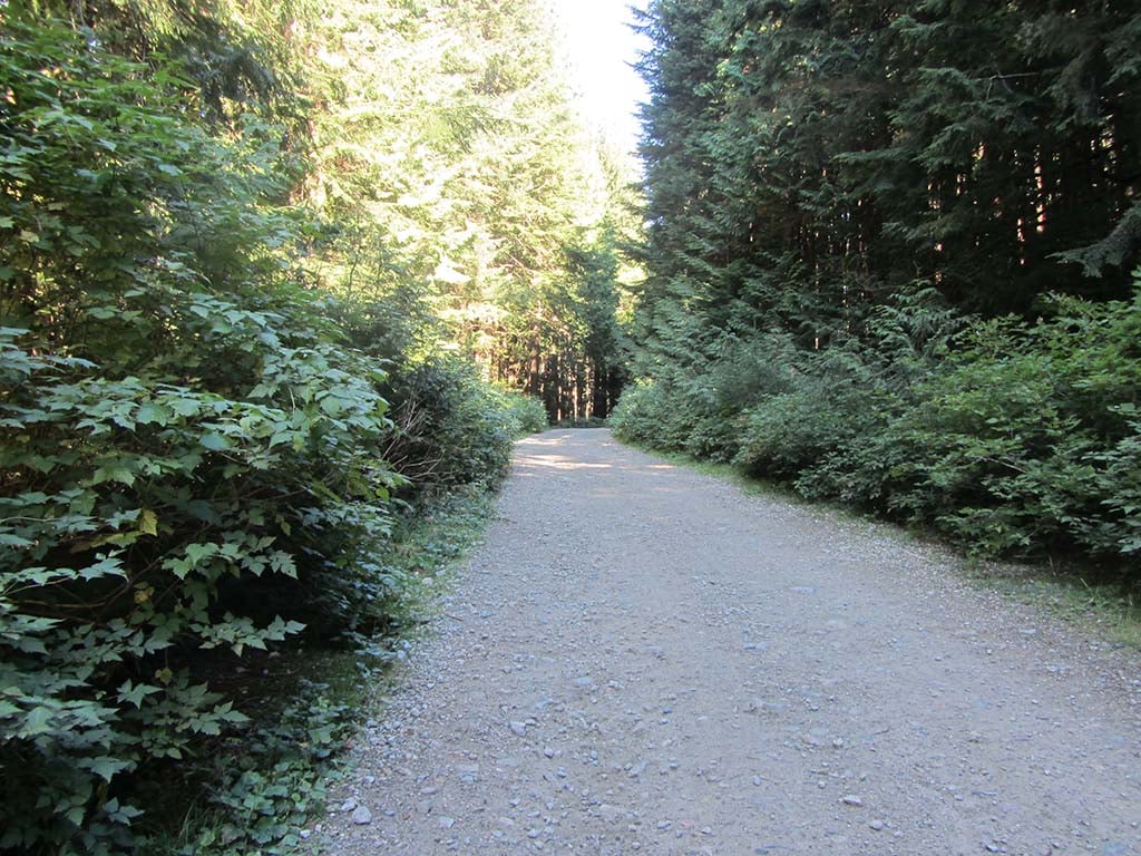
Go left and walk up the wide gravel road of the Old Grouse Mountain route to the first corner. Along the outer edge of the road in the corner is a junction with several trails. This spot can be confusing if you are not familiar with the area. At the outer edge of the road next to a wooden sign post, go right and follow the trail that heads into the forest and uphill. Do not follow the wider trail going straight and away from the road.
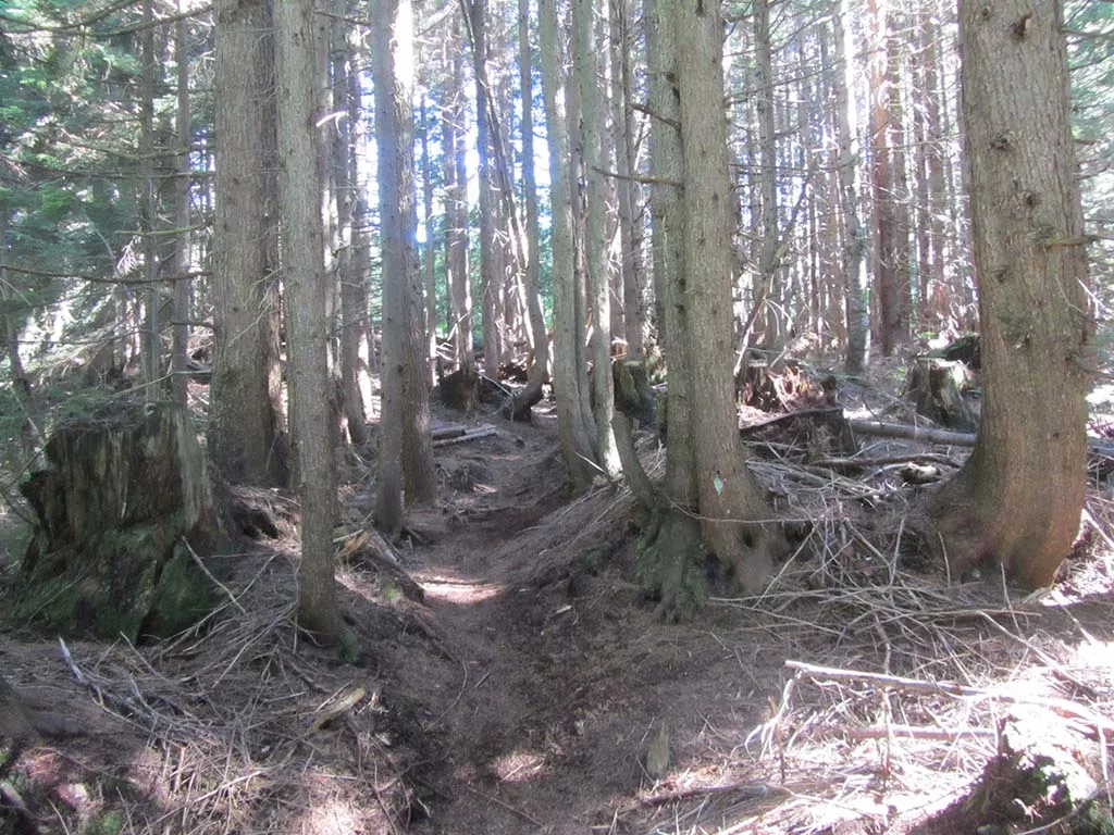
The trail continues to climb and eventually reaches the Old Grouse Mountain Highway once again. Cross the gravel road and directly on the other side, the trail dips into a ditch where a rope is there to help you up the steep dirt, bank and back onto the trail. The next section, the trail climbs gradually and is much easier than the previous sections. The trail wraps around a gravel pit to your left, however, the gravel pit is never visible from the trail. Continue following the markers.
Eventually, the trail becomes steep again and this is the beginning of the final section to the top. Carefully pull yourself up over the rooted trees as you climb quickly. The trail will begin to level as you pass through an open section before reaching a junction. Go right at the junction and the top is only a couple of hundred meters away.
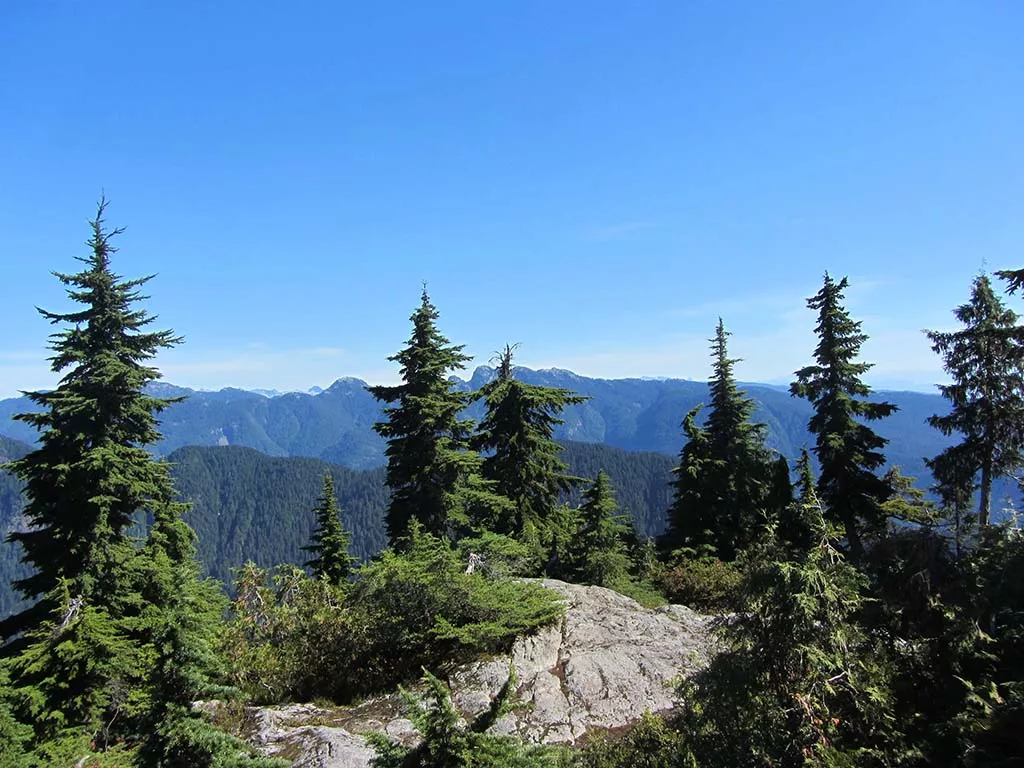
On clear days, you can see many of the backcountry mountain ranges, including as far north as some of the mountains in Garibaldi Provincial Park. Crown Mountain and Goat Mountain behind Grouse are visible to the northwest and Mount Seymour can be seen to the east. There are a couple of spots where you can catch glimpses of Vancouver between the trees but most of the views looking south are blocked by the trees.
After enjoying the views, return the same route you arrived. Make sure to go left at the junction just a couple hundred meters from the top. Further down the trail at the second intersection with the Old Grouse Mountain Highway, make sure to walk back down the wide gravel road until you see the sign to the St. Georges Trail (it's after the mountain biking trail called Executioner). When you reach the power lines, go right and then look for the trail to the left that will take you the short distance back to where you began.

How to get to Mount Fromme
Estimated Driving Time from Vancouver
30 minutes
The trail to Mount Fromme begins from the top of St. Georges Avenue in North Vancouver. Note: There is very limited parking in the neighbourhood and the trail can be started from other nearby access points, from Prospect Road to sections of Braemar Road that have trails that access the Baden Powell Trail. You will have to change your trip slightly to walk along the Baden Powell Trail to the St. Georges Trail if you park at one of these other areas.
From Downtown via the Lions Gate Bridge
From downtown Vancouver, drive to Georgia Street and head westbound as Georgia turns into the Stanley Park causeway. Cross the Lions Gate Bridge and stay to the right as after the bridge, you veer right taking the exit to North Vancouver. Immediately, change to one of the two left lanes and make a left turn at the first set of traffic lights at Capilano Road. Drive up Capilano Road, stay in the right lane, and turn right at the lights making the way to Highway #1 Eastbound and drive onto the highway.
Take Exit #18 Lonsdale Avenue. After exiting, turn left at the traffic lights and drive up Lonsdale. Continue driving up Lonsdale as you pass all the traffic lights and enter the residential area. Turn right onto Braemar Road. At the 4-way stop, turn left onto St. Georges Avenue and drive to the very top at the cul-de-sac. The trail begins here but make sure to check the parking signs and park in an area that you are allowed.
From Vancouver via the Second Narrows
From Vancouver, Burnaby, or anywhere east of the city, drive to Highway #1 and head westbound, crossing the Second Narrows Bridge to North Vancouver. Continue driving on the highway up "the cut" and take Exit #18 Lonsdale Avenue. After exiting, turn right onto Lonsdale and drive up the hill as you continue past all of the traffic lights. Turn right onto Braemar Road, then left at the 4-way stop onto St. Georges Avenue. Drive to the top of St. Georges Avenue where the trail begins from the cul-de-sac. Make sure to check the parking restrictions and to park in a spot where you are allowed.
View a map of Driving directions to Mount Fromme.
Transit Access to Mount Fromme
Taking the bus to the start of the trail to Mount Fromme involves taking one bus from Lonsdale Quay and then walking about 650 meters uphill from the bus stop to the trailhead. The difficult will be knowing which bus stop to get off at but you can always ask the bus driver for assistance.
From downtown Vancouver, make your way to Waterfront Station and take the Sea Bus to North Vancouver. Once at North Vancouver's Lonsdale Quay, take bus #230 Upper Lonsdale. You will need to get off the bus at Braemar Road and St. Georges Avenue, which takes approximately 30 minutes for the bus to get to.
After exiting the bus, walk up St. Georges Avenue for about 650 meters until the end, where a trail on the left side starts. This is the beginning of your hike to Mount Fromme.

Although we try to keep information as current as possible, www.vancouvertrails.com makes no warranty or representation as to the availability, quality, fitness for purpose, conditions or accuracy of the information provided with respect to this trail or trails. The information provided herein is further subject to our Terms of Use.
Comments
Add Comment View All Comments