- Difficulty Intermediate
- Time 3 hours
- Round-Trip 5km
- Elevation Gain 550 meters
- Season April - November
- Camping No
- From Vancouver 25 minutes
- Public Transit Yes
- Dog Friendly Yes
The hike along the Skyline Trail begins from the top of Skyline Drive in North Vancouver and ends at the bottom of the chairlift of "The Cut" ski run on Grouse Mountain. There are several pieces of interesting history along this trail as the route follows the old chairlift that used to go up to Grouse Mountain before the Gondola was built, passes several old cabins that are no longer standing, and is also the site of a US Airforce F-86 Sabre Jet crash that happened in 1954. The hike itself is very steep and essentially goes straight up the mountain, but there is an incredible view of Vancouver from the ski run at the top on a sunny day.
A note about the plane crash, the only remaining significant piece of the jet is an engine which has been made into a memorial for the pilot, Second Lt. Lamar J. Barlow, who was killed in the crash. The engine sits in a beautiful part of the forest, which is located to the east of the Skyline Trail but is not easy to find (see directions below).
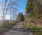
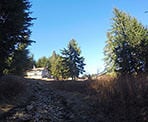
From the parking area, walk up the paved road, past the metal gate and continue following the road as it curves its way up the mountain. The wider, open area that you pass through was the parking lot for the old chairlift to Grouse Mountain. Continue walking past the old parking lot, onto the gravel road and follow it as it again curves left. Several meters after the curve is a sign that points to the Baden Powell ahead and the Skyline Trail to the right. This is when the trail gets steep.
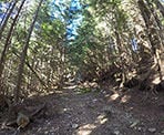
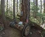
Go right and begin hiking up the steep, rocky trail as it climbs relentlessly. Along the trail, there will be several pieces of the old chairlift, including some wheels and posts, that have been left as a memory to the once busy area before the Gondola was built. The trail continues climbing and the terrain does not change much all the way to the top!
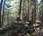
If you want to visit the site of the plane crash, there are several opportunities to know when to veer off the trail to look for the jet engine. First, there is an old cabin that has collapsed and is located just off the trail to the right. While it's visible from the trail, it's really easy to miss. If you see the cabin, you can walk up to it and follow a trail that is not marked to the east where it will curve northward, before heading up a short distance further to where the jet engine lies on your right. It is also easy to miss the jet engine as you keep an eye on where you are walking and not on your surroundings.
The second opportunity to find the jet engine is a small, yellow ribbon tied to a tree, marking a trail that heads eastward. This is located after the old cabin and following this trail will meet with another trail within a few minutes. Go right and walk down the second trail and within a minute, the jet engine should be on the left.
The final opportunity is probably the easiest to find. When the Skyline Trail reaches a 4-way junction, leave the Skyline Trail and go right to where the trail immediately comes to a clearing. Continue straight through the clearing and at the far end, the trail begins again but descends down the mountain. The walk down should take no more than 5 minutes and the jet engine will be on the left of the trail.
To return to the Skyline Trail from the jet engine, follow the unmarked trail uphill for about 5-minutes until it reaches a clearing. Walk through the clearing to a 4-way junction. The trail going left and right is the Skyline Trail. Go right and continue hiking to the top, which is not much further.
The Skyline Trail ends at the chairlift but on a clear, sunny day, it is recommended to walk up the ski run to at least the height of the trees at the bottom for an incredible view of Vancouver.
Continue to the Grouse Mountain Gondola
For those wanting to continue to the Grouse Mountain Gondola from the bottom of The Cut, there is a trail to the left (west) of the chairlift known as SIMIC's trail. Follow this trail and it will lead to the Grouse Mountain chalet.
You can also take the Grouse Mountain gondola back down and return to where you parked your car by walking along the Powerline Trail, which takes about 30-40 minutes. To reach the Powerline Trail, walk towards the gravel parking lot near the Grouse Grind and continue walking through the parking lot, down the hill towards a metal gate. Walk past the metal gate and stay under the powerlines and the trail will return to the parking area on Skyline Drive.
How to get to Skyline Trail
Estimated Driving Time from Vancouver
25 minutes
The Skyline Trail begins from the top of Skyline Drive in North Vancouver.
From the Lions Gate Bridge
After crossing the Lions Gate Bridge, exit to the right towards North Vancouver and Capilano Road. After existing onto Marine Drive, immediate merge into one of the two left lanes so you can turn left at the first traffic lights at Capilano Road. After turning left onto Capilano Road, continue to drive along Capilano Road, passing under the Highway, passing the Capilano Suspension Bridge, and the sign to the Capilano Hatchery. When you reach a corner store on your right, turn right onto the street just after it called Montroyal Blvd. Drive up the steep hill to near the top and watch for a street called Skyline Drive on your left (if you pass a firehall, you have gone too far). Turn left onto Skyline Drive and drive the first 3 blocks, then turn right onto the street that is also called Skyline Drive, and follow it through the switch backs until you reach a gravel area under some powerlines. This is where you will park and the trail begins at the metal gate going up the road.
From the Second Narrows Bridge
After crossing the Second Narrows Bridge (Iron Workers Memorial), continue driving along the highway and take Exit #17: Westview. Turn right onto Westview Drive and stay in the right lane. After driving straight through the lights at Queens, the street you are now on is named Delbrooke Avenue. Continue driving up Delbrooke until you reach a 4-way stop sign near the top. Turn left onto Montroyal Blvd. and drive a short distance until you pass a firehall on your right and over a bridge. At the street after the bridge, turn right onto Skyline Drive. Drive up 3 blocks and turn left onto the street that is also called Skyline Drive. Continue following the switchbacks until you get to the gravel area where you can park. The metal gate up the road is where you will begin your hike.
View a map of Driving directions to Skyline Trail.
Transit Access to Skyline Trail
It is possible to take the bus to the start of the Skyline Trail, although it will require a 20-30 minute uphill walk to the beginning of the trail. From Lonsdale Quay, take bus #246: Highland and ask the bus driver to drop you off near Skyline Drive and Montroyal. Walk to Skyline Drive and follow it, walking uphill through the neighbourhood. Make sure to go right at the 4th street, which is still Skyline Drive and continue walking, as the street weaves back and forth, until you reach the metal gate.
An alternate transit option is to take the bus to Grouse Mountain. One at the base of the Gondola, walk east towards the gravel parking lot and continue through the lot until you reach a metal gate at the end. Walk past the metal gate and onto the Powerline Trail, following this route for about 20-30 minutes until you reach a metal gate at Skyline Drive, where the Skyline Trail route begins.

Although we try to keep information as current as possible, www.vancouvertrails.com makes no warranty or representation as to the availability, quality, fitness for purpose, conditions or accuracy of the information provided with respect to this trail or trails. The information provided herein is further subject to our Terms of Use.

Comments
Add Comment View All Comments