- Difficulty Easy
- Time 1 hour
- Round-Trip 2.6km
- Elevation Gain 100 meters
- Season year-round
- Camping No
- From Vancouver 30 minutes
- Public Transit Yes
- Dog Friendly Yes
Capilano Canyon is one of the Vancouver area's four canyons and offers splendid views of rushing water over rock nestled in a rainforest surrounding.
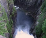
There are several ways to access the Capilano River Regional Park but we will start our hike from Cleveland Dam off of Capilano Road. From the parking lot, make your way towards the dam, taking in the view of Grouse Mountain and the Lions off in the distance to your right. The Capilano Reservoir is one of Vancouver's main sources of drinking water and the area to the north of the dam is off limits to people. If you hear the sound of rushing water, the dam is open and you can stick your head over the side to see the water tumbling below into the canyon.
After taking in the view of the dam, continue to the far side to a clearing where there are two wide trails on your left. Take the most right trail that heads uphill until it levels out and look for a trail on the left side behind a wooden gate. Walk into the forest along the Upper Shinglebolt Trail, enjoying the Hemlock and Fir trees that surround you. After a short walk, the trail begins to descend quite quickly. Once at the bottom, continue to your left and climb up over the roots of a tree where you will reach a fork in the trail.
At this point, turn right and continue making your way downhill until after 5 minutes you reach another section where the trail forks. Go left and a short distance later you come to an intersection that meets with the Capilano Pacific Trail. Cross the trail and continue straight as the path stays fairly level for a brief time before descending even further into the canyon.
After walking for about 10 minutes, you will have reached the bottom of this section where it meets with a wider gravel road. Walk up onto the dirt ridge on the other side and just off to the right, a short, narrow path takes you down towards a fence offering a view of the Capilano River far below. A few more steps to your right and you cross over the Pipe Bridge. For those who struggle with heights, this may be a quick crossing but for others, it may be a chance to take a few minutes (and photos) to enjoy the view of the swirling water below.
After crossing the Pipe Bridge, a few meters up the gravel path is a trail to the left called the Coho Loop. Take this trail as it winds along the river offering occasional glimpses of the canyon to your left. About 15 minutes later, you will reach the Salmon Hatchery. This is a good chance to see some of the important work being done to preserve the salmon stocks in this region. The hatchery's interpretive center is open to the public everyday from 8am until closing times that vary seasonally according to how much daylight there is. A visit to the hatchery is free.
To continue with the hike, walk out of the hatchery and look for the Palisades Trail on your left. Take this trail as you begin your climb back out of the canyon. After an uphill climb, you come to a dirt road that service vehicles use to access the dam area. The trail continues straight ahead, however we will turn left and follow the service road back up towards the dam instead.
As you near the dam, there is a sign on your left that points the way to a viewpoint of the dam from below. Almost an hour ago, you were standing at the top of the dam looking down. Once you've taken in the view, walk back to the service road and continue walking uphill towards the dam. At the end of the trail and sitting against the dam is a set of stairs that will take you up and back to where you began earlier in the day.
How to get to Capilano Canyon
Estimated Driving Time from Vancouver
30 minutes
Access to the Capilano Canyon can be gained from several locations, however for the purpose of this description, the trail begins at Cleveland Dam.
From Downtown
Drive westbound along Georgia Street and continue along the Stanley Park causeway and across the Lions Gate Bridge. Right after crossing the bridge, take the right-hand turn off to North Vancouver and immediately change lanes into one of the furthest left two lanes. At the first set of lights, the left two lanes turn onto Capilano Road. Following Capilano Road as it continues northbound, passing the Capilano Suspension Bridge and Salmon Hatchery on your left. A few minutes later, watch for Cleveland Dam signs and pull into the parking lot on the left.
From Highway #1
Take the Trans Canada Highway (Highway #1) westbound across the Iron Workers Memorial Bridge (Second Narrows Bridge) to North Vancouver and take the Capilano Road Exit. Turn right onto Capilano Road and after 10 minutes of driving, watch for Cleveland Dam signs and pull into the parking lot on the left.
View a map of Driving directions to Capilano Canyon.
Transit Access to Capilano Canyon
Capilano Canyon can be accessed by public transit to Cleveland Dam. From downtown Vancouver, take the Seabus across to North Vancouver. At the Lonsdale Quay exchange, take bus #236 to Cleveland Dam.

Although we try to keep information as current as possible, www.vancouvertrails.com makes no warranty or representation as to the availability, quality, fitness for purpose, conditions or accuracy of the information provided with respect to this trail or trails. The information provided herein is further subject to our Terms of Use.


Comments
Add Comment View All Comments