- Difficulty Intermediate
- Time 2.5 hours
- Round-Trip 5km
- Elevation Gain 360 meters
- Season year-round
- Camping No
- From Vancouver 3 hours
- Public Transit No
- Dog Friendly On-Leash
Mount Daniel is a steep hike on the Sunshine Coast that provides incredible views of the Pender Harbour region. Located in Garden Bay Marine Provincial Park, the trail climbs through the forest to the first peak before descending slightly and heading up to an area near the second peak with several viewpoints.
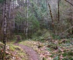
From the trailhead next to the metal gate along Garden Bay Road, follow the gravel road uphill until you reach a junction. Go left at the junction and continue uphill along the wide road as it begins to level. The gravel road ends and a narrow hiking trail enters the forest. Follow this trail and within a few minutes, the trail begins a very steep ascent.
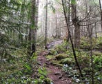
Continue following the steep trail uphill as you pace yourself in-between breaths. The trail passes a BC Parks sign marking the boundary to Garden Bay Marine Provincial Park. During the spring or after a rainfall, sections of the trail can be like walking through a creek, so be sure to watch your step.
The trail begins to level and you make your way up a section that is not that steep, quickly gaining distance. The trail arrives, at what looks like a junction, and off to the right is the first peak. Walk up onto the rocky peak to take a look, however there is no view as the trees have grown and blocked it.
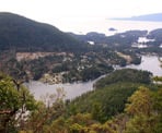
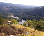
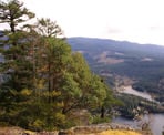
Return to the trail and follow it down a hill into a gully. The trail begins to ascend again and continues through the forest. It eventually reaches the first view through a clearing in the trees. Walk down to the rocky outcrop for the best view as you look down towards Pender Harbour below.
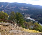
Most hikers stop at this viewpoint, however the trail continues to another spectacular viewpoint that is close by. Follow the worn path as it wraps around the mountain to another clearing, this one looking southward across Gunboat Bay and east towards the mountains.
After enjoying the views, follow the trail back in the direction that you came, leaving the viewpoints and beginning the descent. After dropping down into the gully, hike back up the hill to the area near the first peak, then go right, following the trail back downhill. As you descend the steep sections, watch your footing on the loose rock. Eventually, the trail rejoins the gravel road. Follow the road back down, going right at the junction and returning to the metal gate where you began your hike.
How to get to Mount Daniel
Estimated Driving Time from Vancouver
3 hours
Mount Daniel is located along the Sunshine Coast. The trail begins from Garden Bay Road and passes through Garden Bay Marine Provincial Park. If you are driving from Vancouver, you will have to take the ferry from Horseshoe Bay to Langdale (Gibsons) and drive approximately over 60km to the trailhead.
From Gibsons, follow Highway 101 The Sunshine Coast highway north bound and continue on the highway through Sechelt. After leaving Sechelt, drive for about 35km along Highway 101. Turn left onto Garden Bay Road, next to a Petro Canada gas station. Follow Garden Bay Road for just over 3km and watch for a gravel are on the left side of the road with a metal gate and a wooden map board of the area. Park along this gravel area but do not block the metal gate. The trail starts by walking up the gravel road, past the metal gate.
View a map of Driving directions to Mount Daniel.

Although we try to keep information as current as possible, www.vancouvertrails.com makes no warranty or representation as to the availability, quality, fitness for purpose, conditions or accuracy of the information provided with respect to this trail or trails. The information provided herein is further subject to our Terms of Use.

Comments
Add Comment View All Comments