- Difficulty Easy
- Time 2 hours
- Round-Trip 8km
- Elevation Gain minimal
- Season year-round
- Camping No
- From Vancouver 3 hours, 15 minutes
- Public Transit No
- Dog Friendly On-Leash
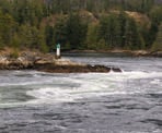
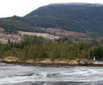
Skookumchuck Narrows is a popular attraction on the Sunshine Coast where the powerful rapids and whirlpools of the changing tidal waters can be seen that flow between Jervis Inlet and Sechelt Inlet. The trail is about 8km roundtrip and passes through a scenic west coast rainforest before reaching the viewpoints at either North Point or Roland Point. These rapids are a fairly unique occurrence as the water flow can reach speeds of 30km/h as about 200 billion gallons of water passes through the narrows during a tide change.
The best viewing times are when the tides change at their peak times. During the peak low tide, Sechelt Inlet floods and the best rapids can be viewed from Roland Point. During the peak high tide, known as the ebb tide, the water leaves Sechelt Inlet and the best whirlpools can be seen from North Point. It is recommended to check a tide table for the times of day when these changes occur and plan enough time to hike in to see them.
The trail begins from a parking area next to the road near the community of Egmont, BC. Walk down the gravel road that passes the wooden BC Parks sign with a map of the area and continue across the bridge. The start of the route follows a road past several houses that is only accessible to local traffic. Please ensure to stay off private property in the area.
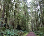
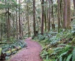
After walking for about 10-15 minutes, the road reaches a metal gate on the right side with a sign that marks the beginning of the trail portion to Skookumchuck Narrows. Follow this trail as you quickly enter a scenic west coast rainforest, rich in moss, sword ferns, cedar trees, and Douglas fir trees.
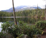
When the trail arrives at Brown Lake, you will have have crossed the boundary and entered Skookumchuck Narrows Provincial Park. Enjoy the views of the lake as you continue hiking along the trail. Just after the trail leaves the lake area, it veers right and begins to descend, continuing through the beautiful forest.
The trail reaches the junction where you can go left to North Point or right to Roland Point. The trail to North Point takes just a few minutes but the trail to Roland Point is a bit longer and takes about 10-minutes to walk each direction. If you are timing it to see one of the tide changes, the view of the whirlpools is best at North Point when it's peak high and the view of the rapids is best at Roland Point during peak low tides.
The view from North Point is set on some rocks, higher up and looks across the narrow waterway. Hikers can sit on a single bench or along the rocks to enjoy the view. The area is surrounded by a fence to prevent anyone from venturing too near the dangerous whirlpools.
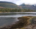
The view from Roland Point is closer to the water and more open. There is not an obvious place to sit but plenty of space to enjoy the views of the rapids. You can get right next to the water but please ensure to not venture too close as the currents are very strong during the tidal changes.
After enjoying the views of the area, hike back along the trail in the direction you arrived, passing the junction and heading up the gradual hill through the forest. Pass Brown Lake and continue to enjoy the calmness and smells of the forest. Once back at the gravel road, follow it back towards the parking area as you cross back over the bridge and make the final few steps of your return.
How to get to Skookumchuck Narrows
Estimated Driving Time from Vancouver
3 hours, 15 minutes
Skookumchuck Narrows is located near the community of Egmont, BC, on the Sunshine Coast. If you are driving from Vancouver, you will have to take the ferry form Horseshoe Bay to Langdale (Gibsons) and then drive about 1.5 hours to the start of the trail.
From Gibsons on the Sunshine Coast, follow Highway 101 The Sunshine Coast Highway northbound and continue through the town of Sechelt. The highway weaves its way north, heading in the direction of the ferry to Powell River.
Just before reaching the ferry terminal, watch for signs and turn right to Egmont. Drive for about 5km and, then, watch for signs for Skookumchuck Provincial Park on the right. There are several gravel parking spots alongside the road on the right where you can park. The hike begins on the gravel road, near a wooden map showing the trail to Skookumchuck Narrows.
Note: The first section of the hike follows a road and the area is restricted to local traffic only. Please do not drive on this road.
View a map of Driving directions to Skookumchuck Narrows.

Although we try to keep information as current as possible, www.vancouvertrails.com makes no warranty or representation as to the availability, quality, fitness for purpose, conditions or accuracy of the information provided with respect to this trail or trails. The information provided herein is further subject to our Terms of Use.

Comments
Add Comment View All Comments