- Difficulty Intermediate
- Time 4.5 hours
- Round-Trip 9.5km
- Elevation Gain 700 meters
- Season July - October
- Camping No
- From Vancouver 2 hours 45 minutes
- Public Transit No
- Dog Friendly Yes
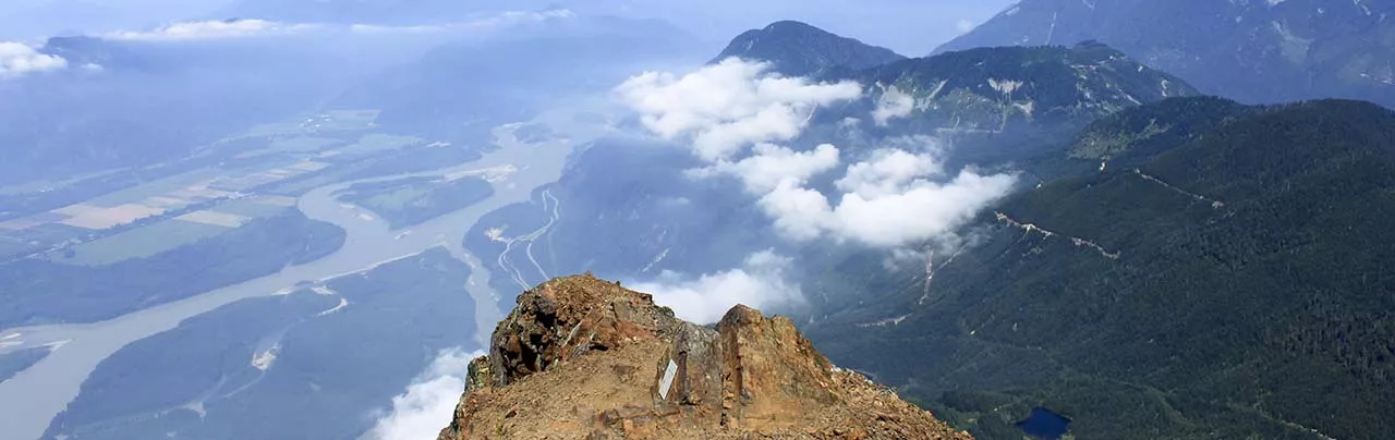
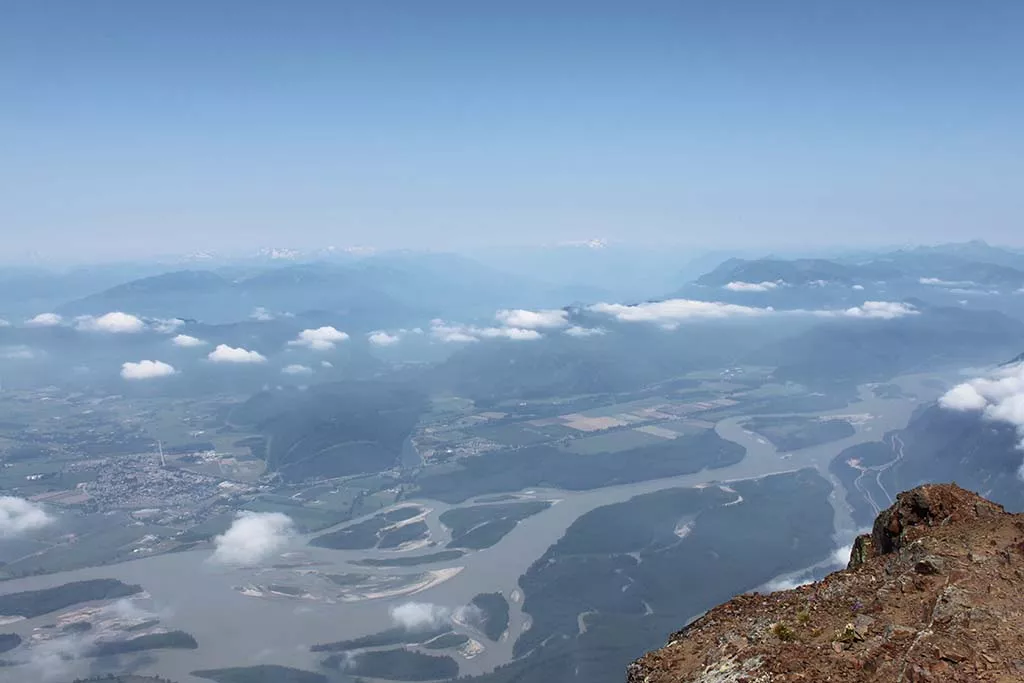
One of the most spectacular views in the Fraser Valley, Mount Cheam offers a 360-degree panoramic view from Chilliwack and the communities along the Fraser River, Jones Lake, the surrounding peaks, and Mount Baker to the south.
The trail to the peak of Mount Cheam is not as difficult as gaining access to the trailhead as the Forest Service Road requires a rugged 4-wheel drive vehicle. From the parking area, climb over the logs and walk along the old section of gravel road past the logged hillsides. Already there are great views of the surrounding mountains and the snow-covered Mount Baker in Washington State can be seen in the distance.
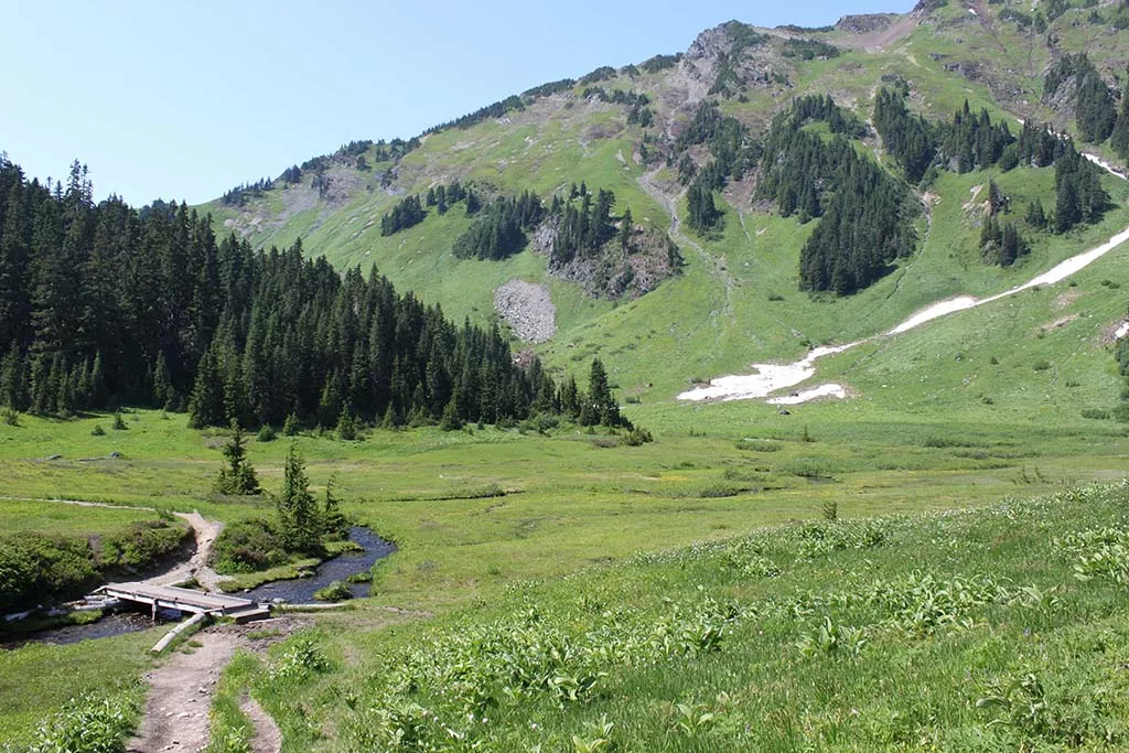
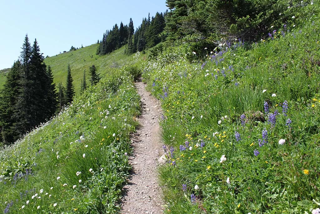
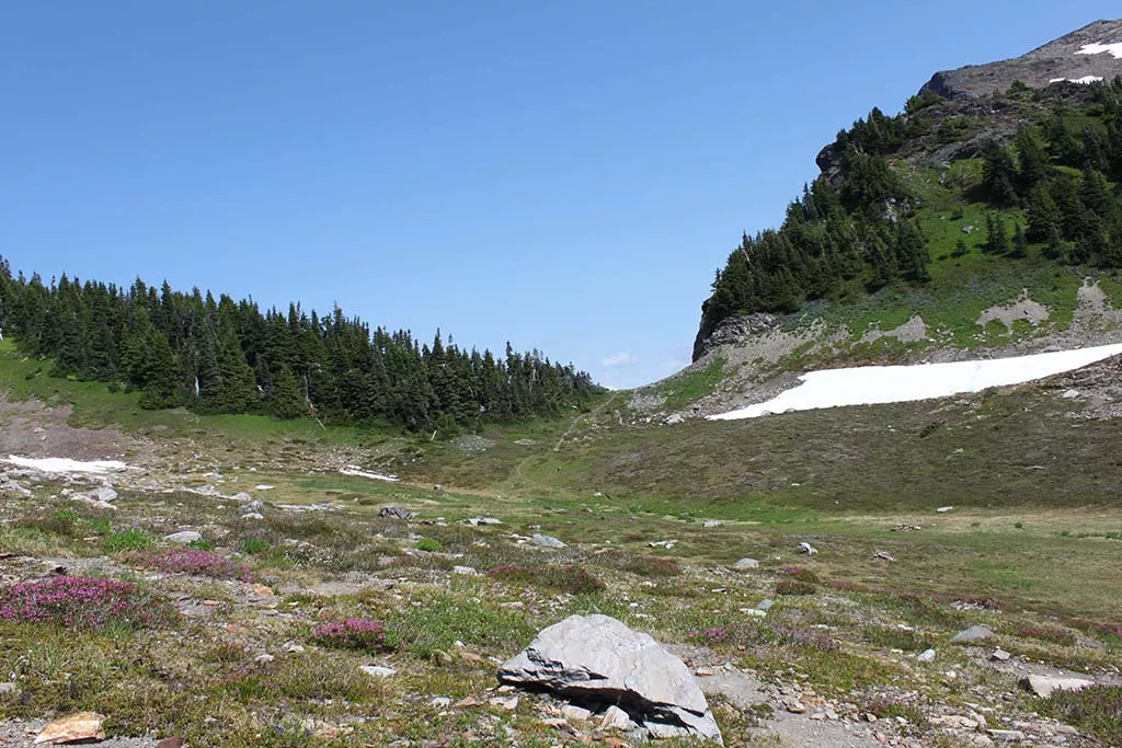
After a 15-minute walk, you reach the end of the old logging road and a trail begins off to the left. It descends slightly into a meadow which is generally lush with colourful wild flowers in August. Cross the small creek and continue to Spoon Lake. From this point on, the steep uphill trail begins. Follow the trail and go right at the junction as the path cuts between the beautiful flowers and tall grass.
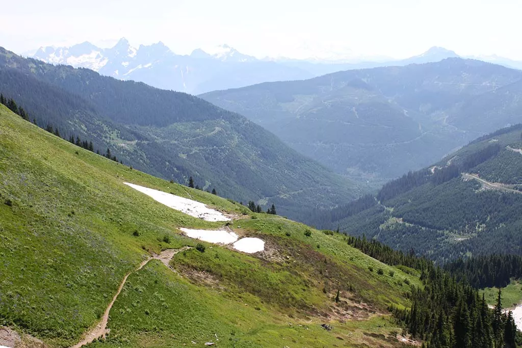
As you make your way up the trail, don't forget to look back to admire the changing view while you catch your breath. After 40 minutes or so, the trail levels as you reach the upper pond. Depending on the time of year, this can either be an empty rock bed or a small pond on the left of the trail. Continue along the trail as it begins to ascend once again, going through a series of switchbacks as it hugs the side of the mountain. As you climb, the vegetation begins to thin utnil you reach the point where the trail and sides are loose rock. A worn path marks the route to the summit.
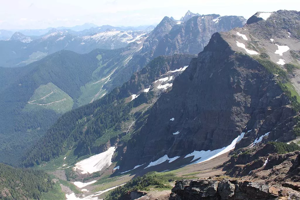
After another 30-40 minutes of uphill, you reach the ridge which offers the first reward for all your hard work; a view of the Fraser Valley far below. On a clear day you are able to see the community of Agassiz, Chilliwack, and Harrison Lake. Before the Forestry Road was built the old trail to Cheam used to ascend from the left of the ridge, over the mountain and starting from a farm far below. This route used to climb over 2000 meters in elevation and took more than 11 hours!
From the ridge, it's just a short hike to the Summit of Mount Cheam where you can experience an unobstructed 360-degree view of the entire region. Some of the highlights include Lady Peak immediately to the south, Mount Baker off in the distance, Jones Lake below, and the entire Fraser Valley.
A word of caution: Do not venture close to the edge as the loose rocks have given way in the past and taken several people over the sheer cliff to their deaths. For this reason, the north side of the summit has been named Angel's Bowl and several plaques at the summit are a stark reminder of the dangers.
After enjoying the view at the summit, head back down following the route you came from and return to the parking area for the long, bumpy drive back to the Chilliwack Lake Road.
How to get to Mount Cheam
Estimated Driving Time from Vancouver
2 hours 45 minutes
Note: The forestry service road to Mount Cheam has been deactivated for several years, and therefore to reach the trailhead requires a 4-wheel drive truck. A car will not make it through the numerous washed-out sections, creeks to drive across, large ditches, and big rocks along the 15km rugged road. Be prepared and use an appropriate off-road vehicle.
The access point to Mount Cheam is located along the highway to Chilliwack Lake. From Vancouver, take Highway #1 (Trans Canada Highway) east for about 90km to Exit #119 Sardis. Turn right and follow Vedder Road southbound until you reach a 3-way intersection at Chilliwack Lake Road. Turn left and zero your odometer. At 28km, turn left onto the Foley Creek Forestry Service Road and drive for 2km. After crossing the bridge, turn left at the junction and drive another 2km and then turn right onto the Chipmunk Creek Forest Service Road. There will be a gravel pit at this location. From this location, continue on the narrow road as it becomes very rough and follow it for about 8km to the end parking area. There are several turnoffs along the route, however stay along the most obvious road and it will take you to the trailhead.
View a map of Driving directions to Mount Cheam. Note: These driving directions only show how to get access to the Forestry Service Road. Read the above instructions on getting to the trailhead.

Although we try to keep information as current as possible, www.vancouvertrails.com makes no warranty or representation as to the availability, quality, fitness for purpose, conditions or accuracy of the information provided with respect to this trail or trails. The information provided herein is further subject to our Terms of Use.
Comments
Add Comment View All Comments