- Difficulty Intermediate
- Time 2.5 hours
- Round-Trip 10km
- Elevation Gain 375 meters
- Season year-round
- Camping No
- From Vancouver 1 hour 30 minutes
- Public Transit No
- Dog Friendly Yes
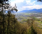
Located in the Promontory neighbourhood of Chilliwack, the steep hike up Mount Thom is rewarded with a scenic view of the region, including Cultus Lake and the Fraser Valley.
There are 2 options for hiking up Mount Thom, including parking at the Sylvan Drive trailhead and completing the entire trail to the top. The other, more family-friendly option is to park near the top and just do the short Lookout Loop. This description will focus on the longer route.
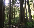
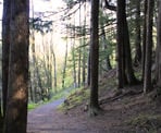
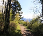
From Sylvan Drive, walk up the wood stairs next to the creek and by the houses as you quickly enter the park area and continue up a wide, gravel trail. Only a few minutes from the backyards of homes, you reach a trail junction. Go left and follow the route to Mount Thom as the wide trail narrows and climbs steadily.
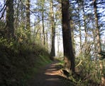
The trail passes through a series of short switchbacks before a long straight stretch wraps around the mountain. At the end of this straight stretch, the trail turns the opposite direction and climbs up a series of steep stairs before reaching another switchback and, again,, into a long straight stretch of trail. Not far after the switchback, you walk up a steep section where there is a clearing on the left and a bench at the top is perfectly placed to catch your breath.
While the trail climbs uphill for the most part, there are short ups and downs along the route. Continue to follow the narrow trail as it wraps around the mountain and eventually reaches a junction with the Lookout Loop Trail. Go right and continue walking uphill for another 10 - 15 minutes until you reach the viewpoint at the top of Mount Thom.
To extend your hike by completing the short Lookout Loop, go right at the clearing just down from the top lookout point and follow the trail as it passes the junction with the Ridgeline Trail and eventually meets a second junction. At the second junction, make sure to go left and continue along the Lookout Loop where a few more steps returns you to the junction with the trail back down to Sylvan Drive on your right.
For those hikers wishing to return to the start of the trail, simply follow your steps back down the mountain, making sure to go left at the junction at the trail back to Sylvan Drive.
Shorter Lookout Loop Hike
The shorter hiking route to the Mount Thom lookout can be accessed by parking near the top of the mountain along Churchill Parkway and walking along a short trail that joins with the Lookout Loop. This route is much easier for families and takes about 20 minutes from the parking lot to the lookout (about 45 minutes return trip).
From the parking lot, walk down the steep hill and follow the trail as it climbs uphills quickly and passes a trail for horseback riders. Just after the trail levels out, you reach a junction with the Lookout Loop Trail. It doesn't matter whether you go straight or right as the route is a circle and you will return from the other direction.
How to get to Mount Thom
Estimated Driving Time from Vancouver
1 hour 30 minutes
Mount Thom is located in the Promontory neighbourhood of Chilliwack. From Vancouver, drive east and onto Highway #1 (Trans Canada Highway) heading eastbound. Continue driving through Burnaby, across the Port Mann Bridge, through Surrey, Langley, Abbotsford, until you reach Chilliwack. Take Highway Exit #123 and after exiting, turn right at the top of the off ramp onto Prest Road.
Continue driving south along Prest Road as it turns into Teskey Way. Turn left onto Jinkerson Road and then make another quick left to stay on Jinkerson Road. Take the first right onto Thom Creek Road and drive to the stop sign at the top. Turn right onto Sylvan Drive and park on the road along the trees. The trailhead is on the other side of the street at the wooden stairs.
View a map of Driving directions to Mount Thom.

Although we try to keep information as current as possible, www.vancouvertrails.com makes no warranty or representation as to the availability, quality, fitness for purpose, conditions or accuracy of the information provided with respect to this trail or trails. The information provided herein is further subject to our Terms of Use.


Comments
Add Comment View All Comments