- Difficulty Easy
- Time 2.5 hours
- Round-Trip 10km
- Elevation Gain 180 meters
- Season year-round
- Camping No
- From Vancouver 1 hour
- Public Transit No
- Dog Friendly On-Leash
Minnekhada Regional Park is a peaceful nature sanctuary located near the Pitt - Addington Marsh Wildlife Management Area.
Before starting your walk, take a look at the board next to the parking lot and feel free to grab a map of the park if they are available.
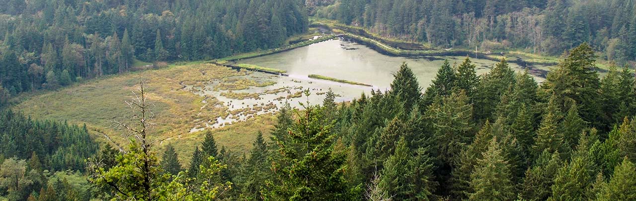
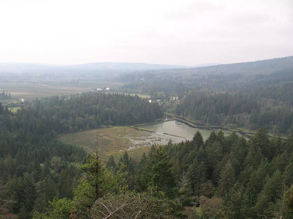
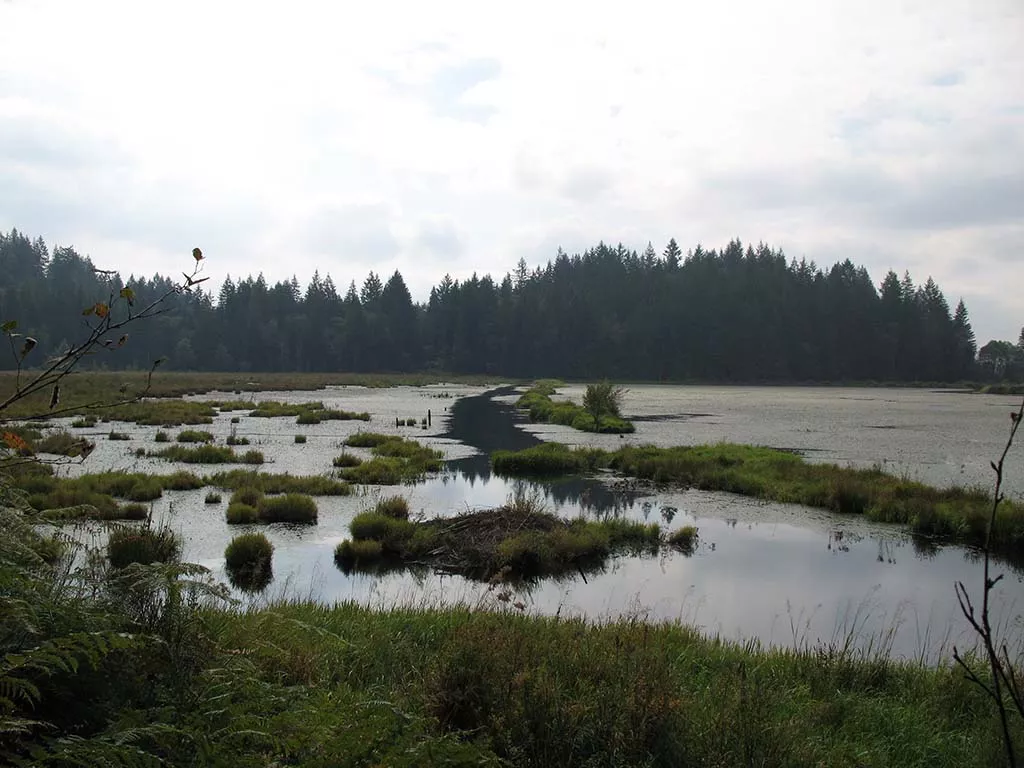
Walk along the path a short distance towards the first fork and take the trail on the right called the Lodge Trail. Five minutes later, continue right at the next fork and the first views of the lower marsh can be seen. A few more steps and the trail emerges from the trees along a dike that offers a scenic view of the area. Watch for Wood Ducks, beavers, and other wildlife that make their homes in this protected marshland.
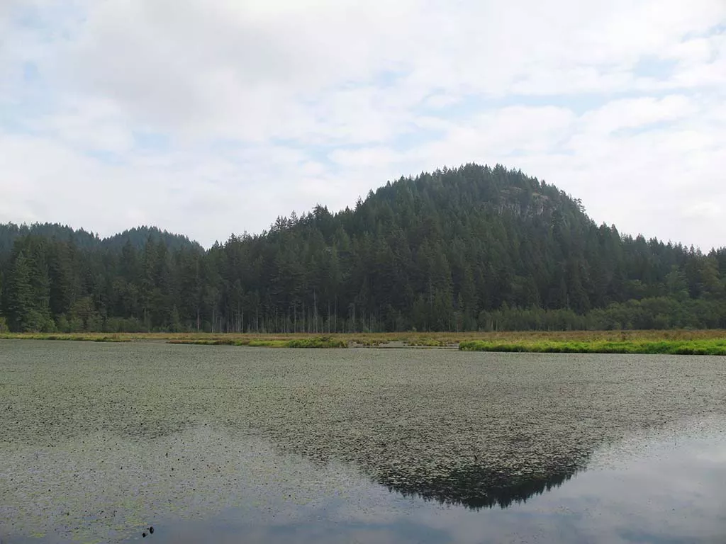
Continue along the trail as it circles around the southwestern edge of the marsh before reaching a picnic area. The viewing platform offers another vantage point of the entire area.
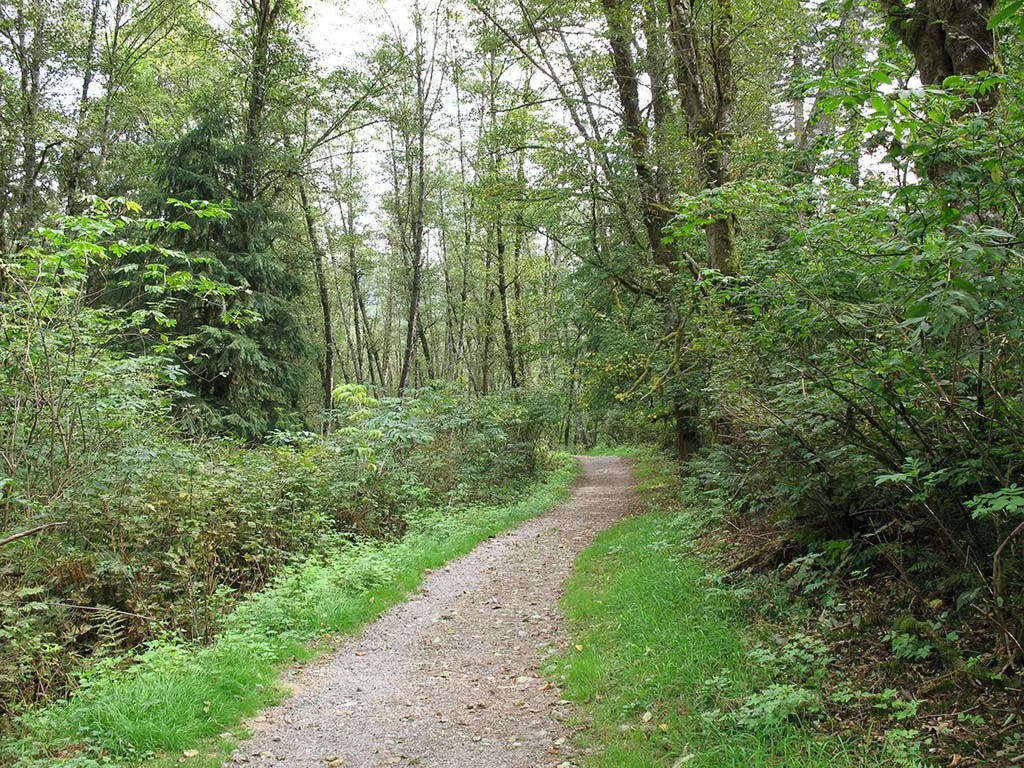
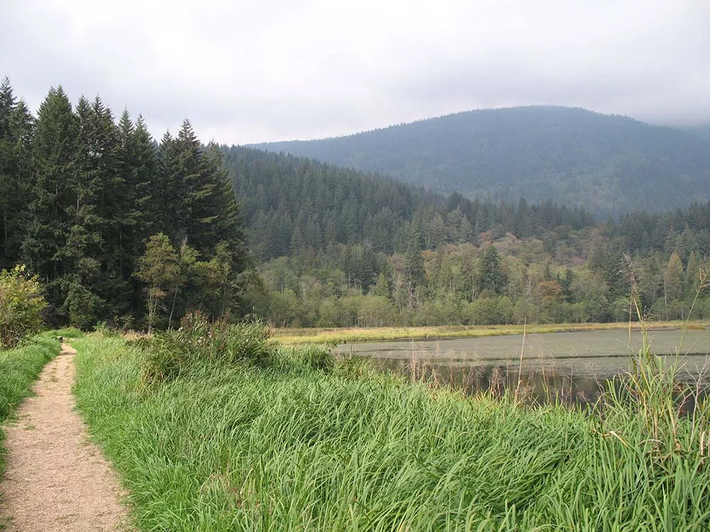
From the picnic area, take the Fern Trail as it heads back into the forest and gradually uphill for the next 2.7km. Approximately 25 minutes later, you reach a sign which points to Addington Lookout to the right. If you have time, this is a nice viewpoint, however, if you are short on time, save your energy for the High Knoll viewpoint.
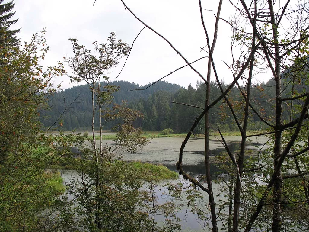
Turn left at the fork and walk up a few short switchbacks before continuing through the forest. After another 15 minutes, a sign points to the Low Knoll on your left. Take this detour for a beautiful view of the marsh below.
Retrace your footsteps back to the main trail and turn left at the sign. At the bottom of a short hill, the trail forks. Go right and continue your walk as you make your way towards the High Knoll. 15 minutes later, you come to the fork that points to the High Knoll off to the right. The High Knoll is only a short distance from here, however, the trail is much steeper than any sections you have passed thus far.
Follow the trail as it makes its way uphill before eventually flattening out and ending at an amazing viewpoint. Facing south, the view from the High Knoll overlooks the Lower Marsh and the Pitt River as it flows past farmland below. On a clear day, Mount Baker in Washington is visible.
After soaking in the view, retrace your steps back downhill towards the fork and turn left, heading in the same direction you came. Watch for a fork in the trail a short distance later on your right and follow that.
Continue downhill through the forest of Cedars and turn right onto the Mid-Marsh Trail after the bridge. This trail weaves around rocky outcrops in sections as it descends towards the marsh. 15 minutes or so later, you exit the trees and cross the dike dividing the upper and lower marsh areas.
Cross the dike and head back into the forest on the other side to a fork in the trail. Go left a short distance and then take the Meadow Trail on the right as it weaves through the trees and eventually exits back onto a main trail. A few more steps and you are back at the parking lot where you began.
How to get to Minnekhada Regional Park
Estimated Driving Time from Vancouver
1 hour
Minnekhada Regional Park is located in the Vancouver suburb of Coquitlam and is about an hour drive from downtown. To get to the park, drive eastbound on Highway #1 (Trans Canada Highway) to Exit #44 Lougheed Hwy East (if you drive over the Port Mann Bridge you have gone too far). Continue along Lougheed Hwy for about 10km until you reach a major intersection at the Coquilam Centre shopping mall. At the lights, turn right and continue along what is now Lougheed Hwy.
After driving for 10 minutes, turn left at the lights onto Coast Meridian Road. Continue heading northbound along Coast Meridian for about 3km and turn right on Victoria Drive. Drive straight for about 2km and watch the street signs on your left for Victoria Drive. While on Victoria Drive turn left as it heads off to the left. Continue for about 2km until the road becomes gravel and turns into Quarry Road. A short distance along the gravel road on the right side, pull into the parking lot with the Minnekhada Regional Park sign.
View a map of Driving directions to Minnekhada Regional Park.

Although we try to keep information as current as possible, www.vancouvertrails.com makes no warranty or representation as to the availability, quality, fitness for purpose, conditions or accuracy of the information provided with respect to this trail or trails. The information provided herein is further subject to our Terms of Use.
Comments
Add Comment View All Comments