- Difficulty Easy
- Time 3 hours
- Round-Trip 8km
- Elevation Gain 180 meters
- Season year-round
- Camping No
- From Vancouver 45 minutes
- Public Transit No
- Dog Friendly On-Leash
Located in the mountains above Coquitlam, the Woodland Walk Trail passes through Pinecone Burke Provincial Park to the scenic Sawblade Falls. The trail begins near the top of Harper Road and gently climbs through second generation growth forest before reaching Woodland Falls. A short, steep climb next to the creek brings you to Sawblade Falls further upstream.
There are a couple of notable issues to hiking in this area. First, the proximity of all the noise from gunfire that comes from the Port Coquitlam and District Hunting and Fishing Club. The gunshots from the shooting range are loud and can be heard until you get quite far away into the forest of the Burke Mountain area. The second issue is there are a lot of trails and they are not well marked in terms of signage. A lot of time and effort has been made by the Burke Mountain Naturalists to improve and mark the trails over the years but the task is daunting and with recent development in the area by BC Hydro, routes have been affected and will see some changes to them in the future.
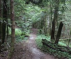
The trail for the Woodland Walk begins right at the metal gate along Harper Road. Do not walk up the gravel road, instead walk onto the trail directly to the left of the metal gate and follow this trail as it weaves its way up hill, over wooden steps and planks. Within 10 minutes or so of hiking, the trail reaches a gravel forestry road. Immediately, go left and follow a trail that leads back into the forest and away from the gravel road.
Within 10 minutes or so, the trail reaches a clearing underneath a set of BC Hydro power lines. The area has been opened up in recent years as BC Hydro expands the power lines. Go left and follow the gravel road underneath he power lines, continuing across the bridge over Prichard Creek. Within a few minutes after crossing the creek, watch for trail markers on your right that mark the Upper Loop for the Woodland Walk route. Enter the forest and follow this trail as it very gradually ascends through the second generation growth.
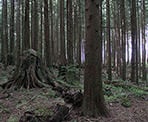
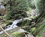
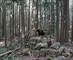
The trail continues to meander through the forest until it reaches a junction. Continue straight at the junction, staying on the Upper Loop route. At a second junction, go left and take the short connector trail down to the Lower Loop. At the junction on the Lower Loop, go right and you should see a very large stump located on the left side of the trail. Continue past the stump for a short distance until you reach a creek and, walking down the narrow trail towards the water will bring you to Woodland Falls.
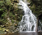
Located further upstream, Sawblade Falls is much more spectacular than Woodland Falls. To reach Sawblade Falls, walk out of the canyon and back to the main trail, then look for a trail that heads steeply uphill and is parallel to the creek. This trail climbs quickly through several switchbacks before reaching a rocky clearing, then disappearing back into the forest to a junction with several trails. At the junction, veer left and continue staying close to the creek and the trail will narrow and take you right down towards the Sawblade Falls.
To return, walk back to the junction and look for a trail that goes downhill to the left of the one you came up. Do not go left and follow the flat, old logging road. Follow the trail downhill as it winds its way through the forest and reaches the junction with the connector trail you took earlier. Go right and down that same connector trail but at the bottom, go left this time and begin your walk back, this time returning along the Lower Loop route.
Continue following the Lower Loop and, when you reach a junction, go right as the trail descends gradually. The trail opens up as you arrive back at the power lines. Walk to the left along the gravel road under the power lines, passing the start of the Upper Loop route and walking over the Prichard Creek bridge. Just after the bridge, go right and follow the trail back the same route that you took earlier. When it reaches the gravel road, immediately go right and stay on the forested trail, as it quickly descends bringing you back to Harper Road where you began.
How to get to Woodland Walk Trail
Estimated Driving Time from Vancouver
45 minutes
The Woodland Walk Trail is located in Coquitlam in Pinecone Burke Provincial Park and starts from a metal gate at the end of Harper Road, just before the PoCo & District Hunting & Fishing Club.
From Vancouver, drive east towards Highway #1 and enter the highway heading eastbound. Follow Highway #1 through Burnaby and turnoff before the Port Mann bridge at Exit 44 to Highway 7 - Lougheed Highway. Follow Lougheed Highway into Coquitlam and turn right at a major intersection onto Lougheed Highway (this intersection is confusing with street names as you have to turn right at the intersection to continue following Lougheed Highway or Highway #7).
Continue driving eastbound on Lougheed Highway and turn left at Coast Meridian Road. Once you've turned left, you will need to turn left again within a few hundred meters, after which you will be driving northbound on Coast Meridian Road. Follow Coast Meridian for quite some distance as it pass through residential areas, heads uphill, and eventually becomes a single lane street. Turn right onto Harper Road, then pass by some houses as Harper Road then veers to the left. The last section of the road is gravel and as you drive up, look for a metal gate on your right. Park on the opposite side of Harper Road and do not block the metal gate.
View a map of Driving directions to Woodland Walk Trail.

Although we try to keep information as current as possible, www.vancouvertrails.com makes no warranty or representation as to the availability, quality, fitness for purpose, conditions or accuracy of the information provided with respect to this trail or trails. The information provided herein is further subject to our Terms of Use.

Comments
Add Comment View All Comments