- Difficulty Intermediate
- Time 5 hours
- Round-Trip 12 km
- Elevation Gain 650 meters
- Season May - October
- Camping No
- From Vancouver 2 hours
- Public Transit No
- Dog Friendly No
With a stunning waterfall and several gorgeous views of the Squamish Valley and Tantalus Range, High Falls Creek is one of the most scenic hikes in the area.
High Falls Creek can be a dangerous hike for those that do not use caution or are afraid of heights. It is tempting to want to stick ones head out over the edge of the trail in an attempt to see the bottom of the falls. However, in doing so, you risk slipping and falling dozens of meters below and causing severe injuries or even death. It has been documented that a few experienced hikers have lost their lives on this trail. Therefore it is important to keep safety in mind and use extreme caution.
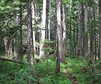
From the parking area, walk across the bridge and continue a short distance on the gravel road until you reach a sign and trail markers that mark the route to High Falls on the right. Follow this trail and enter into the forest. The sound of High Creek can be heard through the trees.
A short distance and you arrive at a large rock at which point the uphill climb begins. Use your hands and legs to scramble up and over the rocks to a viewpoint just above. This view is just a glimpse of what's to come as the view at higher elevations is much nicer. Continue the uphill trek as you make your way over rocks while keeping an eye out for the coloured trail markers.
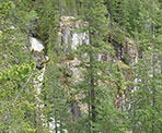
After using the ropes along the trail to pull yourself up through the steep sections, a short side path leads to a view of the falls and the steep canyon wall on the opposite side. Take in the view while being careful not to get too close to the edge.
Head back onto the main trail as it continues to climb steeply for another 20 minutes or so until you arrive at a full view of the falls. The large boulder wedged between the granite rock walls carved out over hundreds of years makes for a truly spectacular photo.
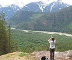
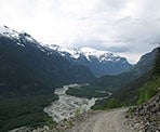
As you continue, it seems as though the steep unrelenting trail will never end. A short distance up, the trail opens onto a rocky bluff with a stunning view of the Squamish Valley. The Squamish River below weaves through the valley while the glacier-covered slopes of the Tantalus Range stand tall behind. After soaking in the view, continue back along the trail.
The trail passes into a small forest before reaching a junction. Go right at the junction and walk a short distance downhill to a view of the upper falls from above. Do not venture too close to the edge as the dirt can be loose and give way. After enjoying the view and cool mist from the falls, walk back up the trail to the junction and go straight as the trail continues up the hill.
The trail continues until it reaches a ridge and begins to level. The steepest sections of the trail have past as you now can see several views of the Squamish River and Valley below. Continue following the trail as it passes through a forest of Douglas Fir and Western Cedar trees. As you continue your hike the trail weaves alongside steep cliffs and a thick forested area, then through a second-generation growth area that was logged in the 90's.
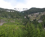
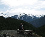
Eventually, the trail reaches a boulder field. Scramble up and over the rocks to a gravel logging road above. From this point go left and walk up the gravel road to where the high point is just a short distance away. At the corner is a log bench overlooking a view of the Tantalus Range in the background. Continue along the gravel road as it slowly makes its way back down towards the valley. Enjoy several scenic views of the Squamish River as you go.
After walking for just over 5km, the gravel road meets the Squamish Valley Road that runs next to the river. Go left and walk about 20 minutes back to where you started your hike.
How to get to High Falls Creek
Estimated Driving Time from Vancouver
2 hours
High Falls Creek is located in the Squamish Valley area, north of the town of Squamish. Take Highway #1 (Trans Canada Highway) westbound towards Horseshoe Bay and take Highway #99 (Sea to Sky Highway) northbound. Continue past the town of Squamish and, just beyond Brackendale, watch for the turnoff on your left to the Squamish Valley Road.
Follow the Squamish Valley Road until, just after a bridge, you reach a junction. Zero the odometer on your vehicle and go left to continue driving along the Squamish Valley Road. Continue along this road until 22.5 km later you pass a pumphouse. Approximately 1km later, at 23.5km, you arrive at a bridge that crosses High Falls Creek. Don't cross the bridge but instead park in the space at the side of the gravel road. The trail begins a short distance over the bridge up the road on the right side.
View a map of Driving directions to High Falls Creek.

Although we try to keep information as current as possible, www.vancouvertrails.com makes no warranty or representation as to the availability, quality, fitness for purpose, conditions or accuracy of the information provided with respect to this trail or trails. The information provided herein is further subject to our Terms of Use.

Comments
Add Comment View All Comments