- Difficulty Easy
- Time 1 hours
- Round-Trip 5km
- Elevation Gain minimal
- Season year-round
- Camping No
- From Vancouver 30 minutes
- Public Transit Yes
- Dog Friendly Yes
Located in Burnaby just east of Vancouver, Deer Lake Park offers a nice, flat, and easy walk that circles the lake and passes by a beach area, a viewing tower, and pier, all offering great scenery. The trails are accessible all year and are popular with residents walking dogs or just out for an afternoon stroll through the park.
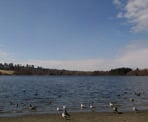
There are several areas to start the walk around Deer Lake including at the Shadbolt Centre or just off of Royal Oak Street, however, we will begin from the beach area on the east side of the lake along Sperling Avenue. The beach can be quite busy on warm summer days with children playing on the playground. Go left and walk towards the small park building where the washrooms are located. On the other side of the building, cross the small bridge and follow the trail as it gradually climbs along the lake, away from the beach area.
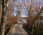
Go right at the paved road and follow the road as you pass by several houses located along the lake. Eventually, the pavement becomes gravel trail again as you walk towards the water and onto a wooden boardwalk. The old trail used to be very muddy through this section, however a new raised platform was built to make it easier on the feet as well as to protect the sensitive ecology.
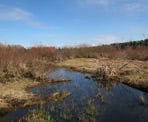
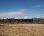
As the trail emerges from the wooden boardwalk, the area opens up with a view of the lake to the right and an open field in between. Continue where a short distance later you arrive at a junction that goes in several different directions. Off to the right is a map of the area, perfect for familiarizing yourself with Deer Lake Park.
This field area was the former site of the infamous Oakalla Prison from 1912 to 1991. It is difficult to imagine that thousands of prisoners were incarcerated on this land and executions even took place at this location up until the 1960's.
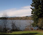
If you want to just do a short loop, follow the trail closest to the lake and walk along the wooden boardwalk to the north end of the park. However, we will complete the longer loop by continuing towards the viewing platform, which offers a view of the entire park area and is popular with bird watching enthusiasts. On a clear sunny day, the city and surrounding mountains are visible and offer a nice backdrop to the park. After enjoying the view, walk down the short gravel hill and head northwards, passing the remote-control airplane field and arriving at another junction. Go right at this junction and walk back towards the direction of the lake.
When you reach the next junction you will note the boardwalk on the right. This path on the right comes from the same direction as the mapboard you looked at earlier and is the shorter route around the lake. Go left and stay on the gravel trail as you begin your walk around the north side of the lake. The trail veers to the left and arrives at another junction. Go right as you enter into a residential area and are suddenly walking on a paved street. There are plans to eventually build a bridge that would link the two shores together but for now you must walk on the road to the right and up about 40 meters to where a trail starts on the right. If you walk as far as where the road turns left, you have gone too far.
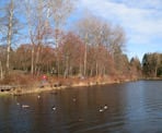
Leaving the road behind and walking down the gravel trail, Deer Lake comes into view once again as the trail continues onto a wooden walkway along the lake shore. There are several view points along this section and a small pier to walk out on. If it is your first time exploring Deer Lake Park, there are several buildings along this side of the lake worth checking out including the Shadbolt Centre and Burnaby Art Museum just up the hill.
If you are catching a bus, there are bus stops on the opposite side of the Shadbolt Centre. If you are returning to the beach area, continue along the path as it heads out towards the road. Cross the small stream along the sidewalk and then veer right back onto the trail towards the lake, staying on the boardwalk until you return to the beach a short distance later.
How to get to Deer Lake
Estimated Driving Time from Vancouver
30 minutes
Deer Lake is located in Burnaby just off the south side of the Trans Canada Highway. From Vancouver, drive east towards the Trans Canada Highway (Highway #1) and enter heading eastbound. Take the Canada Way Exit (Exit #33) and just after leaving the freeway, change into the middle lane before the light. At the light, turn left onto Canada Way and after rounding the first corner, turn right at the first light onto Sperling Avenue. Almost immediately after turning onto Sperling, go straight across the yellow line as Sperling Avenue continues to the left. If you are following a winding round, you missed the turn and must turn around and go back. Follow Sperling Avenue a few blocks until the Deer Lake Beach parking lot appears on your right.
View a map of Driving directions to Deer Lake.
Transit Access to Deer Lake
Transit does provide bus service to the Deer Lake area and bus riders will have to take a bus to the Shadbolt Centre along the north side of Deer Lake. Bus #144 SFU provides direct access from Metrotown Centre and is only about a 15 minute bus ride from the shopping mall. Bus #144 can also be accessed from North Burnaby at the Burnaby Lake Skytrain Station or from SFU and then taken towards Metrotown, with riders getting off at the Shadbolt Centre.

Although we try to keep information as current as possible, www.vancouvertrails.com makes no warranty or representation as to the availability, quality, fitness for purpose, conditions or accuracy of the information provided with respect to this trail or trails. The information provided herein is further subject to our Terms of Use.

Comments
Add Comment View All Comments