- Difficulty Easy
- Time 2 hours
- Round-Trip 6km
- Elevation Gain minimal
- Season year-round
- Camping No
- From Vancouver 40 minutes
- Public Transit Yes
- Dog Friendly On-Leash
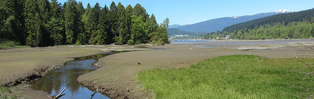
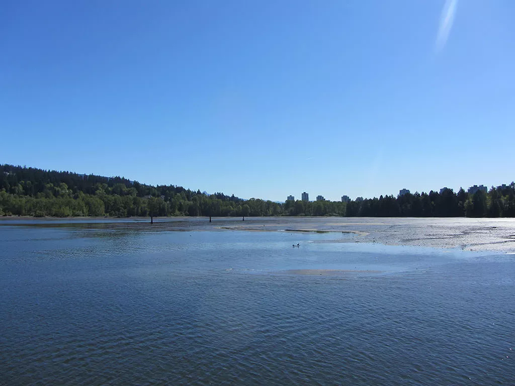
Located along the shores of Burrard Inlet, Rocky Point Park in Port Moody is one of the most scenic parks in the lower mainland. The Shoreline Trail is an easy walking route that wraps around the eastern most section of Burrard Inlet, starting from the pier at Rocky Point Park and ending at Old Orchard Park.
From the parking lot, walk out onto the pier next to the boat launch and enjoy the surrounding view. On a sunny weekend day, the water can be quite busy with motorboats, kayakers, and dragon-boaters. After enjoying the view walk back to the start of the pier and go left along the trail that follows the shoreline and passes through the grassy park area to the right. After walking over the second bridge, the gravel trail begins as you begin to leave the sound of kids playing at the water park.
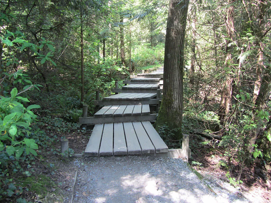
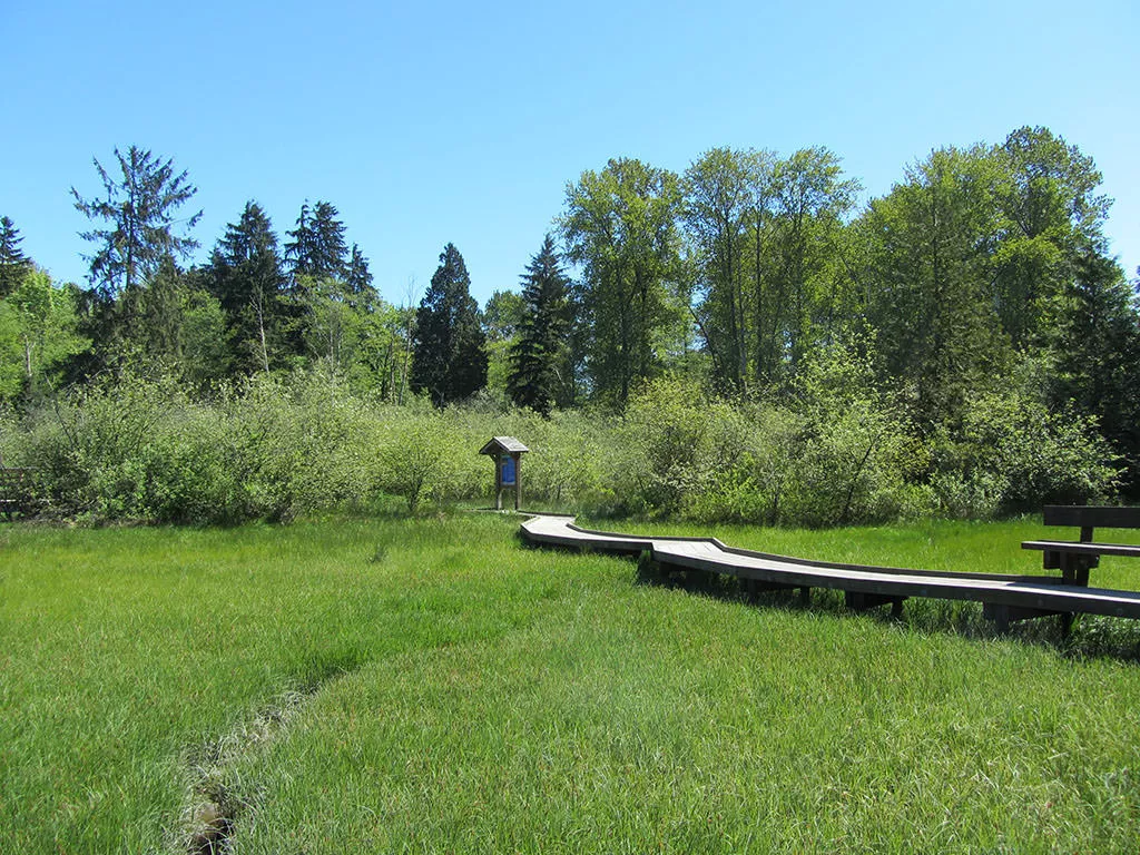
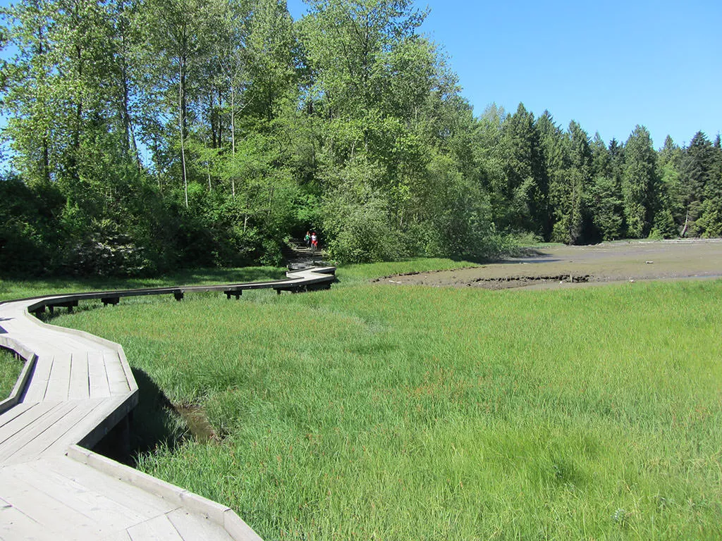
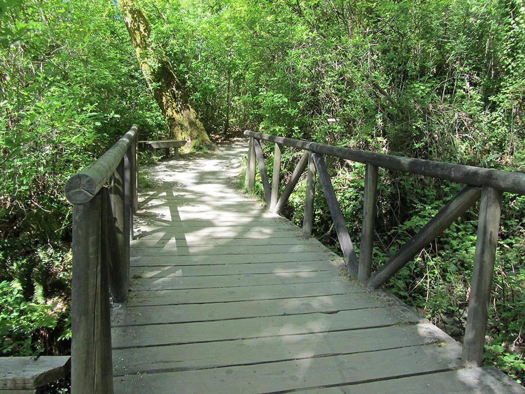
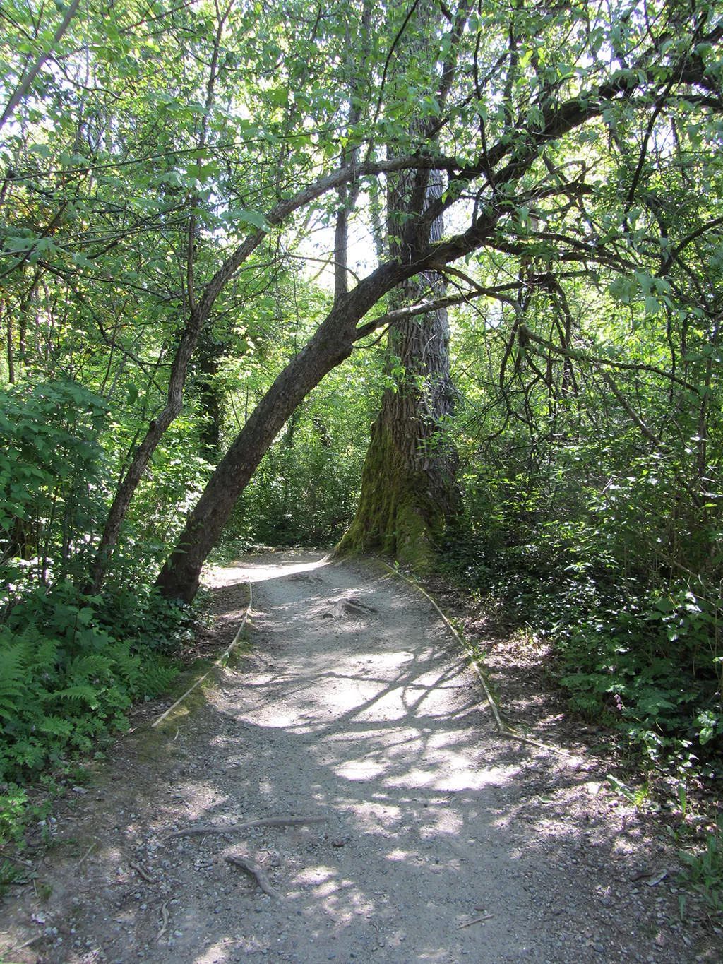
Walk onto the gravel trail on the left side as this trail will stay close to the shore and is not meant for cyclists. The trail passes through a nice forested area, offering glimpses of the inlet to the left, before descending down a set of long wooden steps and opening to a clearing. This is where the narrow wooden boardwalks are located as you make your way across while taking in the view towards the inlet.
After crossing the boardwalks, the gravel trail continues for a short distance before reaching the second series of raised platforms. Walk across these and then cross the wooden bridge at the end. After the bridge, go left, up a short hill, and continue following the narrow gravel trail along the shoreline.
Eventually, the trail opens up into a clearing and you reach a junction on the left. This area was the old McNair Cedar Mill, which burned down in 1949. You may notice some remnants of equipment along the trail along with posts and dock pilings along the shore from the viewpoint.
Back on the trail, continue your walk as you reach a junction. Go left and down a few wooden steps as the trail continues to weave it's way along the shore. Not too much further and you reach Old Orchard Park with picnic tables, a playground, and a small beach area. This is a good place to stop for a rest before walking back along the trail to Rocky Point.
How to get to Shoreline Trail
Estimated Driving Time from Vancouver
40 minutes
From downtown Vancouver, to reach Rocky Point Park, and the start of the Shoreline Trail, by car, drive east along Hastings Street through Vancouver and continue through Burnaby. Continue onto the Barnet Highway out towards Port Moody. Just before the traffic lights at St. John's, which mark the end of the Barnet, merge into the left turning lane and turn left onto Clarke Street. Drive along Clarke Street to the lights at the 3-way stop and turn left onto Moody Street. Cross the overpass as it loops around and make a left after the loop onto Murray Street. Immediately after passing underneath overpass, there is a parking lot on your left. Drive into this parking lot as it's the lot for Rocky Point Park.
View a map of Driving directions to Shoreline Trail.
Transit Access to Shoreline Trail
Rocky Point Park in Port Moody is accessible from downtown Vancouver by public transit. The best option for traveling by transit to Rocky Point Park is to make your way to downtown Vancouver to the intersection of Hastings and Granville. Look for the Eastbound Bus #160 Poco Stn Via Guildford Way. This will be the only bus you take to your destination as it will drive east on Hastings, through Vancouver and Burnaby, onto the Barnet Highway, and eventually along the Barnet Highway in Port Moody. You need to exit the bus at St. John's and Moody Street (ask the bus driver to make a stop at this intersection). The entire bus ride will take about 50 minutes.
One you have exited the bus on St. John's Street, cross the street and walk north along Moody Street. A block later, you walk onto an overpass that crossed train tracks and a road below. Stay to the right on the first offramp and follow the path down towards the parking lot and marina where you reach Rocky Point Park and the start of the Shoreline Trail near the pier.

Although we try to keep information as current as possible, www.vancouvertrails.com makes no warranty or representation as to the availability, quality, fitness for purpose, conditions or accuracy of the information provided with respect to this trail or trails. The information provided herein is further subject to our Terms of Use.
Comments
Add Comment View All Comments