

- Difficulty Difficult
- Time 8 hours
- Round-Trip 14km
- Elevation Gain 1560 meters
- Season July - October
- Camping No
- From Vancouver 40 minutes
- Public Transit Yes
- Dog Friendly Yes
 View Trail Map
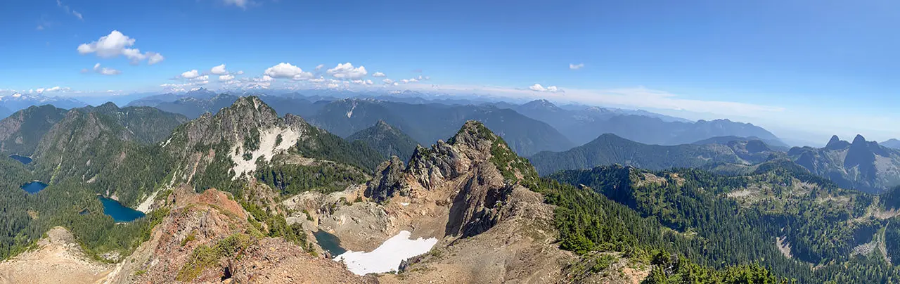
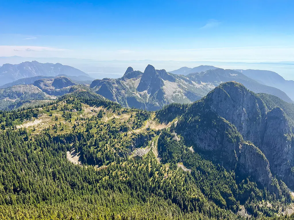
Brunswick Mountain is the tallest mountain on the North Shore, offering complete panoramic views on a clear, sunny day. The trail begins from Lions Bay and is very difficult, with some scrambling near the top. Hikers will be treated to incredible views of Howe Sound, the Lions, and surrounding mountains throughout the region.
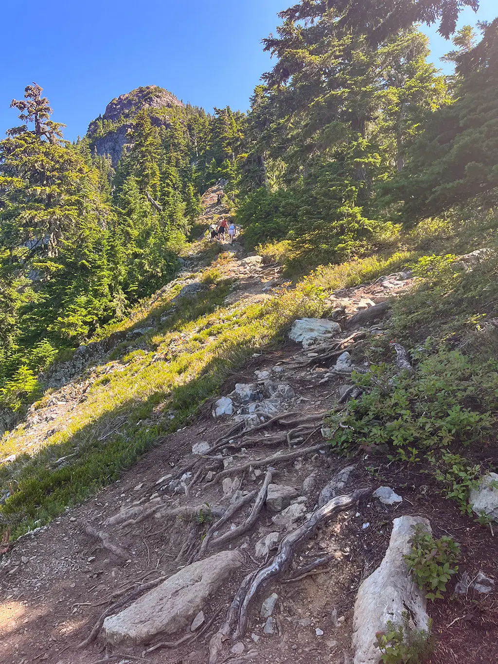
The hike to the top of Brunswick Mountain is challenging and should only be attempted by experienced hikers. Proper hiking footwear is a must as the trail has loose gravel sections of trail on steep inclines, including some sections where some scrambling is involved.
The trail begins from the Sunset Drive parking lot at the top of Lions Bay. Follow the gravel Forestry Service Road (FSR) as it waves its way uphill through several switchbacks. Count the number of switchbacks and at the 7th one, look for a sign on a tree and a trail that leaves the FSR. The trail to Brunswick Mountain initially follows the same trail that goes to Tunnel Bluffs.
Follow the flat trail as you make time quickly, enjoying the pace you are moving before you come to some of the grueling uphill sections of trail. At a junction, go right to Brunswick Mountain as the trail begins to climb steeply. Pace yourself accordingly. The trail will reach a series of switchbacks that climb even steeper than the previous section.
The trail eventually reaches a junction that connects to Magnesia Meadows or Brunswick Lake. Continue straight uphill towards Brunswick Mountain as you carefully watch your step on the loose rock while occasionally looking up to enjoy some of the views.
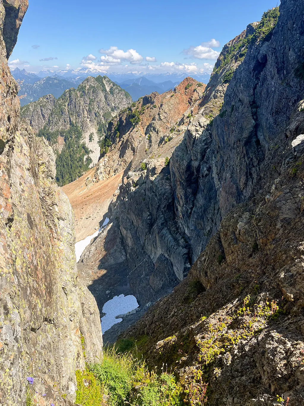
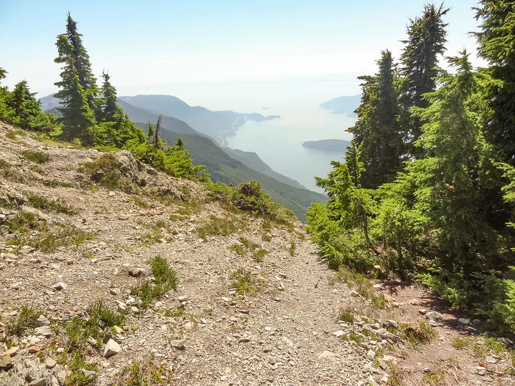
After hiking for a few hours, the trail reaches a viewpoint between two ridges. Enjoy the view looking down towards Howe Sound.
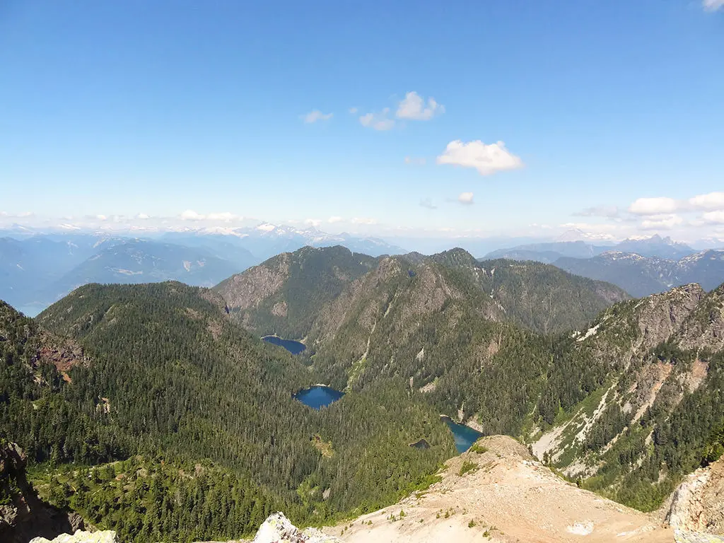
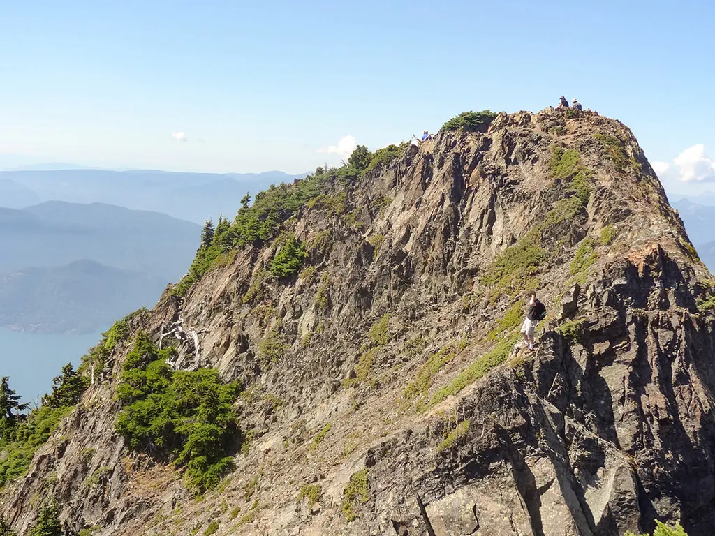
To continue to the peak, follow the trail up the right side where you will reach one of three ridges that you can get to. There is some scrambling involved, so be very careful as you make your way to the top. Once you reach the top, you are immediately treated to incredible panoramic views as you stand on the highest peak of the North Shore. Peering over Howe Sound, Mount Harvey sits close by and the Lions are not far off in the distance too. Brunswick Lake, Hanover Lake, and Deeks Lake can also be seen from the peak. Having someone take your photograph from the peak overlooking Howe Sound in the background is a must.
After enjoying the views, carefully make your way back down the hill, being cautious of the loose gravel and dirt along the steep trail. Pass the junction and continue descending back towards Lions Bay. Go left at the next junction and return to the FSR. Follow the wide FSR back down to the trailhead at Sunset Drive where you began your hike.
How to get to Brunswick Mountain
Estimated Driving Time from Vancouver
40 minutes
The trailhead for Brunswick Mountain begins from the top of Sunset Drive in the community of Lions Bay. Parking is very limited, so plan to get there early or make other arranges to get to the trailhead.
To drive from Vancouver, head westbound on Highway #1 towards Horseshoe Bay. Just before Horseshoe Bay, merge onto Highway 99, the Sea To Sky Highway. As you approach the community of Lions Bay, watch for signs and take the exit for Lions Bay Avenue. After exiting, turn right, then immediately turn left crossing over the bridge. At the stop sign, turn right onto Centre Road, then turn left onto Bayview Road. Follow Bayview Road to the top, passing the elementary school along the way. Turn left onto Sunset Drive where the parking lot for the hiking trails are located.
There is overflow parking at the elementary school but that requires an additional 1km each way of walking. Make sure to park where signage allows as illegally parked vehicles will be towed.
View a map of Driving directions to Brunswick Mountain.
Transit Access to Brunswick Mountain
While there is bus service to Lions Bay, walking from the bus stop from the Lions Bay General Store to the trailhead adds an additional 1.6km each way with more elevation. This is a lot of extra distance for an already long and difficult hike.
If you do plan to take the bus to Lions Bay, the #262 Bus is one option that goes to Lions Bay. The most direct route from downtown Vancouver is taking Bus #257 to Horseshoe Bay and getting off the bus at the ferry terminal (the last stop). From the Horseshoe Bay ferry terminal, transfer onto Bus #262 to Lions Bay and exit this bus at the Lions Bay / Brunswick stop.
Make sure to check the bus schedules as the Lions Bay bus does not run very late.
Although we try to keep information as current as possible, www.vancouvertrails.com makes no warranty or representation as to the availability, quality, fitness for purpose, conditions or accuracy of the information provided with respect to this trail or trails. The information provided herein is further subject to our Terms of Use.
Comments
Add Comment View All Comments