- Difficulty Difficult
- Time 3.5 hours
- Round-Trip 6km
- Elevation Gain 550 meters
- Season July - October
- Camping Yes
- From Vancouver 2 hours
- Public Transit No
- Dog Friendly Yes
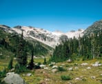
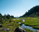
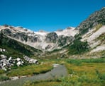
Located just south of Whistler, the hike to Brandywine Meadows brings you to a scenic meadow with a calm creek that meanders through the grass, and surrounded by picturesque mountains and glaciers. If you time it right towards the end of the summer, the meadows will be full of the colourful sights and smells of wildflowers.
Don't let the short distance and time lead you to believe that this is an easy hike. The trail has an average grade steeper than other hikes in the area, such as Wedgemount Lake and Black Tusk. Most of the steep section of trail occurs during the first kilometer.
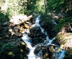
From the brown "Brandywine Meadows" BC Parks sign, walk into the forest and look for the trail and orange marker. The trail can at times feel difficult to follow so make sure to look up for the markers on the trees. Continue as the trail begins to climb steeply, crossing over fallen trees and slippery rocks. After 20 minutes of hiking, the trail veers away from the creek but continues its relentless climb up the mountainside.
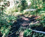
After an hour or so, the trail follows alongside the treeline where an adjoining section of trail has been more recently logged. The trail stays within the trees, passing through a section that is often very muddy. Carefully pass over the wooden planks as you maneuver your way through this section.
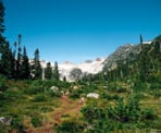
After crossing a final stream and making your way up a final steep section, the trees begin to thin as you make the final approach to the meadows. At a junction, go left and continue as the mountains gradually come into view before reaching some large rocks where you can look down into the meadows and up at the surrounding mountains. You have reached Brandywine Meadows and this is a good point to stop for a rest and something to eat. If you would like to continue your hike, it is possible to hike up Brandywine Mountain starting from the other side of the creek.
Once you are satisfied with your time in the meadows, make your way back to the trail as you take in a scenic view of Black Tusk in the distance on a clear day. Make sure to go right at the junction and continue down the steep hill, through the muddy section, and the other steep hill until you reach the trailhead where you started.
How to get to Brandywine Meadows
Estimated Driving Time from Vancouver
2 hours
From Vancouver, make your way to Highway #1 and head westbound towards Horseshoe Bay. Just before the ferry terminal, merge onto Highway #99 (Sea to Sky Highway) and continue heading north along this scenic route. Pass through the town of Squamish and stay on the highway towards Whistler.
A few kilometers after the Brandywine Falls parking lot, look for a left lane turnoff to the Callaghan Road. Follow this road for less than a kilometer and make a left at the first road. Continue along this road and veer to the left as you pass the Whistler Transfer Station, at which point the road becomes gravel. Stay on the gravel road and pass through a large clearing / parking lot area, rejoining the road on the far side.
A short distance further, the gravel road joins with the Brandywine Forestry Service Road. Stay on this gravel road and continue to watch for the yellow Kilometer signs. The road starts out fairly flat but then does a sharp turn to the right and begins to climb quickly. After driving up a steep hill and passing a view of the Whistler valley on your right, a picturesque mountain view becomes visible in the distance. Continue along the gravel road until you reach a junction.
The junction has a sign that points to the Lower Brandywine Meadows Trail 2km to the left or the Upper Brandywine Meadows Trail 5km to the right.
Lower Brandywine Meadows Trail Parking Lot
The lower lot to the left of the junction is a short drive and the road is fair similar to what you have been driving. The last bit is a steep uphill section until you arrive at the parking lot area. A wooden BC Parks sign will be on the right marking the start of the trail.
Upper Brandywine Meadows Trail Parking Lot
The Upper Brandywine Meadows Trail Parking Lot in 4x4 access only and the road is very steep and rough, particularly the last few kilometres. There is a chance that you will not be able to drive the entire 5km due to the road being so difficult, in which case, you will have to hike up the road the remaining distance.
The hike to Brandywine Meadows is very short from the Upper Brandywine Meadows Parking Lot, assuming you are able to drive all the way there.
View a map of Driving directions to Brandywine Meadows.

Although we try to keep information as current as possible, www.vancouvertrails.com makes no warranty or representation as to the availability, quality, fitness for purpose, conditions or accuracy of the information provided with respect to this trail or trails. The information provided herein is further subject to our Terms of Use.

Comments
Add Comment View All Comments