View Brandywine Meadows Description | Add Comment
Jean from Richmond writes:
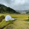
Start 400 meters below the lower parking lot with our Subaru Crosstrek, not an easy drive there and also not an easy hike, but indeed a beautiful place to stay for one afternoon. Spend 2 hours up at the meadows & enjoy this beautiful and peaceful place. ( We brought our portable net tent to keep the bugs away ).
There're some aggressive wasp/hornet on the trail, and I unfortunately got 3 stings on my way down.
Just be caution, and if you see them , just walk fast and quiet. ( I think they are active at the end of summer)
Posted: September 5, 2023 01:15:46 PM PST
Peter from Burnaby writes:
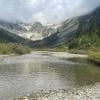
A beautiful meadow is the reward for a difficult hike. Started at lower parking lot as road to upper lot was very rough. A 2WD make it to the lower lot, but it would be difficult. Expect 2~ hours up straight uphill hiking to reach meadows. Terrain is rough, lots of downed logs and uneven footing. It is doable, but requires attention both on the up and the down. Considerable bugs; recommend eating lunch in midst of the river while perched on a rock, otherwise you're sharing your sandwich with 1,000 little friends.
A beautiful meadow with terrific mountains all around. Highly recommended. Hiked on Friday, July 30 and saw
Posted: August 6, 2021 11:35:03 AM PST
kristen blades from vancouver writes:
This hike is great if you have a vehicle to get to the lower or upper lot. Can't use a sedan in either one. Went up Aug 1 2021.
The trail feels a bit like the grind but with way more branches and roots everywhere. It is also easy to miss the trail markers we def got off the trail accidentally at one point and there were 4 of us. Keep your head up when you can and pay attention to the orange markers! Esp with all the wood everywhere on the trail itself you will question if you lost your way.
It took around 2 hrs up with a 30 lbs bag and 1.5 hours down. The meadows are incredible so many great spots to camp and clear water source. No bathrooms and no permit required. In terms of bear safety there aren't a lot of trees to hang your food on but make sure to keep it far enough away from you and other campers.
PS. SOOO many bugs they were just awful on the hike and even in the meadow. We had bug spray and the Off bug rings that burn around the camp area so the bugs go away. That helped but they were still miserable so wear pants.
Posted: August 4, 2021 04:53:25 PM PST
Audra Cowe from Vancouver writes:
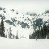
I went up with my boyfriend on May 17, 2020 and it was beautiful! It was covered in snow from almost the bottom of the trail but we managed without crampons or spikes. We had the entire mountain to ourselves which made for an even better day. Highly recommend as it was also not as difficult as we were told.
Posted: May 20, 2021 03:25:15 PM PST
Siobhan from Burnaby writes:
Hi Guys,
Has anyone been to the meadows recently? I'm wondering whether the snow has mostly melted by now?
Thanks!
Siobhan
Posted: July 7, 2020 02:00:48 PM PST
jm from vancouver writes:
Awesome hike, just did this sept 28. It's very cold up there now, with dustings of snow and some slippery snow covered rocks if attempting the hike from the meadows up to brandywine peak. However, still beautiful worth the trip, there were about 1/2 dozen other camp parties up there. All the roads in (even 2 wheel drive road) are pretty rough.
Posted: September 30, 2019 08:25:00 AM PST
Jacky from North Vancouver writes:
We hiked it on July 21 2019 on a hot and sunny day. Beautiful hike and views, well worth a visit. Flowers were coming out; will probably peak soon. And we saw maybe 10 people on the whole hike. Not long in distance but quite steep for the first 2km; going back down was a lot harder than going up as there is a lot of scrambling to do. We had no problem with bugs at all - maybe because it was windy? Except beware of a wasps nest at the base of a tree about 3/4 of the way up the woods - you can see them buzzing around before you get there - hubby got stung; I detoured!. Re the drive, we had a loaner SUV so decided against tackling that large hill just before the official lower parking lot and trailhead - its pretty rutted and steep. We parked and walked up. Total distance was round trip 11Km but we actually went past the meadows and up a scree hill on the left which extended our hike.
Posted: July 21, 2019 07:50:23 PM PST
Liane Veitch from Vancouver writes:
Hike is great, although it is quite steep and the trail up from the Lower parking lot is quite challenging due to lots of slippery tree roots, etc., but the views and the meadow are totally worth it. Word of warning though - we were there overnight on July 13th and there were LOTS of mosquitoes and biting black flies. Be prepared - especially if you're going to be staying overnight!
Posted: July 15, 2019 03:54:06 PM PST
Andrew Harvey from Vancouver writes:
Hi guys! Has anyone been up recently? I'm wondering if the meadows are under snow at the moment? I'm planning to camp there on Saturday 6th July!
Many thanks!
Posted: July 2, 2019 10:08:15 AM PST
Dimo from Burnaby writes:
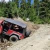
We took a Jeep and a Truck up to skip a lot of the elevation gain... and ... well... aside from an incident with the jeep (lol it's in the vid)... 2 of us attempted Brandywine Peak... which ended up being a night hike back with a lot of path finding, getting lost, and maneuvering scree in the middle of the night. Good times!
It's all here for those interested: :D
https://youtu.be/cOpQK8qrIjQ
Posted: October 17, 2018 02:50:28 PM PST
Phil from Tsawwassen writes:
Hiked Sept 3rd with a group
Nissan X-Trail and Honda CRV had no issues making it to lower lot, 2wd Tacoma made it up too with a bit of a thrash to get up the last hill. Trail was easy to follow, steep with some muddy spots but ultimately a lot easier than we thought it would be. Bugs seem to have moved on, with no bug spray on I didn't get a single bite. We were hoping to catch the meadow in bloom but it appears to have already ended. Decently waterproof shoes recommended, with at least a medium height ankle. A few campers and day hikers around but pretty dead overall and very clean.
Posted: September 4, 2018 12:01:06 AM PST
Alex from North Vancouver writes:
We hiked to Brandywine Meadows this weekend. It's really pretty once you get to the top but the hike up is very steep. Also, the bugs at the top are awful! There are swarms of mosquitoes already. If you have a truck that can get to the top parking lot then the view is worth it, otherwise it's a steep hike for a lot of bug bites.
Posted: July 23, 2018 09:37:59 PM PST
Chen Ha from Vancouver writes:
I hiked this beautiful Brandywine mtn trail on July16, 2018. The sceneries are stunning. Lots of snow at the top.
Unfortunately I lost a pair of prescription glasses on the trail. It is inside a black Rayban sunglass case. If you find it, please contact me at [email protected]. Thank you. Chen
Posted: July 17, 2018 10:16:06 PM PST
Meghan from Vancouver writes:
Did this on June 222nd. First off, it is hard to find. Follow the directions to get to Callaghan Valley Road, pass the waste transfer station, follow the logging road for about 4 k, you will have the option to turn right (if you have a 4 x 4 vehicle) or continue straight and stay right once you hit the next fork in the road. You will then see a postage stamp sized sign next to a gate, pointing to a trailhead in the bushes, ignore that. It makes zero sense. Now just continue as long as your car will allow, I made it maybe another 1 km before I pulled over, then walk up the hill to the trail head. The trail is marked, just look out for the orange markers and pink surveyors tape (thanks whoever did that!). There are a few areas where you will have to go over logs, or around them. The meadow was still covered in about 2 meters of snow, but easy to walk around in regular hiking shoes. I think hiking poles if you have them could be quite helpful, it is quite technical and rooty. Also lots of evidence of bears in the neighbourhood.
Posted: June 26, 2018 10:15:48 AM PST
Michael from Vancouver writes:
Hi,
anyone did this hike recently ?Lots of snow ?
Posted: June 12, 2018 07:52:41 PM PST
Nadine from Burnaby writes:
Anyone attempting the hike now (late October) or is it too late?
Posted: October 27, 2017 02:02:49 PM PST
KC from Vancouver writes:
Did this hike on August 14, 2017. The yellow markers are clear with numbers on them, indicating you're driving up/down to Brandywine, but they are a bit sporadic (I only saw 3). The road to the parking lot is very difficult to get through as others mentioned - a lot of large rocks and bumps in a steep path. I managed to make it about 2.5 km away from the lower parking lot in my Honda Civic at about 15 km/hour before deciding to stop and park because I didn't want to risk it. The rest of the walk is steep but manageable.
The first 45 minutes of the hike is the most difficult, with a very deep incline. I am about 5 feet tall and found myself climbing with my whole body a lot of the time rather than taking large steps. It starts to even out after that and there is a little more variety in terms of platforms, tree roots, etc. There were some very muddy parts so definitely bring some extra socks or a change of shoes if you don't have waterproof footwear.
The meadow is beautiful - definitely worth the climb to get there. It was peaceful and there were a lot of beautiful wildflowers to look at. It was windier than I anticipated, so I would recommend bringing a sufficient long sleeved shirt. We were swarmed with bugs once we stopped in the meadow, so bring bug spray!
We had to take the hike down cautiously as there were many slippery parts, combined with the steep decline.
Overall, a worthwhile hike if you are up for the challenge.
Posted: August 30, 2017 12:22:52 AM PST
Ry from Vancouver writes:
Hiked this on August 21. In the description is says to turn off the highway onto Callagan Creek Road, but you should actually be turning onto Callagan Valley Road. We made that mistake and ended up driving through 5k of unpaved road for nothing.
The hike itself is very enjoyable with lots of variations of terrain. The first 45 mins is steep but it flattens out after that. We found the meadows were beautiful and definitely will come back to stay over night on our next trip here.
The hike was even more enjoyable because of the lack of people around. We only ran into a few small groups, so most of the time we had the meadows to ourselves which makes for an intimate experience with nature. I hope to keep it that way by keeping your hiking groups small, and not to spread it around social media!
Posted: August 22, 2017 05:14:53 PM PST
Zain from Vancouver writes:
Just did this hike (end of July 2017). Absolutely loved it. Views are majestic at the top.
Tips:
- aim to start the hike around noon latest if you're doing a day trip. If you want to go up to the peaks, start early morning.
- take a 4x4 (high-clearance highly recommended!!) I had an all-wheel-drive bmw sedan... Even with that it wasn't easy, as there are many large rocks and potholes.. had to drive very slow. If you plan on driving up to the upper meadows parking lot and starting there, you definitely need a high clearance Jeep or pick-up, as it is very steep and rocky.
- pack afterbite and shower yourself with bug repellant before getting out of the car as there are a LOT of wasps and mosquitos.
- lots of muddy/slippery areas so wear proper shoes
- take pictures/videos or mark your route as you almost start to enter meadows area at the top.. It's very easy to lose your way heading back as there is more than one trail.
Enjoy!
Ps. Search 'zaskariTV' on YouTube for a vlog of my trip.
Posted: August 1, 2017 01:09:33 AM PST
Cody from Vancouver writes:
Did this hike last week. The directions to get here are a bit confusing, so I recommend that you use alternative resources (some other sites have photos of the signs to turn at and a more specific instructions) to ensure that you are following the right way. The road is barely do-able in my Mazda3 with side skirts so we parked before the official parking lot. We could have made it further with some perseverance, on retrospect.
The hike is quite vertical, which I like. The trail as of late July is clear of snow, and has some wet/muddy portions that take a bit of effort to get through without getting super muddy. The view at the top is different from other hikes, but if you love alpine environments like me, this one is a must! You can continue from the meadows to hike up some peaks, but these are unmarked and at your own risk. A good option if you want to do a much longer hike.
We walked the logging road down from the upper parking lot, which was less technically challenging, but seemed like a much, much further walk, even though we parked far before where the logging road branches out to upper/lower parking. I recommend taking the trail back for a more stimulating and cooler walk. Logging roads are boring.
Posted: July 26, 2017 09:28:56 PM PST
Kamilla asla from Oslo writes:
Hi, we are planning to do a trip in BC 13-24 June. It seems that this is a bit off season, as all the hikes are recommended for July-August. But how far has the summer come? Is there still a lot of snow? (I writing from Norway.) Thank you for helping!
Posted: June 4, 2017 12:53:48 PM PST
Adele Berg from Port Coquitlam writes:
Hi, I was thinking of doing this hike in early June. Has anyone been up there or know if there is still snow up there? Thank you
Posted: May 31, 2017 10:05:09 PM PST
Sarah from West Van writes:
Beautiful views at the top but our whole family got stung multiple times by bees/wasps that were swarming on the trail, right through our pants and on our exposed hands & necks.
Posted: August 22, 2016 03:35:21 PM PST
Anton from Vancouver writes:
Amazing place for camping! Just beware, there are some wasps on the trail. Got bitten twice. Saw some people who's got bitten too. You probably can avoid it just wearing some pants instead of the shorts.
Posted: August 21, 2016 08:57:34 PM PST
Braeden Hallam from Langley writes:
Definitely one of my favourites! Amazing meadow to look forward to with camping spots and a small pond for a dip in. Took the longer route since I only have a mazda 3. A few things to make note of before heading out:
1) When driving the gravel road, DO NOT turn anywhere else, you will know when you are going the right way. Turned onto what we soon assumed to be an ATV trail. The road closely resembled the map from "Whistler Hiatus" so we drove it for awhile before getting out, walking, then turning back (was quite an uneasy road to drive) For the lower parking lot, pass a gate on the left (but don't turn left, for atvs as well) with a white sign stating "6km" and keep going until you see an extremely steep hill, if you are in a 2wd vehicle like me, probably best not to try it, you can park at the bottom and walk 10min to the trail head. The bulk of the road can be kind of rough but is easy enough with some patience on large boulders and pot holes (my car has normal clearance, no lifts) so, the previous comment might have taken the wrong route like I previously did, or thought they could not make it. You surely can.
2) about 15 minutes into the hike we came across some confusion. We hiked up a path that didn't have many markers until the last few minutes. After reaching a tree with a pink ribbon we were about to go up until we noticed another marker going slightly downhill so we walked that way. The markers kept going further down until we got frustrated and went back up to see if we missed a marker going up. Sure enough, there was a marker. THIS HIKE HAS NO DOWNHILL. It seems the start has two short paths for some reason that meet, and continue up. But don't know where the other starts.
3) Lots of bugs. The first 2km is mostly small bugs and mosquitos, then the last 1km near the meadows is horseflys.
In the end, totally worth the struggles we encountered
Posted: August 19, 2016 09:54:59 PM PST
Ginger from Kamloops writes:
I didn't even make it to the trailhead. It is worth noting that unless you have a vehicle with a decent amount of clearance you might not make it up the road. I have a small hatchback and nowhere in the description of the directions to the trail was the road described as rough. I was extremely disappointed in the directions to this trail. It also lists Callaghan Creek road as the road you turn onto when it's actually Callaghan Valley Road.
Posted: August 19, 2016 09:46:19 AM PST
Tracy G. from Surrey writes:
Did this hike July 17. Bugs were now minimal, except at the meadows where we sat for a snack (fair # of mozzies and little black flies there, but not enough to ruin your rest stop). No snow left at the meadows.
The road is is pretty rough, after the sign that points you to the lower parking lot, you come to a fork almost right away, stay right!
Hike was very rooty, wet, technical. Was quite a good climb first hour. We made a wrong turn right after the waterfall lookout - it was hard to see the marker "up" and we ended up doing a loop somehow back down to the waterfall. You should only be climbing UP, not down, for the first hour.
The muddy section with the planks was in terrible shape - fell in the mud :) Very muddy boots but still fun. The meadow was gorgeous. Little pink flowers JUST starting to bloom on many shrubs. 1:30 up and 1:10 down. Very technical on the way down (sore knees) but loved it! We will be back
Posted: July 17, 2016 09:25:09 PM PST
Jen from Vancouver writes:
We hiked here on July 4th.
A couple of comments:
1) The trail starts immediately to the right of the parking lot as you come in - there is a brown wooden pole in the ground marking the start. Beyond the parking lot there is a 4x4 path and this is NOT the hike.
2) Trail can be somewhat difficult to follow, the orange triangle markers are the ones you are looking for.
3) Slightly sketchy wooden paths over a very muddy section of trail after you get through the initial steep forest. Be very careful, many already broken and some not attached.
The hike was beautiful on the way up. The meadow still has some snow but does not limit hiking at all. The meadow is gorgeous, not wildflowers yet but soon!
Posted: July 7, 2016 10:19:38 AM PST
Kathy from Vancouver writes:
We just did this trail today. The trail is very well marked. It's really quiet even on holiday. I spotted only a few groups at the top. The scenery along the trail is pleasant. The view from the meadow is stunning. There were also a few wild wildflowers along the trail. We enjoyed this hike very much. Highly recommend.
A few things to notice:
1. Only the first 1km is very steep(but it was manageable), the rest of the trail is much easier to hike.
2. There was quite a bit of snow at the top. The centre of the meadow was still covered in snow.
3. Lots of mosquitos!
Posted: July 2, 2016 02:15:27 AM PST
Josh from Vancouver writes:
Just went up yesterday, quite the fun hike even for a first timer (young 20s and generally fit though).
The drive there was rather rough but doable in our AWD sedan, though the final ascent to the parking lot is probably too steep for a 2WD vehicle.
The trail itself is great, though people are NOT exaggerating about the amount of bugs out there. At the part of the description about the wooden planks, there was another path to the right composed of wooden planks that we went up. At the end of the planks there wasn't really a trail that we could find, but we hiked up through some brush and a really small stream to what I assume was a forest service road. Excellent views of Black Tusk and what I think was Whistler from that road.
The reason we went up there though is because the initial trail (crossing the stream again, steep uphill section) led us to a openish area that still had quite a bit of snow, and my partner's shoes were too slippery on it. As such, I don't think we made it to the meadows proper, but the road we found was just as great I think.
Posted: July 1, 2016 04:49:38 PM PST
Keela from Abbotsford writes:
Wanting to stay the night up there where abouts is the campsite ? (If there is a specific one) or do you just camp whenever you find a good spot ?
Posted: June 30, 2016 02:03:08 AM PST
Rushil Aggarwal from Vancouver writes:
Camped up couple weeks ago.
Beautiful hike, I wouldve rated it 5 star if not for the parade of blood thirsty immortal mosquitos.
No snow but meadows gets cold/windy at night.
Nice area for a base camp to go for day hikes.
Posted: August 19, 2015 01:20:49 AM PST
Lisa from Richmond writes:
Went for this hike this weekend. Completely missed the trail head and just kept going on the ATV path. This ATV gravel path will keep going for about 5-7 more KM past the trail head. So if there's no cars parked at the parking lot, you can easier miss the trail head :( The path is gorgeous though, great views of mountains and wild flowers.
We eventually did find the trail head on our way back, but was too late in the day to do the hike. Near the trail head, there's a bulletin board, the only thing on there was an avalanche warning chart. There's also a portable toilet.
Posted: July 26, 2015 11:07:35 PM PST
Rushil from Delta writes:
We camped out this past weekend. It was great since there were barely any people there. Did see a bear at a distance from campsite. Also for some reason we saw a red moon there Saturday night, kinda freaky.
During the night it got very very windy. So dont forget your tent pegs if you're camping. We saw someones tent flying off.
Also there were horrendous amount of flies, bees and other stuff. The off deep wood insect repellent didn't seem to work at all so bring something stronger.
Posted: July 6, 2015 10:45:36 AM PST
Tara from Coquitlam writes:
Did this hike today & have a few comments to add that will be helpful for future hikers :)
1- we took the lower parking lot road. It is more than just a "gravel" road. Very bumpy, lots of rocks. Hard on a small tercel like mine. My car & my friend's car couldn't make it up the last steep section, so we parked on the side, and then hiked up the 1km (?) up to the trailhead. Great for ATVs though- ha!
2- it got pretty chilly at the top, bring layers :)
3- there are lots of orange markers to follow, we only got turned around once, because we went near the creek. Just make sure you can always see an orange marker & you should be fine.
Enjoy!
Posted: June 20, 2015 09:16:50 PM PST
Diana from Vancouver writes:
Hi,
Has anyone been up recently? Is there snow?
Thanks!
Diana
Posted: May 15, 2015 11:18:01 AM PST
Greg from Vancouver writes:
Has anyone been up lately? Wondering how much snow is left...Thanks!
Posted: May 2, 2015 02:14:18 PM PST
SB from Vancouver writes:
We hiked this trail Sept 1st 2014 (Labour Day long weekend). We were apprehensive about the drive, but the driving directions on this site were easy to follow. Took the road to the lower parking lot, and didn't drive the whole way to the lot, but rather parked on the side of the road just before the last very steep section, as other commenters suggested. All of the above was totally doable in a Toyota Corolla if driving slowly and carefully.
The trail itself: amazing! Not many wildflowers this time of year, but gorgeous nonetheless. Encountered very few people - possibly because it was raining. It's got steep sections but we didn't really feel it merited a 'difficult' rating. There are some very muddy parts and I was glad I wore my hiking boots. Also it was chilly at the end, be sure to bring layers.
Highly recommend this hike.
Posted: September 4, 2014 10:56:38 AM PST
Rob from Port Moody writes:
We hiked this trail for the first time on August long weekend in 2013 and came back this past August long weekend. In comparison to last year, there are A LOT LESS bugs, but still a few blackflies near the top and in the open sections. The trail also isn't as muddy as last year - I think it's a really dry year.
There were some purple and white wildflowers in bloom at the top, but starting to die off. Definitely not as many as last year (dry year?).
Driving to get to the trailhead will be a bit treacherous if you are in a car. We have an SUV and still parked along the road before the parking lot because the last stretch of hill is pretty steep and rocky.
Posted: August 7, 2014 12:14:35 PM PST
Bruce from North Vancouver writes:
Hi Natalie, Hiked Brandywine Meadows Saturday, July 26. The meadow is blossoming with all sorts of wildflowers in blue, white, purple,yellow and red right now. It's awesome, one of mu fave hikes. Have fun!
Posted: July 28, 2014 12:17:06 PM PST
Natalie from Coquitlam writes:
Planning to do this hike either during the second week of August or sometime in September. My biggest attraction is the wildflowers. Does anyone know when they are in bloom and when they will be gone? If I miss the bloom I will wait until next season, but I feel that early September could be good timing?
Posted: July 15, 2014 03:28:24 AM PST
jackie from Vancouver writes:
Hi Brent, thanks for the info. How is the road condition? I don't have a 4x4.
Posted: July 3, 2014 07:06:22 PM PST
Brent from Whistler writes:
Hiked Brandywine Meadows June 30, 2014. There is a bit of snow once you reach the meadow. Great hike!
Posted: June 30, 2014 04:53:33 PM PST
Valerie Lees from Whistler writes:
Has anyone done this hike in June 2014? I'm thinking of doing it this week and wondering on the conditions and if there is still snow. Thanks.
Posted: June 22, 2014 07:30:03 PM PST
David from Vancouver writes:
I did this trip on July 30.
The road is very rough on the way there, as others have mentioned. The last steep section before the trailhead is 4x4 only. However, you can see where to park before this section due to a couple of other vehicles being parked there.
The trailhead is also hard to find if you don't know where to look. At the top of the steep section of road, you'll come to the outhouse, and a bridge over a creek. The trailhead is on the right site of the road, before the bridge. The sign is almost non-existent. Just look carefully and you'll see it. Once you're into the trees, take care to look for the square orange markings nailed to the trees. Don't follow ribbons - they'll take you off the main trail.
The trail itself is miserable. It's straight up the mountain. The bugs are so thick that even if you plaster on the DEET, if you stop, you're going to get swarmed. There are long muddy sections.
However, once you're at the top, it all becomes worth it. If this hike was any more accessible, it would be swarming with people. You spend 1.5 hours in purgatory in order to get to heaven.
This is probably best to attempt in early September.
Posted: September 24, 2013 03:41:56 PM PST
Vin from Burnaby writes:
My experience was similar to PAR - the previous reviewer. I totally agree with all the things he has written.
My biggest mistake was that I had not read the comments/reviews before my wife and I set off.
I underestimated when the post talked about gravel road and the steep sections. It was a BIG MISTAKE to take a 2WD (Honda Civic) up this road.
As the previous reviewer, we took the Callaghan 'Valley' road and the first left on that road. We went on because the other things seemed to match the description in the "getting there" section of the main post.
YOU HAVE TO HAVE A 4WD for the gravel road section. We were going slowly uphill at about 2KM into the service road and we saw a big heavy equipment CAT vehicle at the top of the hill. Since there was a warning at the start of the service road that you might need to back up to a wider clearing if you see a truck or something, I tried to follow that. THAT WAS MY SECOND BIGGEST mistake. The moment i stopped my car and tried to back up, I lost control and the car lost all traction. I could barely control the car and the direction and I got stuck on the side of the road - almost into the ditch beside.
Once I was there, I could not move out . It turned out that the heavy equipment guy did not need us to move out at all - he could have manouvered around us - as he later told us. He tried to help us out but he did not have the right equipment.
Thankfully, we had cell phone coverage and we called up BCAA road side assistance and a tow-truck came and pulled us out of our misery.
The people going up on the road were very helpful and were stopping and asking us if we were ok and if we needed help.
There were a lot of ATVs going up the road and very few cars. Once we were out of the ditch, we tried to see if we could proceed - but it was more of the same section up ahead and we did not want to call another road side assistance.
So, we headed back and I have to agree that I was concerned about the tires as well. I was going real slow to avoid any punctures.
Overall, it was not a pleasant experience and we were underprepared. And by looking at the previous reviewers' comments, it looks like we might not have found the trail head at all!
So, please take caution before you attempt this trail.
Posted: September 1, 2013 09:34:19 AM PST
PAR from Vancouver writes:
A word of caution to cross check for an updated set of directions in addition to this site-- we found out the hard way that this wasn't as straightforward as it sounds.
We turned left on Callahan VALLEY FSR, following the big blue official-looking street signs that said "BRANDYWINE MEADOWS" with an arrow. Callahan Valley road looked promising as we passed the Blackcomb Snowmobile Rental, the large parking lot, and a few steep sections. There is not just one junction, but MANY...this is a WORKING forest service road now, with a maze of not just average dirt roads after awhile, but TERRIBLE roads.
The next day we went for coffee in Whistler and noticed the NEXT road is Callaghan CREEK Road FSR as it is listed here as the road to take, but there is a sign that says "dirt road 6km" which goes straight for a long while. We thought about going here to see if the real trail head is at the end, but we already had too much wear and tear on the vehicle from the previous night.
We never saw the "chocolate bowl" sign at either road.
We were scared our 4W drive van was going to die...and we did start to smell burnt breaks and rubber, making this more costly from the onset than a fun overnight. Only saw a hummer and huge trucks going through, and ATVs. There are yellow "BRANDYWINE 1 UP" signs on Callahan VALLEY road, maybe these are kilometres but we aren't sure. Drove all the way to 7UP before it got insanely dangerous for a regular vehical, looks like ATV only. The views were spectacular so we thought we were going the right way. On our way back from one fork we noticed someone had turned around a DANGER IF YOU MUST PROCEED TO METAL DOME CONTACT FORESTRY SERVICES sign. Each time we thought we went up the 'last steep park' we might come across a parking lot with a wooden sign. There were a lot of forks so it wasn't obvious which way is 'straight' anymore. There are pink and blue ribbon markings on these service/ATV roads, nothing orange or to indicate Brandywine Meadows.
We went back to a large lot clearing around 5 UP with the only small wooden sign we saw that said "Avalance Warning" tips, not Brandywine (Google says this is "50.070472,-123.15996", apparently short of the trail), and a green outhouse, with an obvious trailhead / ATV trail...nothing hidden. Gorgeous views of the mountains all around. We hiked this and noticed a knocked-down stick with faded old yellow and red (orange?) tape on it, so we thought we were on the right path. Walked for about an hour, up moderate rather than steep ATV trail, and came across a newer wooden cabin with a keycode door by a lake with a disco ball inside, then went back to the last fork and continued up the other way. Some other sites listed a cabin as part of the shortcut to the meadows, but the pictures didn't match this one by the lake.
The trail ended up in what looks like an ATV or a snowmobile cul-de-sac over a panoramic valley viewpoint of Whistler and Black Tusk.
We noticed an overgrown trail here and followed it, where a stick with a sign with an orange rectangle with a printed black arrow on it was knocked down, cast to the side and broken. It was the same kind of old stick we saw at the beginning of this ATV trail. The brush was heavy and it was difficult to duck under branches with our bags loaded with camp gear, so with dark coming on and bugs swarming we set up a very cramped campside on the only patch of moss among the rocks (this is a mountain top). It looked like you could follow it as either an old trail or riverbed, but we were uncertain of whether this would actually lead to the meadows. From what I can make of the google maps covered in snow, it doesn't connect.
The sunset was spectacular over the valley viewpoint, but we hid in our tent to escape the bugs rather than relaxed on chairs. Both my partner and I almost dislocated various bones on the hard ground overnight, so we woke up and dawn and broke camp--we don't recommend camping here unless you have an insulated/ inflatable hardy sleeping mat. We left lucky we found a place to camp but discouraged that this and other sites had outdated directions, poor GPS markers, and that the 'dirt' road was keep so poorly that the only vehicals we saw go further were a hummer and truck (to the trailhead? which looks like it's a huge gamble to make up a steep 'road' of rocks) Next time I would pull over in the parking lot around 5UP and plan to hike in the additional 2 KM on the ATV road (and hope we find the trailhead marker), rather than tearing apart our van and terrorizing ourselves.
Posted: July 29, 2013 10:56:42 AM PST
Anders Flygh from Squamish writes:
Will go up this trail on July 29. Anyone want to join in?
Posted: July 23, 2013 03:05:29 PM PST
Lauribear from North Vancouver writes:
I'm hoping to do this hike this weekend. Can anyone comment on the current trail conditions? Is there still a lot of snow?
Posted: July 3, 2013 11:56:31 AM PST
Alex from Vancouver writes:
Hi,
Did anyone hike this trail recently? is there any snow on it?
Thank you!
Posted: June 13, 2013 09:48:57 PM PST
kamuel from Richmond writes:
Oh yes, and still very buggy. DEET is your friend along this trail. We noticed bugs attacking us all along the trail, but a lot more bugs by the creeks/puddles. Reapplication is a must as you sweat off the DEET.
Posted: September 6, 2012 11:16:14 PM PST
kamuel from Richmond writes:
Just did the hike Sept 6th. As a fellow hiker told us, "It is GLORIOUS!"
The trail can be a little hard to follow, keep a watchful eye for markers to guide the way. Still some wet parts where waters trickles down the trail but I really don't see it get any drier.
Make sure you search for the sign "Brandywine Meadows" at the beginning of the trail! It's really just a wooden stick with it painted on, and stuck in some rocks. (We couldn't find it at first and started wandering down the ATV road thinking it's the trail. Ooops)
Posted: September 6, 2012 11:12:40 PM PST
brock from vancouver writes:
i'm a 17 year old wondering if this trail is hard to follow or not. i'm thinking of doing it in a couple of weeks with some friends will we get lost?
Posted: September 6, 2012 08:15:14 PM PST
49ers from Vancouver writes:
Forgot to say, we've been there on Sept 1. Btw, do you know Mt Fee is called 'Castle of Magic'!
Posted: September 3, 2012 01:13:11 AM PST
49ers from Vancouver writes:
Not that buggy at the meadows though so many mosquitos at the parking lot in the evening. Still muddy around streams. Right time or the last chance to camp at the meadows enjoying full bloomings of wild flowers and the music of creeks.
Posted: September 3, 2012 12:44:00 AM PST
Connie from Vancouver writes:
Has anyone been to Brandywine Meadows since Aug 18? Was it buggy? I am thinking about going tomorrow.
Posted: September 1, 2012 11:19:31 PM PST
HopperGoLightly from Vancouver writes:
Hiked this one Aug 18. We have done this trail twice before. The first time, we missed the meadows in bloom. Second time, completely covered in snow. This time, a little bit early. I have never seen bugs this bad on a trail ever. I don't usually get bitten, but I have at least 16 bites. Bring your bug spray if doing this trail in the near future. I had hoped that my RAV4 would make it up the hill, but she doesn't have 4WD and we had to park at the bottom. The meadows are beautiful, even when not in full bloom, but the bugs make it less tolerable to stop and enjoy. Maybe next year my timing will be perfect.
Posted: August 19, 2012 11:11:24 PM PST
GT from Vancouver writes:
Just having done this trail on Aug 10, 2012. My case was I parked my 2WD car too far away from the very steep section near the trailhead. Wrongly took the wide trail from the parking lot then followed someone's direction to the right one.
Poorly maintained trail overall. Big chucks of fallen trees. Hidden and unclear trail markers. I even saw a few supposingly orange but already turned into "white".
I think we took a longer alternative trail up as quite a different route going down followed by a pair of hikers. My friend and I had times of clumsy falls and slips on this muddy trail when going down.
Having said all that, this is a very stunning and private setting meadows. Very rewarding.
P.S. Thank you very much for the family pointed us to the right direction and a pair of brave ladies gave us a long ride down to where I parked my car. :)
GT
Posted: August 12, 2012 01:13:53 AM PST
Brian from Vancouver writes:
Good July 29 hike to the meadows with lunch there on the sunny rocks. Plenty of muddy spots in the forest trail up to the meadows where the snow is melting in patches. Every group we met had trouble finding the trailhead -- take the "Chocolate Bowl" sign road past the parking area for less than a km. Okay for a 2WD small car but park before the steeper section of the road and walk a hundred metres or so up the road to the trailhead. Lots of bugs everywhere but great hike!
Posted: July 31, 2012 09:35:41 AM PST
Julian from Vancouver writes:
The meadow is still covered in snow. Very muddy trail. Still a beautiful hike! The trailhead can be challenging to find...
Posted: July 30, 2012 12:42:48 AM PST
Tanner K from Langley writes:
Does anyone know the current condition of this trail? Is there much snow at the meadows still? Thanks.
Posted: July 12, 2012 09:20:56 PM PST
Lucy from Vancouver writes:
is this hike possible at this time of year in the snow?
Posted: February 2, 2012 02:05:15 PM PST
Jackie from Vancouver writes:
We made it to the meadows today, but that was after two dead end trails. We parked at 5.2 km after highway then walked, got lost by a huge parking lot and decided to go with the biggest road and went up hills, a wrong choice.Where does the trail begin? We never saw any mark and I think we arrived there on snowmobile trail by accident. The view was gorgeous and a fresh bear poo right beside where we parked.
Posted: September 19, 2011 09:14:24 PM PST
Jackie from Vancouver writes:
Thank you, Adrian:
We do have a almost new Mazda-should have listened to my husband and got a Subaru, but now we are all set with Mazda. Anyway, we will drive as far as possible then hopefully we can walk the rest to the trail, or we will return and go to plan B hiking trail instead.
I will definitely let you know whether we make it or not, good luck to us.
Thanks again
Jackie
Posted: September 9, 2011 02:53:28 PM PST
Adrian from North Vancouver writes:
Hiked this route for the first time Sept 8th.
In answer to Jackies question below, I personally would not take a 2WD on the access road. I have a 4WD Nissan Murano which coped OK but from about 1km after the snowmobile place the road becomes very rutted, full of rocks etc. You have to drive very slowly to drive over the bumps and ruts so you don't damage your car, or where there's space drive around them. All of this would be possible in a 2WD but the two sections of steep slope you still have to drive very slowly on for the same reason and then getting traction on the loose gravel could be difficult.
I would not take a good 2WD car on this road for fear of damaging it, if you have an old car with little value you could give it a go ! Coming down will be fine, I don't see why coming down the steep slopes is any different in a 2WD or 4WD.
In terms of access, well signed first 1km or so off Highway, then you pass the snowmobile place and no more signs. The advice below to 'just go straight to the end' is absolutely correct. There are a few forks in the track but just keep taking the most direct straight ahead route and you will eventually (about 20 mins of this gravel road) reach the parking lot.
Trail itself was quite brutal to begin with but well enough marked. Still muddy in places and lots of bugs.
Views at the top are unbelieveable and make all of the above worthwhile. Gorgeous views in a tranquil alpine meadow setting. Didn't want to leave. Very quiet trail, I think I was the only one who walked it the whole day.
Let us know how you get on Jackie, get up there while the weathers beautiful.
Posted: September 9, 2011 08:42:46 AM PST
Jackie from Vancouver writes:
We only have a two wheel drive car, can we still go to Brandwine Meadows? Any advice will be appreciated.
Thanks
Jackie
Posted: September 5, 2011 11:35:30 AM PST
Dragos and Bianca from North Vancouver writes:
We went yesterday there and we wanted to share with you our experience getting to the trail head because it was kind of confusing for us before.
From Vancouver take HWY 99 and make a left to "Callaghan Valley/Olympic Village"
sign.
Take first left at the ATV sign, go onto the gravel road and keep this road until the end. That's it.
There are almost 8 km until the trail head and there are some kind of marks on the road ( 4km, 6km). Somewhere after the 6 km it gets difficult for a 2WD to continue especially the last hill. We have a 4X4 and it was challenging on our way back to descent it.
Otherwise, the trail is steep but nice, lots of bugs and mud but the view when you get there makes you forget all that.
Posted: August 29, 2011 03:02:15 PM PST
JKON from Vancouver (formerly Toronto) writes:
A group and I just finished the hike today. It was a lot of fun except for:
1) the bugs
2) the lack of trail to walk on... mostly mud and branches/shrubs all over the place
Otherwise, the whole hike was beautiful. Getting to the meadows is definitely worth the first two "un-fun" points...I loved the serenity of the area. just river, glacier, trees and rock (lots of mountains surrounding).
Incredible hike all around!! However, I would wait till bugs die down a bit before trying it again!
Posted: August 28, 2011 11:29:46 PM PST
Matt & Olivia from Ohio writes:
We just returned from our hike to Brandywine Meadow (Aug 9, 2011) and while the hike was well worth the effort, we were frustrated with finding the trailhead. After alot of searching, consultation of 3 different map sources, and a bit of luck, we discovered that the correct road to turn off of 99 is actually the one labeled "Callaghan Valley/Olympic Village". Coming from Squamish, this road is actually .8k before the "Callaghan Creek" road. Once you are on this road, the directions given on this website work pretty well. Although be advised that it is quite a long drive past the snowmobile area, a total of 7.8 kilometers after leaving 99. A small car will have trouble making it up the last incline before the parking lot. Good Luck! The meadow is still snow-covered at this point and the climb at times treacherous but we found it a delightful adventure.
Posted: August 9, 2011 05:37:40 PM PST
Julie from North Vancouver writes:
We hiked into Brandywine meadows a few days ago. There is still about 4 or 5 feet of snow covering the meadows. The bug situation was terrible below the snow line. The snow starts about 15 min before reaching the meadows. Would suggest waiting a couple of more weeks in hopes of a dryer trail with fewer bugs!
Posted: July 29, 2011 01:43:40 AM PST
Kelly from Vancouver writes:
A group of us wanted to visit Brandwine Meadows again (we did it two years ago at the end of August and it was fantastic). Does anyone know if there is still snow on the trail??
Posted: July 13, 2011 04:38:11 PM PST
Artem from Burnaby writes:
Just came from this trail - it was very difficult to find this trail. I still think that we're was in a little bit wrong spot.
Right now Brandywine Meadows entrance is open. And from HWY99 make left on "Brandywine Meadows" and "Olimpic Vilage" turn. After that make left where ATM rent sign is. In few km you will be on a big parking lot... There you can see ATM trail which is going up - we're were there and was very enjoy this!
It's very beautiful up there!
Posted: July 10, 2011 06:38:24 PM PST
Julian from Austin writes:
So I am going up to whistler in a few days and I am already planning to hike wedgemount and joffre lakes, but do you think Brandywine meadows hike should be included on my itinerary?
Posted: June 23, 2011 08:32:39 PM PST
Kevin from Vancouver writes:
Just came back from the Summit of Brandywine Mountain. Lots of snow on the trail so make sure you have an ice axe to get through the steep sections.
Brought the split board and toured from the Meadows. Great corn snow for riding but plenty of recent avalanche debris deposited in the bowls from the slow melt this spring.
Road is the same as always but still has sections with piles of snow. Make sure to bring a spare tire, I have blown tires on this road before as well as a power steering pump. Drive slow and be cautious of the final hill on the road it is very steep and rocky. Be prepared to see Bears and enjoy beautiful Brandywine.
Posted: June 22, 2011 08:21:58 AM PST
JP from Vancouver writes:
Does anybody know where i could find baby freindly hikes around the lowermainland.
Im looking for any trails that a jogging type of stroller could pass through.
Posted: January 1, 2011 01:15:57 PM PST
Mike from Burnaby writes:
I haven't been up there this year but it is pretty rough for a car, especially after some heavy rainfalls the past couple of weeks that have probably made huge puddle holes on the road.
Also, you might want to check the insurance on rental cars. As far as I know, a lot of rentals don't include coverage on Forestry Service Roads (FSRs) nor do services like BCAA cover such remote roads.
Posted: September 21, 2010 08:46:14 AM PST
Stephen from New York writes:
Hi all,
We are planning to add this hike to our itinerary while hiking in the region for an upcoming vacation. I'm a bit concerned that our basic rental car will not be able to make it to the trailhead. Has anyone tried taking a small 2-wheel drive car?
Thanks!
Posted: September 21, 2010 07:35:15 AM PST
Eric from Daytona Beach, FL writes:
On August 15, it was warm, we started late and there were a lot of flies and mosquitos, quite a lot of mud, but a very nice, challenging hike. It was well worth it. I don't see anyone patrolling the trailhead but a guy in the meadows just behind us when we got there claimed to drive almost up to the meadows on another road from the one we and the other vehicles parked at. I would have to look into this other road when planning to climb around the peaks.
Posted: August 22, 2010 05:41:40 PM PST
D-Rod from Van writes:
I'm thinking of heading up in a couple weeks on a Friday to camp in the meadows, but I don't think my group will be able to get out of the city in time to make it up before dark. Does anyone know if we'd be able to camp at the parking lot at trailhead? Does anyone patrol this spot or are there gates that get closed?
Posted: August 10, 2010 06:14:08 PM PST
LJC from North Vancouver writes:
Went up on August 1st 2010 - the snow in the meadows was all gone. Trail still very muddy in patches but not too many bugs. We followed the directions to the trail head provided on this website - the ones in my hiking books were all incorrect/outdated. Only one minor correction - where it talks about going past a view of Whistler then up a final steep section, you actually have to keep going quite a distance through a few steep sections, if your vehicle will allow it. Just follow the main road and don't turn off until you reach the parking lot, which has a pit toilet and the brown "Brandywine meadows" sign. I have a 4x4 SUV - managed OK but there were some lower/smaller cars at the trail head as well. Took 4 hours round trip with a good break at the top for lunch.
Posted: August 3, 2010 08:14:25 PM PST
Laura from North Vancouver writes:
Just wanted to clarify that from Highway 99, I turned left up the paved road that goes to Callaghan Valley, took the first left and drove past the transfer station, kept left and entered the snowmobile park clearing. From here, I could not see where to go. Thanks!!
Posted: May 28, 2010 09:31:10 PM PST
Laura from North Vancouver writes:
How do I drive the the trailhead? I tried to find the trailhead in September 2009, but the directions in the Dawn Hannah guidebook are out of date. Can anyone offer directions now that the Olympic Park construction is finished? Thank you!!!!
Posted: May 28, 2010 09:24:37 PM PST
Alice from Vancouver writes:
I was up there yesterday (Aug. 23) and there were hardly any bugs - looks like we missed them. What a wonderful hike!
Posted: August 24, 2009 09:54:10 AM PST
Brian Hampson from Burnaby, BC writes:
Took the 4x4 route in and enjoyed a lovely walk through the meadows on Sunday August 2, 2009. Some knob left a snowmobile up there last winter. I hope they take it out soon before it rusts and becomes an oily blight.
VERY buggy. The deer flies were trying to fly off with bits of us.
A little mud but not much. Seems we missed the prime wildflower time. It must have come early with the hot weather.
Posted: August 5, 2009 12:57:22 PM PST
Ryan from Port Moody writes:
Worth it at the end. The creek through the meadow is gorgeous. Lots of flies everywhere though. Only infrequent breezes would keep them away. Steep but short haul up to the meadow.
I didn't like the lack of established and marked alpine/meadow trails. A number of people walked all over killing the fragile vegetation. The trail is not very well defined at points in the meadow.
To Joel: the no vehicle sign was at a fork, and on the left side. It appears that the sign is with respect to either private property or caretaker property just beyond the left fork. The right fork after the snowmobile parking lot heads up to the trailhead.
Lastly, for directions, callaghan forest service road is not the callaghan creek road. We went up the callaghan forest service road and hit some pretty bad overgrown roads and dead ends before we came back and tried elsewhere. We then turned in where the signs for the whistler waste and garbage facility was. The directions are somewhat misleading since we just went along the highway until we saw a sign with callaghan, but that was the wrong turnoff.
Posted: July 26, 2009 09:12:02 PM PST
Joel from Vancouver writes:
I tried to do this hike about 3 weeks ago. The road up to the parking area has a sign posted "No Vehicle Access past this point". I don't know if this hike is fully accessibile aymore...does anyone have any information on it or has anyone done this hike in 2009?
Posted: July 11, 2009 04:53:56 PM PST
Linda from Burnaby writes:
A very steep hike, but it is well worth it. The meadows with the little streams and the mountains in the background are stunning. We ran into a black bear on the way up. We saw each other and without hesitation he turned around and ran down the hill, across the river and he was gone, leaving me behind with a bouncing heart.
Posted: September 16, 2008 11:55:00 PM PST
Have you hiked Brandywine Meadows? Share your experience with us:
Comments that gratuitously attack or demean individuals or organizations are not acceptable. We reserve the right to remove comments or any other content we deem unacceptable in our sole discretion, including removing user names and profile pictures. For our full website terms and conditions including our legal guidelines for user postings and comments on www.vancouvertrails.com, please see our Terms of Use and Privacy Policy.



Christel from Vancouver writes:
Hi Everyone,
Anyone been here recently? If there is a snow already? Planning to go there on weekends with a RAM truck.
Thank you for the response.
Posted: October 23, 2024 02:22:21 PM PST