View Watersprite Lake Description | Add Comment
Peter from Burnaby writes:
Great hike, VERY tough road. 4x4 or AWD with good tires are essential. Trail is not too tough, unless you are carrying a large pack. Took me 2.5 hrs up and about 2 hrs down, but that was with a day pack. At 330 on a Saturday there were at least 75 cars parked at trailhead. Highly recommend being on trail by 930am to avoid the heat. I started at 8am and it was cool and comfortable all the way to the lake.
Posted: August 12, 2023 09:28:33 PM PST
Sam from Squamish writes:
Heads up for those renting the hut - there is an older man that sleeps inside with you. We rented the full space for our group and were quite surprised to have him sitting with us for all meals and sleeping with us! It was all one floor for sleeping and he was right there with us at all times, no privacy. Quite uncomfortable!
Hike, hut and nature itself were wonderful. Just quite a shocker and something I've never experienced before!
Posted: July 24, 2023 10:46:00 AM PST
L.Dullemond from Squamish writes:
Slight correction. Dogs are permitted, just not in the hut.
Posted: December 31, 2022 09:54:45 PM PST
Jeff from Vancouver writes:
Hiked 8/14/2022. Left around 10:30 am from the trailhead, got back around 6 pm.
There is a lot of misleading information about this trail. First of all, the description should really be updated with more information regarding the road up. Now I don't know about other times of year, but the road up was absolutely atrocious for us (for reference, we drive a 2019 Lexus RX, which is 4x4). Scattered rocks everywhere, holes in the road, extremely narrow sections where it'd be impossible for two cars to fit through, just to name some of the more glaring issues. It appears as if the road is rarely, if ever maintained past a certain point. We saw numerous people that had to turn back after driving about 10 km up the mountain after seeing the ridiculous road conditions. If you don't have a 4x4, don't even think about going. If you have a 4x4 but it doesn't have high clearance (like a jeep or a pickup), I still WOULD NOT recommend coming here. There are just simply better choices in my opinion that offer better views, such as Elfin lakes, Joffre Lakes, and Lake Garibaldi to name a few, and do not require you to risk damaging your vehicle. To be honest, I personally wouldn't even consider coming here at all before hiking all these aforementioned hikes, besides the fact that there might be less people hiking here which could be appealing.
The trail information listed here is also a bit misleading. It says that it's 17km, but in reality is hovering around 21km-22km (apple health showed 22.5km, but I'll round it down to account for error). Be prepared to spend more than 8 hours on the hike as opposed to 7 (including resting and taking pictures).
TLDR: The trail itself is actually very well maintained and marked. The hike itself was quite enjoyable, and the views were not bad at all. Less people tend to come here than some other more popular spots, so that is a plus. However, the drive up is absolutely atrocious and should not be done without a 4x4 with relatively high clearance (or if you don't care about scratching up your car a bit). If it's a great view you're looking for, in my opinion there are better options, some of which I've listed above (however this is just my opinion).
Posted: August 15, 2022 01:33:09 PM PST
ED from Vancouver writes:
Hiked to Watersprite Lake yesterday and couldn't have picked a better day. The FSR was quite bad but we made it in a Toyota Venza. The trail itself is pretty easy and uneventful except for a couple of boulder fields. The incline is mostly gradual so poles not needed. Wear good trail runners or hiking boots, a hat, sunscreen, and bring bug repellent and 2L of water pp. The lake is absolutely stunning and it wasn't very busy (Thursday). Another couple had brought up an inflatable and floated around in the water. Left Vancouver at 7am, FSR at 8:30am, started hiking at 10am, reached lake around 1:30pm, an hour lunching and enjoying the views, back to vehicle at 6pm, FSR out at 7pm, home at 8pm. Leisurely pace and plenty of photo stops along the way. Great day :)
Posted: September 3, 2021 12:24:29 PM PST
Tracey Moffat from Poco writes:
We did the hike yesterday and despite what it says, is not moderate once you factor in the the terrain especially with a 30lb pack on. We took 4.5 hours up and 3.5 down. There are lovely views along the way as it is wide open to the valley and many peaks. Definitely need to fill up water at creek along the way, wear sunscreen and bugs pray. For the most part the sun is unrelenting and the mosquitos are
voracious! If you are using the campground expect 4 boulder fields in total; the last being the one around to the back of the lake where the tent pads are. The lake itself is lovely but I'd say not nearly as impactful as Garabaldi and based on the road up and terrain challenges, in comparison I would choose garabaldi/panorama ridge over this any day of the week. That being said still a decent hike, two days well spent.
Side note: "Just after crossing the second bridge, you reach a junction in the road with two large signs fastened between log pylons on the left" is Latin for turn left at the 20 foot vertical logs the hold a sign saying Skookum Creek
Posted: July 24, 2021 04:23:38 PM PST
Michael Oliver from Vancouver writes:
Hiked this on March 20th 2021. I am sure the hike itself would have been beautiful but did not make it anywhere close to the lake. We had a 4x4 but had to leave the car 15km out from the trailhead. We ended up making it to the trailhead and then turning back. Snowshoes were necessary. I am not sure if we accessed the Winter Trail or Summer Trail. Signage was not clear (at least we did not see any).
Posted: March 22, 2021 09:41:10 AM PST
Grace from Richmond writes:
Hiked this trail on Nov 24th. 4x4 is a must. Most of the trail was covered in ice in the beginning and snow for the rest of the trail. The snow gets thicker as you go up (obviously). It was snowing when we were going up. Hat/toques, gloves, spikes, sticks are all highly recommended. Also recommend bringing headlamps in case you take longer than usual to come down. We hiked down in the dark and it was not pleasant. The plus side is that we saw a beautiful sunset on the way down so it was worth it!
Posted: November 26, 2019 11:04:19 AM PST
Wesley K from Vancouver,BC writes:
When: Hiked this on November 3rd - Sunny and hike was in great condition with minimal ice/mud. Hiking poles an asset but not required at all. Lake was frozen but absolutely gorgeous.
Difficulty: Intermediate - Gradual incling throughout majority of the hike with only a few short steep sections (Boulder field and last section before the lake). Time up: 2.2hours, time down: 2hours (includes water breaks)
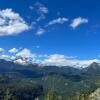
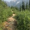
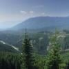
-Gorgeous views of Castle Towers Mountain and surrounding valley throughout the hike.
- Arrive early to beat the traffic, 4x4 not necessary as road was in great condition but would recommend a high clearance vehicle (any regular SUV would suffice).
Posted: November 4, 2019 10:51:07 AM PST
SY from Vancouver writes:
We hiked this trail last weekend. I highly recommend a 4x4 vehicle due to the number of potholes and ditches along the service road. We saw a Ford Fusion and Honda Civic that made it but they were probably crawling up and took some damage. The hike to the lake took 2 hours and 1hour 40 minutes to come down. The overall trail was boring, being relatively flat with little view, but it did open up to beautiful meadows. Towards the end it gets muddy and snowy so several people had slipped and fell. There are a lot of roots and boulders too so I can see why this is considered an intermediate hike even though the elevation gain isn't much. It was SO cold at the edge of the lake (about 3-4 degrees) with strong winds that blew my cap off - best be prepared with a toque, gloves, and fleece.
Posted: October 4, 2019 09:24:14 AM PST
Lara from Vancouver writes:
So I saw all the comments about requiring a 4x4 or SUV for getting to this hike and ignored them and took my sedan. Well... we were able to get most of the way there (had about 3-4km left we couldn't make) with only mildly damaging my car :P. After experiencing that road to the trail head I would personally suggest if you have a sedan DO NOT drive it to this hike unless you want to risk damaging your car. I was lucky but boy did I give myself some grey hairs trying to drive there.
Adventurous car ride aside, this hike is STUNNING! Very little people on the trail head and gorgeous views as you make your way up the mountain. It took us 6 hours to do the round trip. Not an easy hike but wasn't extremely difficult. Legs were very tired after I will say. Would recommend wearing decent hiking boots for this trail with the scrambling near the end you have to come back down. Doable in 1 day (like us) if you get started early. Cabin and camping spots available at the top.
Posted: September 23, 2019 09:35:29 AM PST
Chris Ludwig from Richmond writes:
Note: Saturday June 15th, 2019 Large BCMC Trail Work Party on bottom 5 KM of trail.
Be careful when passing through work zones and make your presence known.
We will be operating chainsaws, brush cutters and building two new bridges as well as extensive new board walks.
Posted: June 14, 2019 02:35:56 PM PST
Anthony Maw from Vancouver writes:
Do NOT attempt to drive there in a passenger car or even an AWD city car. (I have seen both being towed out). You risk damaging your vehicle suspension, overheating or getting flat tires. The road is built and maintained by engineering crews who drive big 4x4 work trucks to the power dam near the Watersprite parking lot. Among other road hazards there are water drainage ditches cut across the road, rocks sticking out of the road surface and steep sections with loose surface. You should only attempt to drive there in a high clearance big tire 4x4 that you don't mind beating up a bit. The trail is fairly straightforward and well marked 8 km takes about 2 to 3 hours going up there. You should bring one or two litres of water do not count on the availability of freshwater streams although there are a few. It's a good idea to bring BEAR SPRAY just in case you meet "smokey". The lake itself is at the top of a steep dirt trail climb.
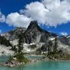
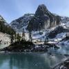
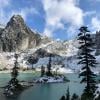
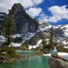
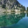
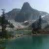
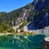
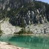
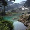
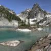
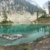
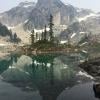
A stunningly beautiful turquoise blue lake nestled among high mountain peaks. BC Mountaineering Club realigned and made improvements to the trail in 2017 in addition to building a cabin. The lake water is freezing cold not good for swimming. I drank it unfiltered without any ill effects but you may have a different experience.
Posted: June 13, 2019 02:50:02 PM PST
Kristina from Vancouver, BC writes:
Has anyone completed this hike recently? Is there still snow on the trail and/or at the lake? Any updates appreciated!
Posted: May 1, 2019 12:02:25 PM PST
Marika from Vancouver writes:
Has anyone done this hike in the last week?
Is there much snow left in the area?
Posted: April 23, 2019 09:47:32 AM PST
Tessa from Port Coquitlam writes:
Hi there!
A few friends and I wanted to check out this hike on Sunday but I just wanted to see if anyone has done it recently and if there is much snow?
Just want to know if we should wear gaters and snow pants or if regular hiking boots and pants are okay.
Cheers!
Posted: November 30, 2018 02:43:43 PM PST
kinsey from Vancouver writes:
HI there! A couple friends and myself are heading up on Sunday to do the hike. It looks like all the spots in the cabin are taken. Could some one please tell me if there is room to sleep on the floor?
Thank you:)
Posted: November 9, 2018 12:14:13 PM PST
Dimo from vancouver writes:
Did this hike 3+ days ago! Half of it at night! The lake is now at the snow line :)
You can checkout my comical experience of the hike along with these 4 goofballs at
https://youtu.be/YDrp21rOvrs
The last 1-2km involves quite a bit of scrambling and... well... leg break avoiding! haha
Cheers! :) Sat Oct6th - Sun Oct 7th.
Posted: October 11, 2018 09:24:25 AM PST
Chris Ludwig from Richmond writes:
Note: Saturday 29th, 2018 Annual Watersprite Brush Clearing Party (KM 1 - 4), including stair, bridge and boardwalk upgrades. Be careful when passing through work zones and make your presence known. This is necessary as the Red Alder in the valley will obliterate any logging road in a single year without maintenance.
Posted: September 26, 2018 04:07:31 PM PST
Mike from Vancouver writes:
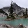
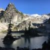
I would not recommend doing this hike more than once. The heavily rutted logging road is rough. I lost my rear bumper. The trail is narrow 2 feet wide only for about half of the trail. The view at the top of mountain is breathtaking. However the trails zig zags so much even on flat ground you would think the trail builders went out of their way to make it longer in distance than necessary. The trail is poorly marked through the boulder field. I added some bright orange trail marking tape through there. The watersprite lake is beautiful with its 3 rock islands sticking up in the turquoise water but it's very small in size compared to upper joffre lake or garabaldi lake.
All in all , a difficult drive up a rough logging road for a narrow bush wacking trail leading to a smaller version of joffre or garabaldi lakes. Do it once to say you completed it. Not worth a second or third hike.
Posted: September 19, 2018 02:44:53 AM PST
Taylor from Maple Ridge writes:
This hike was absolutely stunning. The road in was a bit rough and would not risk if it you don’t have a 4WD vehicle. The trail was rather easy up until you reach the rock slide as it gradually gets steeper from there on. Lots to look at along the trail including many wildflowers if you happen to hike when they are in full bloom. The lake is breathtaking and looks just like the pictures you may find on the internet. Lovely crisp and clear water makes it perfect for a swim to cool off as the hike is in full sun 80% of the time. Highly recommend to anyone.
Posted: August 20, 2018 12:45:39 PM PST
Tracey from Port coquitlam writes:
Im planning watersprite soon but can anyone tell me about overnight camping conditions there?
Posted: August 19, 2018 09:55:01 AM PST
Christina Shields from Vancouver, BC writes:
I completed this hike on the 14th to 15th of August. The road up was tough however I drove up in my 2005 Honda C-RV and made it just fine. If you have clearance and you're a confident driver you will have no problem. The hike up to around 3 and a half hours and we were wearing heavy packs for camping overnight. It is in the sun basically the whole hike so make sure you bring water, a hat, and water purification tablets or a water filter. You can refill your water several times throughout the hike as there are many creeks. Once you get to the lake you have to hike around the lake on boulders for around 15 minutes and then a short 5 minute walk along shrubs and a trail then you make it to the tenting pads. There is an outhouse, 3 bear boxes, and a water source (creek flowing to lake) nearby the tent pads. The lake is beautiful and very refreshing so bring a swimsuit! The hike down took roughly 3 hours.
Overall, I recommend this hike. Beautiful views along the trail and the lake itself is surreal. Be prepared as it is not an easy hike!
Posted: August 16, 2018 01:53:26 PM PST
crossover from Vancouver, BC writes:
I have mixed feelings about this trail. No doubt the views along the trail is gorgeous. However the effort required to get to the lake is huge (rough service road, boulder fields, steep slopes for the last 25% of the trail), and therefore we were quite disappointed when we finally reached the lake. The social media pictures actually made it prettier than it actually is. We were dealt with an extra challenge when we found out the campsite is located on the far end of the lake (another 20-30 mins of boulder scrambling with a 25lbs pack after hiking in the heat for several hours). There is no shade around the campsite and you are fully exposed under the sun. This was especially gruesome when the temperature reached 30+C during the day. On hindsight, we should have booked the BCMC cabin which would surely made the overall experience more enjoyable.
Please note there is no water resource between the Prow Lookout and the first boulder field (almost 3km). Remember to refill your water bottles at the waterfall before tackling this section as it is technical and has practically no shade.
Posted: August 12, 2018 11:21:13 PM PST
Anthony Maw from Vancouver writes:
It’s a great hike not too far from Vancouver. Excellent photo opportunities. You need 4x4 to get to the trailhead The trail starts in bushes but quickly clears out to a deactivated logging road. There is a boulder scrambling section and a steep section to climb up to the lake which is gorgeous. You can bring swim shorts for a refreshing dip. There is water stream on the trail but don’t count on it. I drank straight from the stream unfiltered no problems. Absolutely do not attempt to drive there with a passenger car or AWD I have seen cars with flat tires, cars that got stuck on the steep parts and saw one car getting towed out not cheap.
Posted: August 9, 2018 01:13:37 PM PST
Katy Wilson from North Van writes:
I was really nervous about the road after reading the comments, even though I drive a Nissan Frontier 4x4. It wasn’t anywhere near as bad as I expected, but maybe that’s because we went the wrong way and ended up on a far worse service road (I blame the 4.30am start on that lack of attention). After experiencing the drainage ditches on that one, once we were on the right road it seemed a doddle as long as you have 4x4. We hiked this July 29th which ended up being one of the hottest days of the year so far. As mentioned by others, take lots of water and be prepared for little shade - we thought we would be okay with the early start but ended up much later due to the aforementioned reroute. I wanted to take my dog but thankfully didn’t after realizing what a hot day it would be. The lake is stunning and yes it’s hard to get to, but if you’ve already done Joffre, garibaldi etc this is a nice change and nowhere near as busy. We just did a day home so can’t comment on the camping side - however going Sunday morning we saw most of the campers heading down on our way up so it was pretty quiet at the top. Definitely worth the visit and a quick dip in the lake.
Posted: July 30, 2018 05:24:44 PM PST
Matt from Vancouver writes:
This is a beautiful hike and the lake is amazing... but I would not recommend camping overnight if you want a relatively quiet wilderness experience. There were over 35 tents, 10 inflatable boats and the camping pads were full by 1pm. People had loud speakers going into the night.
This place has gotten extremely busy since they fixed the trail, built the hut, and built the camping pads.
Warning: The road to the trail head is very rough and you should only go up with a 4x4 or at least a car that can drive through deep ditches.
Posted: July 29, 2018 07:41:59 PM PST
Fadi Q from Langley writes:
NOT WORTH IT.
We hiked Watersprite Lake today July 28, 2018.
Be aware that you have to drive for 20km, 1 hour and 20 min on a tough rugged road with steep sections that might damage your car to reach the trailhead.
The hike and the lake was ok. However, definitely doesn’t worth the drive and the effort.
There are so many other lakes that are way more beautiful with better roads to the trailhead.
NOT RECOMMENDED.
Posted: July 28, 2018 10:40:04 PM PST
Bobby Atkinson from Vancouver writes:
We hiked watersprite yesterday (July 25, 2018) and found an iPhone in one of the stream crossings. It was in a green otterbox, but I believe still got some water in it because it won’t charge now. If you lost your phone please reply!
On another note: gorgeous views and beautiful lake that was super refreshing to swim in!
Posted: July 26, 2018 02:24:00 PM PST
Nicola from Vancouver writes:
Thanks to the BCMC for their work on this trail. It starts off with 4km of gradual incline on what is essentially a path, followed by some clearly marked boulder crossings and a hike through thick forest. We camped, and were lucky enough to get one of the brand new tent pants!
Unfortunately, what completely ruined it for us, was the gaps that was up there. Ease of access means the influx of very large groups. I think one girl counted 40-50 tents - several pitched close to the lake in areas that are clearly marked as no camping. There were lineups to get into the outhouse.
I can cope with crowds, however what I really dislike is those obnoxious folk who decide to bring up their speakers and have a party all day and night. It’s not what many of us go into the backcountry for.
Posted: July 23, 2018 07:16:49 AM PST
Jenn from Burnaby writes:
Great hike! Kudos BCMC on your amazing trail work! Definitely a stiffer hike than I anticipated.
Note: if you’re hiking up to camp, please DONT bring your speakers and your twinkle lights. While you might get the best Instagram picture or story out of it, I assure you most of us that trekked up didn’t do it to hear your music, or stare at your stupid lights instead of the stars.
You wanna play your tunes and party? Drive in camping my friend. Or a beach.
Posted: July 22, 2018 08:23:42 PM PST
Linda from Vancouver writes:
It’s hell. Honestly, if you are not an avid hiker, don’t put yourself through this. There’s no shade for 95% of the hike. Bring lots of water or water purification tablets to add to stream water. After the 4K mark there are zero Km marks so it’s quite a bit frustrating not to be able to know wheee the hell you are. Also, if the toad was better kept, all cars could pull it off going slow. But man, there are a bunch of ditches running across the road that are too deep for some cars. My hatchback Hyundai Accent pulled t off, but I damaged the muffler a bit. On our way back we saw two bumper/fender parts that feel off some cars. Right after the deep ditches. It’s not that much work to fill them up with rocks. That’s all. Overall not worth it.... Joffre lakes are as beautiful and a lot easier to access.
Posted: July 22, 2018 03:25:07 PM PST
crossover from Vancouver, BC writes:
I love this trail! A big thanks to BCMC!! I love the views and the moderate climb for the 1st 4km. Unfortunately i felt ill before reaching the lake. I will return in August to finish the trail.
Like everyone has mentioned, the service road was rough. It took me one hour to reach the trailhead. I have a capable high clearance 4WD SUV and still felt a bit nervous at some sections. 2WD and low clearance vehicles are not recommended although i saw a VW Passat and a Hyundai Accent parked in the pull off area just before the steep slope before reaching the parking lot.
Posted: July 17, 2018 12:30:18 AM PST
Jillian from Vancouver writes:
Anyone done this trail recently that can tell me if a 4x4 vehicle is actually necessary to get up the FSR? I'm hoping to do this hike in a couple weeks and have a Hyundai Accent which doesn't have as high of clearance as an SUV.
Posted: July 16, 2018 05:23:27 PM PST
Mitchell from Squamish writes:
Hiked to the Lake on July 14. Hike was great with amazing views along the way! Thanks a lot to the BCMC for working hard to create such a great trail. Ran into Chris from the BCMC and he was very enthusiastic about the new upgrades that were being done this weekend. The lake was spectacular and very refreshing after a hot hike there!
Encountered a bear on the way back from Lake around 100-200m from trailhead just off the trail. This seems to be a common occurence after reading other peoples reports. It could have been the mother and cub. I waited for a large group of hikers behind to catch up and we made our presence known as a large bear watched us from the treeline for an extended period of time. It didn't seem very scared of our around 10 person presence but after a while moved off and we walked through.
These bears are definitely hanging around so be bear aware and prepared. Not sure if their presence near the trailhead and parking lot has anything to do with human presence there or whether it is coincidence. Nevertheless, practice no trace hiking and be very careful with food being left around parking area and trail.
Also, I lost my bear spray on the trail hours before encountering the bear. If anyone found it and I could get it back in any way that would be great :)
Posted: July 16, 2018 09:49:18 AM PST
KM from Vancouver writes:
Great hike! The trail is pretty flat for the first part of the trail then gets a bit more difficult after the 4km mark. Second half is definitely harder. The lake is gorgeous and worth it once getting there! A bit muddy in sections but trail maintenance was working putting up boardwalks across some areas! We didn’t encounter any wildlife but a bear on the road when driving out of the parking lots after a minute or two. Take bear spray, definitely bear country out there!
Posted: July 15, 2018 09:35:20 PM PST
Ly V from Vancouver writes:
We had a bear encounter at 3:10pm when we were hiking back. We heard some big noise in the woods a couple of times so we got more cautious. In the last minute of the trail when we were almost back at the parking lot, we saw a bear standing on the trail. We tried to scare her away by talking loudly and making ourselves big, but she held her ground and keep watching us. Later on we saw her cub on the tree, so we backed off right away and found another exit route around them. We reported the bear when we had signals, worrying that other hikers after us will walk right into them. Bring bear spray and know what to do!
The lake was gorgeuos and dipping in fhe water was so refreshing. Thanks BCMC for being up there this weekend to build the trail.
Posted: July 15, 2018 12:57:23 AM PST
Kiana from Squamish writes:
Did this hike July 11 and had very few problems! The first portion was a breeze, with the majority of the elevation gain in the first 2/3, however the upper portion just before the lake was very muddy and sometimes very difficult to maneuver around! There was a warning at the beginning of the hike of a momma and baby bear spotted in the area, and we were (un)fortunate(?) enough to come across both of them; they were very uninterested in us but be beary careful of their presence
Posted: July 11, 2018 06:28:41 PM PST
Chris Ludwig from Richmond writes:
All Hikers on the Watersprite Lake Trail please be aware from July 13 to 16 that BCMC and Government officials will be conducting a major joint operation (myself as co-leader with a crew of 20) to perform upgrades on the upper part of the trail and lake area. There will be significant helicopter operations, chainsaw operations, the construction of tent platforms, 200 feet of new boardwalk construction, outhouse maintenance and major boulder work on the trail form the cabin to the campsite. Please use extreme caution when approaching or travelling through an active work zone and establish eye contacted with the crew chief, and please try to minimize interruptions to crews while they are working.
Posted: July 7, 2018 01:48:06 PM PST
Joshua Caplan from Vancouver writes:
I'm thinking about heading up the weekend of July 21 and staying overnight at the campground. Do you think my CRV will make it up? How cold it I at night? Is there snow that time of year?
Posted: June 27, 2018 03:54:39 PM PST
Anthony Maw from Vancouver writes:
It's a great day trip maybe an overnighter if you can book the cabin or just tent camp. Be aware that the road going up there is best done with a big-tire 4x4 SUV type vehicle. The road is built and maintained by the power company crews who drive 4x4 trucks. The road is steep with water bar drainage ditches, lots of potholes and there are rocks sticking out of the road surface that will damage passenger car tires and suspensions especially if loaded with passengers. Last year I was up there a few times in my Nissan Xterra 4x4 SUV with friends from Meetup VanHikers. I saw a smaller AWD car which had a flat tire, another car that could not drive out of a short steep section because it was steep and the ground was loose guy was just spinning his tires, and we saw another small passenger car getting towed - expensive! Be warned!!
Posted: June 18, 2018 03:18:54 PM PST
Ruth from Pitt Meadows writes:
Hello :)
I'm wondering if the cabin at Watersprite has a stove for cooking food or to bring our own stove and propane? My friends and I have booked spots in the cabin for next weekend and are planning logistics. Thank you!
Posted: June 12, 2018 12:01:57 PM PST
Jakub from North Vancouver writes:
Hi Everyone. Thanks for building a great challenging hike with amazing views and a beautiful cabin! We did an overnight hike from May 12 to May 13, 2018. Had to stop our car approx. 2.5 km before the trailhead since the rest of the road was under patches of snow, making our hike longer. Compact snow started right off the bat from the trailhead. Really wet and heavy snow made our hike take much longer then we expected. It took us approx. 8 hours to hike up to the cabin and about 6.5 hours to hike down back to the car. It looked like most of the avalanches already slid down, but would definitely recommend to bring all avalanche gear since approx. the last 2 kilometers of the trail are going through an avalanche area. At the cabin, there was about 2 meters of snow left. First part of the trail was well marked but second part was hard to follow as we couldn't find many markers on our way, possibly due to the winter conditions with a lot of snow left. Definitely would recommend at least offline GPS map. Overall, very nice challenging hike with almost no people and cozy cabin at the top serviced by BCMC. Would be great to come back during the summer to see lake after all the snow melts down.
Posted: May 22, 2018 10:03:11 PM PST
Dora Prieto from Vancouver writes:
Hi there,
I want to bring my mother here for Mother’s Day May 13 — was wondering if anyone from the area has any idea what the conditions will be like? We could bring snowshoes if necessary, and would be in a rental car so hopefully the parking area would be accessible by that time.
Thanks for any insight! Appreciate it.
Dorah
Posted: March 19, 2018 10:24:29 AM PST
Salvador Olson from Surrey writes:
I’m planning on doing this hike in a week or two, is the trail well marked, how easy or hard is in winter, can a SUV make it to the gates?
Thanks for the I do and for the hard work!!!!
Posted: January 2, 2018 09:55:49 PM PST
Sara from Vancouver writes:
I posted about the conditions on our hike here:
You should definitely bring snowshoes if you're going up in late November! Also, this description calls the hike intermediate difficulty, but the last quarter of the hike is technical and challenging. I was there with a large group of people in our mid-twenties to mid-thirties with a fair amount of outdoor experience, and the vast majority found the hike more challenging than expected, so be prepared! https://bcmc.ca/forum/#topic/Conditions-at-Watersprite-Lake-.htm
We were lucky in that the road up was clear of snow, but just last weekend someone told us the had to park 6-km away from the gate and snowshoe to the trailhead, so I would recommend getting an early start.
Posted: November 14, 2017 10:11:15 AM PST
Jenn from Vancouver writes:
Hello, I plan on hiking this trail in two weeks, Does anyone know if snowshoes would be recommended or if hiking boots with gators are adequate. Thank you
Posted: November 13, 2017 10:46:04 AM PST
Chris Lippmann from Delta writes:
I think that Watersprite lake could make a good base camp for further adventures, but it's not the most interesting day hike as the vast majority of it is on low incline dectivated logging roads. It would make for a pleasant snowshoe or ski trip though.
Thanks to the BCMC for all of the work on the trail. The hut looks great.
We were cautious at c. 3000 ft on the connector trail for the wasp nest but they must be gone or dormant as we saw no sign of them.
Chris.
Posted: October 14, 2017 08:56:41 AM PST
Chris Ludwig from Richmond writes:
As the BCMC Volunteer Crew Chief responsible for the Watersprite Lake Trail, I too today had the pleasure of getting stung by the wasps on my bare legs at 1.8 KM in the major and final set of stairs we built in the connector trail (as I was working on trail upgrades). One of my volunteer crew also got stung. Yes, it hurts like heck and I am sorry if others are have also gotten stung, but this is the reality of the backcountry and we are not pest control specialists. I am hoping the winter will kill off this minor annoyance. Perhaps next year I may try the gasoline in the nest trick should the little rotters decide to set up camp again.
Today, my crew of almost 35 brushed out and upgraded the entire first 4 KM of trail in a single day. All bridges and infrastructure have been prepped and reinforced to hopefully withstand the Winter including the new Watersprite Creek Bridge at KM 8 which received two heavy steel truss upgrades.
As the weather is now changing and the days are getting shorter, be more mindful of safety as it can get very cold and wet in that valley at this time of year. Nighttime in the Skookum Valley comes fast and is deep on the Watersprite Trail and the rains can be intense. It would sadden me if anyone were to run into trouble on "my trail" at this time of year.
Happy and safe hiking to all - Chris Ludwig, BCMC
Posted: October 8, 2017 01:52:04 AM PST
Lee from Surrey writes:
After looking forward to doing this trail all summer, we finally had a free sunny Saturday and headed out. The forestry road wasn't as bad as we expected for vehicles with good clearance (a must) and the trail was clearly marked. Unfortunately at about the 2 km mark, there must have been a wasp next right under or beside the trail as we were suddenly swarmed by wasps and my 10 year old and I were quickly covered with extremely painful wasp stings. I was starting to have a bit of a reaction to the stings, so we figured the safe thing to do was head back down. Our hike was over, and I'm pretty sure there's no way I'm going to convice my child to come back here anytime soon. Obviously my rating doesn't represent the whole hike, but since I have to give one, I'll give it a 3 based on our experience with the wasps tempered by what was an enjoyable experience up to that pont.
Posted: September 18, 2017 08:17:52 AM PST
Jillian from Vancouver writes:
Incredible hike! Went up 09/04/17 and it was HOT. It wasn't too crowded, even though it was Labor Day, likely because the road was so rough getting up. Really rough. Like, the roughest road I've ever been on.
You've all read the hype and seen the pics, so I'll only post what I feel I can add to the wealth of information here:
1. Dogs ARE allowed. They are not recommended. This is because of the big bear/cougar population, and how tough and exposed the trail is. But I made sure to go on a well-traveled day and we were fine.
2. This hike is even more exposed and tough than described. The elevation gain isn't awful, but on a 30 degree day every hiker there was struggling. My dog and I went through 4 (4!!) liters of water just on the way up, not including the streams my dog drank from on the way up.
I would highly recommend bringing a filter or water purification tablets, as well as popping some electrolyte tabs in your water. This will significantly improve your comfort and performance.
3. The road up is hell. It takes about an hour from the Sea to Sky highway to the parking lot - if you don't make a wrong turn. Be very careful if you are driving back in the evening, as the way back is even more confusing than the way up. I'm a pretty good navigator and I took the wrong fork right from the first bridge away from the parking area. That road ended in a rock slide and I nearly got stuck before I realized the horrible mistake I'd made. I ended up reversing for a quarter mile to get back to the road.
Ultimately, this is an awesome hike. Just make sure to be prepared!
Posted: September 5, 2017 10:52:56 AM PST
Ray O from Vancouver writes:
Thanks for your detailed hiking guide. We consider your website as a great service and always use your information to plan our hikes.
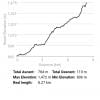
Some feedback regarding this hike: We hiked Watersprite Lake yesterday and it took us about 5.5 hours going and 4.5 hours coming back., a far cry from the estimated 7 hours return that we were expecting. We used an app to track our distance and elevation and total ascent was 784 meters. It was a hot day for a hike (31C) and most of the trail is on a West exposure without forest cover. It also took us a good 1.5 hours to drive through the Forestry Service Roads from the Sea to Sky Highway in our SUV. We were surprised to find a Honda Civic and a Toyota Camry that made it to the parking lot at the trail head!
We personally would describe this hike as difficult. At first we thought we were the only ones having a difficult time but we met up with many young ones (in their 20s (about half our age or more) and almost all of them said that would agree that the hike is a difficult and not moderate as advertised. We were worried about our return trip and didn't linger long enough to enjoy the lake due to the time constraints. We felt that it would be unsafe to hike through the three boulder fields and the rooty rocky technical and steep sections on final 25% of the hike in the dark (last 2 km) so we safely hiked through that section before sunset . We encountered four parties at and after sunset on our hike back and most of the them didn't realize how difficult and slow the last 25% of the hike would be. We hope they all made it safely to the lake.
We would greatly reconsider this as a suitable day hike given the amount of time needed to reach the trail head by car and the amount of time to hike to the lake and back. We've hiked to Elfin Lakes and Garibaldi Lake before and your guide is right on the money for these ones. Hopefully in the future, the roads and trail to this beautiful lake will be improved so more people can enjoy it for a day hike.
Thanks again and happy hiking in beautiful BC everyone!
Posted: September 3, 2017 01:36:50 PM PST
Luke from Vancouver writes:
This hike was unreal! There are lots of people who do this as a day trip although I far prefer to camp up there and enjoy the views. Make sure you pay careful attention to the directions on this site for how to get to the trail head because it's easy to get lost on the logging road. Camping spots are limited so I suggest getting in before 4pm and don't forget a sleeping mat because you may have to set up on a large boulder.
Posted: August 21, 2017 08:21:46 AM PST
Marlon Doll from Vancouver writes:
This hike was amazing and def recommend reserving the cabin. Be careful on the slushy snow on the rocks at the top! Someone slipped through and cut their shin. I filmed an eye-catching video of the experience you can watch here: https://www.youtube.com/watch?v=G0T9c5ypRnU
Posted: August 17, 2017 04:05:30 PM PST
Montana from North Vancouver writes:
The flies. Oh the flies! There must have been a hatching recently because our entire hike to the lake was accompanied by black flies and the occasional horseflies. We wore bug spray with fly repellent and it stopped them from biting, but not from a constant swarm around the face for the entire 3 hour hike. We wanted to relax and camp at lake but ended up going back. Such a beautiful hike, and still worth going, but wear a mosquito net hat if you don't want constant new friends in your face. Side note: We saw a car in the parking lot and have no idea how's it cleared the road. Do not drive a car that you car about up here.
Posted: August 9, 2017 09:33:45 AM PST
Elise M from White Rock writes:
We hiked up here late on August 2nd, and camped the following two nights. It was beautiful despite the smoke, and I highly recommend. We saw some fresh bear poop near the trailhead, but didn't encounter any critters.
To anyone who has done this hike in past years, you should be aware that they have built a completely new trail. The new trailhead is few km past the old one, and I think the hike is a km or two longer (although that's just a guess). In my opinion the new route is more scenic, and the elevation gain is a bit more spread out.
We made it up (slowly) in my Honda civic, but I wouldn't recommend attempting it in a 2WD vehicle if you are an anxious driver or if you really care about your car. The last km before the trail is a bit hairy with two wheel drive, so if I did it again I would park on the shoulder and walk to the trailhead (I realize this isn't to helpful if you're not sure where the trail starts - sorry).
Posted: August 4, 2017 05:56:04 PM PST
jessica relkoff from VANCOUVER writes:
great hike! would definitely recommend. just a word of caution for those camping at the lake: you really shouldnt set your tent up on the right side of the lake! as you will see there are many boulders and rocks ready to tumble. From our camping spot on the island my friend and i woke up to the sound of several large rocks crashing down and luckily missed the couple tenting right below. not sure how they had peace of mind sleeping there...glad theyre ok.
Posted: August 4, 2017 06:20:42 AM PST
Daniel Rowsom from Vancouver writes:
My wife and I headed out to camp at Watersprite on Thursday, July 27. I was hesitant to drive the road in my Forester, but after getting a first-hand report, we decided it was worth a try. It was slow-going, but we made it to the trailhead without incident. I would not recommend attempting the road without 4WD/AWD and half-decent clearance.
We unfortunately did not make it to the lake. After only about half of a kilometer of hiking, we heard a very strange sound in the distance, perhaps several hundred meters away. It seemed to have originated behind us and off to the right. It was unlike anything I had ever heard before, and so was difficult to place. It was an odd mix of a woman screaming and fabric scraping. My wife was instantly nervous (and correct) that is was a cougar, but I was in denial that it was anything to be too worried about, based mostly on the distant quality it seemed to have.
We carried on for maybe another quarter kilometer. At this point we heard much closer, louder, and more clearly: a big, scary cat noise. Again, it had a quality of a woman’s scream, or what you could imagine a housecat might sound like, if it was much larger, more gravelly, and coming directly from hell. This time it sounded as if it could be directly to our right, within 100 meters.
I have never heard from or otherwise encountered a cougar before. But based on the two calls/growls/screams we heard, it seemed to be following us. A big, wild cat potentially stalking you is a terrifying thought, so we changed our direction and headed back to our car. Since we could not see the animal, and the only information we had was that it was perpendicular in direction to the trail, we figured the change in direction would not appear to be running away (since that could provoke a chase). I kept a watchful eye over my shoulder, we each had our bear-spray out, and we both stamped and yelled to each other (to seem large) until we reached the parking lot.
Most of what I know of cats is that they are stealth predators, and so the fact that it was announcing itself would mean that it may not have been likely to attack. Perhaps it had made a recent kill and wanted to scare us away. Perhaps it was a second cat, and they had been communicating in some fashion. But it was a terrifying experience, and neither of us would have slept soundly that night had we continued onward.
The notice-board at the trailhead included a picture of a four-inch-wide cougar print in the snow from a few months ago. It would seem that the cougar has decided to stick around.
The first 750 m of the trail are quite nice. Hopefully I can bring myself to try the rest some other day.
Posted: July 29, 2017 04:36:28 PM PST
Ela from Vancouver writes:
My Mitsubishi outlander from 2003 made it up with no problem. Of course, with 5km/h and a lot of attention. Plan for the lodging road to take you about 1:30 h-2 h. We did not approximate well left the house at 6:30 am and with the traffic and the FSR conditions we made to the trail head at 11... But it is sooooo worth it.
Posted: July 27, 2017 05:38:35 AM PST
Karen from Burnaby writes:
Will an old 2005 Subaru Forester make it up to the trail head ? Will this car have high enough of a clearance ?
Posted: July 27, 2017 12:28:52 AM PST
Chris Ludwig from Richmond writes:
BCMC Volunteer Trail Crew Update
We finally completed the installation of a new and important bridge at KM 8 across Watersprite Creek yesterday. We also completely brushed out KM 0 to KM 3.2 of all new growth with brush cutter, and added additional trail markers.
Outstanding work includes construction of our final bridge across Upper Demon Creek at KM 4.2, clearing of new vegetation growth from KM 3.2 to 4.0, and route optimization and trail bed improvements of the final last KM of trail. These task may remain outstanding until the fall.
Beware of nails, screws and metal in the parking area as I got a flat in my Jeep yesterday. Please respect the sensitive environment at Watersprite Lake by not leaving garbage or human waste in the alpine.
Chris Ludwig - BCMC Volunteer Crew Chief
Posted: July 24, 2017 08:40:06 AM PST
HOWARD ADAM from North Vancouver writes:
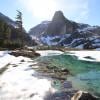
July 16, 2017: What an absolutely spectacular view/lake at the top! I am absolutely amazed that there is such beauty so 'close' to Vancouver. Yes, you need an AWD or 4x4, or a vehicle with good clearance, but well worth the 20km FSR scenic drive to get to the TH. Most of the hike is 'in the open' (not alpine - but clear views to the south and west mountains). The lake at the top is surrounded by large peaks, and the lake itself was still snow/iced over, with dark blue pools here and there, but that added to the shear beauty of this place. I'll be back in summer to gete a totally new experience of the same place...and probably camp over this time to immerse myself and bask in nature. WELL DONE to all the volunteers for making this a gem of a hike!
Posted: July 17, 2017 09:00:02 AM PST
tilo from Vancouver writes:
awesome hike. we did it on July 15. Lake was mostly frozen. Top has and outhouse ( across the cabin)
drove up to trailhead with 2003 Honda CR-V. Following the awesome comments on his site.
watch out for bears and cougars. We saw lots of droppings.
Posted: July 16, 2017 06:30:37 PM PST
Bryan from Vancouver writes:
Its worth noting that about the 15.7 or 15.8km into the drive you run into a split in the road with the right fork going uphill and the left fork heading downhill. Although both forks eventually meet up and will take you to the parking lot, the right fork is a much easier drive.
Beautiful hike and mostly clear of snow except at the top on July 10. Be prepared for a long drive in once off the highway (~ an hour to 1.5 hours). Lots of animal droppings on the path and reported sightings of a black bear + cub and cougar tracks near the lake so just be conscious that they are in the area while hiking.
Posted: July 10, 2017 12:20:42 PM PST
Christine from Vancouver writes:
July 9th update: Lake is still frozen and some snowy patches up at the top. Stuffy views, beautiful trail - thanks BCMC!
Quite a few campers up at the lake - and little bits of plastic that come along with it. Pickup your plastics, people! keep it beautiful :)
Posted: July 9, 2017 08:44:17 AM PST
Sarah S from Vancouver writes:
****There are no pictures because we lost our point and click digital camera on the trail or at Watersprite hut. If you find it, please message me*
Wow, what an adventure! First of all, please don't attempt to drive to the trailhead with a low clearance 2WD vehicle. We made the rookie/foolish mistake of believing that our Prius (with 4 people and 4 packs) could make it somewhat close to the trailhead. It didn't take us long to realize why people in their big trucks/SUVs either laughed or shook their heads at us as we passed them on the Forest Road. We ended up having to ditch our car at the power station and tacking on additional 9km uphill hike to our day (which included getting lost at one point).
The trail is gorgeous - and the folks who are fixing it up are doing a great job. Just make sure to wear appropriate footwear to get through the wet patches, and watch your feet as there are lots of roots and stumps to snag your feet on. Personally I enjoyed all of the varied challenges of the terrain, as well as the stunning views along the ridge. The only challenge that at times felt insurmountable was the last ~150-200 metres of snow. Mind you, at that point we had been hiking for 7 hours with heavy packs, the we were trying to beat the setting sun. So every time one foot punched through three feet of snow, or slipped backwards down the hill - it felt a bit demoralizing. But it was worth it! The views from the Watersprite hut were stunning, and the hut is so perfect!
Sadly there is still several feet of snow, and there was only a tiny glimpse of the blue water on the lake. I really hope that the snow melts by September and we are able to return to see it in all of its glory. **Avalanches were happening off the chutes behind the hut ALL night long. Do not walk near the chutes***
The hike back is really easy - and we did it in 2.5 hours - even with our packs on. A big shout out to the group of folks we met on the trail who generously shuttled us back to our car the next day.
Posted: July 3, 2017 02:05:49 PM PST
JSR from Vancouver writes:
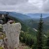
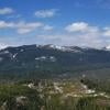
This is an unusual West Coast BC hike. Most of the hike is NOT spent in forest. Through the middle 5-6km, you are in the open and there are scenic vistas of Garibalidi, Pyramid, the Tantalus Range, and Sky Pilot. You also get tremendous valley views right down to Squamish. Jaw-dropping. The BCMC hut at Watersprite Lake is first rate (kudos to BCMC!).The trail is well-marked, except for the last half a kilometre-or-so steep ascent to the Lake and Hut, but you can't really get lost. The hike is accurately graded as "moderate," but with some challenges through some boulder fields, and there are a couple of log bridges over quick running water (in late June 2017). Lots of running water and some wet patches along the trail. Good hiking boots and probably poles required. You have to believe you are lucky to take your chances with 2W drive to get to the trail head - and then home. It should be rated 4W drive with proper clearance.
As of June 23, there is snow on the last .5km ascent to the lake and the lake itself is still frozen. The scenery around the lake is spectacular. If you are waiting for the snow to clear from the last part of the trail, check back in 2 or so weeks. When the snow goes, the peaks around the Lake look like scambling material. We were a 61 year old hiker plus 24 year old son...
Posted: June 23, 2017 07:10:35 PM PST
Mia from Whiterock writes:
Drive to the trail was very rocky. MY SUV was struggling on the way up the rocky parts. A 4wd vehicle would be best if you're going up there. I suggest to wear proper hiking boots because some parts of the trail were very wet and muddy. Also, have a bear spray handy just in case you encounter bears along the way. We attempted the hike this morning, but when we got to the middle of the trail, we decided to head back down because there was a cub hanging around just a few steps away from us. It sucks we didn't get to the lake, maybe next time we'll be more prepared.
Posted: June 22, 2017 09:18:53 PM PST
Jennifer from White rock writes:
Is this trail clear of snow now? We have been waiting to do this one. thanks!
Posted: June 19, 2017 06:24:16 AM PST
Chris Ludwig from Richmond writes:
Hello Hiking Public,
As the BCMC Trail Crew Chief responsible for the New Watersprite Lake Trail, I wanted to let everyone know that we have been late this year in clearing downed alder and deadfall from the trail this year.
The reason being is we have been investing our time into heavily upgrading the first two Kilometres of the trail with new infrastructure. There are now three bridges spanning all major creeks in the first half of the trail (only two remain to be bridged in the later half of the trail) and 90 feet of newly installed boardwalk across Demon Creek Swamp. This Saturday, we will be constructing up to 90 stairs and heavily upgrading the "connector" trail at KM 1.5 to 1.8. We will also be installing a large trail Kiosk, and removing all deadfall from the first 2 KM.
We are scheduled to clear the deadfall and alder for KM 2 - 5 two weeks following this Saturday (As well as repairing the culvert/logging bridge which was damaged this winter at the 4 KM Mark).
The long term plan is to make the trail BC Parks quality, but that is a multi-year project on our part.
See you on the Trail
Chris Ludwig - Your friendly neighbourhood BCMC Trail Building Crew Chief
Posted: June 15, 2017 03:27:50 PM PST
Daphne from Vancouver writes:
Emma, we used 4WD but we saw several other 2WD cars up there this past May long weekend They clearly made it just fine but I personally wouldn't want to drive up there in anything less than a high clearance 4WD.
There is tons of snow, starting about halfway up. It's melting pretty quickly and we were postholing waist deep in areas. Some of the creek crossings are also getting weird with high/fast water levels and snow bridges. Be careful of avalanches as there are a few significant avalanche slopes.
Posted: May 25, 2017 03:05:04 PM PST
Emma from Chilliwack writes:
Thank you, Scott!! I really appreciate the reply :) If I'm reading this right, you do need a 4x4 to get up there?
Posted: May 22, 2017 06:46:04 PM PST
Scott from Vancouver writes:
Emma,
I haven't been up there, but there is currently still decent amounts of snow up in the 1200m - 1400m elevations. I'm looking to do this hike sometime in June or July this year.
Posted: May 22, 2017 12:20:35 AM PST
Emma from Chilliwack writes:
Do you think there would be snow up there in May?
Posted: May 21, 2017 10:10:50 PM PST
Greg from North Vancouver writes:
Did this hike August 2016, and I liked it a lot. Wasn't too easy finding the trail as I believe it changed, but we managed to make it all the way up. We had to go all the way to the end of the logging road until we couldn't go any further as there was a closed gate. While not too bad, there were some spots where it got a little rough. The hike was pretty tough, with 2 boulder fields to cross and several ups and downs with technical terrain. I think it took us roughly 7 hours round trip, and we were actually keeping a respectable pace. Some of the sections remind me of Hanes Valley, and there is tons to see along the way, including some panoramic vies of Squamish Valley. The actual lake is gorgeous, with a huge rockface looming over you, and it's well worth the trip. Very quiet compared to most glacial lakes (Joffre or Wedgemount), and the trail is much less beaten up. A unique hike that will feel more like an adventure and less like a tourist attraction, very cool!
Posted: May 12, 2017 06:37:49 PM PST
Gemma Coughlan from Vancouver writes:
In the winter, snow covers the road which makes it hard to find the trailhead. We parked at around 15.5km, which means walking to the candy cane shaped air vent/pipe. At the pipe, take the left fork and continue for 4km. You'll go over at least two bridges and past at least one more candy cane air vent. Apparently the trailhead is well marked after 4km.
Posted: April 14, 2017 06:31:45 PM PST
Have you hiked Watersprite Lake? Share your experience with us:
Comments that gratuitously attack or demean individuals or organizations are not acceptable. We reserve the right to remove comments or any other content we deem unacceptable in our sole discretion, including removing user names and profile pictures. For our full website terms and conditions including our legal guidelines for user postings and comments on www.vancouvertrails.com, please see our Terms of Use and Privacy Policy.









Peter from Burnaby writes:
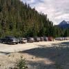
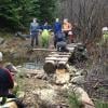
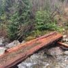
Note that the road is in very good shape until the turnoff to the Skookum Dam FSR. There is a significant water bar you will need to pass to continue soon after turning onto the Skookum Dam FSR. I would not be surprised if this has been put there as a warning - if you can't make it past this point, you should not be on this road. An AWD vehicle with good clearance and (more importantly) good tires can make it.
Posted: September 10, 2024 01:10:58 PM PST