- Difficulty Easy
- Time 0.75 hours
- Round-Trip 1.5km
- Elevation Gain 110 meters
- Season year-round
- Camping No
- From Vancouver 1 hour, 40 minutes
- Public Transit No
- Dog Friendly On-Leash
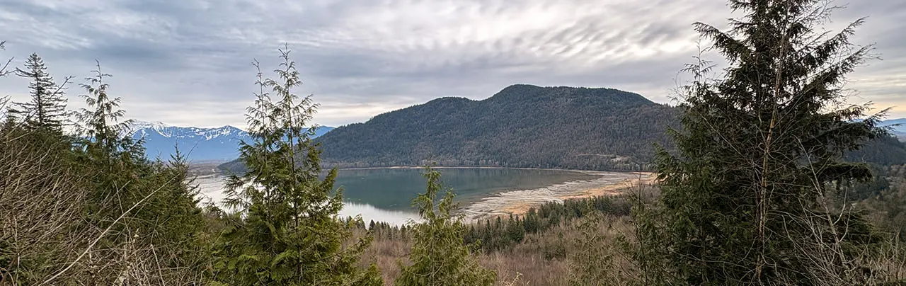
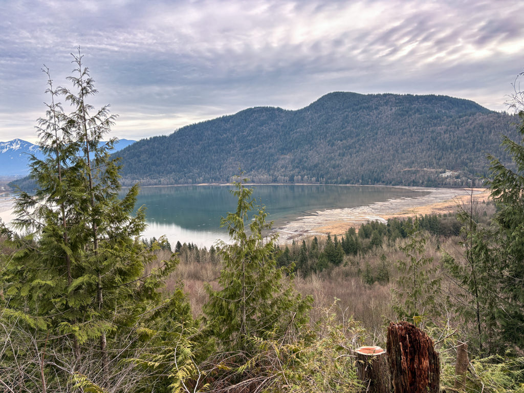
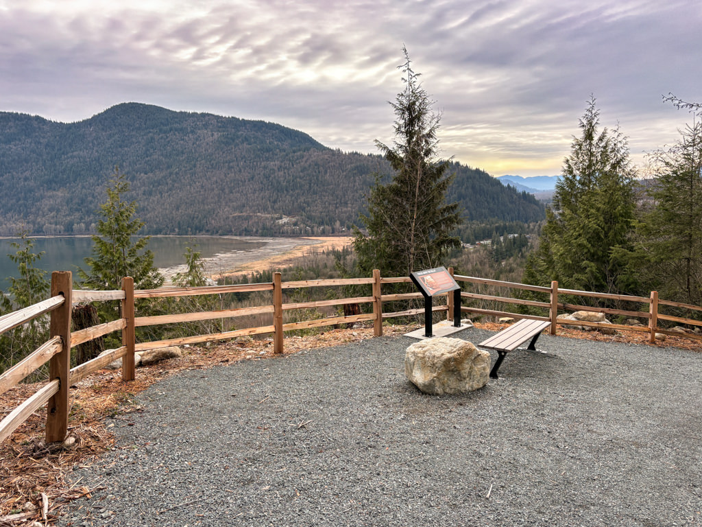
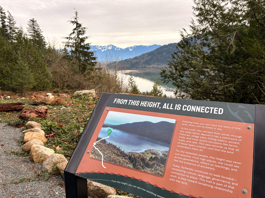
The Sturgeon Trail is located near Lake Errock and is a short hike that climbs uphill to a scenic viewpoint of the Harrison Bay area. The trail passes over Sq’ewlets First Nation land and information signs have been installed along the trail in addition to a picnic table at the top to enjoy the view from.
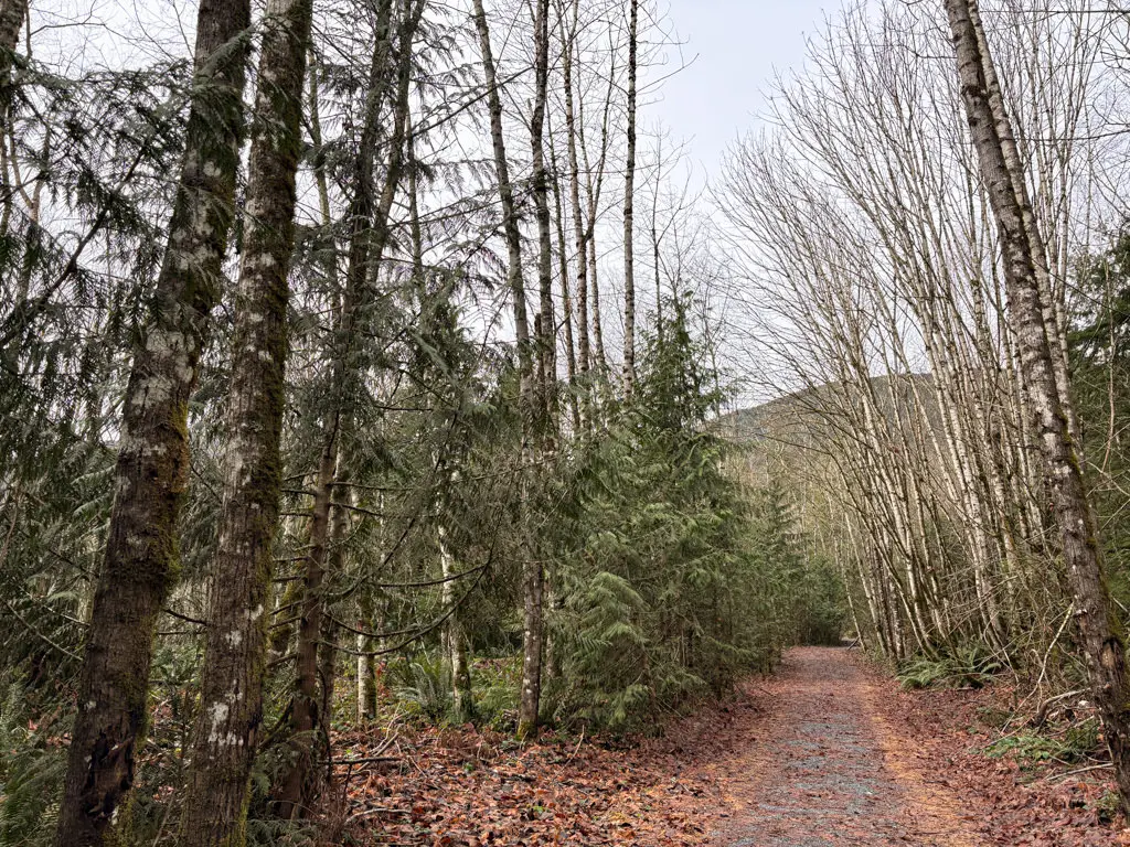
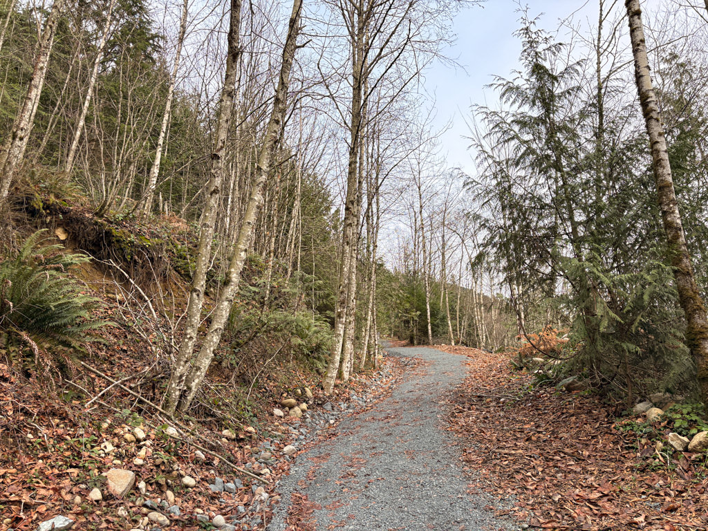
While the trail climbs uphill, it is relatively easy due to its short length and even terrain. The first half of the trail has a grade of about 10%, while the last portion is slightly steeper.
From the wooden signboard near the cemetery gates, follow the gravel trail as it climbs uphill along the well defined path. The trail climbs quickly through the forested area as you hike away from the noise along the highway.
At a sign board, the trail veers to the right before a long straight section climbs to a viewpoint overlooking the Harrison Bay, Harrison River, and across to the Harrison Mills area. At the top, there are two final lookouts with a picnic table, benches, and more information signs.
After enjoying the view, walk back down the gravel trail as you quickly descend back to the start of the trail and down to the area by Lougheed Highway.

How to get to Sturgeon Trail
Estimated Driving Time from Vancouver
1 hour, 40 minutes
The Sturgeon Trail hike is located just off Lougheed Highway near Lake Errock, east of Mission and west of Agassiz, BC.
The trailhead is next to gates to the Sq’ewlets First Nation cemetery. Do not park near these gates. There are a few spaces at the bottom of the hill just off of Lougheed Highway.
If you are driving from Mission, BC, follow Highway #7 Lougheed Highway east towards Harrison for about 30km. Pass the Deroche General Store and stay on Highway #7. The trail starts just after the Sq’ewlets Cannabis Store, however you cannot turn left over the double, solid lines along this section of Lougheed Highway. Continue a short distance to the Harrison Bay Resort RV Park and pull off the highway here. Turn around and head the opposite direction on Lougheed Highway for 400 metres and turn right into the gravel area. Park just off of the highway at the bottom of the hill, then walk the short distance up the hill to the trailhead.
View a map of Driving directions to Sturgeon Trail.

Although we try to keep information as current as possible, www.vancouvertrails.com makes no warranty or representation as to the availability, quality, fitness for purpose, conditions or accuracy of the information provided with respect to this trail or trails. The information provided herein is further subject to our Terms of Use.
Comments
Add Comment View All Comments