- Difficulty Easy
- Time 1.5 hours
- Round-Trip 4km
- Elevation Gain 85 meters
- Season year-round
- Camping No
- From Vancouver 2 hours
- Public Transit No
- Dog Friendly Yes
Harrison Hot Springs is a popular tourist spot during the summer but few people venture beyond the crowded beaches, restaurants, and spa. However, the Whippoorwill Point Trail offers a nice escape from the crowds and is a short 4km hiking trail that passes the hidden Sandy Cove beach and offers several views of the Harrison River. This trail is fairly steep in sections and it's recommended for those with proper footwear and in good physical condition.
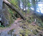
From the metal gate outside the Harrison Hot Springs Resort, follow the wide gravel service road around the end of the lake. Many people walk out this route to see "The Source" of the hot springs but turn back after. Pass "The Source" and several meters further, you reach the end of the road at a metal fence. Look to your left and follow a very steep trail that enters the forest and goes up the side of the mountain.
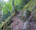
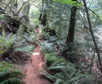
There are not many trail markers at the beginning of the route, so just watch for the worn path, which is fairly easy to follow. The trail reaches a wide area and it looks as though it goes around the rock, however that leads to a dead-end. Instead of going around the rock, go left just before it and up the steep section, over tree roots, and the trail will veer to the right and pass over that same rock. Follow the rough trail as it drops down and then back up a few steps before leveling out.
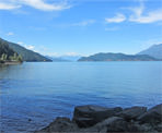
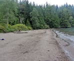
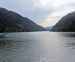
The trail starts to change from rugged into a well, worn dirt path that's fairly flat, passing moss covered rocks and getting away from the noise of the crowded beach area. After only a few minutes, the trail descends and veers to the right where you reach a "T" junction, with the option of either going right or left. This point marks the beginning and end of the loop that the Whippoorwill Point Trail does. Go right and continue down a slight hill, as you step over a rock, pass some fallen trees, and reach a beach known as Sandy Cove. This is normally not a busy beach as the only ways to access it are to hike the trail you just did or to get there by boat. It also offers a scenic view of Harrison Lake, the surrounding mountains, and is a nice place for lunch.
The trail continues at the far end of the beach and is easy to miss. However, if you walk along the edge of the beach and forest area and look up, there is a white cross on one of the trees and a visible path at the base of that tree. Follow the path as it weaves through the forest and reaches an old wooden triangle marker used for boats to indicate the point next to the Harrison River. The trees have grown over the years and therefore, don't offer much of a view of the lake or river through this part.
Continue following the trail and watching for trail markers on trees as this section of trail is fairly well marked. The trail briefly climbs a small hill before descending and following alongside the Harrison River. There is a short trail that goes to a rocky bluff with a view of the Harrison River. This trail isn't easy to find as there is no marker for it, however it's at a fairly low point of the hiking trail, just before the trail steps up onto some rocks. Also, the path is a bit worn, so keep an open for it on your right and it should be noticeable. The short path takes you up onto a rock where there are metal remnants of industry left over from the years past.
After enjoying the viewpoint, return to the trail and continue as it follows the river and offers a few more views down stream. Watch for the trail markers as the trail then goes left and uphill, back into the forest. A short hike through an overgrown set of bushes and you arrive back at the "T" junction. Go right, up the hill and head back the way you came, passing the large rock and carefully descending down the steep slope back onto the gravel road. A short walk along the road brings you back to Harrison.
How to get to Whippoorwill Point Trail
Estimated Driving Time from Vancouver
2 hours
The Whippoorwill Point Trail is located at Harrison Lake and begins from the Harrison Lake Spa Resort. From Vancouver, drive east towards Highway #1 the Trans Canada Highway and merge onto the highway heading eastbound. Continue for roughly the next 100km, through the Fraser Valley and past Chilliwack.
Take exit #135 BC-9 Towards Agassiz / Harrison. Veer to the right and loop around, crossing back over the highway and continue along the road before going straight through the roundabout. After crossing the bridge over the Fraser River, make a left towards Agassiz / Rosedale BC-9 and continue into the town of Agassiz. Follow the signs by turning left onto Cheam Avenue, then making a right onto Evergreen Drive and crossing the train tracks, before veering left on BC-9. At the 3-way intersection, turn right and follow Hot Spring Road (still BC-9) into Harrison.
The start of the Whippoorwill Point Trail begins at the metal gate and gravel road right in front of the Harrison Hot Springs Spa Resort.
View a map of Driving directions to Whippoorwill Point Trail.

Although we try to keep information as current as possible, www.vancouvertrails.com makes no warranty or representation as to the availability, quality, fitness for purpose, conditions or accuracy of the information provided with respect to this trail or trails. The information provided herein is further subject to our Terms of Use.

Comments
Add Comment View All Comments