- Difficulty Difficult
- Time 9 hours
- Round-Trip 19.5km
- Elevation Gain 1025 meters
- Season July - September
- Camping No
- From Vancouver 2 hours
- Public Transit No
- Dog Friendly No
The Skywalk North Loop is a hiking route that follows several trails on the west side of Whistler, taking you up into the alpine for incredible views of Rainbow Glacier, Iceberg Lake, Screaming Cat Lake, and many mountain ranges in the region. While snow can linger into July at the higher elevations, the challenging route takes you well into the backcountry before looping back and passing through the scenic meadows near Rainbow Mountain.
The network of trails can be a bit confusing to navigate, particularly near the lower sections. This description will start from Mountain View Drive and follow the Lower 19 Mile Creek Trail to the Screaming Cat Lake Connector Trail. Then follows the Scream Cat Lake Connector, then up the Flank Trail North to Screaming Cat Lake, before following the Skywalk North Trail to Iceberg Lake. The route then returns via the Upper and Lower 19 Mile Creek Trails. This route does not include the Skywalk South Trail as doing both the north and south routes as day-hikes is very difficult and requires more than one day to complete for most. There is also a route that goes directly to Iceberg Lake by the 19 Mile Creek Route and returns the same way, less challenging then completely the Skywalk North sections.
From the wooden signboard at the end of Mountain View Drive, walk past it and immediately turn left at the trail marker, following the trail uphill. Walk a short distance up until you reach a gravel road, then go left walking up the gravel road for about 40m to another trail sign on the right side, where the Lower 19 Mile Creek continues. Follow this trail as it continues to climb until you reach a second gravel road. Cross this road and walk up the path on the other side, entering the forest.
Follow the trail across a small bridge before the path begins to climb steadily. You gain plenty of elevation in the first section of this route, so make sure to pace yourself. At a sign to a viewpoint, walk a few metres out to see the view of Green Lake below.
Return to the trail and a short distance further, cross a 4-way junction with a mountain biking trail. Just after passing the mountain biking trail, the trail reaches a wide section where you go right and hike up the steep hill. At the top of this section, go left and a few metres on the right is a trail marker for the Screaming Cat Lake Connector Trail. It's important to find this trail marker as this is where the loop starts and ends.
Follow the Screaming Cat Connector Trail as it climbs up the mountain, continuing to gain elevation. Go straight through, what looks like, a 4-way junction and pass another trail sign. At another sign, go right onto the Flank Trail and continue following the route as the elevation gain becomes more gradual.
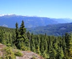
The route continues to pass through forest, offering few views. When you arrive at another sign for the Upper Howler Trail, make sure to go right and continue uphill as the route to the left is a mountain biking trail. The next section gains elevation very gradually as you quickly make your way through the forest until you reach a junction with the Valley Lookout Trail. Going right is a side hike that is about 260m and climbs up onto a rocky bluff, offering scenic views down the valley towards Showh Lakes.
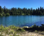
Return to the trail and continue following it until you reach a junction where you must go left towards Screaming Cat Lake. There's still about 800m to the lake, so follow the trail and watch for trail markings and signs. Go left and follow a worn path between two small hills as and veers to the right, following the path until you end up next to Screaming Cat Lake on your right. The scenic lake offers a great place to stop before continuing and the lake also marks the start of the Skywalk North Trail.
Follow the trail to the far end of the lake to where it leaves the area and climbs steeply. The continues through forest before descending and arriving at a meadow. Walk along the path, through the meadow to a junction with the Kevin's Homerun Trail. Kevin's Home Run Trail connects the Skywalk North Trail to a section over halfway down the Upper 19 Mile Creek Trail. This trail offers a shorter return trip, if needed, however there are some incredible views to come, so go right and continue not he Skywalk North route.
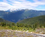
The trail passes through several scenic meadow areas, offering views of the mountains in the backcountry. The trail veers left and then begins to climb steeply again, taking you even higher before it passes over an open rock area, offering glimpses of Rainbow Mountain ahead and incredible views of the Soo Mountain Ranges and Ipsoot Mountain.
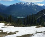
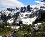
Follow the trail markers as you, sort of, zig zag your way through the alpine. The trail begins to climb steeply again as it passes a lake down to the left, before veering right and climbing up an even steeper section. The route then crosses a rocky section where, looking down to the left, you can see Green Lake and part of Whistler. Eventually, the trail veers left and begins to descend as you have past the high point for this route. Carefully make your way downhill, catching the occasional glimpse of Iceberg Lake and many incredible views of Rainbow Glacier.
After descending through a series of switch backs, the trail crosses one more rocky section and arrives just above Iceberg Lake, which is situated at the base of Rainbow Mountain. Walk down to the lake area and find a place to relax to soak in the incredible alpine views. The water is extremely cold and snow often lingers at the lake area well into July as the area gets less sun on the north side of the mountain.
After enjoying the views at Iceberg Lake, begin your descent back to the trailhead via the 19 Mile Creek Trail. The trail begins on a worn path, a few metres up the hill by the lake and descends down into the valley towards the meadows in the direction of the drainage river from the lake. Follow the route over the rocks, carefully watch your step and watching for trail markers and worn areas for the trail. Make sure to frequently stop to enjoy the views as all angles are quite spectacular.
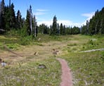
The trail reaches the meadow, leaving the rocky route behind and following a dirt trail as it crosses over a few small bridges. The views from the meadows of the mountains are incredible, with multiple waterfalls in sight from the melting ice. Follow the trail until it reaches a junction with the Skywalk South Trail. The Skywalk South route is a much longer route back and is not easily done as a day-hike, so save this route for another day. Go left and follow the Upper 19 Mile Creek downhill into the forest.
The descent along the Upper 19 Mile Creek is also quite scenic as it follows the creek for quite sometime, where there can be small waterfalls. The trail crosses several small bridges over muddy sections as you enjoy the sounds of the rushing water. Eventually, cross a bridge over 19 Mile Creek and then pass the junction with the start of Kevin's Home Run Trail. Continue down the Upper 19 Mile Creek Trail until it ends at a wide trail called the Flank Trail.
Go left on the Flank Trail and walk for a couple of minutes before reaching the junction with the Lower 19 Mile Creek Trail. Go right and follow the Lower 19 Mile Creek Trail downhill as you make your downhill quickly, then go right at a second junction. The trail will reach the sign and junction with the Screaming Cat Connector Trail where you began your look earlier in the day. Go right and down the wide, steep trail and then make a left back onto a narrow trail, going straight across the 4-way junction with the mountain biking trail.
Continue down the steep trail until it eventually reaches the first logging road. Cross the road and walk down the trail to the second road. Go left on the second logging road and walk about 40m to where the trail continues on the right side, making the final descent back down to the cul-de-sac at Mountain View Drive.
How to get to Skywalk North Loop
Estimated Driving Time from Vancouver
2 hours
The start of the Skywalk North Loop begins at the top of Mountain View Drive in Whistler.
From Vancouver, drive to Highway #1 and enter the highway, heading westbound towards Horseshoe Bay. Just before the ferry terminal, watch for signs and merge onto Highway #99: The Sea To Sky Highway heading northbound towards Squamish and Whistler.
As you enter the Whistler area, continue following the highway and pass the turn off to Whistler Village, continuing north on the Sea To Sky. About 4km beyond the turnoff to the village, turn left onto Meadow Lane. Immediately after turning left and leaving the highway, turn right onto Parkwood Drive. At a 3-way stop sign, turn left onto Mountain View Drive and follow this street uphill, going straight through a 4-way intersection, and veering right until you reach the end of the street.
Parking and Whistler Bus
There are limited parking spots in the cul-de-sac and parking anywhere where there are no-parking signs will result in your car being towed. If no parking is available, Whistler recommends parking at Meadow Park but this will add another 2km to the trailhead, or about 30-minutes walking each way.
Another option is to take Bus #30 from Whistler Village to the intersection of Valley Drive and Mountain View Drive. From the bus stop, it is just a 900-metre walk, or about 15-minutes. The buses are free during the weekends in Whistler.
View a map of Driving directions to Skywalk North Loop.

Although we try to keep information as current as possible, www.vancouvertrails.com makes no warranty or representation as to the availability, quality, fitness for purpose, conditions or accuracy of the information provided with respect to this trail or trails. The information provided herein is further subject to our Terms of Use.

Comments
Add Comment View All Comments