- Difficulty Intermediate
- Time 6 hours
- Round-Trip 16km
- Elevation Gain 850 meters
- Season July - September
- Camping No
- From Vancouver 2 hours
- Public Transit No
- Dog Friendly No
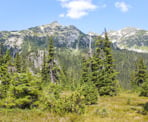
Rainbow Lake is located in Whistler and is one of the area's most scenic and pristine alpine lakes. When timed right in August, the wildflowers around the lake are in full bloom and the views on a clear day are spectacular, with Black Tusk visible in the distance. The trail follows 21 Mile Creek as you pass Rainbow Falls near the beginning and climb gradually through a scenic forested trail.
Rainbow Lake is a source of Whistler's drinking water and therefore, swimming in the lake and camping at the lake are NOT permitted. Camping is allowed at Hanging Lake, which is 1.5km beyond Rainbow Lake.
From the trailhead along Alta Lake Road, walk past the large map of the area and into the forest as you follow the route next to 21 Mile Creek. The trail gradually climbs until you reach a gravel road. Stay on the trail on the right side of the road, then re-enter the forest on a trail that is just after the road's corner on the right (don't follow the road).
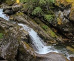
A few minutes from the road, you reach a junction where going right takes you to Rainbow Falls. The short side trip is worth the walk as you are offered a great view standing on rocks directly over the falls, peering down at the cold, rushing water below. After enjoying the waterfall, return to the junction and follow the trail uphill until it arrives at the gravel road a short distance later.
Cross the road and continue walking straight, passing a building to your right until you reach a sign post that points to a trail to the left called the Flank Trail. Do not follow the Flank Trail, instead go right and follow the wide gravel route uphill as it gradually climbs through the forest with the sounds of 21 Mile Creek below, to your right. Not far up the hill, you pass the first outhouse and then another junction with the Flank Trail. Continue straight, staying on the wide gravel path.
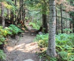
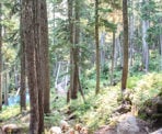
At 3km into the hike, you reach a wooden gate with a sign about Whistler's Watershed. At this point, the wide route ends and becomes a narrower hiking trail. Pass the wooden gate and follow the trail uphill along the smooth path into the second generation forest. The forest section is enjoyable as you gradually gain elevation and the trail crosses many small, wooden bridges. Eventually you reach a sign pointing to the second outhouse to the left. A few minutes further along the trail, cross a large cable bridge and walk up the trail as it veers left where there is a view of a waterfall that cascades down from the rocks high above.
Continue along the trail as it keeps steadily climbing through the forest until it eventually reaches a series of old, wooden boardwalks that cross a bog. The open bog area provides great views of the surrounding mountains but watch your step on the old wooden slats as many are loose. Note: As of 2014, major trail work is ongoing around this section and it looks as though there will be a new trail that bypasses this route through the bog. There is a new trail junction that is blocked off just beyond the bog area, which will probably join the main trail once it's completed. The completion date is supposed to be by the end of the 2014 season.
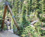
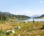
About 10-minutes after the bog area, the trail reaches a spectacular looking suspension / cable bridge. Cross the bridge and continue along the smooth trail as it begins to emerge from the forest and offer several views of the area, including Rainbow Mountain to your right. The trail winds through a meadow area before going up one final steep section. As the trail levels, Rainbow Lake comes into view. Walk down past the big rock and over the bridge to where the large wooden sign is located. For other great views of the lake, it's worth walking along the path next to the lake to the far end, where you can see the lake on a clear day with Black Tusk towering in the distance.
After enjoying your time at Rainbow Lake, retrace your steps back down the trail you came, following the 8km route through the forest, across the many bridges, back to the parking area along Alta Lake Road.
How to get to Rainbow Lake
Estimated Driving Time from Vancouver
2 hours
The trailhead for Rainbow Lake is located in Whistler, on the west side of Alta Lake. From downtown Vancouver, drive to Georgia Street and head westbound as Georgia turns into the Stanley Park Causeway. Cross the Lions Gate Bridge and stay in the left lane as you loop around and into West Vancouver. At the first set of traffic lights at Taylor Way, turn right and drive up the steep hill, watching for signs for Highway #1 Westbound. Turn left and merge onto the Highway.
Continue driving along the highway through West Vancouver and, just before Horseshoe Bay, merge onto Highway #99 Northbound to Squamish / Whistler. Continue driving northbound, passing through Squamish and eventually into Whistler.
Pass through the first set of traffic lights in Whistler and continue along Highway #99 until you reach a turnoff to Alta Lake Road on your left (if you reach Creekside and the Mohawk gas station, you have gone too far). Turn left onto Alta Lake Road and follow it for the next 7km as it loops around, cross train tracks, and steadily climbs uphill passing several homes. Just after the cemetery, watch for a gravel parking area on your left and a big sign marking the start of the trail to Rainbow Lake.
View a map of Driving directions to Rainbow Lake.

Although we try to keep information as current as possible, www.vancouvertrails.com makes no warranty or representation as to the availability, quality, fitness for purpose, conditions or accuracy of the information provided with respect to this trail or trails. The information provided herein is further subject to our Terms of Use.

Comments
Add Comment View All Comments