- Difficulty Difficult
- Time 4 hours
- Round-Trip 4.5km
- Elevation Gain 760 meters
- Season July - October
- Camping No
- From Vancouver 40 minutes
- Public Transit Yes
- Dog Friendly No
Trail Notice
Paton Peak and all other backcountry trails in Lynn Headwaters Regional Park are now closed for the season. The trail will re-open in roughly July 2025, or when the snow and conditions allow.
The Paton Peak hike description only refers to the hike itself. There is an additional 20km (10km each way) that will add at least 2-hours by bike.
Check the time on the Lower Seymour Conservation Reserve Gate Closure times to ensure you do not get stuck in the parking lot.
Paton Peak is located in the Lower Seymour Conservation Reserve and has awe-inspiring views that look down towards the Seymour Lake Watershed, across to Cathedral Mountain, and up towards Coliseum Mountain.
The trailhead is about 10km each way (20km extra) from the Lower Seymour Conservation Area parking lot and located just off the Seymour Valley Trailway, a paved road for bikers and walkers. This adds a significant amount of distance to your hike, so ensure to account for the added time for your hike or plan to bike to the trailhead and lock your bike to a tree.
Getting To The Trailhead
From the parking lot, follow the Seymour Valley Trailway past the metal gate and begin the 10kms to the Paton Peak Trailhead.
If you are riding a bike, you will spend about 45 minutes traversing an undulating road through pristine forest and over small bridges. While the hills can be wearying, remember that most of the uphill you do at this point will be downhill on the trip back.
Notice Jack's Burn Picnic site on the left side, the trail will descend from this point through the 8 and 9 km markers. About 250 meters after the 9 km marker, you'll need to start paying close attention to the left side of the road for a paved exit heading back and up into the forest. If you reach the Stoney Creek Picnic Site, you've cycled just a bit too far; turn around and head back and you can't miss the turnoff.
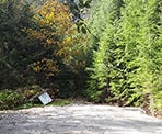
After leaving the main Seymour Valley Trailway, the road ascends on pavement for about 100 meters, then turns to hard-packed gravel as it begins to go steeply uphill. Continue on this road for less than a kilometer, cycling in some parts, walking in others, until you reach a small clearing. Lock your bike up to a tree, catch your breath, and proceed through a narrow trail opening opposite from where you entered the clearing. After a minute of walking, you'll see orange tags on your right heading up and into the forest.
The Hike Begins
From here, the Paton Peak trail resembles many other classic North Shore hikes. Beautiful cedar trees, spongy needle-packed trails, and all the other expected sights. That said, the trail is steep and relentless, with switchbacks continuing for the majority of the hike.
After about 500 meters of hiking, a short side trail offers a scenic view of the back side of Mount Seymour, Runner's Peak, and other peaks in the Fannin Range. Take a quick moment to pause, gulp down some water, and take in a view of Mount Seymour.
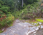
Shortly after the view, the trail becomes more difficult, with scrambling over rocks using root handholds, rope-assisted climbs, and more complicated footwork. At no point does it reach the level of mountaineering, and you should never feel especially unsafe, but bear in mind to be careful and pay close attention to your steps. A turned ankle here means a very long day.
From here until the peak, the trail continues its upward trend. Be mindful of looking up as you hike to find the orange trail tags in the trees. It's easy to wander off the trail, and while re-finding the trail wouldn't be difficult, it will mean added exertion on an already difficult hike.
After negotiating yet another rope climb through a narrow gap over some boulders, you'll soon reach the alpine, and the forest will begin to thin out, offering remarkable peekaboo views of the surrounding mountains, as well as the sheer cliff descending from Paton Peak (remember this sight when you're edging to the precipices at the summit).
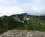
A few minutes later and you will emerge at a crossroad marked by a cairn and some orange tags; going left and down means heading towards Coliseum Mountain. Instead, head to the right, following tags through the last bit of forest before reaching Paton Peak's inspiring boulders. Scramble up any route you prefer to reach the summit and surrounding you on all sides are the views of mountains. To the west, take in the Needles, Coliseum, and the majestic Cathedral. To the east, the Fannin Range spotted through the forest earlier, and now in full view. To the south, a delightful view of downtown Vancouver.
Continue walking all the way to the northern terminus of the Peak, being mindful of the very steep cliffs on all sides. From the end, the blue waters of Seymour Lake stretch out before you, surrounded by steep, lush forest. Along the way, walk amid pretty tarns scattered along this terrific, rarely visited spot.
After enjoying your lunch, begin your descent. You've still got another hour of hiking and an hour of biking left to go as you retrace your steps back down hill to the trailhead before riding back along the Seymour Trailway.
How to get to Paton Peak
Estimated Driving Time from Vancouver
40 minutes
The trailhead to Paton Peak begins about 10km from the parking lot for the Lower Seymour Conservation Reserve.
To reach the parking lot from Vancouver, take the Second Narrows bridge across to North Vancouver and take the third exit, Exit #22A. Immediately get into one of the lanes on the left and drive straight through the lights, driving uphill towards Capilano University. Stay in the left lane and go straight at the light.
Pass the cemetery and the yellow gate, then the road continues as it pass over a lot of speed bumps. Continue driving until you reach he parking lot at the end.
View a map of Driving directions to Paton Peak.
Transit Access to Paton Peak

Although we try to keep information as current as possible, www.vancouvertrails.com makes no warranty or representation as to the availability, quality, fitness for purpose, conditions or accuracy of the information provided with respect to this trail or trails. The information provided herein is further subject to our Terms of Use.


Comments
Add Comment View All Comments