- Difficulty Intermediate
- Time 5.5 hours
- Round-Trip 10.5km
- Elevation Gain 550 meters
- Season July - October
- Camping No
- From Vancouver 45 minutes
- Public Transit No
- Dog Friendly On-Leash
Mount Strachan is one of three mountains that make up the Cypress Ski Resort area in West Vancouver. The challenging terrain on the hike to Mount Strachan is rewarded on a clear day with views of Howe Sound and backcountry mountains as far north as Garibaldi Provincial Park. Another point of interest along the trail is the historical crash site of a Royal Canadian Navy T-33 Jet where several pieces of the aircraft still rest today.
The route described here will be a clockwise loop from the Howe Sound Crest Trail and then returning via the Old Mount Strachan route and Baden Powell. The route is challenging at times due to a steep scramble up an area from the Howe Sound Crest Trail known as Christmas Gully. Sections of the Old Strachan trail back town are steep and technical with many muddy sections and snow lingering into July. The start of the trail is well marked up until the Howe Sound Crest Trail passes Strachan Meadows, at which point trail markers and flagging tape are not always obvious.
From the downhill ski parking lot, walk towards the Cypress Creek Lodge, staying to the right. Just beyond the lodge is Yew Lake and some signs pointing towards the nearby hiking trails. Follow the Yew Lake trail and watch for the well marked signs as you meander through the beautiful forest before reaching the first of several junctions. Go right and keep following the signs with the ultimate goal of reaching the Howe Sound Crest Trail. The next two junctions are quick and you will go left at each of them, again looking at the posts and going where the Howe Sound Crest Trail is.
At the 3rd junction, the trail emerges from the forest onto an old logging road. Go left on this wide route and continue to a small wooden bridge. Cross the wooden bridge as the trail begins to climb at a steeper pace, passing through some switchbacks before reaching a junction with the Bowen Lookout. A couple of hundred meters from the trail, the Bowen Lookout is worth a short side trip as it offers a scenic view of Howe Sound towards Bowen Island.
Back on the trail, continue up hill until you reach another junction next to a wooden map board of the Howe Sound Crest Trail. Go left at this junction as you are now on the Howe Sound Crest Trail. This section of trail is fairly flat and you pass quickly through the forested area.
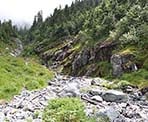
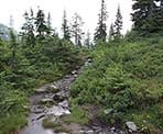
At about 1km from the wooden map board, you reach 2 small wooden bridges in an area known as Strachan Meadows. There are no obvious trail signs like before, so make sure to watch for the two bridges. Between the two bridges is a trail on the right side that passes into Strachan Meadows and begins to climb steeply up the rocky creek. Stay just to the left of the creek as you scramble up the rocks. There are very few trail markers to begin but once you reach climb up and over a large rock, a trail appears that follows to the left of the creek through the trees, offering a slight relieve from the rocks. Continue following this trail as you make your way up and over fallen logs, passing the occasional marker. The trail then veers back onto the rocky creek bed where you must continue your uphill scramble up the rocks. Eventually, you reach the top where you are between the north and south summits of Mount Strachan.
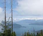
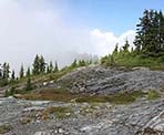
After a short rest, go left and up the trail to the north summit of Mount Strachan. This side trip is worth while as it's the higher of the two peaks offering a different view of the area. After enjoying the view, return to the area between the two summits and walk up a rocky section onto the south summit. On a clear day, incredible views of Howe Sound and the surrounding mountain ranges are visible. This is a great place to stop for lunch.
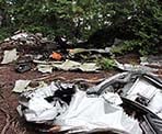
After taking in the views on Mount Strachan, begin your descent by looking for the 2 orange markers n the back of the South Summit (you may need to walk along the rocky summit until you see them on your left). Follow the trail as it descends towards a ski lift. The trail is fairly steep and technical in this section, so watch your footing as you descend. Within 30 minutes along the trail, you reach the site of the T-33 plane crash. The Navy jet was on a training mission in 1963 when it crashed in the heavily wooded area the day after John F. Kennedy was assassinated. It took several days for crews to locate the crash site and, today, the area is still preserved with several pieces of the plane amongst the forest.
Continue along the trail downhill as it veers left and then passes up onto a large rock (if you reach the ski run, you missed the rock and must walk back about 20 meters). The trail then descends into a ravine area and reaches a junction. The junction is not well marked and you must go right and continue downhill. If you find yourself hiking uphill at this point, you are on the trail to Hollyburn Mountain and should return and follow the ravine downhill.
The trail continues through muddy sections as you cross over more fallen trees and eventually reach a giant tree. There used to be a trail to the right that appears on old maps but it has become overgrown and the new maps of the area recommend following the Old Strachan Trail back down to the Baden Powell. The route adds some distance onto your hike as it veers east in an almost parallel direction to the Baden Powell Trail.
Eventually, the trail reaches the junction with the Baden Powell Trail where you go right to return to the downhill ski area. Hike along the scenic North Shore forest of the trail as it crosses a few small creeks and within about 30 - 45 minutes, you reach an opening at the down hill ski area. Go left and walk the remaining short distance back down to the parking lot where you began earlier in the day.
How to get to Mount Strachan
Estimated Driving Time from Vancouver
45 minutes
The hike to Mount Strachan begins from the Cypress Mountain Downhill Ski area. From downtown Vancouver, drive to Georgia Street and then head westbound as you pass through the Stanley Park Causeway. Stay to the left after crossing the Lions Gate Bridge as the offramp loops around and into West Vancouver. At the first traffic lights at Taylor Way, turn right and drive up the hill towards Highway #1. Turn left for the Highway #1 Westbound entrance and drive onto the highway. Take Exit #8 for Cypress Mountain and, after exiting the highway, continue driving along Cypress Bowl Road as it begins to climb up the mountain. As you approach the ski area, go straight at the junction to the downhill ski area and park in the parking lot.
View a map of Driving directions to Mount Strachan.

Although we try to keep information as current as possible, www.vancouvertrails.com makes no warranty or representation as to the availability, quality, fitness for purpose, conditions or accuracy of the information provided with respect to this trail or trails. The information provided herein is further subject to our Terms of Use.

Comments
Add Comment View All Comments