View Mount Gardner Description | Add Comment
Rudy Pospisil from Burnaby writes:
The trail is brautiful but poorly marked . Many trails branch off and some flank trails have names not even on the map. Terrain is steep and getting lost in poor weather very possible and dangerous. Prepare to spend a night. Google maps is not reliable. Avoit south summit gring for descent ateep and dangerous no ropes poorly marked.
Posted: August 22, 2023 08:48:22 AM PST
Mohammad Zandsalimy from Vancouver writes:
The hike was decent. But that is not the point of my comment.
I trusted google maps with the trail going down the south side of the mountain.
I got lost because the trail on google maps does not exit!
I fell down a cliff. Bruises all over my legs and body. I could barely walk.
I just decided to go downhill (like 70 degrees slope I kid you not).
Insane cliffs, no footpath what so ever. Thankfully I was able to get out in 2 hours and a very kind lady drove me to the ferries.
I was scared for my life.
No google maps anymore. I suggest everyone else too. Please, if you are going hiking check the official trails.
PS Let me know if you want to see photos of my bruises and cuts.
Posted: August 16, 2022 02:36:00 AM PST
VanHiker from Vancouver writes:
Excellent hike. There is new sign posts at all the trail junctions. Did this for the second time in February 2022 in a clockwise route. It was a little cold. I drove on the ferry and parked by Killarney lake. I went up on the skid trail to the south summit. The last fifteen minutes is on the south summit grind, it was very steep and paused at the south summit for a few minutes then walked to the north summit for a long lunch break. It took a little over 2 hours to walk up. After about 90 minutes at the top, walked down the north summit ridge trails passing a viewpoint to a trail junction. I turned left to walk down a steep narrow trail to the handloggers trail (or mid level trail). Then I turn right and follow it to the hikers trail road. It passes another viewpoint on the way and is quite an easy trail. It took about 2.5 hours to walk back to the lake from north summit. There is a really good pdf map at: https://bowentrails.ca/wp-content/uploads/2015/pdfs/bowen-rotary-trail-map-gardner.pdf
Total time including breaks is about 6 hours.
Posted: February 27, 2022 01:30:40 PM PST
Claire from Toronto writes:
Hiked in June 2021. I echo the comments about using Trailforks or a similar app, particularly for the transition from gravel path to wooded trail. Though, I used Trailforks and there was one section of trail on the southern portion of the loop that was not reflected in the app which sent me off for 20 minutes or so (FYI if coming back along the southern loop, follow the post towards the end of the wooded trail that says "Exit" and it will keep you on Skid Trail). The orange flags in the wooded area were easy to follow.
I took several breaks and the whole loop to 4 to 4.5 hours.
Very quiet, hiked on a weekday and did not see anybody else the entire hike.
Posted: June 11, 2021 08:07:32 PM PST
Alexandra Popovic from Vancouver writes:
Recommend using Gaia or similar to make sure you don't go off on a few of the other trails, a couple didn't lead anywhere. Generally good signage and the walk itself was through beautiful forest with a few nice outlooks. Moderate difficulty, great views at second peak and took around 4 hrs.
A plea: a small black and white 'wiener' dog called Alan was lost on the Mount Gardner trail today (Sun 1st Nov). He may be wearing a blue jacket. He was last seen about 1km away from Second Peak in the direction of Galbraith Bay as you look at the map. He may still be on the mountain or have made his way down in any direction from there down to a road. If you think you've seen him please private message me on here and also let his very worried owner Samantha know on 2369782118.
Posted: November 1, 2020 09:46:55 PM PST
Nikhil from Richmond writes:
Hiked August 2020.
Navigation:
Yes the signage or wooden obelisks are not great as mentioned, but they did add new tree tags so it's not too bad at all. Don't worry about it too much as it's hard to get lost and to make your life easier, download "Trailforks"; you won't miss a beat. Very easy.
There are two ways: clockwise or counterclockwise
- Hikers Trail (Tower Road): a logging road that's a steady incline to climb which eventually leads you to Gardeners Trail which takes you to the summit. The Hikers Trail is an uneventful steady climb but once you're on Gardeners trail it's nice and you'll appreciate the climb.
- Skid trail which takes you directly to the summit through the forest which is very nice both up and down. You may opt to take Skid Trail both ways.
Difficulty and time:
- This is subjective to individuals but as a comparison to the Grouse Grind or The Chief, I would consider this an "easier" hike than the two. I'm not sure where they get 7 hours from but unless you're really slow or you decided to connect back to Handloggers Trail, it isn't that long at all. Maybe 2/2.5 up and 1.5/2 down.
Suggestion:
I would suggest going up Hikers Trail --> Gardners trail because coming down that way is not going to be fun for your knees; there also a small scramble but nothing gnarly. Coming down via Skid trail is very nice and your knees will thank you.
The View:
Top is beautiful and if you get a clear shot of Baker, it's stunning. Bring a telephoto lens for you photographed out there! Little to no bugs; whisper quiet in the forest.
Downhill Biking:
Trailforks says Skid Trail is a green. While there are some portions that are, it's not accurate to classify it as a green. There are some gnarly sections and would not recommend for beginners unless they are okay walking some sections.
Posted: August 23, 2020 05:40:29 PM PST
Mer from New Westminster writes:
Lovely day trip!
The Mt Gardener trailhead itself is about 3km away from the Snug Cove ferry terminal, so you an either bring your bikes and ride there, or walk through Crippen Park past Killarney Lake. It adds about 80 minutes to your day, but it's a nice gentle warm up.
I strongly recommend going up the north side first-- it's a workout! Apparently locals call it the "Gardner Hardener," and it's Bowen's version of the Grouse Grind. This also means your knees don't take a beating when you descend via the gentle Skid Trail. The radio tower at the 2nd summit doesn't disappoint -- views of Gibsons on one side, and Vancouver on the other.
Someone has done a bit of work to put up signs, but the trail system is still quite confusing. I recommend taking a map, a copy of your directions, and downloading the TrailForks app to keep yourself on track.
Posted: July 22, 2020 06:11:56 AM PST
C.Simundson from Vancouver writes:
I've hiked Mt. Gardner twice in the past and can attest to how confusing the trail system can be. I was planning on taking my sister tomorrow and stumbled across a fantastic new resource for navigating the convoluted trail system and thought I'd share it here. Outdoor Therapy has created an easy to follow pdf map system with several hiking options. I downloaded it and it's fantastic. Each map comes with a link to a Google Maps that can be loaded on your device or you can just print and pack it old school.
Check it out at https://outdoortherapy.ca/mount-gardner-hikes/
Here is the link to the pdf I downloaded - if it doesn't work, just go to their website and request it from there (It came through under the "promotions" section in my gmail): https://attachments.convertkitcdnn.com/31428/9c3fd136-da47-425f-8968-058abc07c262/10%20OT%20Mt.%20Gardner%20Hike%20Guide.pdf
Posted: August 10, 2019 12:10:53 PM PST
gillybean604 from Vancouver writes:
Hiked the trail this past weekend July 15 2019. Great trail conditions. Only came across 1/2 dozen hikers along the way. I started my hike at the Mount Gardner trailhead and it took me 5 hrs (including lunch at the North Summit). It is true about the trail signs; they are very confusing. There are multiple forks along the hike and they will either a) have signs that point opposite directions 2) be no signs at all. I found I had to rely on my phone GPS to identify which direction to go on the forks. Each fork will also have multiple orange markers but at least the trails are well marked. If you drive to the Mount Gardner trailhead, turn onto Mount Gardner road and drive up the gravel path to the metal gate. There are about 1/2 dozen park spots on the gravel road. At the first fork, if you take the Skid Trail, you'll get the forested route. If you take the Hikers Rd/N. Mt Gardner Tr./Killarney Lake trail, you'll get the gravel/rock logging road route. Either way, it'll be a straight 2 hr uphill climb to the north summit. Also, there are snakes on the trail which no one mentioned. Otherwise, very beautiful hike. I'd definitely do it again.
Posted: July 18, 2019 08:58:32 PM PST
Rohan from Vancouver writes:
A rewarding hike with great views on the top. I followed the trail suggested on this website but as other hikers have noted below, the trails are often confusing even though there are markers everywhere. I downloaded the trail on my phone and used the GPS to navigate. I wouldn't recommend going all the way up using the Skid Trail but I did take it on my way down. I did use the Skid Trail during the climb for a bit but then switched to the Hiker's trail as that has an easier climb.
The distance listed here (17km) is from the Snug Cove ferry terminal. If you have a car, you can go to the trailhead and makes the total hike about 11 km. It took me 2 hours to go up and 1.5 hours to come back down (starting and ending at the ferry). I would recommend taking an early ferry there but the trail in general was empty regardless.
Don't bother with the south peak, there is no view there but north peak has good views of Sunshine coast, West Vancouver, and Vancouver.
Posted: May 26, 2019 05:14:16 PM PST
VanHIker from Vancouver writes:
This is a good spring hike on a sunny day. Did this April 2019. There directions on this website are terrible. It best to this in clockwise loop instead and drive to the start of the trail. There is a few parking spots near the gate. Take the first trail on the left called Skid trail and follow it to Junction 3. Then follow the south summit trail up the scrambly hill. This is the fun of the hike. Pass by the south summit markers on the way to the north summit rest area. Take a long break and make lots of photos. Then go down the north summit trail to handloggers trails. Then follow this back to skid trail. Doing this will avoid walking on the ugly road. There is also parking at Killarny lake that has a toilet. Hike from gate to top is about 2 hours including rest stops on way up. Taking car on ferry costs $29 + $10 per passenger. The views are really nice at the top.
Posted: April 27, 2019 12:45:52 PM PST
Kate from Vancouver writes:
Awesome hike but worst trail marks ever. It is just confusing when there are 3 signs at on junction and every single one tells somethong else! Bring a map along the trip!!
Posted: July 12, 2018 07:44:47 PM PST
Jugdish from Vancouver, BC writes:
A nice quiet trail in the morning. I took the 9am ferry to Bowen Island on a sunny Saturday and there was almost no traffic on the trail at that time. Things started picking up as I came down.
I recommend mapping the route on your phone, as there are a couple points where I relied on GPS at confusing forks in the path.
Posted: June 17, 2018 08:38:38 AM PST
Diego from Vancouver writes:
Did this hike on Monday May 21 2018
The hike does not take 7 hrs, unless you consider the walk from snug cove and at least a couple of hours on the summit.
The walk from snug cove to the beginning of the hike takes about 45 mins, and it's all flat.
From the entrance of the gate to the summit is about 2 hours at an average pace.
We got lost a couple of times and still made it to the top in about 2 hours with a couple of long breaks.
Descending took us about 1 1/2 hours, plus the 40 mins walk back to snug cove.
Overall, the view is truly amazing but the hike is very badly marked and confusing.
We thought we were going to the north summit, but found the south one first. Both summits are about 5 mins walk from each others, so that was not a big deal, we were just confused.
Enjoy it!
Posted: May 23, 2018 09:44:38 PM PST
Robert from Vancouver writes:
I did this hike yesterday, using a combination of the directions here, as well as my GPS.
I was apprehensive about the number of comments saying how confusing the markings were, and I 100% agree with them. I would not recommend this hike without a GPS, and I would personally have got lost just following these helpful directions, without my electronic friend.
I followed the Vancouver Trails guidance initially, taking Skid Trail and following the Handloggers Trail etc. it was in the next section, however, where I found the directions on this site a bit confusing, once you get towards the North Summit.
Assuming you loosely follow the orange markers, you hit a sign that points left for 'North Summit', or right for 'North Summit Loop'. I took left, mistakenly, as I just wanted to get there. I ascended using the rope section, but it was slippery and very steep. Not recommended for another few weeks at least as its snowy and treacherous!
Once I got to the North Summit, the views are absolutely outstanding, and if you take the sign 'North Summit Loop' instead of 'North Summit', you take a more leisurely route to the summit. I took that route down, and it was a lot more forgiving.
On the whole I hiked from Snug Cove to the Trailhead via Killarney Lake (around an extra 3-4km each way), and the day was a snowy and mountainous 19km in total. Yes, I am exhausted! This hike is recommended, and it took me around 5.5 hours to do the whole lot from ferry to ferry.
I hope this helps, and happy hiking. R
Posted: March 16, 2018 07:22:13 PM PST
Kyle from Vancouver writes:
Did this hike last weekend. It seems that there have been new orange trail markers installed, which are very helpful. We found the main trail to be pretty well marked, but we took the wrong trail going back down the mountain. We intended to loop back around to our car at Killarney lake, but ended up on the complete wrong side of the mountain, at Laura Road and West Side Road! Had to call a cab!
Apparently this is not uncommon as some of the signage at the top is a bit confusing. Will have to try again in the summer and see if we get it right! The hike was beautiful. The snow started deepening about halfway up the trail. The trail near the top was pretty much iced over with hard packed snow, so be careful hiking this time of year! There was about two feet of snow at the top.
I followed the directions at this site and they were spot on regarding the ascent (including Handloggers Trail):
https://www.outdoorvancouver.ca/mount-gardner-hike-bowen-island/
Handloggers added about thirty minutes, I think. The hike back up from the viewpoint to the main trail was QUITE steep, and the snow made the ascent more difficult for sure.
Beautiful views along the way and at the top. We will definitely come back up during the summer to see if we can do the loop properly. Another word of wisdom: both my phone and my girlfriend's phone drained their batteries for some reason. Maybe it has something to do with the copper in the mountain, but if you have a mobile phone charger, bring it. Also double check your route using a GPS or Google Maps to make sure you're on the right path, don't do what we did and blithely follow the vague directions down the wrong side of the mountain!
Posted: March 12, 2018 12:09:10 PM PST
Dave L from Vancouver writes:
Phewf, what a hike. I found it somewhat challenging, but the views and seclusion make it all more than worth it. I went in late summer on a hot sunny Saturday, and after getting out of the immediate Sung Cove area, I saw maybe 5-6 other humans on the entire trail, which was wonderful. The one drawback is that the trails can be quite confusing/hard to follow at times, which isn't ideal.
I did the standard north approach, from Killarney Lake. The first bit from Snug Cove to the "real" start of the trail took just under an hour, and was quite pleasant (especially the meadow). After that it gets more vertical/challenging, but there are still many nice easier parts that go through these beautiful dark valleys with mossy trees and a few opportunities to break off the trail slightly to access some of the more minor viewpoints that the mountain has to offer.
When I went, there were some handy arrows written with white sand on the ground, and it was always reassuring to find the next one. However, after the first major viewpoint mentioned in the Vancouver Trails guide (of "Gambier Island on the right, Keets Island on the left"), the arrows recommended I continue along the Hand Loggers trail, but the guide recommended turning at a fork to head up to the summit, which is what I did. This is when I found the trail really difficult to follow, and I considered turning back until I eventually saw a power line/telephone line. I followed it up the mountain and sure enough it led me to the radio tower at the summit, which was a huge relief to see. Never saw/did any of the ropes/pulleys mentioned here, which would have been nice for that final section, which is fairly steep.
There are two wooden helipads on the summit on both the east and west sides, and the unobstructed views they offer make all the trudging up rocks worth it. It was a clear enough day that, when looking southeast, I could see Mt. Baker and another snow-capped mountain nearby it (perhaps Mt. Shuksan? I'm not sure...)
For the way down, I intended to follow the Vancouver Trails recommendation of wrapping around the southeast side of the mountain, but I just ended up back on the trails on the north side that I had previously taken to get up, so I just followed the white arrows backwards to Killarney Lake.
All-in, the hike took me around 6 hours. From Snug Cove to the summit was about 4 hours, and then from the summit back down to the ferry took about another 2. Overall great hike, will do it again next summer!
Posted: September 3, 2017 11:08:41 AM PST
John Soanes from Langley writes:
The views are incredible, the endless gravel road ...not so much. Worse yet was the awful trail marking, SAR must get a lot of business from this trail. I use a GPS app on my phone as backup to trail flags. There were many "obvious" trails that were the wrong ones -- killed my phone I was having to rely on the loaded track so much.
Posted: August 30, 2017 09:59:04 PM PST
Louise Domenach from Vancouver writes:
Hi!
I am planning to do this hike tomorrow and from my understanding there are several ways to do this hike . Which trail is the best and has the best view ?
Also Don't really get where you exactly park! Any idea?
Thanks a lot!
Louise
Posted: August 20, 2017 03:04:00 PM PST
Steve Léonard from Vancouver writes:
Poorly marked. The map provided at the information centre could not be more useless. No map at the beginning of the trail, orange markers only during the last few kilometres. Overall, if you have been doing hiking in many places in BC, don't go there. Waste of time. My girlfriend feedback: mediocre.
Posted: July 23, 2017 06:25:42 PM PST
Michael Johnston from Richmond writes:
Had a great hike! I took a wrong turn and ended up on the Hand Loggers trail. I'm glad I did, because it was secluded and had lovely view points free of the loud buzzing of the radio tower at the summit. It does have two points that I wouldn't want to do during wet weather -- two spots on switchbacks that are very narrow & crumbly with a long steep drop to the side. Also lots of it is along rocky runoff beds, but they were totally dry when I went. I came all the way around the mountain and went up the south trail to the summit and came back via the north trail. All in all with the hike along the lake to & from the ferry I ended up doing around 25km.
Posted: July 24, 2016 02:06:33 AM PST
L&L from Vancouver writes:
Did this July 21st. We always start from Laura Road instead of doing the longer route where you must traipse thru the park first. It's a great park, I just prefer to walk around the lake in the park as one visit, and do the hike as a separate visit. If you have the means to do so, then you can do this as a quick but not overly easy hike. If you do want a better work out you can just increase your pace to as fast as possible. I really enjoy this hike. Five minutes in, we ran into 3 people just finishing, and that was it for the whole way up. Spent 30 minutes on the top and still nobody else. No one else until halfway down. This is what's so great, you see very few people and can enjoy true solitude. And if you don't do the long route through the park then you have plenty of time to wander in Snug Cove later.
Posted: July 24, 2016 01:08:48 AM PST
Randy from Langley writes:
The views at the peaks are absolutely fabulous and each peak offers something unique. We walked onto the Bowen Ferry and began our trek from the marina in through Killarney Lake. This was a nice meandering walk to help warm up the legs. The next section as you begin to climb is rather boring as you will be walking on mostly rocks for about 45 minutes. Once you are in the trails the journey becomes quite enjoyable. Pick a clear day so that your views are unobstructed!
Posted: July 14, 2016 11:51:35 AM PST
Sofie from Vancouver writes:
We asked a local which was the best route to take: We drove up Hiker's Trail road to the start of the hike, and parked there. She recommended Skid Trail to the North Summit (has a view). The South Summit doesn't have a view.
Unfortunately, it was overcast - we could still see bits of Vancouver and the islands/coast, but I imagine this view is stunning on a clear sunny day!
We took the logging road down, wasn't nearly as nice as Skid Trail. Would recommend doing Skid Trail both ways! Hope this helps someone!
Posted: May 15, 2016 08:15:09 PM PST
Erika K from New Westminster writes:
We did this hike on Monday. There are MANY different ways to do this hike as there are multiple loop trails weaved throughout the mountain and Crippen Regional Park. I think we got a little caught up with following the directions when we could have just made our own way up and had less stress. (Also, there are more direct routes if you want a shorter hike, or quicker descent, all depends on what you want to experience) Overall, there are a few fairly steep sections, not too much variety in terrain (mostly forest) the view points are nice, but there are better views from other hikes that aren't as much of a commute. It's an interesting day trip to take the Ferry over and explore the island though, so the overall experience is worth it. The north peak does have two helipads which afford two beautiful views. I can't say I would come back and do this hike again, however i'm glad I did it.
Posted: May 12, 2016 12:05:13 PM PST
Dave from Vancouver writes:
Did this loop clockwise, going from the south trail first, then the north trail. The south trail was decently marked, but going down the north trail had a few unmarked forks.
Not too many sights to see until you reach the summit, but there are quite the nice views up there.
You don't need too much water to complete this, unlike some of the other comments suggested. I drank maybe 1.5L on this 10C day. You'll probably want a little more in the dead of summer though.
Posted: April 24, 2016 11:33:27 PM PST
Mike from Vancouver writes:
Thank you Nicola! Much appreciated. I was told Bowen Island was considering creating an accurate hiking map for Mt. Gardner. That would be great. But glad you used my story, and the map.
Posted: June 22, 2015 10:45:24 PM PST
Nicola from Vancouver writes:
Victoria Day was a perfect day to do this hike. The map (& the descriptor that came with it) at the link below made life sooooooooooo easy! I opted for the less traveled N Gardner trail as described in the link and didn't meet the crowds until after I'd eaten lunch at the top of the north summit. There's a good mix of elevation & a nice push to the Sunshine Coast view point & north summit.
The trail is, for most part, VERY well marked if you have an idea of what you're looking for/which route you're going to take. However, unlike most other trails the red-orange diamonds you find on so many of our trails (thanks a million to the people who do this BTW) were tiny - not a complaint, just a heads up you might want to pay attention, which isn't a terrible thing when you're exploring - so it was nice to have this as a back up. Periodically there are also what look like painted bottoms of coffee tins and really nice large wooden signs with names & directional arrows carved into them.
Be mindful there are quite a few trails on here. That said I don't think you could truly get lost here. Just don't take the turn off for Bowen Bay unless you want to add, I believe, an extra 10km as pointed out in another comment.
My route was exactly as described in the link... and I also didn't bother with the South Summit... there's no view and well an extra few ft really wasn't worth the extra effort. Note there are two helipads - visit them both as they are on opposite sides so afford gorgeous views of different coastlines.
Take plenty of water - I saw no opportunities on my way and I drank the 4L I took plus more when I got back to Snig Cove.
It took me 2hr 58 min to do 10.71 miles. The elevation courtesy of my Garmin was slightly higher than that stated here. It actually took me longer to get home than to do the hike due to a 2hr wait for the ferry.... Certainly not the worst thing in the world. :)
http://www.vancourier.com/sports/hiking/hiking-stand-atop-bowen-island-to-see-vancouver-at-a-distance-1.595167
Thank you Mike Hanafin!
Posted: May 19, 2015 08:21:36 AM PST
Bryan from Vancouver writes:
I hiked up this past weekend with a friend. A few parts of the trails were flooded and we had to find ways around them or just walk right through it. It rained the whole time and was still fun! We set up a tarp about 25 min from the north summit and spent the night there. Tons on flowing water to boil up for some coffee. No snow to be found. Great weekend spot.
Posted: February 10, 2015 04:25:59 AM PST
Bryan from Vancouver writes:
Has anyone ever spent the night on the mountain? I believe their official policy is no on camping but I would love to do an overnight stay in my bivy bag tent. Has anyone else done this?
Posted: January 26, 2015 03:47:34 AM PST
C from Vancouver writes:
Completed this hike on Saturday in 8 hours round trip and the weather was perfect for it.
After walking to Killarney Lake, we walked along Mt. Gardner road to Hiker's Trail and took the steep logging road all the way up until the road eventually turned into the forest. The forest trail wasn't too bad though steep at times and you had to do some scrambling in sections especially at the last ascent (thank goodness for the rope and chains) before the very top where the radio towers/helicopter pads are. (one section would have been better if they had chains or ropes - I lost my footing due to the rain the previous days and could have severely injured myself after sliding).
After soaking in the views at the two viewpoints, we took the south trail back down to the logging road following it all the way back to the village where we stopped at the Bowen Island Pub for a burger and beer before heading back to Vancouver on the ferry.
One thing I must say is that the markers on the trails are ATROCIOUS when you enter the forest after the end of the logging road. The orange markers on most of the trees were about the size of a quarter which was ridiculous since if you weren't looking or have any vision issues, you may not see them and easily lose your way.
All in all a fantastic day. Definitely not an "easy" hike by any stretch of the imagination and I highly recommend taking lots of water and some food to enjoy at the top. (we saw some people with no water or food - for an all day hike in the heat, I don't know how they did it given there is no water/food along the trail)
Posted: September 22, 2014 10:10:26 AM PST
Matt Ross from Vancouver writes:
Fantastic hike and glad I completed this before moving from Vancouver.
The views from Mt. Gardner, especially east are spectacular. Well worth the day trip.
The directions as provided on this Web site are just about spot on regarding the initial ascent around the lake. From the ferry to the Keats Island lookout takes two hours and it will get your heartbeat flowing.
Only minor drawback was a wrong turn on the descent resulting in arriving at Windjammer Road. Somehow a right should have been a left.
Surprisingly Windjammer is 10 kilometres from Snug Cove. However, hitchhiking is common along Grafton Road and besides, the extra length only took ninety minutes in addition to the ninety-minute return to pavement from the peak/radio tower.
Mt. Gardner is recommended for avid hikers who are also looking to avoid crowds.
Posted: September 21, 2014 10:24:05 PM PST
Kim from Coquitlam writes:
Completed hike from Snug Cove to North Summit to South Summit to Snug Cove
Walked from Snug Cove to Killarney Lake to Hiker's trail
Took a left turn onto Skid trail at the gate, followed a few markers then followed what looked like a trail winding up the hill, fairly steep in some parts
Exited on the gravel road then continued along small trail labeled with a small handmade marker
Trail got rocky and we emerged onto a great view of Gibsons and Keats Island - CLear view just before lunchtime and could see fog rolling in as we sat there
Continued up the trail for another 1/2 hour and reached the ropes leading up to the North Summit
Wandering through deer and/or mountain bike trails we had already spent longer than planned on the hike - first people we saw were at the summit so we asked quickest way down
We were told to head to the South summit then down the trail from there following signs to Killarney Lake.
Approaching the South summit we asked a couple coming from there the same question and were told that the trail descending the other side of the south Summit was very steep but it was a trail: we took this route and while steep and requiring climbing down in places rather then just walking, it was fine - a nice challenge.
We followed the path to Killarney Lake, emerging on the gravel road to the gate at top of hiker's trail then walked back to Snug Cove
Posted: August 18, 2014 12:04:36 PM PST
L&L from Vancouver writes:
Still one of our fav day trips for a hike that offers a bit of sweat, but only requires you to bring along some water and a snack. We drive to Laura Road to start rather than walk thru Crippen Park first. It's a fast easy hike and you can relax on the helicopter pad and stay as long as you wish. Best of all it is never busy; you will not run into many people. Nice to walk around Snug Cove after; a perfect summer day trip.
Posted: August 17, 2014 08:05:49 PM PST
R from vancouver writes:
Did the north trail up and back.
About 2 hour 12 min from snug cove to the top. Signage is atrocious for the north
loop -- good thing I had done this last year.
On the way back down, as soon as we hit the logging road, we took it all the way back down.
I'd probably recommend taking the logging road as far up as possible. Only the last bit is enjoyable (before the first viewpoint/after).
About 1 hour 45 back down from the top. Instructions and signage are hyper bad.
Posted: July 30, 2014 09:52:37 PM PST
Kim from Bowen writes:
Canada Day Hike up to the peak of Gardner was bliss. Lots of great (and fun) signage! Took South up and North down. North is a bit dull and rocky on the bottom half of the trail, but fun rope ascent/descent near the top. South trail is a steady incline but beautiful.
Posted: July 1, 2014 06:46:37 PM PST
Patrick from Montreal writes:
Did the Mt Gardner road hike yesterday. We didn't do the full loop. According to the women at the info center it takes around 4-5 hours to complete. We did it in under 4 hours while having lunch at the top. The hike starts getting interesting an hour and a half into the ascension. That's when you stop seeing rubble and enter a wilder and greener track. The view on top is great. We had the chance of having a clear blue sky so we were able to see bellingham and Mt. Baker at the distance.
It's a good hike for first-timers.
Posted: May 18, 2014 10:51:04 AM PST
L&L from Vancouver writes:
Did this hike July 29th; starting again from Laura Road. Based on reading other posts it is worth it to drive to Laura Road if you are able to. Then you hit the trail right away. I enjoy this hike; it is not super tough but it does get the juices flowing if you go fast. No problems with signage or getting lost taking this route, IMO. The lookout is nice; you can watch ferries coming in to Snug Cove.
Posted: September 2, 2013 07:17:29 PM PST
Krista from Vancouver writes:
I did this hike yesterday with a friend visiting from the States. We did the route from Skid Trail in the clockwise direction doing the south route up and the north route down. There is very little signage and at junctions just went with gut feels knowing where the mountain was.
We are both in good shape and by the top we certainly felt like we had done something. However, it was very frustrating from the south view point since there are no indicators of how far to go etc. and there is no view at all until you get to the heli-pads at the north view point. The most valuable signs were the hand written signs people have written on the existing signs or have posted themselves!!
We ran down the north route since it is mostly a logging road, and that was actually a lot of fun. Walking up it would have been pretty boring until the last 30 minutes when it goes into a trail.
At the end of the day I'm glad we did it, but I won't be doing it again and I'm not going to recommend it since there isn't any view until the top; not overly rewarding!!!
Posted: August 4, 2013 06:30:41 AM PST
Molly from Sydney writes:
Excellent instructions - follow them and you can't go wrong. It might be helpful to note that when you take the fork off Skid Trail on the way up, and cross the Hikers Road, the trail you are looking for on the left is called Handloggers Trail. It has numerous labels along it and pointing back to it; it leads to the trail proper to the North Peak. So glad I found these instructions for a very short visit to Vancouver with a day spare. Thanks to the walk compilers and website folks!
Posted: July 28, 2013 07:34:49 PM PST
Michele from North Van writes:
We just did this hike yesterday, first trying to follow the route outlined here. We made it to the north peak but somehow missed the views along the way. We retraced our steps to the junction of the north and south routes and went up the south route and had a much more scenic and enjoyable hike. I don't know why most directions for this hike suggest the north route; it is boring and has lots of scree. While the south route is steep, anyone with reasonable fitness and hiking experience will be able to manage it. As others have said, it is well marked and easy to follow.
Posted: July 14, 2013 01:38:08 PM PST
sarahz from Chilliwack writes:
Below are links to a map of Bowen Island and the Mount Gardner hiking trails. Please note that the solid black lines depict roads and the black dotted lines depict hiking trails.
I will be putting this map to use this weekend, as I have planned a hike up Mount Gardner. Hopefully the map proves useful :)
http://www.carfree.ca/images/stories/maps/bowenisland.swf
http://www.car-free.ca/bc-car-free/hiking/bowen-island-mount-gardner-trail.html
If the links do not work google the following:
bowen island mount gardner car-free
The website will appear within the top 5 searches.
Posted: June 7, 2013 12:14:36 PM PST
Rob Chan from Vancouver writes:
Did this hike just now.
The written instructions are not very precise and good at some critical junctures.
Several times we had to stop and figure out if we were on the correct trail or not. It did not help that it was not very well marked.
Reading through some of the other posts here it appears to be the 'north route'. I would not try to hike this for the first time without downloading someone elses correct GPS track as a guide.
Nutshell: Not very good trail marking in some critical spots, not very helpful trail description in written directions...
If you are doing it for the first time I would recommend downloading a GPS route.
Posted: June 3, 2013 08:56:23 PM PST
Nick from Vancouver writes:
My girlfriend and I did this hike yesterday. We went up in 3 hours 24 minutes and back down in about 2 hours 18 minutes - although we just followed the road back down as we were tired and couldn't be bothered trying to follow the trail.
We did a total of 16km from the ferry, to the summit and back to the ferry - total time 5 hours 40 minutes.
There were some really tough parts, one of the early sections we found it very hard to keep track of the trail as there were very few markers, and towards the end we were very tired and there was some pretty steep sections, with some slippery bits too.
The views were incredible, but I don't have much desire to do this hike again anytime soon!
We are pretty unfit, so perhaps we should have started out with some easier hikes first!
Posted: June 3, 2013 08:59:13 AM PST
Renee from North Vancouver writes:
A group of friends and I did this hike on May 19th.
There are quite a lot of fallen trees from the winter months, so be prepared to go a little slower and spend a little extra time looking for trail markers.
Still, despite slow downs, we did the hike 4.5 hours (round trip) and the views were fantastic. :D It was my first time ever to Bowen Island and I'm definitely going to go again.
Posted: May 21, 2013 02:02:17 PM PST
Taurus from Van writes:
We did it today, perfect day !
we followed the directions but still it's confusing and we could have easily missed the trailhead. When you see the Killarney lake, ask someone for the Mt. Gardner trailhead and you'll be fine (just to reduce the time). took us around 3 hrs to reach the top from the snug cove. We decided to get down using the other trail from the top (south side I guess), but not a good idea !
We were on the other side of snug cove around 10 km away) but people are nice to give us a ride back to the snug cove.
Great hike and there's no snow anywhere. Make sure you take lot's of water, some sunscreen and you'll be fine !
Posted: May 4, 2013 11:05:01 PM PST
Ana from Vancouver writes:
My family and I would like to do this Friday, April 26th. Has the snow melted at the top? Many thanks in advance.
Posted: April 25, 2013 06:00:05 PM PST
Rachele from Surrey writes:
Did this one yesterday... was a crazy day for weather! Started sunny, got some hail when nearing top of North Peak; turned to snow on the way down. Just rain by the time we reached South Peak. And then of course sun for the entire descent. Even though I couldn't get any decent pictures from the top due to the crazy weather, was so worth the trek!!!
Posted: April 22, 2013 08:34:56 AM PST
John Foulkes from Vancouver writes:
Hiked it today, plenty of snow at the top from the recent cold spell, but melting fast - made it to the South Summit, but couldn't figure out how to take the North summit road back so ended up taking the south back again - great hike, took 4 hours total, decent views even with the snow and fog.
Posted: April 13, 2013 04:44:19 PM PST
Mark from Vancouver writes:
Hiked to the summit of Mt Gardner yesterday absolutely beautiful. Towards the summit allot of fallen trees and hard snow made it a challenged but was worth it for the view. Compass was a help in places.
Posted: March 22, 2013 12:31:55 PM PST
Jenny from Brier, WA writes:
Hiked the south trail starting at Laura Rd today and found the first 35 minutes quite steep. The trail was very well marked and dry as a bone. Arrived at the north summit in 1 hour 45 minutes hiking at a steady (albeit slow) pace. The trip down (same route) took just over an hour. My favorite part? The elegant sound of wings at work when large birds flew overhead as I sunned myself on a rocky outcrop.
A long luxurious swim in Bowen Bay complimented the day perfectly, not to mention a delicious dinner at Miksa in the cove.
Life is good!
Posted: August 30, 2012 07:36:15 PM PST
Freya from Surrey BC writes:
My friend and I got lost along the way as you could easily get lost by taking the wrong turn. I would say the easiest way is just follow the hiker logger road. this trail was a work out. the first viewpoint looking at Gibson and Sunshine Coast was rewarding.
Posted: August 26, 2012 07:51:30 PM PST
L & L from Vancouver writes:
For our first time on Mount Gardner we chose to drive to the Laura Road trailhead. Easy to reach via Grafton Road, right on Adams, right on Westside and left on Laura which ends in a roundabout with a large sign; it is impossible to miss. Starting from here, we reached the first viewpoint and had a snack; found south summit; and landed at the radio tower on north summit after 1.5 hours. Great view from here although the towers are an eyesore in the middle of beautiful forest. A great day trip from the city; this was not a super strenuous hike and will not be a challenge for anyone who's done more than a few intermediate hikes. A few brief, somewhat steep-ish sections but nothing unmanageable. You will feel exercised and deserving of an ice cream back in Snug Cove when done. Also, heading out early ensured there were few others along the way which is exactly how we like it.
Posted: August 25, 2012 07:31:50 PM PST
Chuck from Bowen Island writes:
I live on Bowen and hike up to the Mt. Gardner summit often. I especially like to run/hike it. For those who are looking for a less crowded and more challenging but equally rewarding alternative to the Grouse Grind, you may want to consider the "Gardner Grind".
Posted: July 2, 2012 09:28:56 AM PST
Matt from Vancouver writes:
Did the "north side" Mt Gardner trail today and it was all very well marked and a beautiful hike. There was even a local scruffy dog that led the way for us for a km or two!
Posted: May 7, 2012 10:59:49 PM PST
seaves from Vancouver writes:
I agree with Dan - if you've got the means to get to the south side of the mountain, it's a great place to start from. The trail is well-marked and doesn't have a lot of confusing junctures. And the forest is beautiful all the way through. I'd say it's a rigorous intermediate route with some steep uphills, but softened out by easier sections too.
I easily found the trailhead at the end of Laura Road, off of Westside. This approach isn't a good option for day hikers coming over from Vancouver by foot, but worth it if you've got wheels. The trail takes you to the south summit, or you can continue up to the north.
Posted: January 22, 2012 08:18:10 PM PST
Dan Archer from Vancouver writes:
Climbing the trail on the south side near Bowen Bay is very rewarding and much nicer than the "main" trail on the north side, which is nearest to Killarney Lake - although the Skid Trail jutting out from the northern trail about halfway is quite charming and dark with mossy oaks, splendid cedars and a brook runs through it - sorry about the dull Hollywood phrase.
On the south side,there are no transversing powerlines and the trees are mostly old growth strands. Moreover, the trail on the south side is still well-marked - the problem is that this great trail is hard to find. Consult a map, take a left off Laurel Road and then look for a turn-a-round with a huge map board. You won't be dissapointed.
Posted: July 25, 2011 12:51:43 PM PST
Vince from Vancouver writes:
All in all this hike was quite frustrating. Can relate to the many comments off wasted time looping around the wrong way, or getting lost completely on the north route.
The south route may be the easier of the two to navigate on the way up, as the north route as near as our group could tell just dead ended in the forest.
No doubt the island gets a lot of tourism business, perhaps someone from the municipality who has the knowledge could properly mark out the routes to avoid a lot of confusion and frustration for visitors and increase their likelihood of returning.
All that being said, beautiful day on the island and definately worth the ferry ride over!
Posted: July 4, 2011 07:36:26 AM PST
Christian from Hamburg, Germany writes:
Took the ferry from Horseshoe Bay on a beautiful sunday morning. Walked from the cove to the summit in 3 hours plus. Followed the reasonably well marked skid trail red signs. One does need to pay attention a couple of times though, as it is easy to take the wrong turn in at least one occasion. The view from the summit is awesome and worth the effort, especially since all the approach is in a gorgeous forest.
Fairly challenging towards the top but very safe. Great first hike in this beautiful spot. Perfect day out.
Posted: May 9, 2011 08:44:22 AM PST
Stella from North Vancouver writes:
I have hiked Mt. Gardner on many occasions over the years. This past Friday I took the Bluewater shuttle bus to Windjammer Road and decided to take the trail to Mt. Gardner from that side. It was pleasant with a wonderful viewing spot of Paisley, Wortcombe and other small Islands. However, the trail did get very steep and narrow (due to washouts?) and I finally found my way to the north summit. The new signage is such an improvement, though there are still some trails that are confusing and I did waste close to an hour on the loop trail inadvertently retracing steps. It took me 4.5 hours, jogging downhill in places to make up the lost time. Not an intermediate hike. I was say challenging in the upper areas.
Posted: September 7, 2010 01:56:09 PM PST
Rob from Steveston writes:
Our family did the hike today, Aug 14, 2010 in the beautiful weather. It was a great hike and the kids were pushed to their limits, they are 5 and 8...but both made it all the way to the North Summit. The toughest part was the roadway past the gate, the rocks are loose and footing sketchy.
The trails were well marked and it was easy to understand our way around the mountain.
Posted: August 14, 2010 03:31:16 PM PST
Helge from Oberwinter writes:
Hi,
we (group) of exchange students from SFU hiked this hike yesterday and cached the good weather.
The marking is kind of spare but we did it.
I have tracked the track so if anybody wants the .gpx for a GPS, download it here:
http://www.zeitnetz.net/helge/gps-tracks/MtGardner_Bowenisland.zip
Have fun
Posted: September 27, 2009 08:45:21 PM PST
Jayme from Kenai, AK (living in Vancouver) writes:
A group of friends and I hiked the trail today. We were astonished at how easy it is to lose your way on the mountain, even with a map. We accidentally missed the Skid Trail and ended up heading around to the North Summit.
A couple of times, we followed orange/pink markers that seemed to lead us to dead ends. At one point, our party split up with the more athletic members attempting to find a way up to the North Summit. We still aren't quite sure where we went wrong. (Luckily, cell phones do work on the mountain!) Best part was that the few people hiking the mountain were friendly and helpful.
I would definitely consider this a challenging hike, and not suitable for someone who's just trying out their first "intermediate".
Posted: September 13, 2009 10:14:12 PM PST
Julie from Vancouver writes:
We hiked to the summit of Mt.Gardner from the ferry, June 14, 2009. It was a very nice hike. It took us about 2 1/2 hours to reach the top from the ferry. It was a beautiful day and the view was fantastic. We followed the Skid Trail. (We took the new ferry from Granville Island to Bowen Island -- saved us the drive to Horseshow Bay and it was a blast!)
Posted: July 13, 2009 08:14:06 PM PST
Seb from Vancouver writes:
I tried this hike last week-end. Until Mount Gardener road, it is a very easy and pleasant hike. However, I missed the starting point of the skid trail and continued on the gravel road. The markers on the trails are very bad and not enough numerous. Moreover, the trails are very difficult to follow at some places. I even never reached the summit. Very disappointed, but I will try again at fall with a good map.
Posted: July 7, 2009 04:33:33 PM PST
Sam from Richmond writes:
Nice little hike. We started and ended our hike at the ferry terminal which was easy enough; the walk to/from the trailhead from the ferry is a pleasant stroll through a flat park.
We chose to go up the mountain via the southern, Skid Trail route. It is nice and shady, well maintained, and well marked. It can be steep at times. This way brings you first to the higher South summit, which is a very short walk away from the North Summit. The North Summit was somewhat crowded, and the communications towers are obviously an eyesore, however the views are spectacular.
For our descent we took the trails on the North side of the island and then the gravel road.
In general I would say that this mountain is a bit confusing; there are plenty of junctions. Make sure to bring a map... and if you take the south side route like us, make sure you don't go down the "mid island trail"!
Posted: May 25, 2009 12:10:03 PM PST
Lee from North Vancouver writes:
Went to Bowen Island for the first time and hiked up to Mount Gardner. It was a challenging hike and difficult to follow some of the markers on the way up. The radio towers were a bit of a surprise but we had lunch on the helicopter pad with one of the most amazing views out towards West Vancouver and English Bay. The walk back down was much easier but it took quite awhile to get back to the ferry. We enjoyed a couple of beers before catching a late evening ferry back to the mainland.
All in all it was a challenging hike, great view, but nice to get out of the city for the day.
Posted: May 10, 2008 10:21:58 PM PST
Have you hiked Mount Gardner? Share your experience with us:
Comments that gratuitously attack or demean individuals or organizations are not acceptable. We reserve the right to remove comments or any other content we deem unacceptable in our sole discretion, including removing user names and profile pictures. For our full website terms and conditions including our legal guidelines for user postings and comments on www.vancouvertrails.com, please see our Terms of Use and Privacy Policy.



Sara Holland from Vancouver writes:
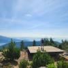
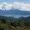
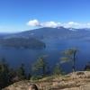
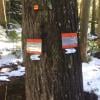
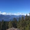
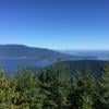
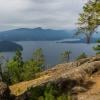
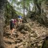
My partner and I are fit and have done challenging hikes in BC. This hike is difficult and should not be classified as intermediate. It is mostly uphill on some difficult terrain. Some of the markers are missing and trails are confusing causing extra time and stress. The view from the top is ok but there are a few other viewpoints along the hilke that are better. The rocky roads are hard on the feet, especially coming down.
Posted: July 2, 2024 06:38:14 PM PST