- Difficulty Easy
- Time 2.5 hours
- Round-Trip 8.5km
- Elevation Gain minimal
- Season July - September
- Camping Yes
- From Vancouver 3 hours
- Public Transit No
- Dog Friendly On-Leash
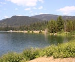
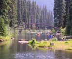
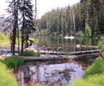
Lightning Lake in Manning Provincial Park is a beautiful lake that is a popular destination for people visiting the park. While it appears as though there are two lakes, Lightning Lake is just one lake with a narrow stretch of water connecting the different sections. A trail loops around both sections and a crossing known as the Rainbow Bridge connects the trails on both sides of the lake along the narrow stretch.
This hike describes the route looping around the lake in a clockwise direction. From the day-use area at the large wooden map boards, go left along the paved path next to the beach and walk to the end, where the trail becomes a dirt path. Cross the dam (the dam is not that noticeable) and follow the trail as it stays close to the shores of Lightning Lake. On the other side of the lake where a sign marks the start of the Frosty Mountain trail, go right and begin following the trail around the lake.
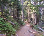
The trail is forested and fairly close to the lake, offering glimpses of the water as you leave the noise of the day-use area. The dirt trail has very minimal changes in elevation but you must still watch your footing as you have to step over the occasional rock or tree roots. As the water area to the right narrows, a few more steps brings you to the Rainbow Bridge that crosses to the other side. The waterway connecting the two sections of the lake can be fairly shallow during the end of the summer months but is often used by canoeists and paddle boarders to get between the two sections. Walk out onto the bridge to enjoy the view.
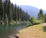
Continue back along the same trail you were on, following the trail as it continues along the next section of Lightning Lake. Again, the trail is forested but the walk is peaceful and enjoyable. After hiking for awhile, the trail veers to the right and reaches a small wooden bridge over a creek. The water from this creek comes down from Frosty Creek and is quite cold, as it drains into Lightning Lake. Continue walking until the trail crosses over another bridge with a scenic view looking towards the lake. A few more metres and the trail reaches a junction where a route to the left continues on along the Lighting Lakes Chain Trail.
At the junction, go right and continue hiking back. Move quickly along the narrow trail until you pass the junction with the Skyline Trail. Shortly after, the trail turns into a wide path that was formerly a forestry road. Continue past the sign to the lake viewpoint as you move northward.
Watch for some stairs on the right and a sign that points to the Fisherman's Trail and go right, following the trail that's closest to the shoreline. Within minutes, you return to the Rainbow Bridge, this time on the opposite side. It's at this point that you must decide whether you want to return to the day-use area quickly or complete the entire route. The quicker return route is to actually cross the bridge, then go left and walk back along the route you started, ending near the Mount Frosty Trailhead.
However, we will complete the loop by not crossing the bridge and going straight past the bridge, following the trail. It crosses over a small creek known as Little Muddy Creek, before veering to the left and passing through a picnic area popular with families staying at the campsite. Walk past the picnic area and just as the path starts heading up a small hill, look for a trail to the right that follows near the lake and take this path as it heads into the forest.
Following the trail until it reaches a point where you can see the day-use area on the other side. It appears as though you are near the end, however this is deceiving because the trail loops around a small inlet, which adds well over one kilometre to the route (this is why crossing at the Rainbow Bridge would have been the quicker route). Continue following the trail as it makes its way around the inlet, passing a picnic area, then turning into a wide gravel road.
While walking along the wide gravel road section, watch for a sign on the right and follow the trail into the forest, again, staying close to the water. Eventually, the trail veers left and you arrive back at the day-use area. Walk past the wooden steps, following the trail right to the end where it terminates at the day-use parking lot.
How to get to Lightning Lake Loop
Estimated Driving Time from Vancouver
3 hours
Lighting Lake Loop is located in Manning Provincial Park and begins at the day-use area.
From Vancouver, head eastbound on Highway #1 as you drive across the Port Mann Bridge and through the Fraser Valley. Just after passing the town of Hope, get into the right lane and merge onto Highway #3 the Crowsnest Pass. Continue driving until you reach the Manning Park Resort.
Turn right at the Manning Park Resort and drive up the road heading towards Lightning Lake. At the fork, go left towards the day-use area and park in the large parking lot. The trail begins from the wooden map boards near the beach area.
View a map of Driving directions to Lightning Lake Loop.

Although we try to keep information as current as possible, www.vancouvertrails.com makes no warranty or representation as to the availability, quality, fitness for purpose, conditions or accuracy of the information provided with respect to this trail or trails. The information provided herein is further subject to our Terms of Use.

Comments
Add Comment View All Comments