- Difficulty Easy
- Time 0.75 hours
- Round-Trip 1.5km
- Elevation Gain 40 meters
- Season year-round
- Camping Yes
- From Vancouver 2 hours, 40 minutes
- Public Transit No
- Dog Friendly Yes
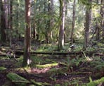
The Homesite Caves Trails is a short hike, through a rugged forest that passes several caves that have formed from water that has carved out the limestone rock. The caves are small and very unstable, so it is not possible to go inside of them, however the trail is still an interesting hike to see how the creek has carved away the surrounding area.
The trail is short and relatively easy, however the terrain is quite rugged in areas, including rocky sections that pass through the creek and several fallen trees to climb over. The start of the trail begins near a spur along the Forestry Service Road (FSR) and ends at the Homesite Creek Campsite. From the campsite, you can walk back down the same trail or you can walk through the campsite and walk back down the FSR.
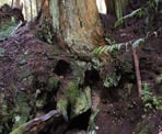
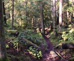
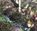
Starting from the trailhead about 1.6km up the FSR, walk into the forest and follow the trail as it meanders through the forest. The trail slightly descends and you have to carefully climb over a couple of fallen logs. As you walk, look for several caves to the left of the trail. The caves are usually at the bottom of some small hills, where a creek has worn a path through the forest, carving out the limestone. Some are well hidden behind rocks or trees that have fallen and block their entrances.
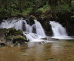
The trail continues as you make your way through a small valley along the creek until you reach a junction, where a short trail goes to Homesite Creek and a scenic waterfall. After enjoying the view of the rushing water, walk back to the junction and follow the trail up the hill as it heads in a direction parallel to the creek. Another short trail branches off to the right to some smaller waterfalls as you can walk down to the edge of the creek.
Returning to the trail, it goes up a short, steep hill and arrives at the campsite. This is the end of the trail and you can either return via the same trail you took or walk through the campsite to the front gate, then down the FSR back to where you parked.
How to get to Homesite Caves Trail
Estimated Driving Time from Vancouver
2 hours, 40 minutes
The Homesite Caves Trail is located north of the town of Sechelt on the Sunshine Coast. If you are traveling from Vancouver, you will need to take the ferry from Horseshoe Bay to Langdale (Gibsons) and then drive north along Highway 101.
From the town of Sechelt, follow Highway 101 heading north for about 20km. After passing the turnoff to Halfmoon Bay, watch for signs to the Homesite Creek Recreation area or Homesite Creek Campground. Turn right onto the gravel road next to the sign to the Homesite Creek Campground and zero your odometer. Drive up the gravel Forestry Service Road (FSR) for about 1.6km to where there is a junction with a spur (another road) going left. Park to the left where there is space but do not block any of the roads or the metal gate.
The trail begins on the right side of the main road, directly across from the spur. There is a small sign marking the start of the trail.
View a map of Driving directions to Homesite Caves Trail.

Although we try to keep information as current as possible, www.vancouvertrails.com makes no warranty or representation as to the availability, quality, fitness for purpose, conditions or accuracy of the information provided with respect to this trail or trails. The information provided herein is further subject to our Terms of Use.


Comments
Add Comment View All Comments