- Difficulty Easy
- Time 3 hours
- One-Way 5km
- Elevation Gain 40 meters
- Season year-round
- Camping No
- From Vancouver 20 minutes
- Public Transit Yes
- Dog Friendly No
The Foreshore Trail is a scenic beach route in Pacific Spirit Regional park that follows around the west side of the University of British Columbia and passes through Wreck Beach and Acadia Beach. The hike provides scenic views looking westward out into the Strait of Georgia and northwest to Bowen Island and the entrance to Howe Sound.
A few words of warning before trying this hike, more than half of the trail follows the beach, which is rocky, slippery, and can be challenging at times during high tides. There are many sections where there used to be a trail but the land has eroded and is only passable via the beach, so caution should be taken while walking on the rocks and the route is best hiked during low tides. In addition, the trail passes directly through Wreck Beach, which is Vancouver's only nudist beach, and it should be expected that there will be people without clothes enjoying the sunshine.
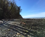
From the parking lot at Acadia Beach, walk down the trail towards the beach. Continue past a trail that splits to the left and walk onto the beach, heading westbound. Much of the route to Trail #3 is along the rocky beach and this section will take longer than some of the areas with a defined hiking trail. As you walk along the rocks, you can faintly see an area above the tide line where the rocks are pressed down and most people walk.
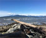
Enjoy the scenic views as you make your way around the northwestern section of Point Grey. The view looks out towards West Vancouver, Bowen Island, and the entrance to Howe Sound. You can often see one of the ferries in the distance heading to or returning from Nanaimo.
The first point of interest is an old World War II instrument tower that sits along the beach. The tower was part of the defence system for Vancouver to warn of a possible attack coming from the Pacific. Today, the graffiti covered tower sits along the beach as a memory of the past.
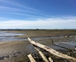
From the tower, follow the dirt trail and within a minute, you reach the well marked junction and stairs for Trail #3. This leads up to NW Marine Drive and is the first exit point along the beach. Continue following the Foreshore Trail as it ends shortly and you return to walking along the beach. The terrain of the beach becomes sandier as you continue to make your way around Point Grey.
A second tower is visible in the distance and you quickly approach it. It too is locked and covered in graffiti but was also part of the important defence system during World War II. Continue walking and within 5-minutes, you reach the junction with Trail #4, offering the second exit to NW Marine Drive.
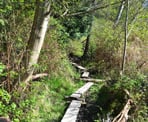
As you continue your hike, you round the corner and enter the Wreck Beach area. On a sunny day, the beach is busy with many people sunbathing in the buff. Just after passing the showers, there is a junction with Trail #6 which leads back up to the UBC area. From this junction, follow the hiking trail that follows the beach area but heads into the trees. This section can be quite muddy during the winter or after a rainfall, however when it's dry, it's much quicker to walk along than the previous beach areas as you will be following a trail the rest of the route.
The trail follows the shoreline as you are now located across from the Iona Beach area, which acts as a breakwater and protects the beach from the waves. There are still areas along the trail where there are sunbathers so continue hiking and keep people's privacy in mind when enjoying the views of the scenery.
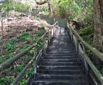
The trail eventually reaches the junction with Trail #7 after about 1-hour of hiking from Wreck Beach. At this point, the trail does continue further, however it's recommended to follow Trail #7 back up to NW Marine Drive and return via the UBC campus. Trail #7 follows a creek and heads up a very steep set of wooden stairs to Old Marine Drive. At the top, go left and walk up to NW Maine Drive.
The easiest way to return to the Acadia Beach parking lot is to walk back along NW Maine Drive. Make sure to go left at the 4-way intersection and continue following NW Marine Drive, not Chancellor Blvd. Walking back down the hill will return you to the parking lot.
Note, the total distance is not included in the return trip because some people will choose to walk back via the NW Marine Drive route described, some via the beach, or some might take a different route through the University campus.
How to get to Foreshore Trail
Estimated Driving Time from Vancouver
20 minutes
The Foreshore Trail is located in Pacific Spirit Regional Park but follows a route around the beach area to the west of the University of British Columbia. There are several places to access the route but the easiest place is to park at the gravel parking lot near Acadia Beach along Northwest Marine Drive.
To get to the Acadia Beach parking lot from downtown Vancouver, drive to Howe Street and head southbound on Howe where it merges onto and crosses the Granville Street bridge. Stay in the right lane and before the end of the bridge, take the 4th Avenue West exit. Merge onto 4th Avenue and continue driving west for about 6km as the road pass through Pacific Spirit Regional Park and becomes Chancellor Blvd. Just after the park ends, turn right onto Acadia Road and follow it to NW Marine Drive. Turn right onto NW Marine Drive and drive about 500-meters to a gravel parking lot with a large gate on your left. Pull into the parking lot and take note of the time the gate closes to ensure you are back in time.
In addition to the Acadia Beach parking lot, you can also park at various locations on the UBC Campus and access the beach area via Trail #3, Trail #4, Trail #6, and Trail #7.
View a map of Driving directions to Foreshore Trail.
Transit Access to Foreshore Trail
Since the Foreshore Trail is close to the University of British Columbia, there are several busses that go to the University. Bus #044 from downtown Vancouver is a good option as it drives along Chancellor Blvd. You can exit bus #044 at Chancellor Blvd and Hamber Road and follow a trail next to Hamber Road called the Salish Trail, which is a short walk to the start of the Foreshore Trail.
Alternatively, you can walk from various points in the UBC Campus or access the beach from one of the trail access points.

Although we try to keep information as current as possible, www.vancouvertrails.com makes no warranty or representation as to the availability, quality, fitness for purpose, conditions or accuracy of the information provided with respect to this trail or trails. The information provided herein is further subject to our Terms of Use.


Comments
Add Comment View All Comments