- Difficulty Easy
- Time 1 hour
- Round-Trip 2km
- Elevation Gain 52 meters
- Season May - October
- Camping Yes
- From Vancouver 2 hours, 30 minutes
- Public Transit No
- Dog Friendly Yes
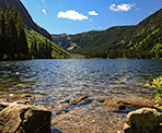
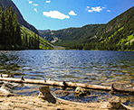
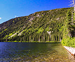
Falls Lake is a beautiful lake located in the subalpine of the Coquihalla Summit Recreation Area between the towns of Hope and Merritt. The trail is a short, well marked route that follows a creek right to the shores of the lake, offering scenic views of Nak Peak to the left and Zoa Peak to the right.
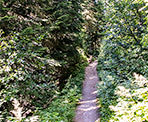
From the gravel parking lot, walk up the road on the right side and within about 20-meters, a sign on the left will point in the direction to Falls Lake. Go left at the sign and head uphill into the forest, following the creek down below to your left.
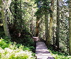
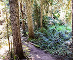
The trail initially climbs quickly but the ascend is more gradual as you continue through the forest, crossing a couple of small wooden bridges. The sound of the rushing creek below can be heard through most of the hike but only small glimpses of it can be seen.
As the trail plateaus, it begins to descend slightly and the first views of the lake can be seen in-between the trees. A few more steps and you arrive at the incredible view of Falls Lake where the towering Nak Peak sits on the left side of the lake.
After enjoying the view, head back down the trail in the direction you arrived, following the well worn back to the gravel parking lot area where you began.
How to get to Falls Lake
Estimated Driving Time from Vancouver
2 hours, 30 minutes
Falls Lake is located just off the Coquihalla Highway at Exit #221, between the towns of Hope and Merritt.
From Vancouver, drive towards Highway #1 and enter the highway heading Eastbound. Continue on Highway #1 for roughly 150km to Hope, BC. After passing the town of Hope, continue onto Highway #5 the Coquihalla Highway heading towards Merritt.
About 45km after passing the town of Hope, watch for signs for the Coquihalla Summit Recreation Area. Take Exit #221.
After exiting the highway, drive under the highway and turn left. Do not get onto the highway again; turn right and follow the narrow road uphill until you reach a gravel parking lot. Park in this lot as the trail begins just up the gravel path where there is a sign pointing to Falls Lake.
View a map of Driving directions to Falls Lake.

Although we try to keep information as current as possible, www.vancouvertrails.com makes no warranty or representation as to the availability, quality, fitness for purpose, conditions or accuracy of the information provided with respect to this trail or trails. The information provided herein is further subject to our Terms of Use.

Comments
Add Comment View All Comments