- Difficulty Difficult
- Time 8 hours
- Round-Trip 16km
- Elevation Gain 975 meters
- Season July - September
- Camping No
- From Vancouver 1 hour, 45 minutes
- Public Transit No
- Dog Friendly No
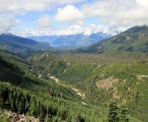
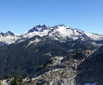
The hike to Demon Ridge provides some of the most spectacular views of the region, including the Mamquam area, Martin Peak, and down towards Watersprite Lake. The trail branches off from the Watersprite Lake Trail, just before the prow lookout (at KM 4.7). Take the left fork at the sign marked "Demon Ridge" where it follows an old logging road and follow the road as it makes its way up the south side of Demon Ridge.
The following trail description for Demon Ridge begins at the Watersprite Lake Trailhead.
Please note that this is a high elevation route and the trail climbs steeply in sections. Snow can linger along the route well into the summer months.
From the metal gate at the Skookum parking lot area, walk up the hill to the wooden Trail Kiosk map board and continue past it. Follow the rocky route as it passes just above the Skookum Dam below, to the left. Follow the trail into the forest on an old logging road, first crossing Demon Creek on a wooden bridge, then almost immediately cross a wooden boardwalk that spans muddy Demon Creek Swamp. Five minutes later, cross a second bridge over Skullhead Creek (KM .9).
After about 20-30 minutes of hiking, the trail veers left and descends along a narrower route into the forest. Watch your step as you follow the trail downhill briefly before it starts ascending quickly, following along a narrow band that passes between two bog areas. Continue until you reach a 3-way junction and take note of this junction as you will need to follow the same route back when you return later in the day.
Go right at the junction and follow the wide trail as it gradually climbs before becoming fairly level. Move quickly through this section as it's relatively flat and easy. Eventually, the trail will veer left and begin to climb up a rocky section as you quickly gain elevation. After hiking uphill for about 600-metres, make a turn to the right and, a bit further, you will begin to see views of the valley and nearby peaks.
After enjoying one of several views, continue following the trail, and cross the small creek next to the waterfall. The trail continues ascending at a gradual pace until you reach the junction for the Demon Ridge Trail at KM 4.7, which is marked by a labeled a green aluminum "Demon Ridge" sign on a post.
Before going left to Demon Ridge, you may wish to follow the Watersprite Trail just a few meters further to an incredible viewpoint known as the "The Prow Lookout". This stunning view overlooks the entire valley, up towards the Elfin Lakes area in Garibaldi Provincial Park, and down towards Squamish.
From the signpost and junction with the Watersprite Trail, follow an old logging road uphill to the left. After the trail passes a switchback to the right, it levels out briefly before passing a switchback to the left and climbing again. After passing some large boulders, the trail opens up with incredible views of the valley to your right.
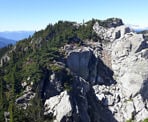
As you enjoy the impressive views to the right during your hike up the old Demon Ridge logging road, continue to the end of the road and watch for flagging. At the end of the logging road, continue to follow the flagging along a trail as the well marked route continues to the summit.
After enjoying the views, follow the route back down the way that you came, making sure to follow the trail ribbons. Rejoin the old logging road, and soak in the views once again before descending back down, as you quickly make time before rejoining the Watersprite Lake Trail. Go right and follow the Watersprite Lake Trail as it descends gradually, before veering left and descending down the rocky section of trail.
After walking along the fairly flat section and reaching the 3-way junction, make sure to go left to head back towards the parking lot. Follow the narrow trail down before ascending to the final section of the route. After the final creek crossings and crossing over the wooden boardwalks, the trail opens up above the dam as you walk the last section back down to the metal gate where you began.
The Demon Ridge Trail is a new trail and route, so further improvements and changes are expected. As the views from the Demon Ridge Trail rival the now popular Watersprite Lake Trail, this one is also poised to become a local favorite.
How to get to Demon Ridge
Estimated Driving Time from Vancouver
1 hour, 45 minutes
Note: The Forestry Service Road (FSR) is rugged in some areas and 4x4 vehicles with clearance are recommended.
The Demon Ridge and Watersprite Lake trails start from the same trailhead and the Demon Ridge Trail branches off of the Watersprite route at about the 4.7km mark.
The trailhead to Watersprite Lake begins about 20km up a series of Forestry Service Roads to the east of Squamish. From Vancouver, drive to Highway #1 and enter the highway heading westbound. Following Highway #1 towards Horseshoe Bay and then merge onto Highway #99: The Sea To Sky Highway heading towards Squamish. Follow the scenic Sea To Sky Highway northbound for about 40km.
About 1.5km after passing the Sea To Sky Gondola, turn right onto the gravel Mamquam River FSR and zero your odometer (note: this turnoff is just before the 4-way stop by Chances Casino, so if you reach the intersection, you will need to turn back). Follow the Mamquam River FSR for the next 13.2km as it starts out relatively smooth but becomes bumpy and steeper in some sections. At the 13.2km mark, turn left and drive over the bridge crossing the Mamquam River. Drive past the parking area for the kayak put-in at 9 Mile Bridge on your left before crossing a second bridge over Skookum Creek.
Just after crossing the second bridge, you reach a junction in the road with two large signs fastened between log pylons on the left. Turn left and pass between the signs as you are now on the Skookum Dam FSR. Pass the power station on your left and continue to follow the Skookum Creek FSR as it steadily climbs through a fairly bumpy section of road while offering views of the valley to the right.
Near the 16km mark, you reach a junction in the road next to a huge metal air vent that looks like a giant candy cane. Go left at this junction to continue to the new trailhead for Watersprite Lake as the road continues through a relatively flat section for a bit before climbing up a very steep hill and then descending a short time later.
The road ends at a metal gate and large parking area near the Skookum Dam. Park your vehicle here and begin the hike near the metal gate.
View a map of Driving directions to Demon Ridge.

Although we try to keep information as current as possible, www.vancouvertrails.com makes no warranty or representation as to the availability, quality, fitness for purpose, conditions or accuracy of the information provided with respect to this trail or trails. The information provided herein is further subject to our Terms of Use.


Comments
Add Comment View All Comments