- Difficulty Intermediate
- Time 3 hours
- Round-Trip 4.8km
- Elevation Gain 210 meters
- Season July - October
- Camping No
- From Vancouver 50 minutes
- Public Transit No
- Dog Friendly On-Leash
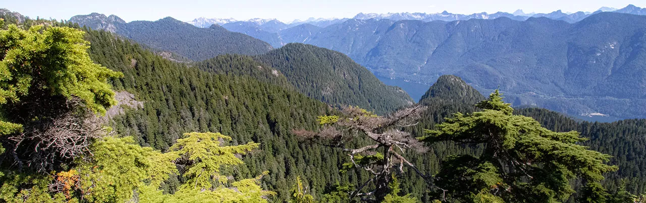
The hike to De Pencier Bluffs on Mount Seymour is a bit more difficult to find then some of the other popular trails, however there are scenic views of the nearby peaks and as far down to Indian Arm. The route passes Mystery Lake and is done as a loop.
From the wooden map board at the end of the Mount Seymour parking lot, walk down the short hill and look for a sign on the right pointing to Mystery Lake. Follow the trail as it passes under the chairlift, then begins to head uphill. The trail climbs at a moderate pace as you continue to make your way through the low foliage along the well defined trail.
The trail goes up a hill, then passes a small pond on the right as you walk along a series of boardwalks. Continue hiking as the route begins to climb again before crossing an open ski run, offering a view in the distance. After crossing this opening, the trail heads back into the forest and climbs steeply.
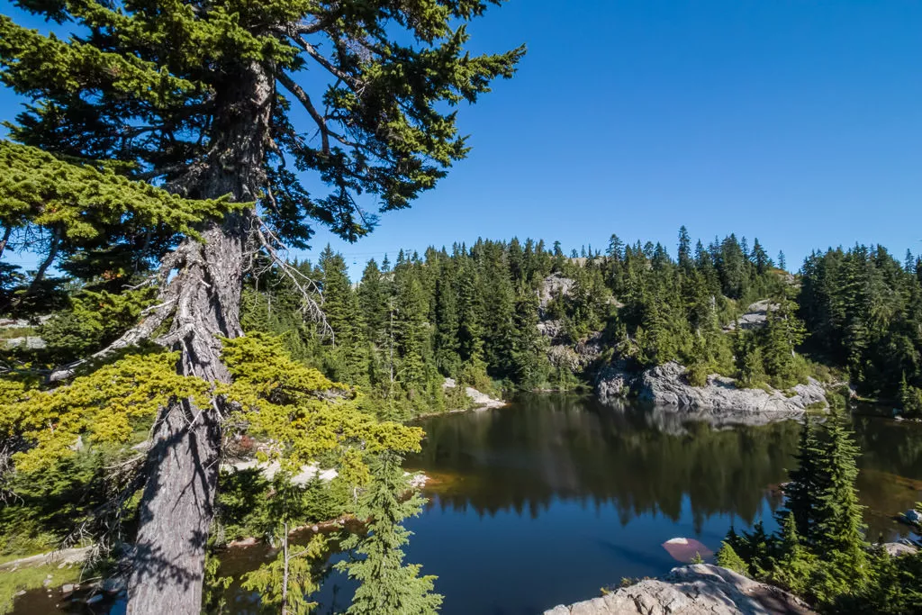
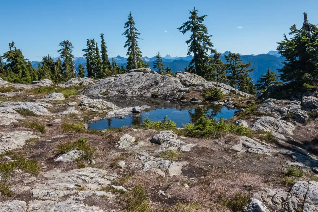
As the route begins to level and you step onto some large rocks, you approach Mystery Lake. In the summer, this is a popular short hike offering an opportunity to swim and cool off in the lake.
Continue hiking by following the trail along the right side of the lake. The trail does not appear obvious at first but it goes up a steep rock where you can see an orange trail marker on the tree up high. Go right at a junction (left takes you to another view of Mystery Lake) and follow the trail as it leaves Mystery Lake.
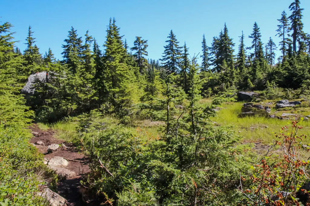
The trail passes through an open, grassy area before descending down a hill. Near the bottom of this short hill, watch for a trail on the right. The trail is not marked with a sign but the path can be seen. Follow this trail as it descends down a steep hill, carefully picking your route and watching you step. The trail crosses a small creek then continues. Watch for junction to the left and go left. There is no sign at the junction but there are a couple of signs on trees that say “De Pencier” but they are also easy to miss.
Follow this trail uphill and, after a short distance, take a short path to the right to a rocky outcrop with a view. While the view is not too bad, it is obstructed by several trees. Return to the trail and continue to follow it as it drops down a hill before continuing to ascend again.
Finding the trail that goes to De Pencier Bluffs is the tricky part. As the trail goes uphill, watch for a rock that is about 3 feet high on your right. The rock has a indent in it that acts like a step, and the trail onto of the rock is clearly visible if you are looking for it. If you reach a clearing with a stream and cliff wall on your right, you have gone too far.
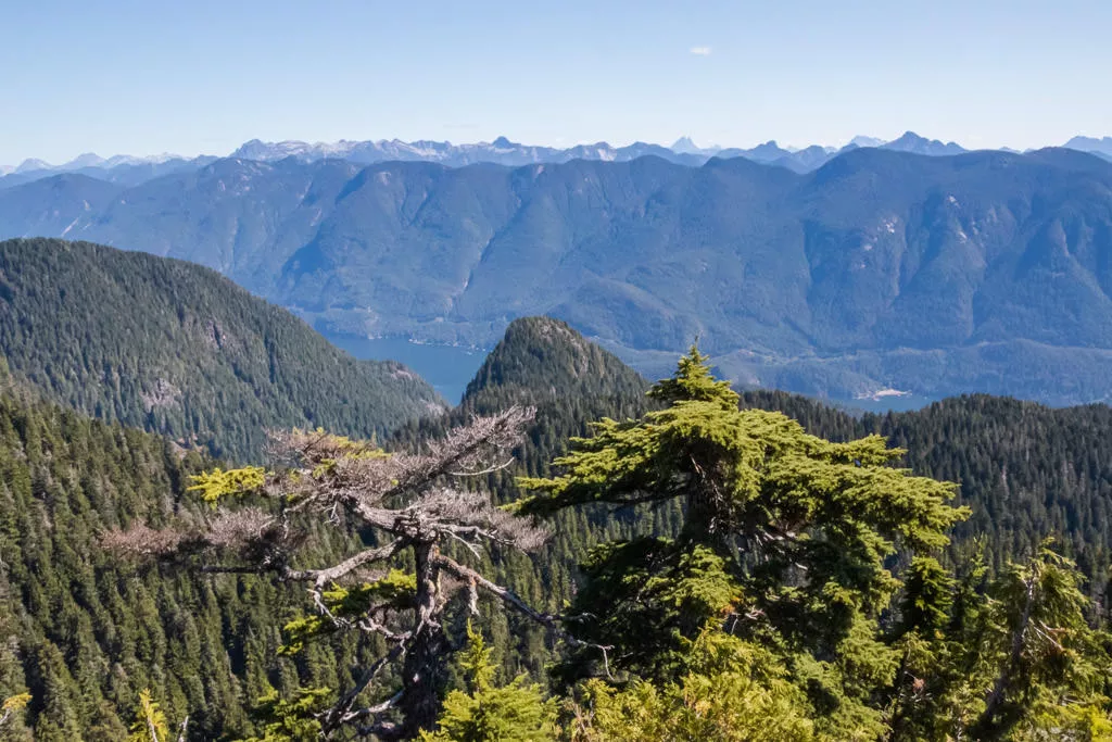
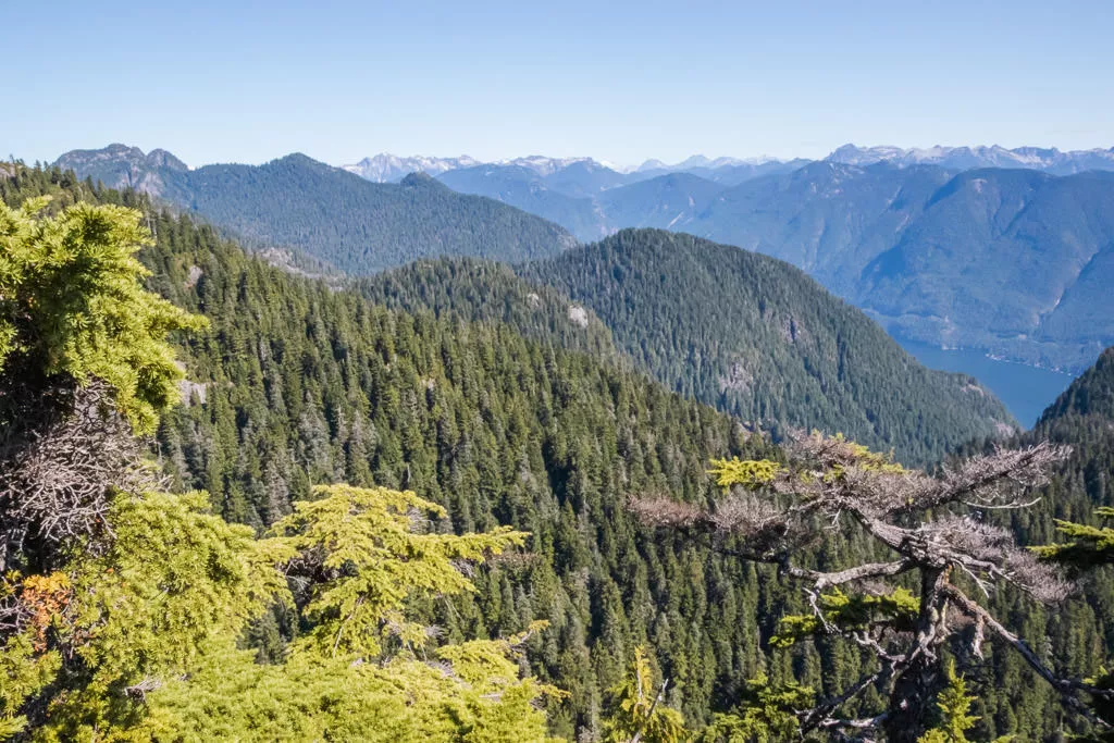
Use the “step” to get onto the trail on top of the rock and follow the trail. There is a view to the right a short distance along the route. Go left as the trail climbs uphill and up a steep rocky section. At the top of the rocky section, the well defined route continues and veers right to go to the top of the Bluffs. Before going to the top, continue straight past where the trail veers right for an incredible view looking towards Mount Seymour and down towards small viewable sections of Indian Arm. This is probably the best viewpoint but be careful as sections to the left are a sheer cliff.
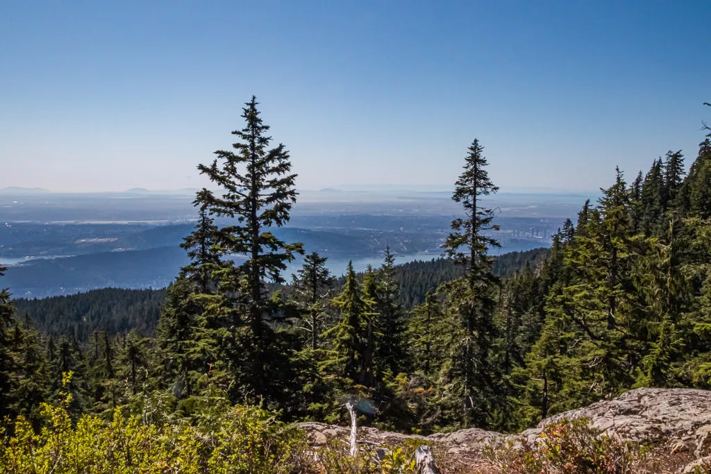
Walk to the top of De Pencier Bluffs to see some of the views, including one looking down towards the parking lot and across to the mountains in the Belcarra region.
Once you’ve enjoyed all of the views, follow the trail back down, carefully walking down the steep rocky section. Veer to the right and returns to the trail by the rock with the step at the junction. Instead of going back the route that you arrived, go right to begin a loop back to the parking lot. Follow the trail as it passes through a beautiful meadows with a stream and a rock cliff wall on the right.
The trail crosses the stream before heading out of the meadow area. Make sure to follow a well defined trail as there are some other paths from people taking wrong routes but the actual trail is pretty obvious. The path heads uphill before passing a pond on the left and continuing to a ski run where a chairlift hangs overhead. Walk down the hill to the ski run, then go right and walk up the short hill before it veers to the left.
Follow a ski run downhill for about 10-15-minutes until you reach a trail sign on the right. While it’s possible to follow the ski hill back down, it’s better to follow proper hiking trails. Go right and walk along the path before going left and following the rocky route back downhill, carefully watching your step. The trail will pass two junctions to Dinkey Peak and also pass the memorial to Tim Jones, the North Shore Rescue Manager who sadly passed away in 2014. Continue hiking downhill until you reach the bottom of the hill and arrive back at the parking lot.
How to get to De Pencier Bluffs
Estimated Driving Time from Vancouver
50 minutes
The hike to De Pencier Bluffs begins from the Mount Seymour day-use area. The trail starts from the end of the parking lot by the wooden map board.
From downtown Vancouver, drive to Highway #1 and enter the highway heading westbound across the Second Narrows Bridge. After crossing the bridge, take Exit 22B to Mount Seymour Parkway. Immediately turn right onto Mount Seymour Parkway and head eastbound. Watch for signs, then turn left at the light to Mount Seymour. Go left at the junction, then begin the long drive up to Mount Seymour. Park as close as possible to the far end of the parking lot.
View a map of Driving directions to De Pencier Bluffs.

Although we try to keep information as current as possible, www.vancouvertrails.com makes no warranty or representation as to the availability, quality, fitness for purpose, conditions or accuracy of the information provided with respect to this trail or trails. The information provided herein is further subject to our Terms of Use.
Comments
Add Comment View All Comments