- Difficulty Intermediate
- Time 5 hours
- Round-Trip 9km
- Elevation Gain 450 meters
- Season July - October
- Camping No
- From Vancouver 50 minutes
- Public Transit No
- Dog Friendly Yes
One of the local Vancouver ski hills in the winter, the summer hike wanders up the mountain, passing over a couple of peaks before reaching a panoramic view of the city and the Coastal Mountain Range.
From the end of the parking lot next to the BC Parks sign board, walk towards the ski run and follow it uphill to a green sign on the left. The first trail goes to Dog Mountain, another scenic and shorter hike then Mount Seymour. Instead, follow the trail that heads uphill and parallel to the ski run. The trails on the mountain are well marked with signs at junctions that have accurate distances to each destination.
The trail climbs quickly and steadily away from the parking area. Go right at the first junction and then right at a second junction as you pass alongside wild foliage and over small wooden bridges. The trail eventually reaches what looks like a dirt road but is actually a ski run in the winter. Go left at this point and continue up the wide gravel path staying on the middle route. Do NOT follow the path to the right that goes up a steep hill.
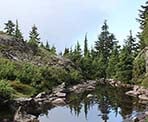
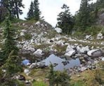
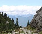
About a couple of hundred meters up the wide path, another green sign appears with an arrow and distance to Mount Seymour. Go left and walk down the slight hill, past the pool of water on the right and continuing your ascent up a rocky hill. You will reach another junction with a sign. Go left over the rock and continue following the trail as it briefly descends. Make sure to take an opportunity once in awhile to look around at the surrounding views as the scenery varies from views of the city, nearby mountains, and even spectacular rock slides that occurred over thousands of years next to the trail.
The final junction marks the trail to Elsay Lake on your right and Mount Seymour to the left. Go left and up the steep hill as the trail weaves around rocks before reaching a short 400 meter trail on the left to First Peak. Go left for a short side trip and climb up onto the highest point for an incredible view of the city on a sunny, clear day.
Back at the main trail, walk past the green marker and watch for orange markings on the rocks ahead. The trail veers slightly to the right, over the rocks and not straight down as the path would seem. The orange paint on the rocks can be worn in areas and hard to see but it?s there and frequent enough to follow, so just keep an eye out for it. The trail descends before heading up another steep slope with lots of loose rock.
At the top of this point is Second Peak. Make your way up the side of the mountain on the right for a quick view from this point. Return to the trail and continue following the path as it again descends and passes along a narrow rock with a steep hill below. The trail reaches the edge of more rocks and it?s back to following the orange spray painted markings on the rocks as you ascend the steep rock section of Mount Seymour. After climbing a steep section, the trail plateaus briefly as it winds through the rocks and reaches a section of loose rock between some small trees. Follow the trail up this section and make the final ascent onto the peak.
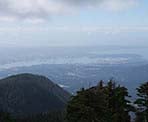
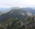
The view from the top of Mount Seymour is truly spectacular on a clear day as you can see Vancouver to the south, part of Indian Arm to the east, Grouse Mountain to the west, and an enormous section of the Coastal Mountain Range to the north. Pick a spot to rest and have lunch before making your way back downhill, following the same route, and returning to the Mount Seymour parking lot.
How to get to Mount Seymour
Estimated Driving Time from Vancouver
50 minutes
The trail to Mount Seymour is accessible from the downhill ski area parking lot at Seymour in North Vancouver. To reach the parking lot, drive east to the Trans Canada Highway (Highway #1) and enter the highway heading westbound. Continue across the Iron Workers Memorial Bridge (Second Narrows) and take Exit #22, Mt. Seymour Parkway, shortly after crossing the bridge. At the set of lights, turn right onto Mt. Seymour Parkway and continue along the parkway for about 4km until you reach the traffic lights and small shopping area at Mt. Seymour Road. Turn left onto Mt. Seymour Road and continue straight as the road begins to climb up Mount Seymour for the next 13km. Park at the far end of the parking lot near a wooden signboard with a map of the area. Don't forget to buy a parking ticket.
View a map of Driving directions to Mount Seymour.

Although we try to keep information as current as possible, www.vancouvertrails.com makes no warranty or representation as to the availability, quality, fitness for purpose, conditions or accuracy of the information provided with respect to this trail or trails. The information provided herein is further subject to our Terms of Use.

Comments
Add Comment View All Comments