- Difficulty Easy
- Time 0.5 hours
- Round-Trip 1.1km
- Elevation Gain minimal
- Season year-round
- Camping No
- From Vancouver n/a
- Public Transit No
- Dog Friendly On-Leash
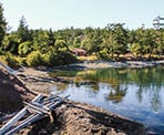
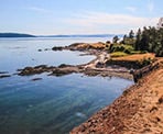
Brooks Point is located on south Pender Island and has incredible views from its rocky shoreline across Boundary Pass to the San Juan Islands in the United States. The beach area is a great place to explore and often seals, whales, and other animals can be spotted from the shoreline. The trail to the shoreline is a short, east walk and great place for families to enjoy.
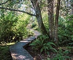
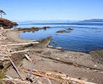
From the trailhead at Gowland Point Road and Kloshe Road, walk past the park map and follow the wooden boardwalks through the lush vegetation. After only a few minutes, the trail reaches a junction next to some toilets. Go straight at the junction and follow the trail as it quickly leaves the forest. Walk to the far right and up onto the rocky Gowland Point where there are scenic coastal views of Drummond Bay and Boundary Pass.
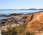
Walk back in an eastward direction along the shoreline, following an unmarked route. There are a few access point to the rocky beach area which can be explored, particularly during low tide.
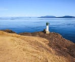
Continue eastward along the path as it gently climbs and you walk towards a small automated lighthouse at the eastern section of the park. The views are equally as good as you look across to the San Juan Islands while the waves gently brush against the shore.
To walk back from the lighthouse, follow a trail westward that pass through some grasslands. This trail weaves its way back into the forest and back to the junction next to the toilets. At the junction, go right and walk back along the boardwalks returning to the trailhead where you began your walk.
How to get to Brooks Point Regional Park
Estimated Driving Time from Vancouver
n/a
Brooks Point Regional Park is located on south Pender Island, near the end of the main road.
From the Driftwood Shopping Centre, drive south on Bedwell Harbour Road, which turns into Canal Road just after leaving the centre. Follow Canal Road and watch for signs to South Pender Island. Turn left onto Canal Road (same road name) and continue driving until you cross a one-way bridge connecting the two islands.
After crossing the bridge, immediately turn left and continue to follow Canal Road. Follow the main road as it will eventually veer right and turn into Spalding Road. The road passes through a narrow section, then veer left onto Gowland Point Road. Follow Gowland Point Road until, just before Kloshe Road, there is a sign for Brooks Point Regional Park on your right. Park in the gravel area off to the side of the road.
View a map of Driving directions to Brooks Point Regional Park.

Although we try to keep information as current as possible, www.vancouvertrails.com makes no warranty or representation as to the availability, quality, fitness for purpose, conditions or accuracy of the information provided with respect to this trail or trails. The information provided herein is further subject to our Terms of Use.

Comments
Add Comment View All Comments