- Difficulty Easy
- Time 2 hours
- Round-Trip 5km
- Elevation Gain minimal
- Season year-round
- Camping No
- From Vancouver 50 minutes
- Public Transit Yes
- Dog Friendly On-Leash
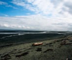
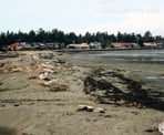
Boundary Bay Regional park is located south of Vancouver near the border with the United States and is a popular bird watching area for nature enthusiasts. There is a long trail that wraps around a large portion of Boundary Bay, however we will focus on an area known as the 12th Avenue Dyke Trail. This area includes Centennial Beach and a Wildlife Reserve area. Bring your binoculars and take your time enjoying the wildlife in the area.
From the parking lot at Centennial Beach, walk out towards the beach and along the main 12th Avenue Dyke Trail trail to the left. Follow the trail until you reach a wooden signboard with a map of the area at a junction with the Dune Trail. The Dune Trail is a short trail that loops out towards the water before returning to the main path a short distance later.
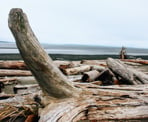
Back on the 12th Avenue Dyke Trail, follow the route as it veers to the right, passing the junction with the Raptor Trail on the left. The gravel path follows alongside the beach of Boundary Bay offering many opportunities to view a variety of ducks and other waterfowl. The trail eventually reaches a junction where a viewing platform stands. Climb the steps of the platform for a better look at the region.
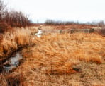
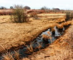
Continue walking along the shores of the bay until you reach a junction with a set of stairs on the left to the Raptor Trail. Walk down the set of stair, cross the bridge, and follow the narrow dirt trails. This area of the park is a protected nature reserve and is the home of many species of birds, including eagles, ducks, and much more.
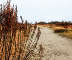
The first section seems like a maze of trails but they mostly end up in the same place. Follow the trails and continue to where they meet. Loop back through the park along the Raptor Trail until it reaches a junction with boards on the left. Stay to the right and either continue following the Raptor Trail to where it meets up with the 12th Avenue Trail or walk up a small dyke hill on the right to the Savannah Trail and go left back towards the parking lot.
How to get to Boundary Bay Regional Park
Estimated Driving Time from Vancouver
50 minutes
Boundary Bay Regional Park is located in the community of Tsawwassen, south of Vancouver near the border with the United States. To get to the park, drive south along Oak Street in Vancouver and continue across the Oak Street Bridge after which the road widens and becomes Highway #99. Continue driving south and go through the Deas tunnel and then take exit #28 towards the BC Ferries terminal. Drive along the highway and turn left at the set of traffic lights at 56 Street South for Tsawwassen and Point Roberts.
Now in the community of Tsawwassen, turn left at 12th Avenue and follow the road as it veers to the right and onto Boundary Bay Road. Watch for Regional Park signs and turn left into the designated parking lot area.
View a map of Driving directions to Boundary Bay Regional Park.
Transit Access to Boundary Bay Regional Park
From Bridgeport Skytrain Station along the Canada Line, take bus #601 South Delta / Boundary Bay right to Boundary Bay Regional Park. This bus has limited peak hour service to Boundary Bay and may require a transfer at the South Delta Exchange. Ask the driver if the bus is going to Boundary Bay and if not, get off the bus at the South Delta Exchange and take bus #C89 Boundary Bay / South Delta Exchange.

Although we try to keep information as current as possible, www.vancouvertrails.com makes no warranty or representation as to the availability, quality, fitness for purpose, conditions or accuracy of the information provided with respect to this trail or trails. The information provided herein is further subject to our Terms of Use.

Comments
Add Comment View All Comments